- McHenry County, North Dakota
-
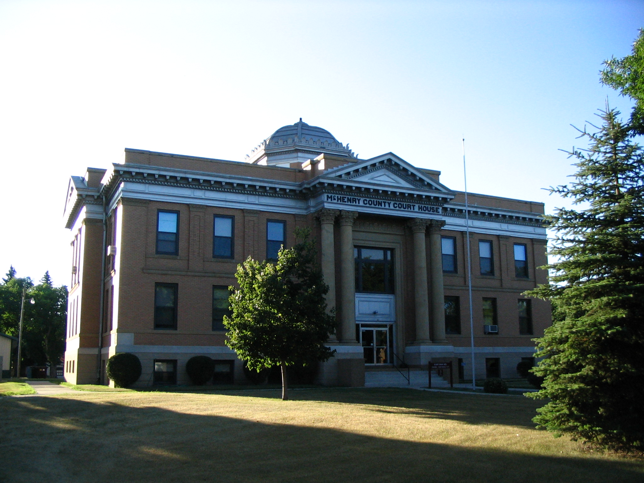
McHenry County, North Dakota 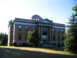 McHenry County Courthouse
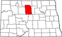
Location in the state of North Dakota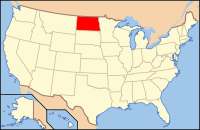
North Dakota's location in the U.S.Founded 1873 Seat Towner Largest city Velva Area
- Total
- Land
- Water
1,912 sq mi (4,952 km²)
1,874 sq mi (4,854 km²)
38 sq mi (98 km²), 1.97%Population
- (2010)
- Density
5,395
3/sq mi (1/km²)Website www.mchenrycountynd.com McHenry County is a county located in the U.S. state of North Dakota. As of 2010, the population was 5,395.[1] Its county seat is Towner.[2]
The Territorial legislature formed McHenry County in 1873 from part of Bottineau County. The name comes from James McHenry, an early settler of Vermillion, South Dakota. The county government was first organized on October 15, 1884. Before becoming Towner in 1886, the county seat was Villard from 1884 to 1885 and Scriptown from 1885 to 1886.[3] Both former seats are now ghost towns.
McHenry is part of the Minot Micropolitan Statistical Area.
Contents
Geography
According to the U.S. Census Bureau, the county has a total area of 1,912 square miles (4,950 km2), of which, 1,874 square miles (4,850 km2) of it is land and 38 square miles (98 km2) of it (1.97%) is water.
Townships
- Anamoose
- Balfour
- Bantry
- Berwick
- Bjornson
- Brown
- Cottonwood Lake
- Deep River
- Deering
- Denbigh
- Egg Creek
- Falsen
- Gilmore
- Granville
- Grilley
- Hendrickson
- Karlsruhe
- Kottke Valley
- Lake George
- Lake Hester
- Land
- Layton
- Lebanon
- Little Deep
- Meadow
- Mouse River
- Newport
- Normal
- North Prairie
- Norwich
- Odin
- Olivia
- Pratt
- Riga
- Rose Hill
- Round Lake
- Saline
- Schiller
- Spring Grove
- Strege
- Velva
- Verendrye
- Villard
- Voltaire
- Wagar
- Willow Creek
Major highways
 U.S. Highway 2
 U.S. Highway 52
 North Dakota Highway 14
 North Dakota Highway 19
 North Dakota Highway 41
 North Dakota Highway 53
 North Dakota Highway 97
Adjacent counties
- Bottineau County (north)
- Pierce County (east)
- Sheridan County (southeast)
- McLean County (southwest)
- Ward County (west)
- Renville County (northwest)

Renville County Bottineau County Ward County 
Pierce County  McHenry County, North Dakota

McLean County Sheridan County National protected areas
- Cottonwood Lake National Wildlife Refuge
- J. Clark Salyer National Wildlife Refuge (part)
- Wintering River National Wildlife Refuge
Demographics
Historical populations Census Pop. %± 1890 1,584 — 1900 5,253 231.6% 1910 17,627 235.6% 1920 15,544 −11.8% 1930 15,439 −0.7% 1940 14,034 −9.1% 1950 12,556 −10.5% 1960 11,099 −11.6% 1970 8,977 −19.1% 1980 7,858 −12.5% 1990 6,528 −16.9% 2000 5,987 −8.3% 2010 5,395 −9.9% U.S. Decennial Census As of the census[4] of 2000, there were 5,987 people, 2,526 households, and 1,699 families residing in the county. The population density was 3 people per square mile (1/km²). There were 2,983 housing units at an average density of 2 per square mile (1/km²). The racial makeup of the county was 98.73% White, 0.08% Black or African American, 0.40% Native American, 0.03% Asian, 0.05% from other races, and 0.70% from two or more races. 0.40% of the population were Hispanic or Latino of any race. 45.4% were of German and 34.0% Norwegian ancestry according to Census 2000.
There were 2,526 households out of which 28.3% had children under the age of 18 living with them, 58.2% were married couples living together, 5.6% had a female householder with no husband present, and 32.7% were non-families. 29.8% of all households were made up of individuals and 15.40% had someone living alone who was 65 years of age or older. The average household size was 2.35 and the average family size was 2.92.
In the county the population was spread out with 24.0% under the age of 18, 5.9% from 18 to 24, 23.3% from 25 to 44, 25.1% from 45 to 64, and 21.8% who were 65 years of age or older. The median age was 43 years. For every 100 females there were 103.9 males. For every 100 females age 18 and over, there were 101.0 males.
The median income for a household in the county was $27,274, and the median income for a family was $35,676. Males had a median income of $25,740 versus $18,505 for females. The per capita income for the county was $15,140. About 12.0% of families and 15.8% of the population were below the poverty line, including 18.5% of those under age 18 and 16.8% of those age 65 or over.
Places
Cities
Note: all incorporated communities in North Dakota are called "cities" regardless of their size.
Unincorporated communities
- Norwich
- Verendrye
- Rangeley
- Guthrie
- Norfolk
- Funston
- Newport
- Berwick
- Denbigh
- Riga
- Kongsberg
- Rising
- Simcoe
- Genoa
- Kottkethal
- Rose Hill
- Cole Ford
- Willowdale
- Willow Vale
- Willow Valley
- Willow Creek
- Milroy
Notable people
- Sondre Norheim - pioneer of modern skiing
See also
References
- ^ "2010 Census Redistricting Data (Public Law 94-171) Summary File". American FactFinder. United States Census Bureau. http://factfinder2.census.gov/faces/tableservices/jsf/pages/productview.xhtml?pid=DEC_10_PL_GCTPL2.ST05&prodType=table. Retrieved 3 May 2011.
- ^ "Find a County". National Association of Counties. http://www.naco.org/Counties/Pages/FindACounty.aspx. Retrieved 2011-06-07.
- ^ "County History". Official Portal for North Dakota State Government. http://www.nd.gov/content.htm?parentCatID=83&id=County%20History. Retrieved 4 May 2011.
- ^ "American FactFinder". United States Census Bureau. http://factfinder.census.gov. Retrieved 2008-01-31.
External links
Municipalities and communities of McHenry County, North Dakota Cities 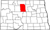
Townships Anamoose | Balfour | Bantry | Berwick | Bjornson | Brown | Cottonwood Lake | Deep River | Deering | Denbigh | Egg Creek | Falsen | Gilmore | Granville | Grilley | Hendrickson | Karlsruhe | Kottke Valley | Lake George | Lake Hester | Land | Layton | Lebanon | Little Deep | Meadow | Mouse River | Newport | Normal | North Prairie | Norwich | Odin | Olivia | Pratt | Riga | Rose Hill | Round Lake | Saline | Schiller | Spring Grove | Strege | Velva | Villard | Voltaire | Wagar | Willow Creek
Unorganized
territoryEast McHenry | Northeast McHenry
Unincorporated
communitiesCategories:- North Dakota counties
- McHenry County, North Dakota
- Minot micropolitan area
- States and territories established in 1873


Wikimedia Foundation. 2010.