- Wahpeton, North Dakota
Infobox Settlement
official_name = Wahpeton, North Dakota
settlement_type =City
nickname =
motto =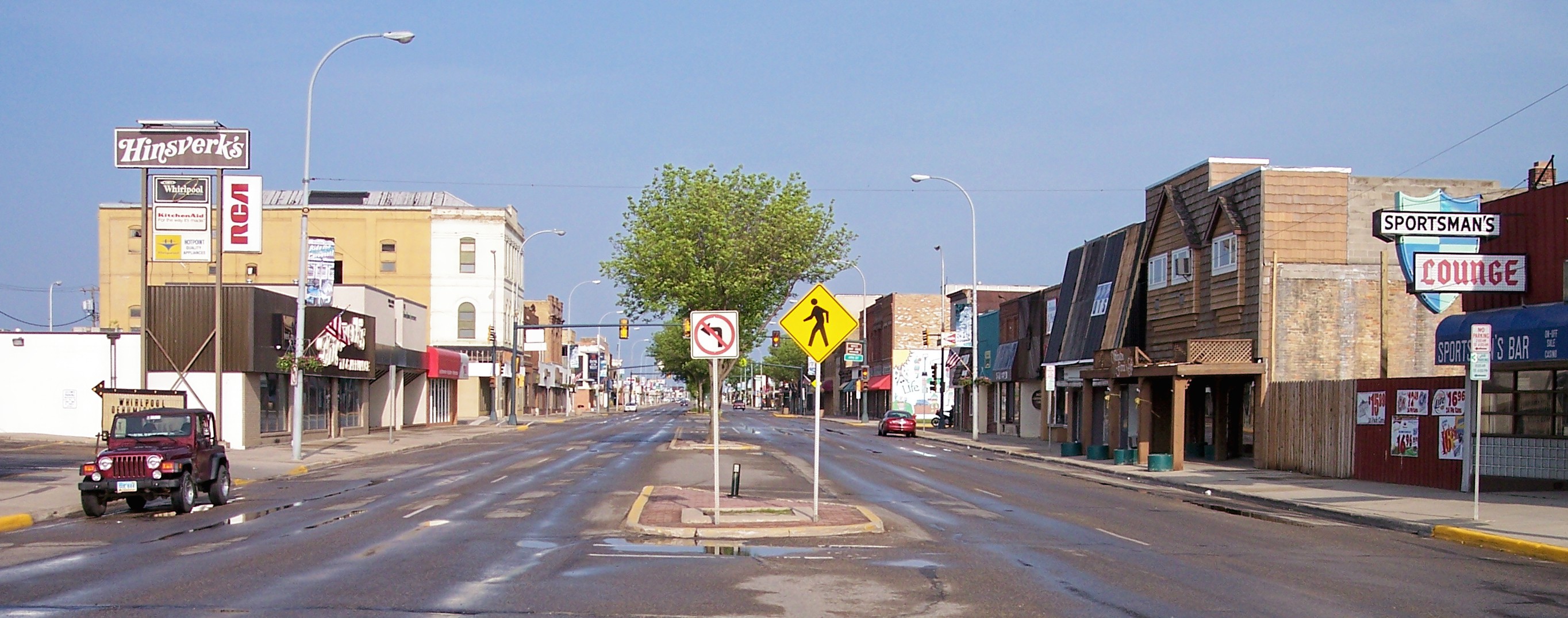
imagesize = 250px
image_caption = Dakota Avenue in downtown Wahpeton in 2007
image_
mapsize = 250px
map_caption = Location of Wahpeton, North Dakota
mapsize1 =
map_caption1 =subdivision_type = Country
subdivision_name =United States
subdivision_type1 = State
subdivision_name1 =North Dakota
subdivision_type2 = County
subdivision_name2 = Richlandgovernment_footnotes =
government_type =
leader_title = Mayor
leader_name = Jim Sturdevant
leader_title1 =
leader_name1 =
established_title =
established_date =area_footnotes =
area_magnitude =
area_total_km2 = 12.9
area_land_km2 = 12.9
area_water_km2 = 0.0
area_total_sq_mi = 5.0
area_land_sq_mi = 5.0
area_water_sq_mi = 0.0population_as_of = 2000
population_footnotes =
population_total = 8586
population_density_km2 = 663.4
population_density_sq_mi = 1718.1timezone = Central (CST)
utc_offset = -6
timezone_DST = CDT
utc_offset_DST = -5
elevation_footnotes =
elevation_m = 294
elevation_ft = 965
latd = 46 |latm = 16 |lats = 12 |latNS = N
longd = 96 |longm = 36 |longs = 38 |longEW = Wpostal_code_type =
ZIP code s
postal_code = 58074-58076
area_code = 701
blank_name = FIPS code
blank_info = 38-82660GR|2
blank1_name = GNIS feature ID
blank1_info = 1033621GR|3
website =
footnotes =Wahpeton is a city in Richland County,
North Dakota in theUnited States . It is thecounty seat of Richland CountyGR|6. The population was 8,586 at the 2000 census. Wahpeton was founded in1871 . It is the principal city of the Wahpeton Micropolitan Statistical Area, which includes all of Richland County, North Dakota and Wilkin County,Minnesota .Wahpeton's twin city is
Breckenridge, Minnesota . TheBois de Sioux River and theOtter Tail River join at Wahpeton and Breckenridge to form theRed River of the North .The
North Dakota State College of Science is located in Wahpeton. The local newspaper is the "Wahpeton Daily News ".History
Early history
The first explorer in the area was
Jonathan Carver in 1767. He explored and mapped the Northwest at the personal request of Major Robert Rogers. Rogers was commander ofFort Michilimackinac , the British fort atMackinaw City, Michigan which protected the passage between Lake Michigan and Lake Huron. Carver's mission was to find the Northwest passage, the imaginary waterway to the Orient which Rogers was convinced existed. While Carver failed in his search, the passing years saw many fur traders and explorers pass through the area.More than one hundred years after the Carver expedition, a Government surveying party passed through the Wahpeton area. J. W. Blanding, a member of the expedition was so impressed by the fertile river valley that he returned to his Wisconsin home determined to move his family and belongings to the Dakota Territory. Blanding so influenced other Wisconsin settlers that many of them arrived and homesteaded in the Wahpeton area before Blanding could return.
The first settler was Morgan T. Rich. His plow turned the first furrow of rich black bottomland in 1869. When other settlers arrived, they formed a tiny community and quite naturally named it Richville. An apt name considering its founder and the fertile quality of the soil.
In 1871, a Post Office was opened. At the same time, the town's name was changed to "Chahinkapa" an Indian name meaning "the end of the woods." Two years later, the county was organized and called Chahinkapa County. Later that year the county was renamed Richland County and the town of Chahinkapa renamed Wahpeton. Credit for suggesting the name Wahpeton is given to an early settler named William Cooper. The name of the city of Wahpeton was adapted from the Dakota name of the local population of
Dakota Indians, the Wakhpetonwan. The name meant "leaf dwellers," and was adopted when they lived in the vicinity ofLake Mille Lacs before they were displaced by theOjibwa . cite book| last =Upham| first =Warren| authorlink =Warren Upham| title =Minnesota Place Names, A Geographical Encyclopedia, 3rd Edition| publisher =Minnesota Historical Society| date =2001| location =Saint Paul, Minnesota| pages =pp. 75| isbn =0-87351-396-7]Growth of the village of Wahpeton was quite slow during the first few years. But a flurry of activity was created in 1872 when the St. Paul and Pacific Railway (now the Great Northern) extended a line into Breckenridge, Minnesota, a tiny community just across the Bois de Sioux River. This created a booming business in flat boat building in both Breckenridge and Wahpeton. Flat boats could carry freight directly from the railroad down river to northern North Dakota and all the way to Winnipeg, Canada, via the Red River of the North, the waters of which eventually reach Hudson Bay.
At the same time, the railroad opened up the area to many more settlers. Germans, Bohemians, Scandinavians and native Americans moved to Richland County to file homesteads. Wahpeton was growing. And in 1874, Jacob Morvin and Joseph Sittarich opened the first retail store in the county. By 1876 the traffic between Wahpeton and Breckenridge had grown to where the local ferry could not handle it and a bridge was built across the Bois de Sioux River connecting the two towns.
Another flurry of growth was realized in 1880 when the St. Paul, Minneapolis and Manitoba Railroad crossed the river and pushed its tracks on toward the north-west. A few years later, in 1883, the population of Wahpeton was estimated to be as high as 1,400 people.
As the county seat, Wahpeton was the center of all activity. Here was the courthouse, the bank and the first flour mills. In 1889 the Red River Valley University was established later to become the North Dakota State School of Science.
As the century came to a close, Wahpeton had settled down into a hard-working agricultural community. Its frontier had, years before, passed further west.
In 1904 the United States Government established the Wahpeton Indian School (now called Circle of Nations School) for the education of Native American children from northern Minnesota, North Dakota and northern South Dakota.
Through the Twenties and Thirties, Wahpeton continued to grow, develop and to keep pace with the rest of the nation. It has been through this half of the Twentieth Century that the Red River Valley has earned its reputation as one of the richest agricultural belts in the nation.
Recent history
Wahpeton is located in a county with many producing farms, a city with the most modern medical center in the area, St. Francis Hospital. Wahpeton has two railroads, a bus line, five truck lines and an airport with runways of just over 3,000 and 5,000 feet in length. It is the home of the North Dakota State College of Science which includes a junior college, business college trade school and technical school.
Recreation is also important to the citizens of Wahpeton. The area attracts outdoorsman and hunters, because it is located in the midst of the Western flyway, which means that the Wahpeton area provides excellent migratory waterfowl hunting. In the spring and summer the Bois de Sioux Golf Course offers golfers the opportunity to literally hit their tee-shot "into the next state". It is the only golf course in the nation where half the course is in one state and the other half in another.
Near the golf course is Chahinkapa Park, which offers many opportunities for recreation. Here young people will find all kinds of playground equipment and can see bears, buffalo, Ilama, elk, and other zoo animals. The park also has baseball, softball, and football facilities, miniature golf, tennis, and during the summer the large swimming pool is also open.
There are many points of interest in Wahpeton, among them is the Richland County Historical Society Museum which is the most modern of its kind in the state and it provides hours of enjoyable browsing. Just a short drive from Wahpeton is
Fort Abercrombie , where the restored fort and museum artifacts bring back the days of the covered wagon. Just outside the city is the Circus Monument erected in memory of circus workers killed by lightning here in 1897 and where circus performers hold a memorial service whenever they perform in the area. The Leach Public Library houses over 17,000 volumes. The Carmelite Monastery, nestled in the bend of the Wild Rice River a few miles from Wahpeton, is also within driving range. It was recently announced that the Imation in Wahpeton, an employer of many of the town's people, will be shutting down by sometime in the year 2009.Source: http://www.wahpeton.com [http://www.wahpeton.com]Geography
Wahpeton is located at coor dms|46|16|12|N|96|36|38|W|city (46.269931, -96.610463)GR|1.
According to the
United States Census Bureau , the city has a total area of 12.9km² (5.0 mi²), all land.The Red River of the North forms one of the most fertile river valleys in the world. As it flows north to Canada it forms the state boundary between North Dakota and Minnesota. Near the river's head-waters on the bank of the Bois de Sioux is Wahpeton, North Dakota.
Demographics
USCensusPop
1920= 3069
1930= 3176
1940= 3747
1950= 5125
1960= 5876
1970= 7076
1980= 9064
1990= 8751
2000= 8586
estimate= 7906
estyear= 2006
estref=As of the
census GR|2 of 2000, there were 8,586 people, 3,254 households, and 1,867 families residing in the city. Thepopulation density was 663.0/km² (1,718.1/mi²). There were 3,492 housing units at an average density of 269.7/km² (698.8/mi²). The racial makeup of the city was 95.47% White, 0.62% African American, 2.41% Native American, 0.43% Asian, 0.03% Pacific Islander, 0.12% from other races, and 0.92% from two or more races. Hispanic or Latino of any race were 0.76% of the population.The top 6 ancestry groups in the city are German (47.4%), Norwegian (28.4%), Irish (7.1%), Swedish (5.8%), French (4.0%), English (4.0%).
There were 3,254 households out of which 30.4% had children under the age of 18 living with them, 45.3% were married couples living together, 8.5% had a female householder with no husband present, and 42.6% were non-families. 32.7% of all households were made up of individuals and 10.0% had someone living alone who was 65 years of age or older. The average household size was 2.28 and the average family size was 2.97.
In the city the population was spread out with 21.2% under the age of 18, 24.1% from 18 to 24, 24.2% from 25 to 44, 17.5% from 45 to 64, and 13.0% who were 65 years of age or older. The median age was 29 years. For every 100 females there were 109.8 males. For every 100 females age 18 and over, there were 112.3 males.
The median income for a household in the city was $33,471, and the median income for a family was $44,645. Males had a median income of $30,199 versus $20,089 for females. The
per capita income for the city was $15,293. About 7.3% of families and 13.4% of the population were below thepoverty line , including 8.9% of those under age 18 and 10.4% of those age 65 or over.Economy
Economic Development is a program, group of policies, or activity that seeks to improve the economic well being and quality of life for a community, by creating and/or retaining jobs that facilitate growth, provide a stable tax base and create wealth.
On May 14, 1991, City of Wahpeton voters approved a 1% city sales and use tax, the proceeds of which are to be dedicated solely to economic development of the City of Wahpeton and Richland County, North Dakota by means of business and industrial expansion including job creation, job retention, business and industrial diversification, and the creation, fostering and maintenance of business and trade activities and facilities. The tax would become effective July 1, 1991 and sunset in five years. On June 14, 1994, voters approved to extend the sales tax 10 years to June 30, 2006. And again on October 14, 2003, voters approved broadening the use and extending the 1 1/2% sales tax to June 30, 2026.
In addition to strictly city sales tax funds, and the New Construction in jobs development levy direction and administration, the Economic Development operations budget enables, leverages and includes leadership/management of and/or support to a much broader range of related economic development activity. This activity includes but is not limited to the Community Development Corporation, revolving loan program, planning, other city departments, housing and community development, commercial and industrial base, work force training and development, chamber, tourism, county, regional, state and federal matters.
Wahpeton is the home of several large manufacturing plants, including
Imation Corporation , [http://www.woodcraftindustries.com/index.php Woodcraft Industries, Inc.] , WCCO Belting, Minn-Dak Farmers Cooperative, andCargill .For more information, visit: [http://www.wahpeton.com/index.asp?Type=B_BASIC&SEC={792046D0-57D2-4AA9-9D91-ED61E6A2B304}]
Education
K-12
The city of Wahpeton is served by [http://www.wahpeton.k12.nd.us/Zimmerman%20Elementary.htm Zimmerman Elementary School] , [http://www.wahpeton.k12.nd.us/Central%20Elementary.htm Central Elementary School] , [http://www.wahpeton.k12.nd.us/Middle%20School.htm Wahpeton Middle School] , and [http://www.wahpeton.k12.nd.us/High%20School.htm Wahpeton Senior High School] . A private school, St. John's Elementary School, is also located in Wahpeton.
High school championships
*State Class 'A' football: 1930, 1971
*State Class 'A' boys basketball : 1941, 1944, 1954, 1979
*State Class 'A' girls basketball : 1986
*State Class 'A' volleyball: 1985, 1986
*State Class 'A' wrestling: 2007
Higher education
*
North Dakota State College of Science Culture
Wahpeton's area attractions include the [http://www.wahpetonpark.com/PR%20Carousel.htm Prairie Rose Carousel] and the
Chahinkapa Zoo . The Wahpeton/Breckenridge community also features theBois de Sioux Golf Course with nine holes located in North Dakota and nine in Minnesota. Kidder Dam, home to"Wahpper" the World's Largest Catfish , offers swimming and fishing.Fishing: [http://www.wahpeton.com/index.asp?Type=B_LOC&SEC={5EFDB701-02CD-4611-A975-FB01E854FCEE}&DE={315BA862-AF96-472D-BBE2-9A1487594720}] Dakota Magic Casino: [http://www.wahpeton.com/index.asp?Type=B_LOC&SEC={5EFDB701-02CD-4611-A975-FB01E854FCEE}&DE={88D92E0F-4FD6-44F6-8C03-ADFE4357DEB7}] Bagg Bonanza Farm Historic Site: [http://www.wahpeton.com/index.asp?Type=B_LOC&SEC={5EFDB701-02CD-4611-A975-FB01E854FCEE}&DE={879CC647-EBCF-4A3C-900B-C32A85EC3CB1}] Ringling Bros. Circus Monument: [http://www.wahpeton.com/index.asp?Type=B_LOC&SEC={5EFDB701-02CD-4611-A975-FB01E854FCEE}&DE={07D892C4-8D70-4A06-9612-EBC61DE62756}] Prairie Rose Carousel: [http://www.wahpeton.com/index.asp?Type=B_LOC&SEC={5EFDB701-02CD-4611-A975-FB01E854FCEE}&DE={750393E8-B439-4C9A-844D-084EFD065D36}] Fort Abercrombie State Museum: [http://www.wahpeton.com/index.asp?Type=B_LOC&SEC={5EFDB701-02CD-4611-A975-FB01E854FCEE}&DE={A3588E38-CE3A-48AC-AA03-2913C2EE41B6}] Richland County Historical Museum: [http://www.wahpeton.com/index.asp?Type=B_LOC&SEC={5EFDB701-02CD-4611-A975-FB01E854FCEE}&DE={AB3CBDD9-11E2-463E-B4C0-3F89E17A4362}] Tewaukon National Wildlife Refuge: [http://www.wahpeton.com/index.asp?Type=B_LOC&SEC={5EFDB701-02CD-4611-A975-FB01E854FCEE}&DE={10F3AC98-FCC1-4B96-913F-77136BE5D0BF}]
Chahinkapa Zoo : [http://www.wahpeton.com/index.asp?Type=B_LOC&SEC={5EFDB701-02CD-4611-A975-FB01E854FCEE}&DE={CA16C244-7845-4407-8CDE-8ED08C65B553}] Camping Sites: [http://www.wahpeton.com/index.asp?Type=B_LOC&SEC={B50E170F-E8CC-4A78-9AEC-AD739CA6EC24}] Motels/Hotels: [http://www.wahpeton.com/index.asp?Type=B_LOC&SEC={0484478A-A05F-497B-B626-14A376256299}] Restaurants: [http://www.wahpeton.com/index.asp?Type=B_LOC&SEC={0484478A-A05F-497B-B626-14A376256299}] Events Calendar: [http://www.rrvc.net/events/calendar.htm] Source: http://www.wahpeton.comNotable residents
*
Sam Anderson - actor
*Louise Erdrich -Ojibwa author who grew up in Wahpeton. (Erdrich was born in nearbyMinnesota .)
*Woodrow W. Keeble - Highly decoratedWorld War II andKorean War veteran, Medal of Honor recipient
*Porter J. McCumber - former U.S. Senator
*Steve Myhra - former field goal kicker for the Baltimore ColtsNotes
External links
* [http://www.wahpeton.com City of Wahpeton official website]
* [http://www.wahpeton.k12.nd.us/ Wahpeton Public Schools website]
Wikimedia Foundation. 2010.