- Oliver County, North Dakota
-
Oliver County, North Dakota 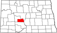
Location in the state of North Dakota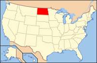
North Dakota's location in the U.S.Founded 1885 Seat Center Largest city Center Area
- Total
- Land
- Water
731 sq mi (1,893 km²)
724 sq mi (1,875 km²)
8 sq mi (21 km²), 1.05%Population
- (2010)
- Density
1,846
3/sq mi (1/km²)Oliver County is a county located in the U.S. state of North Dakota. As of 2010, the population was 1,846.[1] Its county seat and only city is Center.[2]
The county was created by the 1885 territorial legislature and was organized on May 18, 1885. It was named for Harry S. Oliver of Lisbon, North Dakota (1855-1909), a Republican politician and member of the Dakota Territory House of Representatives at the time. Sanger (Raymond) was the county seat from 1885 to 1902, when the title went to Center.[3]
Contents
Geography
According to the U.S. Census Bureau, the county has a total area of 1,894 km² (731 sq mi). 1,874 km² (724 sq mi) of it is land and 20 km² (8 sq mi) of it (1.05%) is water.
Major highways
 North Dakota Route 25
 North Dakota Route 31
 North Dakota Route 48
 North Dakota Route 1806
 North Dakota Route 200A
Adjacent counties
- McLean County (northeast)
- Burleigh County (east)
- Morton County (south)
- Mercer County (west and north)

McLean County Mercer County 
Burleigh County  Oliver County, North Dakota

Morton County Demographics
Historical populations Census Pop. %± 1890 464 — 1900 990 113.4% 1910 3,577 261.3% 1920 4,425 23.7% 1930 4,262 −3.7% 1940 3,859 −9.5% 1950 3,091 −19.9% 1960 2,610 −15.6% 1970 2,322 −11.0% 1980 2,495 7.5% 1990 2,381 −4.6% 2000 2,065 −13.3% 2010 1,846 −10.6% U.S. Decennial Census As of the census[4] of 2000, there were 2,065 people, 791 households, and 604 families residing in the county. The population density was 1/km² (3/sq mi). There were 903 housing units at an average density of 0/km² (1/sq mi). The racial makeup of the county was 97.58% White, 0.15% Black or African American, 1.26% Native American, 0.10% Asian, and 0.92% from two or more races. 0.63% of the population were Hispanic or Latino of any race. 59.2% were of German, 13.6% Norwegian and 6.5% American ancestry according to Census 2000.
There were 791 households out of which 35.50% had children under the age of 18 living with them, 69.20% were married couples living together, 3.90% had a female householder with no husband present, and 23.60% were non-families. 21.00% of all households were made up of individuals and 10.70% had someone living alone who was 65 years of age or older. The average household size was 2.61 and the average family size was 3.05.
In the county the population was spread out with 27.40% under the age of 18, 4.70% from 18 to 24, 23.50% from 25 to 44, 30.10% from 45 to 64, and 14.20% who were 65 years of age or older. The median age was 42 years. For every 100 females there were 107.50 males. For every 100 females age 18 and over, there were 106.20 males.
The median income for a household in the county was $36,650, and the median income for a family was $45,430. Males had a median income of $40,577 versus $19,015 for females. The per capita income for the county was $16,271. About 11.20% of families and 14.90% of the population were below the poverty line, including 23.60% of those under age 18 and 13.90% of those age 65 or over.
Places
City
Note: all incorporated communities in North Dakota are called "cities" regardless of their size.
Unincorporated communities
- Hannover
- Sanger
See also
References
- ^ "2010 Census Redistricting Data (Public Law 94-171) Summary File". American FactFinder. United States Census Bureau. http://factfinder2.census.gov/faces/tableservices/jsf/pages/productview.xhtml?pid=DEC_10_PL_GCTPL2.ST05&prodType=table. Retrieved 3 May 2011.
- ^ "Find a County". National Association of Counties. http://www.naco.org/Counties/Pages/FindACounty.aspx. Retrieved 2011-06-07.
- ^ "County History". Official Portal for North Dakota State Government. http://www.nd.gov/content.htm?parentCatID=83&id=County%20History. Retrieved 4 May 2011.
- ^ "American FactFinder". United States Census Bureau. http://factfinder.census.gov. Retrieved 2008-01-31.
Municipalities and communities of Oliver County, North Dakota City 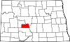
Unorganized
territoriesEast Oliver | West Oliver
Unincorporated
communitiesFort Clark | Hannover | Hensler | Otter Creek | Price | Sanger
Categories:- North Dakota counties
- Oliver County, North Dakota


Wikimedia Foundation. 2010.