- Almont, North Dakota
Infobox Settlement
official_name = Almont, North Dakota
settlement_type =City
nickname =
motto =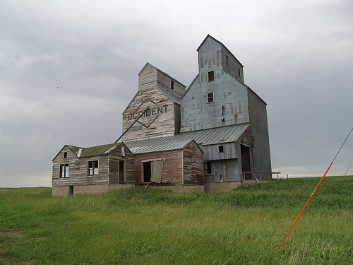
imagesize = 250px
image_caption = An old grain elevator in Almont
image_
mapsize = 250px
map_caption = Location of Almont, North Dakota
mapsize1 =
map_caption1 =subdivision_type = Country
subdivision_name =United States
subdivision_type1 = State
subdivision_name1 =North Dakota
subdivision_type2 = County
subdivision_name2 = Mortongovernment_footnotes =
government_type =
leader_title =
leader_name =
leader_title1 =
leader_name1 =
established_title = Founded
established_date = 1906unit_pref = Imperial
area_footnotes =
area_magnitude =
area_total_km2 = 6.8
area_land_km2 = 6.8
area_water_km2 = 0.0
area_total_sq_mi = 2.6
area_land_sq_mi = 2.6
area_water_sq_mi = 0.0population_as_of = 2000
population_footnotes =
population_total = 89
population_density_km2 = 13.0
population_density_sq_mi = 33.8timezone = Central (CST)
utc_offset = -6
timezone_DST = CDT
utc_offset_DST = -5
elevation_footnotes =
elevation_m = 585
elevation_ft = 1919
latd = 46 |latm = 43 |lats = 38 |latNS = N
longd = 101 |longm = 30 |longs = 23 |longEW = Wpostal_code_type =
ZIP code
postal_code = 58520
area_code = 701
blank_name = FIPS code
blank_info = 38-01700GR|2
blank1_name = GNIS feature ID
blank1_info = 1027687GR|3
website =
footnotes =Almont is a city in Morton County,
North Dakota in theUnited States . It is part of the "Bismarck, NDMetropolitan Statistical Area " or "Bismarck-Mandan ". The population was 89 at the 2000 census. Almont was founded in 1906.Geography
Almont is located at coor dms|46|43|38|N|101|30|23|W|city (46.727164, -101.506362).GR|1
According to the
United States Census Bureau , the city has a total area of 2.6square mile s (6.8km² ), all of it land.Demographics
As of the
census GR|2 of 2000, there were 89 people, 43 households, and 22 families residing in the city. Thepopulation density was 33.8 people per square mile (13.1/km²). There were 63 housing units at an average density of 23.9/sq mi (9.2/km²). The racial makeup of the city was 100.00% White.There were 43 households out of which 25.6% had children under the age of 18 living with them, 44.2% were married couples living together, 4.7% had a female householder with no husband present, and 48.8% were non-families. 44.2% of all households were made up of individuals and 23.3% had someone living alone who was 65 years of age or older. The average household size was 2.07 and the average family size was 3.00.
In the city the population was spread out with 24.7% under the age of 18, 5.6% from 18 to 24, 28.1% from 25 to 44, 23.6% from 45 to 64, and 18.0% who were 65 years of age or older. The median age was 40 years. For every 100 females there were 81.6 males. For every 100 females age 18 and over, there were 86.1 males.
The median income for a household in the city was $25,625, and the median income for a family was $30,625. Males had a median income of $24,375 versus $15,000 for females. The
per capita income for the city was $13,761. There were no families and 6.4% of the population living below thepoverty line , including no under eighteens and 38.9% of those over 64.References
External links
Wikimedia Foundation. 2010.