- Moffit, North Dakota
-
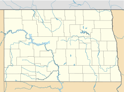
Moffit — Unincorporated community — Location within the state of North Dakota Coordinates: 46°40′39″N 100°17′42″W / 46.6775°N 100.295°WCoordinates: 46°40′39″N 100°17′42″W / 46.6775°N 100.295°W Country United States State North Dakota County Burleigh Time zone Central (CST) (UTC-6) – Summer (DST) CDT (UTC-5) ZIP codes 58560 FIPS code GNIS feature ID Moffit is an unincorporated community in Burleigh County, North Dakota, United States. It lies along US 83 10 miles south of Sterling. Moffit's ZIP code is 58560.
Municipalities and communities of Burleigh County, North Dakota Cities Townships Apple Creek | Boyd | Canfield | Christiania | Clear Lake | Crofte | Cromwell | Driscoll | Ecklund | Estherville | Florence Lake | Francis | Ghylin | Gibbs | Glenview | Grass Lake | Harriet-Lien | Hay Creek | Hazel Grove | Logan | Long Lake | McKenzie | Menoken | Missouri | Morton | Naughton | Painted Woods | Richmond | Rock Hill | Schrunk | Sibley Butte | Steiber | Sterling | Taft | Telfer | Thelma | Trygg | Wild Rose | Wilson | Wing
CDPs Unorganized
territoriesBurnt Creek-Riverview | Lincoln-Fort Rice | Lyman | Phoenix
Unincorporated
communitiesFootnotes ‡This populated place also has portions in an adjacent county or counties
 Bismarck-Mandan Metropolitan Area (ND)
Counties Core city Surrounding areas Categories:- Unincorporated communities in North Dakota
- Populated places in Burleigh County, North Dakota
- North Dakota geography stubs
Wikimedia Foundation. 2010.


