- National Register of Historic Places listings in Grand Forks County, North Dakota
-
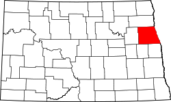 Location of Grand Forks County in North Dakota
This is a list of the National Register of Historic Places listings in Grand Forks County, North Dakota. This is intended to be a complete list of the properties and districts on the National Register of Historic Places in Grand Forks County, North Dakota, United States. The locations of National Register properties and districts for which the latitude and longitude coordinates are included below, may be seen in a Bing or Google map.[1]
With 63 properties and districts listed on the National Register, Grand Forks County has more listings than any of the state's other 52 counties.
The city of Grand Forks has been damaged by floods and fires numerous times, including by floods of the Red River, overflowing its banks in record floods in 1882, 1893, 1897, 1950, 1965, 1966, 1969, 1975, 1978, and 1979."[2]:2 Many of the historic buildings listed on the National Register date from the 1890s period. Many buildings of that era were designed by architects Joseph Bell DeRemer and others; over 60 percent of the commercial buildings were built by the Dinnie Brothers, bricklayers.[2]:17 Other notable architects whose work is reflected in the listings include: Buechner & Orth, Theodore B. Wells, George Hancock and John W. Ross.
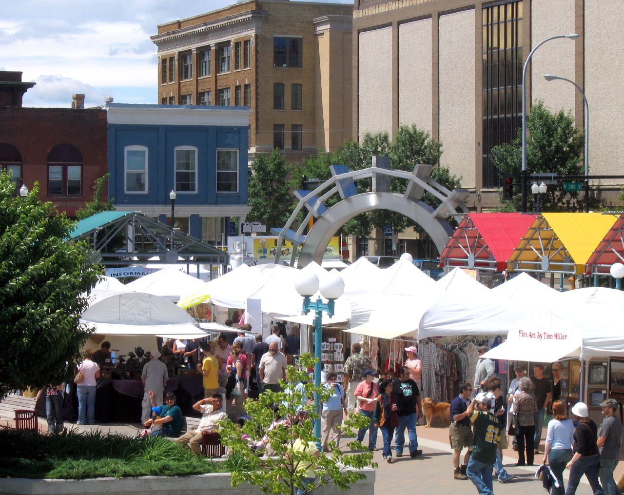
A large number of buildings were identified as worth preserving in a 1981 study of Downtown Grand Forks historical resources. [2] This led to many individual buildings being NRHP-listed, and to the listing of several large historic districts. The 1997 flood and fire destroyed some of the National Register-listed buildings.
In 2005, despite the flood and fire damage to the area, the Downtown Grand Forks Historic District was listed. The most recent listings, in 2010, are the University of North Dakota Historic District and WPA Stone Structures in Memorial Park and Calvary Cemetery, and in 2011, The Kegs Drive-In.
A large number of the listings were prepared by Dr. Norene Roberts, of North Dakota State University. Additional notes for many are archived at the university.[3]
Contents: Counties in North Dakota Adams | Barnes | Benson | Billings | Bottineau | Bowman | Burke | Burleigh | Cass | Cavalier | Dickey | Divide | Dunn | Eddy | Emmons | Foster | Golden Valley | Grand Forks | Grant | Griggs | Hettinger | Kidder | La Moure | Logan | McHenry | McIntosh | McKenzie | McLean | Mercer | Morton | Mountrail | Nelson | Oliver | Pembina | Pierce | Ramsey | Ransom | Renville | Richland | Rolette | Sargent | Sheridan | Sioux | Slope | Stark | Steele | Stutsman | Towner | Traill | Walsh | Ward | Wells | Williams -
- This National Park Service list is complete through NPS recent listings posted November 10, 2011.[4]
Key
† Covered in the Downtown Grand Forks MRA Current listings
Landmark name Image Date listed Location City or Town Summary 1 Avalon Theater 
February 4, 1991 210 Towner Ave.
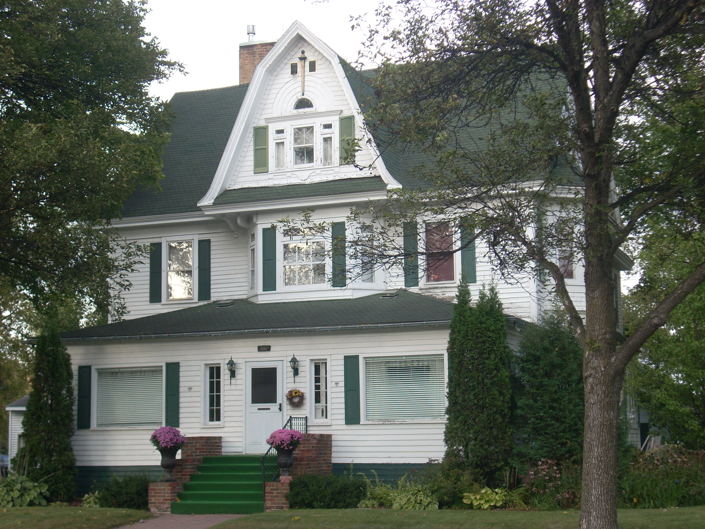
47°54′19″N 97°37′25″W / 47.90528°N 97.62361°WLarimore Art Deco style movie theater built in 1938 as a 350 seat theater[5] 2 Harriet and Thomas Beare House 
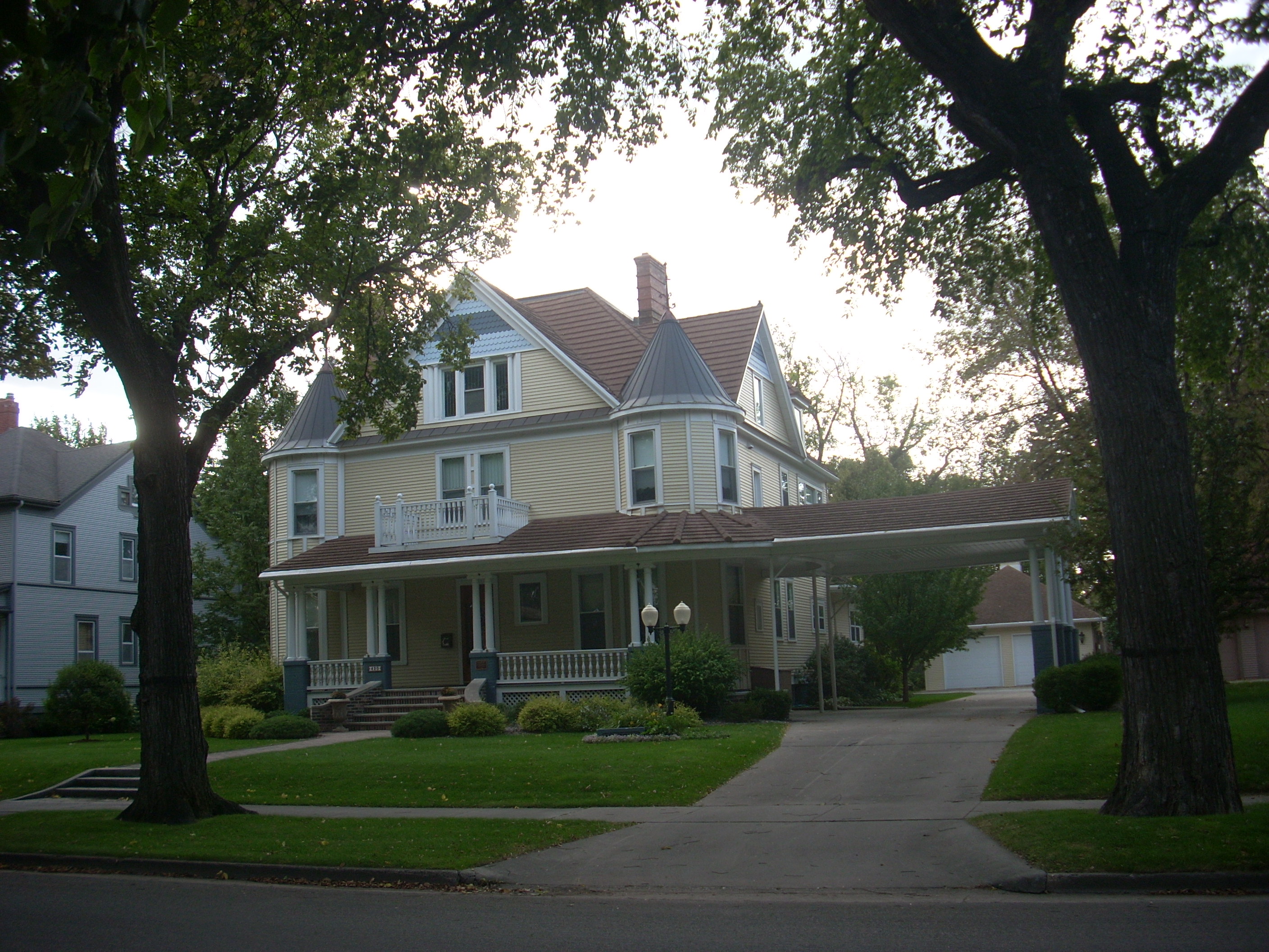
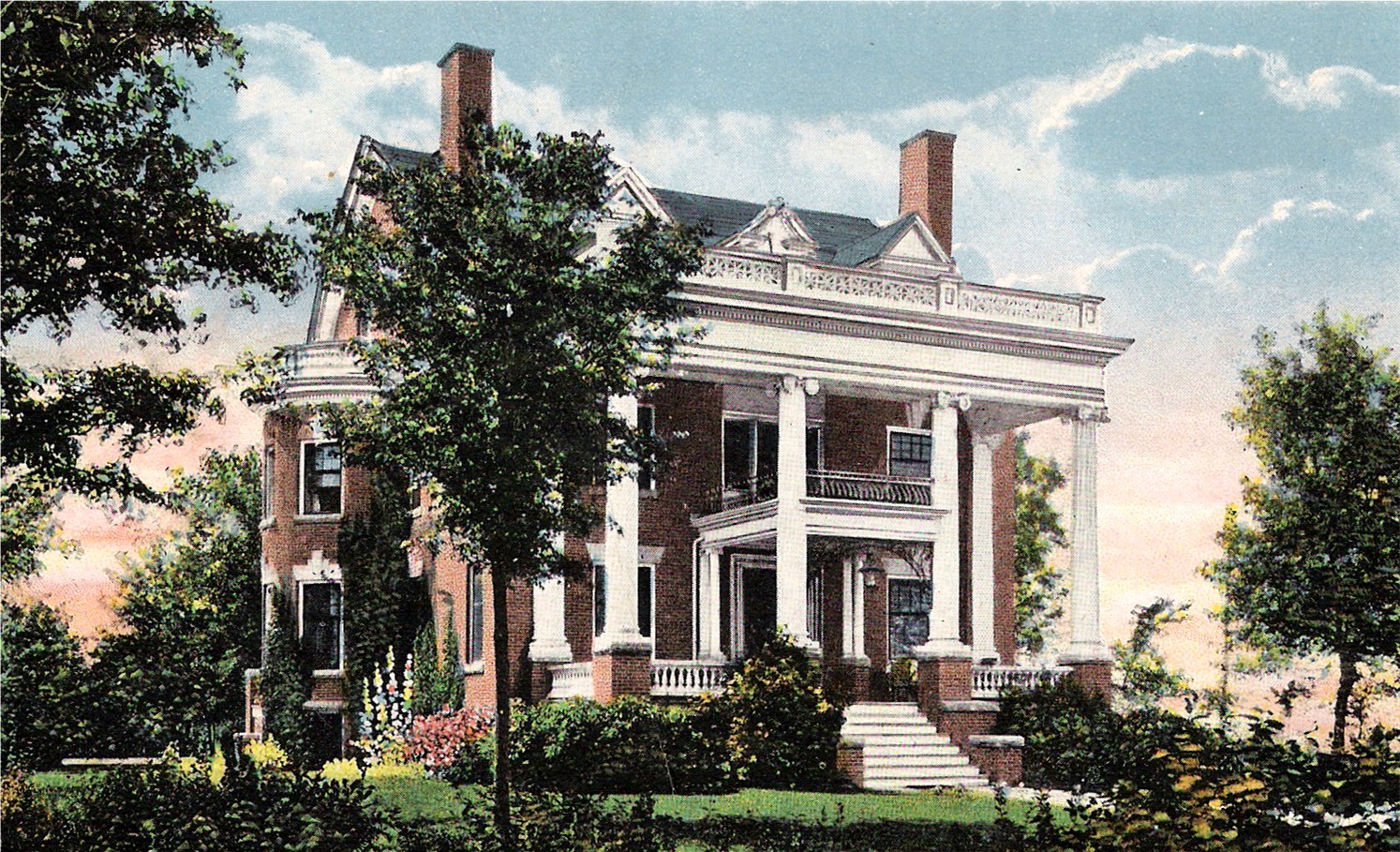
April 20, 1995 420 Reeves Dr.
47°55′4″N 97°1′36″W / 47.91778°N 97.02667°WGrand Forks Victorian house built in 1901 for real estate man Thomas Beare, exemplifying the conspicuous consumption of the cities' elite during the Progressive Era and the growth of the Second Dakota Boom.[6] 3 R.S. Blome Granitoid Pavement in Grand Forks 
November 5, 1991 (listing)
August 30, 2010 (boundary decrease)Roughly Lewis Boulevard south of Conklin Ave. and the area around the junctions of Walnut St. and 3rd Ave. and Minnesota Ave. and 5th St.
47°55′27″N 97°1′58″W / 47.92417°N 97.03278°WGrand Forks Paved area of a historic road surface, a Portland cement–aggregate combination that was intended to bridge the gap between the needs of Horse-drawn vehicles, which required sure footing, and automobiles, which needed a hard, resilient surface, in the early 1900s.[7] 4 B'nai Israel Synagogue and Montefiore Cemetery October 13, 2011 B'nai Israel Synagogue: 601 Cottonwood St.
47°54′58″N 97°1′58″W / 47.91611°N 97.03278°W
Montefiore Cemetery: 1450 N. Columbia Rd.
47°56′2″N 97°4′0″W / 47.93389°N 97.066667°WGrand Forks 5 Building at 201 S. 3rd St. 
October 26, 1982 201 S. 3rd St.
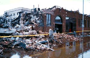
47°55′22.7″N 97°1′37.5″W / 47.922972°N 97.027083°WGrand Forks Built in 1888, "one of three frame storefront buildings in Grand Forks dating from the early period of frame construction along South Third Street, which was the original main thoroughfare in the city between 1870 and the coming of the railroad and the great Dakota Boom in the 1880s. It represents the first period of early boom town building in the city."[8] Relocated to 216 S. 3rd St. after the 1997 Red River Flood[9] 6 Building at 205 DeMers Ave. October 26, 1982 205 DeMers Ave.
47°55′32″N 97°1′46″W / 47.92556°N 97.02944°WGrand Forks Destroyed by the 1997 Red River Flood, NRHP removal requested 3/21/2005[10] 7 Building at 312 Kittson Ave. 
October 26, 1982 312 Kittson Ave.
47°55′27″N 97°1′45″W / 47.92417°N 97.02917°WGrand Forks 8 Building at 317 S. 3rd St. October 26, 1982 317 S. 3rd St.
47°55′21″N 97°1′30″W / 47.9225°N 97.025°WGrand Forks Destroyed by the 1997 Red River Flood, NRHP removal requested 3/21/2005[10] 9 Thomas D. Campbell House 
September 29, 1987 2405 Belmont Rd.
47°53′47″N 97°1′38″W / 47.89639°N 97.02722°WGrand Forks Gothic Revival style log and wood frame home built in 1879, now a house museum.[11] 10 George B. Clifford House 
September 30, 1986 406 Reeves Dr.
47°55′6″N 97°1′36″W / 47.91833°N 97.02667°WGrand Forks 11 Dakota Block 
October 26, 1982 21 S. 4th St.
47°55′26″N 97°1′48″W / 47.92389°N 97.03°WGrand Forks 12 Joseph Bell DeRemer House 
June 9, 1983 625 Belmont Rd.
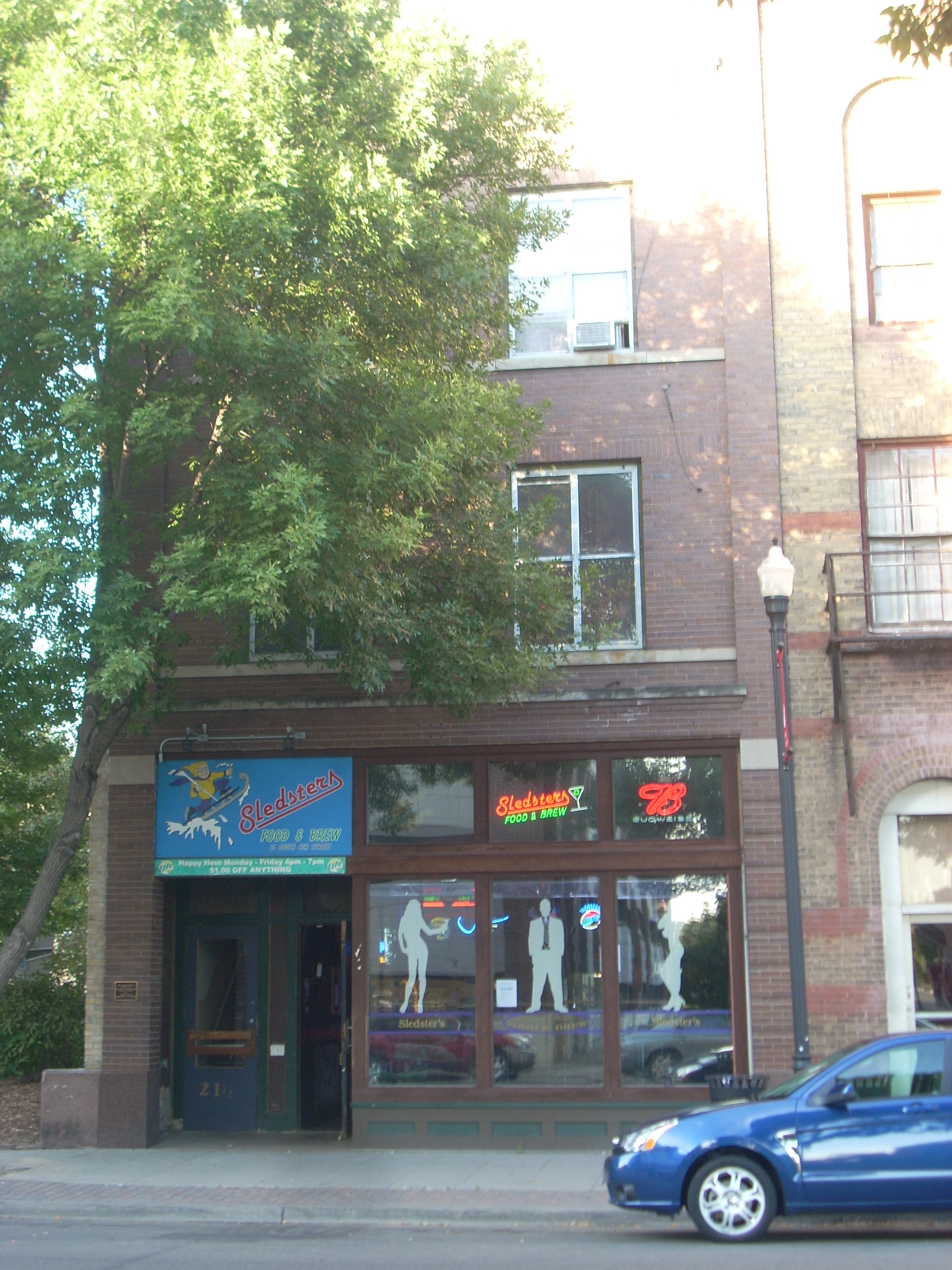
47°54′57″N 97°1′42″W / 47.91583°N 97.02833°WGrand Forks 13 Dinnie Apartments† 
June 3, 1994 102-108 4th Ave., S.
47°55′7″N 97°1′33″W / 47.91861°N 97.02583°WGrand Forks 14 Downtown Grand Forks Historic District 
December 28, 2005 Downtown Grand Forks, at the Red River of the North
47°55′35″N 97°1′51″W / 47.92639°N 97.03083°WGrand Forks 15 Edgar Building 
April 15, 1983 314 Kittson Ave.
47°55′27″N 97°1′46″W / 47.92417°N 97.02944°WGrand Forks 16 Finks and Gokey Block 
April 20, 1983 414-420 DeMers Ave.
47°55′27″N 97°1′55″W / 47.92417°N 97.03194°WGrand Forks 17 First National Bank 
October 26, 1982 322 DeMers Ave.
47°55′29″N 97°1′52″W / 47.92472°N 97.03111°WGrand Forks Damaged by fire during the 1997 Red River Flood. Only burned structure to survive.[12] 18 Carlott Funseth Round Barn October 7, 1986 ND 38
47°46′46″N 97°35′56″W / 47.77944°N 97.59889°WKempton 19 Grand Forks City Hall 
October 26, 1982 404 N. 2nd Ave.
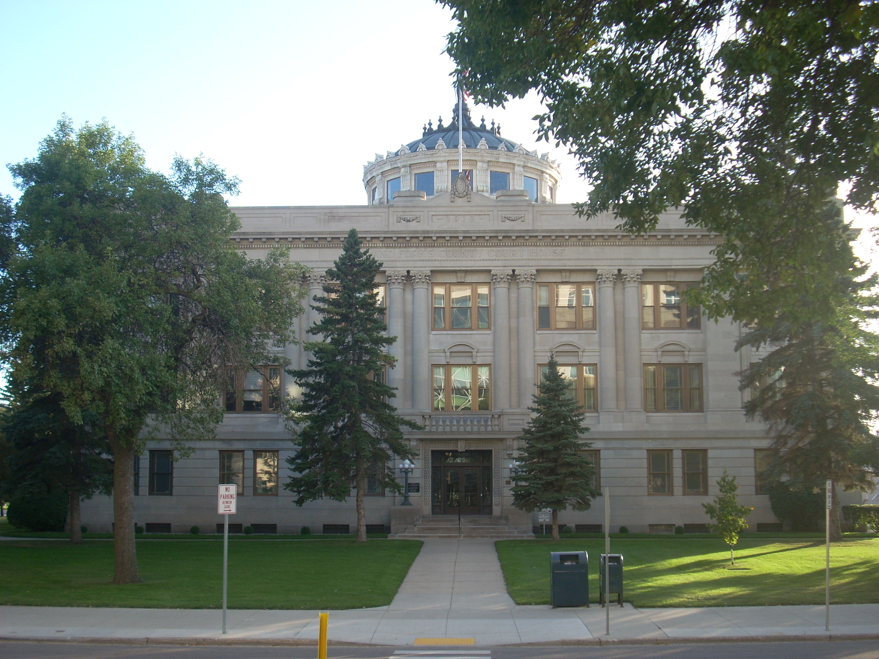
47°55′33″N 97°2′3″W / 47.92583°N 97.03417°WGrand Forks 20 Grand Forks County Courthouse 
November 25, 1980 S. 5th St
47°55′22″N 97°1′46″W / 47.92278°N 97.02944°WGrand Forks 21 Grand Forks County Fairgrounds WPA Structures 
April 21, 2009 2300 Gateway Dr.
47°55′59.24″N 97°3′34.14″W / 47.9331222°N 97.0594833°WGrand Forks 22 Grand Forks Herald 
November 30, 1982 120-124 N. 4th St.
47°55′33″N 97°1′58″W / 47.92583°N 97.03278°WGrand Forks Destroyed by the 1997 Red River Flood and subsequent fire.[12] 23 Grand Forks Mercantile Building 1898 
July 14, 2004 112-118 N. 3rd St.
47°55′42″N 97°1′56″W / 47.92833°N 97.03222°WGrand Forks 24 Grand Forks Mercantile Co. 
October 26, 1982 124 N. 3rd St.
47°55′36″N 97°1′56″W / 47.92667°N 97.03222°WGrand Forks 25 Grand Forks Near Southside Historic District 
July 28, 2004 Roughly bounded by ND 697, the Red River, 13th Ave., and Cottonwood St.; also 1216 Belmont Rd.
47°55′3″N 97°1′37″W / 47.9175°N 97.02694°WGrand Forks Belmont Road address represents a boundary increase 26 Grand Forks Riverside Neighborhood Historic District 
November 15, 2007 North of U.S. Route 2 (Gateway Dr. and west of the Red River)
47°56′13.77″N 97°2′31.52″W / 47.9371583°N 97.0420889°WGrand Forks 27 Grand Forks Woolen Mills 
October 26, 1983 301 N. 3rd St.
47°55′38″N 97°2′2″W / 47.92722°N 97.03389°WGrand Forks 28 Great Northern Freight Warehouse and Depot 
January 29, 1990 899 2nd Ave., N.
47°55′15″N 97°2′15″W / 47.92083°N 97.0375°WGrand Forks 29 Hook and Ladder No. 1 and Hose Co. No. 2 
October 26, 1982 215 S. 4th St.
47°55′21″N 97°1′38″W / 47.9225°N 97.02722°WGrand Forks 30 House at 1648 Riverside Drive September 2, 1994 1648 Riverside Dr.
47°56′9″N 97°2′11″W / 47.93583°N 97.03639°WGrand Forks NRHP removal requested 3/21/2005[10] 31 Iddings Block 
October 26, 1982 9 N. 3rd St.
47°55′32″N 97°1′52″W / 47.92556°N 97.03111°WGrand Forks 32 The Kegs Drive-In 
August 24, 2011 901 N. 5th St.
47°55′48″N 97°2′39.6″W / 47.93°N 97.044333°WGrand Forks 33 J. Nelson Kelly House 
February 18, 1994 521 S. 5th St.
47°55′10″N 97°1′28″W / 47.91944°N 97.02444°WGrand Forks 34 Larimore City Hall May 31, 1990 Block 64, bounded by Towner, 3rd, Terry, and Main
47°54′23″N 97°37′58″W / 47.90639°N 97.63278°WLarimore 35 Martin V. Linwell House February 28, 1980 316 S. Raymond St.
47°43′56″N 97°34′5″W / 47.73222°N 97.56806°WNorthwood 36 Lyons Garage 
October 26, 1982 214-218 N. 4th St.
47°55′35″N 97°2′3″W / 47.92639°N 97.03417°WGrand Forks 37 Masonic Temple 
October 26, 1982 413-421 Bruce Ave.
47°55′18″N 97°1′43″W / 47.92167°N 97.02861°WGrand Forks 38 Metropolitan Opera House 
August 27, 1999 116 S. 3rd St.
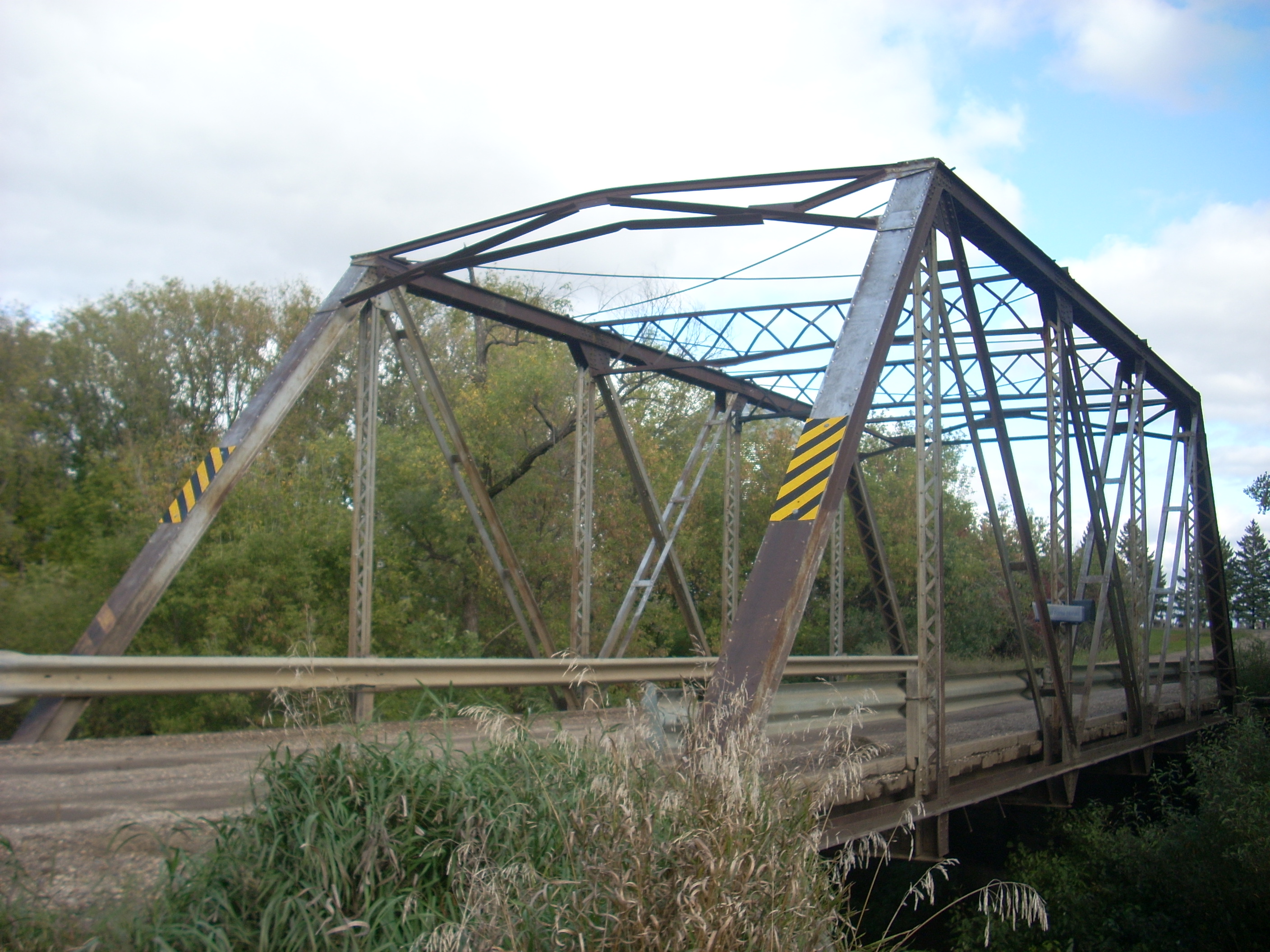
47°55′26″N 97°1′41″W / 47.92389°N 97.02806°WGrand Forks 39 Midway Bridge February 27, 1997 Unnamed county road across an unnamed creek, approximately 1.5 miles south and 2 miles west of Johnstown
48°7′50″N 97°30′50″W / 48.13056°N 97.51389°WJohnstown 40 New Hampshire Apartments 
October 26, 1982 105 N. 3rd St.
47°55′34″N 97°1′55″W / 47.92611°N 97.03194°WGrand Forks Classically-detailed, Early Commercial building designed by Joseph DeRemer, constructed by Dinnie Brothers in 1904; destroyed by the 1997 Red River Flood,[12] NRHP removal requested 3/21/2005.[10][13] A historical marker indicates that the building was destroyed in the 1997 Red River Flood and fire. 41 North Dakota Mill and Elevator 
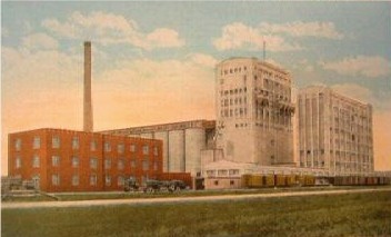
May 11, 1992 1823 Mill Rd.
47°56′21″N 97°3′21″W / 47.93917°N 97.05583°WGrand Forks 42 Northern Pacific Depot and Freight House 
October 26, 1982 202 N. 3rd St.
47°55′37″N 97°1′58″W / 47.92694°N 97.03278°WGrand Forks 43 Northwood Bridge February 27, 1997 Unnamed county road across the Goose River, 1.5 miles southwest of Northwood
47°43′3″N 97°36′25″W / 47.7175°N 97.60694°WNorthwood 44 Odd Fellows Block 
October 26, 1982 23-25 S. 4th St.
47°55′26″N 97°1′47″W / 47.92389°N 97.02972°WGrand Forks 45 Ost Valle Bridge 
February 27, 1997 Unnamed county road across an unnamed tributary of the Red River, approximately 6 miles east and 1 mile north of Thompson
47°47′18″N 96°58′57″W / 47.78833°N 96.9825°WThompson 46 Oxford House 
May 2, 1973 University of North Dakota campus
47°55′19″N 97°4′26″W / 47.92194°N 97.07389°WGrand Forks 47 Roller Office Supply 
October 26, 1982 7 N. 3rd St.
47°55′31″N 97°1′51″W / 47.92528°N 97.03083°WGrand Forks 48 St. John's Block Commercial Exchange 
October 26, 1982 2 N. 3rd St.
47°55′32″N 97°1′49″W / 47.92556°N 97.03028°WGrand Forks 49 St. Michael's Church 
June 30, 1988 520 N. 6th St.
47°55′37″N 97°2′21″W / 47.92694°N 97.03917°WGrand Forks 50 St. Michael's Hospital and Nurses' Residence 
April 20, 1995 813 Lewis Boulevard
47°55′57″N 97°2′22″W / 47.9325°N 97.03944°WGrand Forks 51 Sorlie Memorial Bridge 
July 19, 1999 Eastern end of Demers Ave.
47°55′37″N 97°1′40″W / 47.92694°N 97.02778°WGrand Forks 52 South Junior High School 
March 5, 1999 1224 Walnut St.
47°54′33″N 97°1′55″W / 47.90917°N 97.03194°WGrand Forks 53 Speed Printing 
October 26, 1982 220 S. 3rd St.
47°55′23″N 97°1′35″W / 47.92306°N 97.02639°WGrand Forks 54 Stratford Building 
October 26, 1982 311 DeMers Ave.
47°55′29″N 97°1′50″W / 47.92472°N 97.03056°WGrand Forks 55 Telephone Co. Building 
October 26, 1982 24 N. 4th St.
47°55′31″N 97°1′55″W / 47.92528°N 97.03194°WGrand Forks 56 U.S. Post Office and Courthouse 
June 3, 1976 102 N. 4th St.
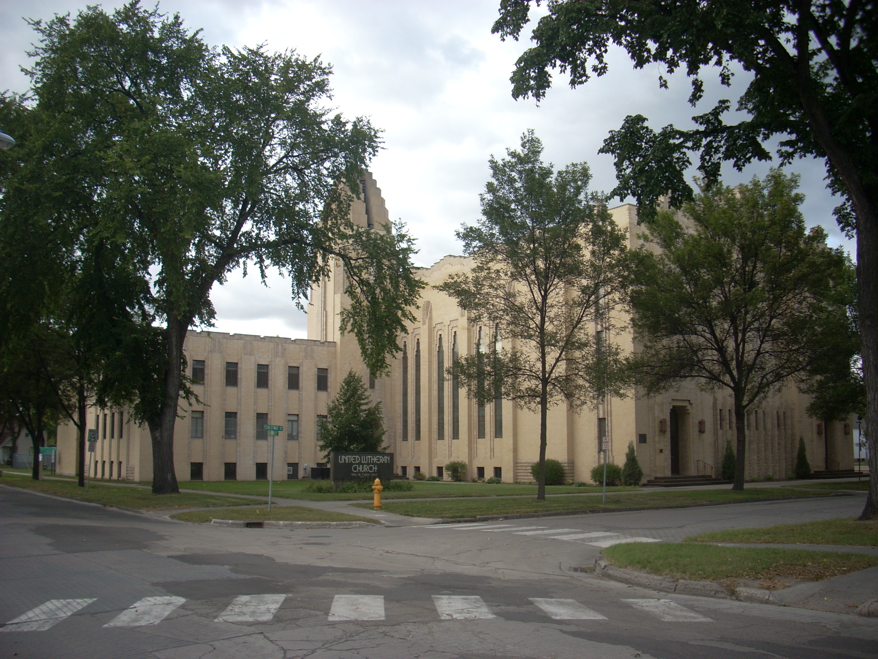
47°55′32″N 97°1′57″W / 47.92556°N 97.0325°WGrand Forks 57 United Lutheran Church 
December 30, 1991 324 Chestnut St.
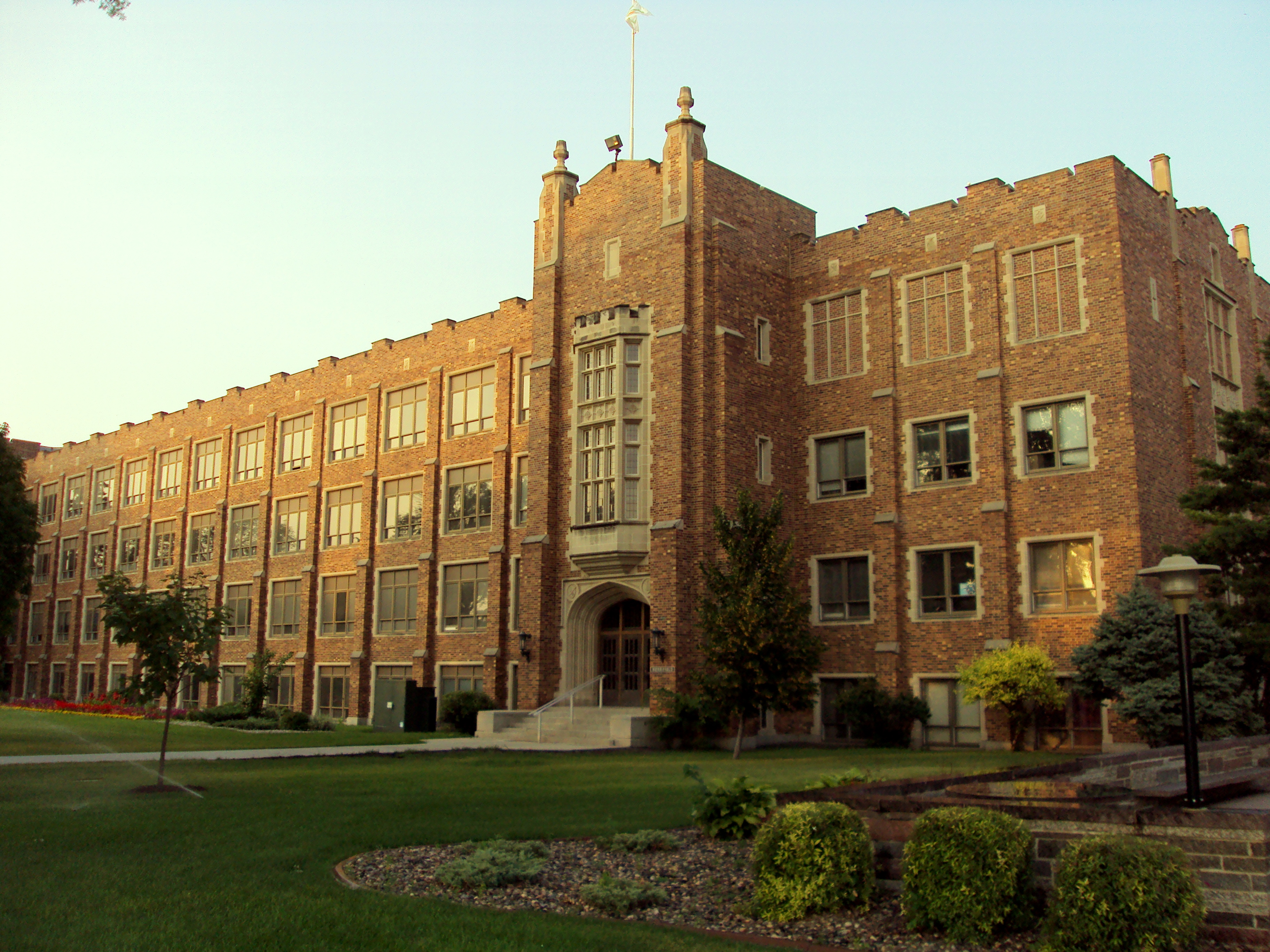
47°55′7″N 97°1′49″W / 47.91861°N 97.03028°WGrand Forks 58 University of North Dakota Historic District 
January 13, 2010 University of North Dakota
47°55′20.8″N 97°4′14.21″W / 47.922444°N 97.0706139°WGrand Forks 59 Viets Hotel October 26, 1982 309-311 3rd St., S.
47°55′22″N 97°1′30″W / 47.92278°N 97.025°WGrand Forks Damaged by the 1997 Red River Flood. Destroyed by fire in September 2000;[14] NRHP removal requested 3/21/2005[10] 60 Washington School 
February 24, 1992 422 N. 6th St.
47°55′34″N 97°2′18″W / 47.92611°N 97.03833°WGrand Forks 61 Dr. Henry Wheeler House 
January 16, 1986 420 Franklin St.
47°55′13″N 97°1′33″W / 47.92028°N 97.02583°WGrand Forks 62 WPA Stone Structures in Memorial Park and Calvary Cemetery 
July 6, 2010 Southeast corner from intersection of Gateway Dr. and N Columbia Rd.
47°55′59″N 97°4′0″W / 47.93306°N 97.066667°WGrand Forks 63 Wright Block 
October 26, 1982 408-412 DeMers Ave.
47°55′28″N 97°1′54″W / 47.92444°N 97.03167°WGrand Forks Formerly listed
Landmark name Image Dates Location City or Town Summary 1 BPOE Lodge: Golden Block† February 4, 1991 (listed)
September 23, 2004 (removed)12 N. 4th St. Grand Forks Early Commercial/vernacular style building that was designed and/or built by Josep Bell DeRemer. Destroyed by the 1997 Red River Flood.[15] 2 Clifford Annex† September 23, 2004 (removed) 407-411 DeMers Ave. Grand Forks Destroyed by the 1997 Red River Flood and subsequent fire.[15] 3 Dinnie Block† September 23, 2004 (removed) 109 N. 3rd Ave. Grand Forks Destroyed by the 1997 Red River Flood.[15] 4 Electric Construction Co. Building† September 23, 2004 (removed) 16 S. 4th St. Grand Forks Destroyed by the 1997 Red River Flood.[15] 5 Flatiron Building† September 23, 2004 (removed) 323 Kittson Ave. Grand Forks Destroyed by the 1997 Red River Flood.[15] 6 Red River Valley Brick Co.† September 23, 2004 (removed) 215 S. 3rd St. Grand Forks Destroyed by the 1997 Red River Flood.[15] See also
- List of National Historic Landmarks in North Dakota
- National Register of Historic Places listings in North Dakota
References
- ^ The latitude and longitude information provided in this table was derived originally from the National Register Information System, which has been found to be fairly accurate for about 99% of listings. For about 1% of NRIS original coordinates, experience has shown that one or both coordinates are typos or otherwise extremely far off; some corrections may have been made. A more subtle problem causes many locations to be off by up to 150 yards, depending on location in the country: most NRIS coordinates were derived from tracing out latitude and longitudes off of USGS topographical quadrant maps created under the North American Datum of 1927, which differs from the current, highly accurate WGS84 GPS system used by Google maps. Chicago is about right, but NRIS longitudes in Washington are higher by about 4.5 seconds, and are lower by about 2.0 seconds in Maine. Latitudes differ by about 1.0 second in Florida. Some locations in this table may have been corrected to current GPS standards.
- ^ a b c Norene Roberts and Joe Roberts (November 30, 1981). "National Register of Historic Places: Downtown Grand Forks MRA". National Park Service. http://pdfhost.focus.nps.gov/docs/NRHP/Text/64000472.pdf.
- ^ Archive info
- ^ "National Register of Historic Places: Weekly List Actions". National Park Service, United States Department of the Interior. Retrieved on November 10, 2011.
- ^ Dennis McCoy (November 3, 1990). "NRHP Registration: Avalon Theater". National Park Service. http://pdfhost.focus.nps.gov/docs/NRHP/Text/90002191.pdf. and Accompanying nine photos, exterior and interior, from 1990
- ^ Roberts, Norene; Roberts, Joe (1995-04-20). "National Register of Historic Places Registration Form". National Register of Historic Places Registration Form. National Park Service. http://pdfhost.focus.nps.gov/docs/NRHP/Text/95000469.pdf. Retrieved 2009-09-28.
- ^ Morris, Sally; Morris, Clyde; McCrosky, Lauren (11/05/1991). "R.S. Blome Granitoid Pavement in Grand Forks". Natiohttp://en.wikipedia.org/w/index.php?title=National_Register_of_Historic_Places_listings_in_Grand_Forks_County,_North_Dakota&action=edit§ion=2nal Register of Historic Places Registration Form. National Park Service. http://pdfhost.focus.nps.gov/docs/NRHP/Text/91001583.pdf. Retrieved 2009-09-29.
- ^ C. Kudzia, Norene Roberts, Joe Roberts, and Gary Henrickson (July, 1981). "North Dakota Cultural Resources Survey: Building at 201 S. 3rd St.". National Park Service. http://pdfhost.focus.nps.gov/docs/NRHP/Text/82001315.pdf. and Accompanying three photos from 1981
- ^ Downtown Grand Forks Historic District Registration, 2005, Section 7 Page 15
- ^ a b c d e [eDocket (3/21/2005) http://edocket.access.gpo.gov/2005/05-5447.htm]
- ^ Roberts, Norene A. (1987-09-29). "Thomas D Campbell House". National Register of Historic Places Registration Form. National Park Service. http://pdfhost.focus.nps.gov/docs/NRHP/Text/87002010.pdf. Retrieved 2009-09-30.
- ^ a b c [1]
- ^ C. Kudzia, Norene and Joe Roberts, Gary Henricksen (September, 1981). "NRHP Inventory-Nomination: New Hampshire Apartments". National Park Service. http://pdfhost.focus.nps.gov/docs/NRHP/Text/82001332.pdf. and Accompanying two photos, exterior, from 1981
- ^ [2]
- ^ a b c d e f "Weekly Announcements October 15, 2004". National Park Service. October 15, 2004. http://www.nps.gov/history/nr/listings/20041015.htm.
U.S. National Register of Historic Places Topics Lists by states Alabama • Alaska • Arizona • Arkansas • California • Colorado • Connecticut • Delaware • Florida • Georgia • Hawaii • Idaho • Illinois • Indiana • Iowa • Kansas • Kentucky • Louisiana • Maine • Maryland • Massachusetts • Michigan • Minnesota • Mississippi • Missouri • Montana • Nebraska • Nevada • New Hampshire • New Jersey • New Mexico • New York • North Carolina • North Dakota • Ohio • Oklahoma • Oregon • Pennsylvania • Rhode Island • South Carolina • South Dakota • Tennessee • Texas • Utah • Vermont • Virginia • Washington • West Virginia • Wisconsin • WyomingLists by territories Lists by associated states Other Municipalities and communities of Grand Forks County, North Dakota Cities 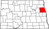
Townships Agnes | Allendale | Americus | Arvilla | Avon | Bentru | Blooming | Brenna | Chester | Elkmount | Elm Grove | Fairfield | Falconer | Ferry | Gilby | Grace | Grand Forks | Hegton | Inkster | Johnstown | Lakeville | Larimore | Levant | Lind | Logan Center | Loretta | Mekinock | Michigan | Moraine | Niagara | Northwood | Oakville | Pleasant View | Plymouth | Rye | Strabane | Turtle River | Union | Walle | Washington | Wheatfield
CDP Unincorporated
communitiesFootnotes ‡This populated place also has portions in an adjacent county or counties
Categories:- National Register of Historic Places in North Dakota by county
- Grand Forks County, North Dakota
- Greater Grand Forks
-


Wikimedia Foundation. 2010.