- Ost Valle Bridge
-
Ost Valle Bridge
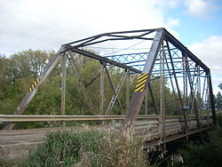 Bridge in 2009
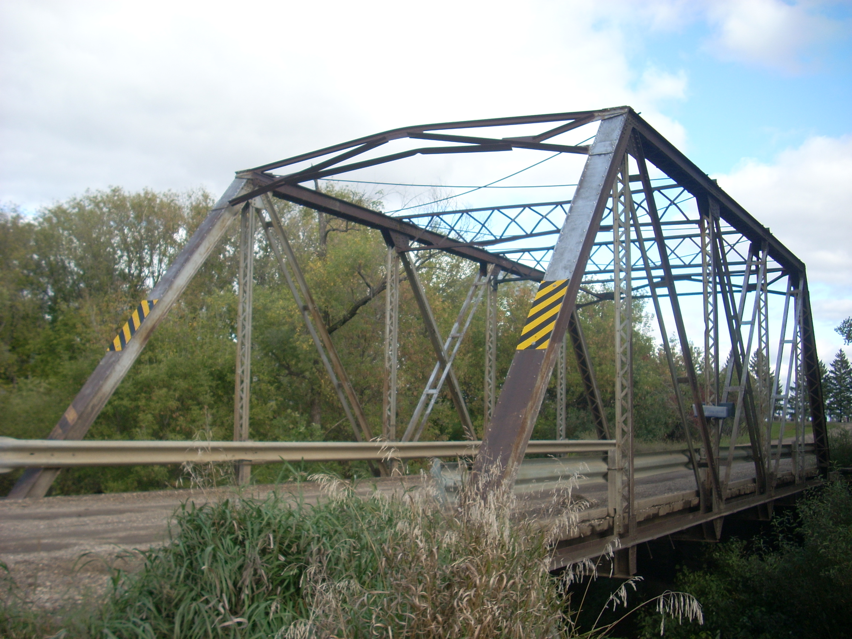

Location: Across an unnamed tributary of the Red River, unnamed co. rd., approximately 6 mi. E and 1 mi. N of Thompson, Thompson, North Dakota Coordinates: 47°47′17.56392″N 96°58′58.53828″W / 47.7882122°N 96.9829273°WCoordinates: 47°47′17.56392″N 96°58′58.53828″W / 47.7882122°N 96.9829273°W Area: less than 1 acre (0.40 ha) Built: 1910 Architect: Jardine & Anderson Architectural style: Other; Pratt through truss Governing body: Local MPS: Historic Roadway Bridges of North Dakota MPS NRHP Reference#: 97000178 [1] Added to NRHP: February 27 , 1997 The Ost Valle Bridge is a bridge near Thompson, North Dakota that was listed on the National Register of Historic Places in 1997. It crosses an unnamed tributary of the Red River, about one mile west of the Red River itself. It is "one of the two oldest documented bridges in Grand Forks County that were built by longterm county bridge builder, the Jardine & Anderson".[2]:7
It was probably built in 1910, based on examining county records.[2]:7
It includes Pratt through truss design/architecture.[1]
The property was covered in a study of Historic Roadway Bridges of North Dakota.[3]
The listing was for an area of less than one acre with just one contributing structure.[1]
The property is also denoted as 32GF292[1]
References
- ^ a b c d "National Register Information System". National Register of Historic Places. National Park Service. 2009-03-13. http://nrhp.focus.nps.gov/natreg/docs/All_Data.html.
- ^ a b Mark Hufstetler (December 10, 1996). "NRHP Registration: Ost Valle Bridge / 32GF292". National Park Service. http://pdfhost.focus.nps.gov/docs/NRHP/Text/97000178.pdf. and Accompanying two photos
- ^ Mark Hufstetler (December 10, 1996). "National Register of Historic Places Multiple Property Submission: Historic Roadway Bridges of North Dakota MPS". National Park Service. http://pdfhost.focus.nps.gov/docs/NRHP/Text/64500380.pdf.
U.S. National Register of Historic Places Topics Lists by states Alabama • Alaska • Arizona • Arkansas • California • Colorado • Connecticut • Delaware • Florida • Georgia • Hawaii • Idaho • Illinois • Indiana • Iowa • Kansas • Kentucky • Louisiana • Maine • Maryland • Massachusetts • Michigan • Minnesota • Mississippi • Missouri • Montana • Nebraska • Nevada • New Hampshire • New Jersey • New Mexico • New York • North Carolina • North Dakota • Ohio • Oklahoma • Oregon • Pennsylvania • Rhode Island • South Carolina • South Dakota • Tennessee • Texas • Utah • Vermont • Virginia • Washington • West Virginia • Wisconsin • WyomingLists by territories Lists by associated states Other Categories:- Buildings and structures in Grand Forks County, North Dakota
- Bridges completed in 1910
- Bridges on the National Register of Historic Places in North Dakota
- North Dakota Registered Historic Places stubs

Wikimedia Foundation. 2010.