- National Register of Historic Places listings in Shoshone County, Idaho
-
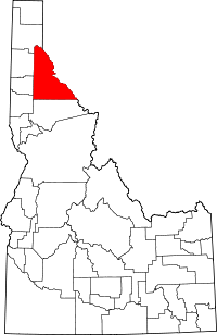 Location of Shoshone County in Idaho
This is a list of the National Register of Historic Places listings in Shoshone County, Idaho.
This is intended to be a complete list of the properties and districts on the National Register of Historic Places in Shoshone County, Idaho, United States. Latitude and longitude coordinates are provided for many National Register properties and districts; these locations may be seen together in a Google map.[1]
There are 22 properties and districts listed on the National Register in the county. More may be added; properties and districts nationwide are added to the Register weekly.[2]
-
- This National Park Service list is complete through NPS recent listings posted November 10, 2011.[3]
Current listings
[4] Landmark name [5] Image Date listed Location City or town Summary 1 Avery Depot September 20, 1984 Chicago, Milwaukee, St. Paul and Pacific railroad line
47°15′01″N 115°48′19″W / 47.250278°N 115.805278°WAvery North Idaho 1910 Fire Sites TR 2 Avery Ranger Station June 27, 1974 Near the St. Joseph National Forest
47°15′04″N 115°48′29″W / 47.251111°N 115.808056°WAvery 3 Bullion Tunnel September 20, 1984 East of Avery
47°24′04″N 115°42′04″W / 47.401111°N 115.701111°WAvery North Idaho 1910 Fire Sites TR 4 Cedar Snags September 20, 1984 North of Avery
47°22′41″N 115°45′50″W / 47.378056°N 115.763889°WAvery North Idaho 1910 Fire Sites TR 5 Chicago, Milwaukee, St. Paul and Pacific Railroad Company Historic District October 26, 2000 Idaho Panhandle National Forest
47°21′46″N 115°39′30″W / 47.362778°N 115.658333°WAvery 6 John C. Feehan House August 27, 1980 Main St.
47°37′36″N 115°51′05″W / 47.626667°N 115.851389°WMurray 7 Grand Forks September 20, 1984 East of Avery
47°21′08″N 115°40′14″W / 47.352222°N 115.670556°WAvery North Idaho 1910 Fire Sites TR 8 Halm Creek, Bean Creek Fire September 20, 1984 South of Red Ives
47°00′27″N 115°21′13″W / 47.0075°N 115.353611°WRed Ives North Idaho 1910 Fire Sites TR 9 Magee Ranger Station February 18, 1981 West of Pritchard
47°50′31″N 116°14′35″W / 47.841944°N 116.243056°WPritchard 10 Mallard Peak Lookout April 12, 1984 Southeast of Avery
46°56′17″N 115°31′26″W / 46.938056°N 115.523889°WAvery 11 Murray Courthouse November 14, 1978 Main St.
47°37′38″N 115°51′21″W / 47.627222°N 115.855833°WMurray 12 Murray Masonic Hall May 19, 1987 Main St. between 2nd and 3rd
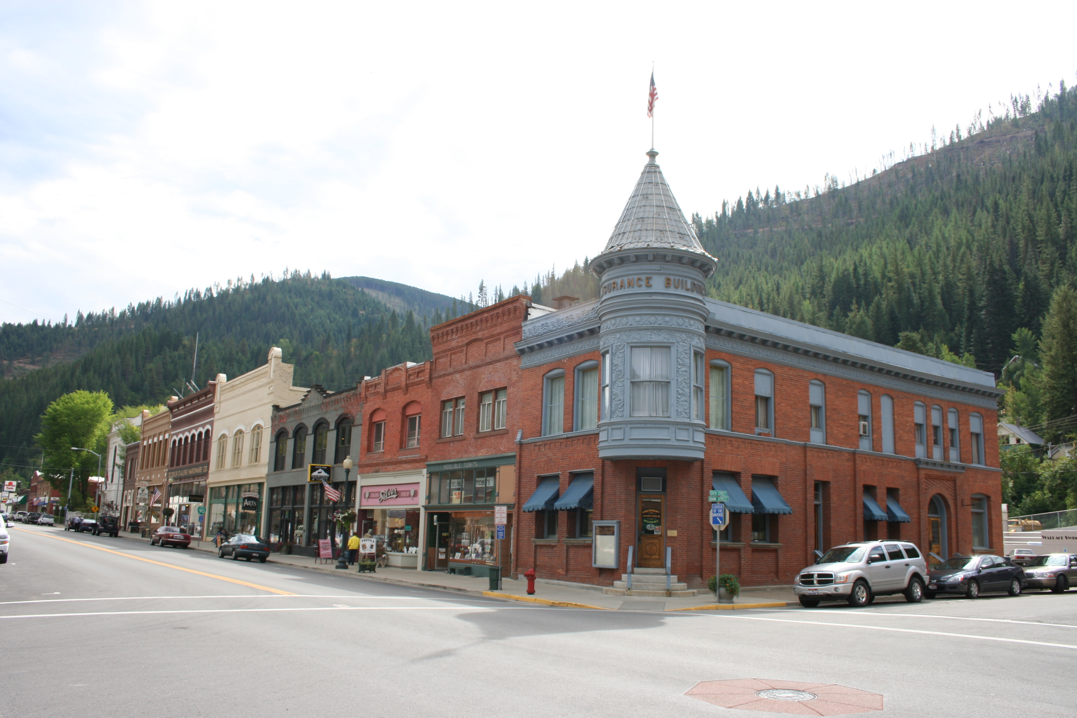
47°37′36″N 115°51′23″W / 47.626667°N 115.856389°WMurray 13 Northern Pacific Railway Depot 
April 2, 1976 219 6th St.
47°28′24″N 115°55′21″W / 47.473333°N 115.9225°WWallace 14 Pine Creek Baptist Church November 17, 1982 Main and S. 3rd Sts.
47°32′21″N 116°14′10″W / 47.539167°N 116.236111°WPinehurst 15 Edward Pulaski Tunnel and Placer Creek Escape Route September 20, 1984 Southwest of Wallace
47°26′58″N 115°57′24″W / 47.449444°N 115.956667°WWallace North Idaho 1910 Fire Sites TR 16 Red Ives Ranger Station September 13, 1986 Southeast of Avery on Forest Service Rd. 218
47°03′20″N 115°21′06″W / 47.055556°N 115.351667°WAvery 17 St. Andrew's Episcopal Church April 1, 1999 104 Hunter Ave.
47°28′11″N 115°48′01″W / 47.469722°N 115.800278°WMullan 18 US Post Office-Kellogg Main May 30, 1990 302 S. Division
47°32′05″N 116°07′15″W / 47.534722°N 116.120833°WKellogg 19 US Post Office-Wallace Main March 16, 1989 403 Cedar St.
47°28′21″N 115°55′37″W / 47.4725°N 115.926944°WWallace 20 Wallace 1910 Fire Memorial September 20, 1984 North of Wallace
47°29′18″N 115°54′51″W / 47.488333°N 115.914167°WWallace North Idaho 1910 Fire Sites TR 21 Wallace Carnegie Library 
February 3, 1981 415 River St.
47°28′28″N 115°55′31″W / 47.474444°N 115.925278°WWallace 22 Wallace Historic District 
August 10, 1979 Roughly bounded by Pine, Bank, 5th and 7th Sts.; also roughly bounded by Oak, Silver, C, Mullan, Canyon, Fir, and 1st Sts.
47°28′19″N 115°55′23″W / 47.471944°N 115.923056°WWallace Second set of boundaries represents a boundary increase See also
References
- ^ The latitude and longitude information provided in this table was derived originally from the National Register Information System, which has been found to be fairly accurate for about 99% of listings. For about 1% of NRIS original coordinates, experience has shown that one or both coordinates are typos or otherwise extremely far off; some corrections may have been made. A more subtle problem causes many locations to be off by up to 150 yards, depending on location in the country: most NRIS coordinates were derived from tracing out latitude and longitudes off of USGS topographical quadrant maps created under the North American Datum of 1927, which differs from the current, highly accurate WGS84 GPS system used by Google maps. Chicago is about right, but NRIS longitudes in Washington are higher by about 4.5 seconds, and are lower by about 2.0 seconds in Maine. Latitudes differ by about 1.0 second in Florida. Some locations in this table may have been corrected to current GPS standards.
- ^ "National Register of Historic Places: Weekly List Actions". National Park Service. http://www.cr.nps.gov/nr/nrlist.htm. Retrieved March 29, 2009.
- ^ "National Register of Historic Places: Weekly List Actions". National Park Service, United States Department of the Interior. Retrieved on November 10, 2011.
- ^ Numbers represent an ordering by significant words. Various colorings, defined here, differentiate National Historic Landmark sites and National Register of Historic Places Districts from other NRHP buildings, structures, sites or objects.
- ^ "National Register Information System". National Register of Historic Places. National Park Service. . http://nrhp.focus.nps.gov/natreg/docs/All_Data.html.
Properties on the National Register of Historic Places in Idaho  Ada • Adams • Bannock • Bear Lake • Benewah • Bingham • Blaine • Boise • Bonner • Bonneville • Boundary • Butte • Camas • Canyon • Caribou • Cassia • Clark • Clearwater • Custer • Elmore • Franklin • Fremont • Gem • Gooding • Idaho • Jefferson • Jerome • Kootenai • Latah • Lemhi • Lewis • Lincoln • Madison • Minidoka • Nez Perce • Oneida • Owyhee • Payette • Power • Shoshone • Teton • Twin Falls • Valley • Washington
U.S. National Register of Historic Places Topics Lists by states Alabama • Alaska • Arizona • Arkansas • California • Colorado • Connecticut • Delaware • Florida • Georgia • Hawaii • Idaho • Illinois • Indiana • Iowa • Kansas • Kentucky • Louisiana • Maine • Maryland • Massachusetts • Michigan • Minnesota • Mississippi • Missouri • Montana • Nebraska • Nevada • New Hampshire • New Jersey • New Mexico • New York • North Carolina • North Dakota • Ohio • Oklahoma • Oregon • Pennsylvania • Rhode Island • South Carolina • South Dakota • Tennessee • Texas • Utah • Vermont • Virginia • Washington • West Virginia • Wisconsin • WyomingLists by territories Lists by associated states Other Municipalities and communities of Shoshone County, Idaho Cities 
Unincorporated
communitiesFootnotes ‡This populated place also has portions in an adjacent county or counties
Categories:- National Register of Historic Places in Idaho by county
- Shoshone County, Idaho
-


Wikimedia Foundation. 2010.