- Mullan, Idaho
-
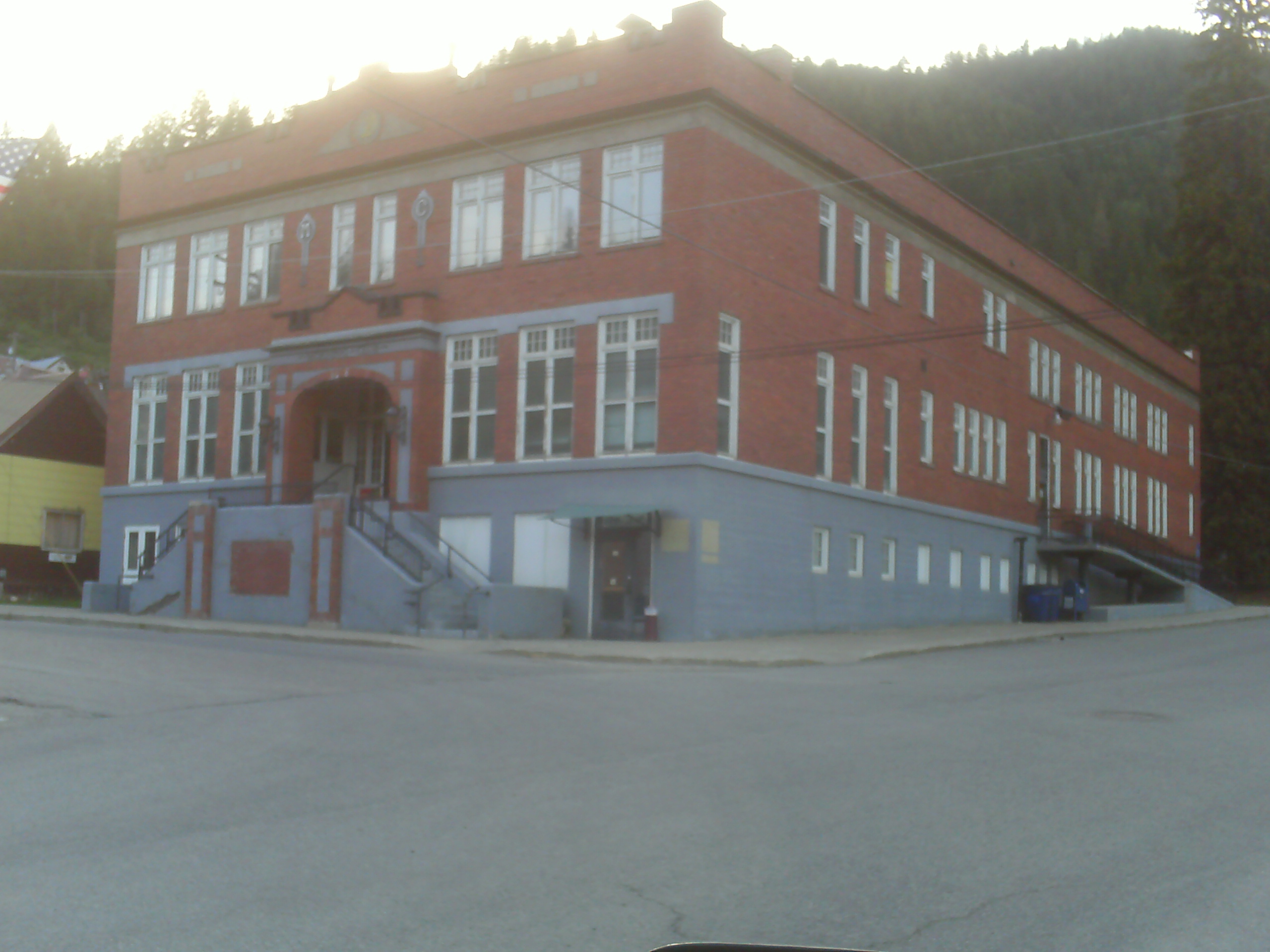
Mullan, Idaho — City — Historic building in downtown Mullan Location of Mullan, Idaho
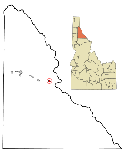
Coordinates: 47°28′10″N 115°47′53″W / 47.46944°N 115.79806°WCoordinates: 47°28′10″N 115°47′53″W / 47.46944°N 115.79806°W Country United States State Idaho County Shoshone Area – Total 0.8 sq mi (2.2 km2) – Land 0.8 sq mi (2.2 km2) – Water 0.0 sq mi (0.0 km2) Elevation 3,278 ft (999 m) Population (2010) – Total 692 – Density 1,011.6/sq mi (390.6/km2) Time zone Pacific (PST) (UTC-8) – Summer (DST) PDT (UTC-7) ZIP code 83846 Area code(s) 208 FIPS code 16-55630 GNIS feature ID 0387396 Mullan is a city located in a sheltered canyon of the Coeur d'Alene Mountains in Shoshone County in the northern part of the U.S. state of Idaho. The population was 840 at the 2000 census and decreased to 692 at the 2010 census. The city is in the east end of the Silver Valley mining district; the elevation is 3250 feet (990 m) above sea level. The Lucky Friday mine is several hundred yards east of the city center [1] The active mine (silver, lead, & zinc) descends more than 6000 feet (1.8 km) below the surface.
Interstate 90 runs by the south side of the city, and the Montana border at Lookout Pass is 4 miles (6.4 km) east at 4700 feet (1432 m).
Contents
History
Mullan came into existence in 1884 when with the discovery of gold at the Gold Hunter Mine which turned out to be a lead and silver producer. That same year George Good made a lead-silver strike with the morning mine and Mullan came into existence between the two mines. The site was filed in August 1888, after the village had twenty log and fifteen frame houses, a sawmill, and a population of 150. The Northern Pacific Railway came to it in 1889 and the city was incorporated in 1904.[1]
During the Coeur d'Alene, Idaho labor confrontation of 1899 200 miners from Mullan joined the Dynamite Express. In the aftermath of the labor war, many of Mullan's leaders and Populist elected officials including the sheriff were arrested and sent to the Wallace bull pens[2]
The city was named for West Point graduate John Mullan, who was in charge of selecting a wagon route (commonly called the Mullan Road) between Fort Benton (Montana) and Fort Walla Walla (Washington). Lieutenant Mullan, a topographical engineer, began gathering information in 1854. Delayed by the Indian War of 1858, construction began in 1859 from Fort Walla Walla. The highest elevation of the road was Mullan Pass at 5168 feet (1575 m), which is about 7 miles (11 km) east of the city on the Idaho-Montana border. After the strenuous project was completed in 1860, floods wiped out substantial stretches of the road, and the road was re-routed in 1861. Floods again damaged the road, and ultimately, no provision for maintenance was provided.[3]
Mullan's population has shrunk consistently in recent decades from a total of 2,291 in 1940.[4]Mullan Today
Although Mullan is significantly smaller than it was in the hayday of the Morning and Lucky Friday mines, there remains a strong community. The Mullan School District operates the John Mullan Elementary School (K-6) and the Mullan Junior/Senior High School (7-12). Mullan also has its own fire department. Mullan also owns and maintains an Olympic sized swimming pool for community use.
The Morning Club was built by the Morning Mine as a gift to the town. The Club is now owned by the city and is home to a bowling alley and the library. There is also a multipurpose room complete with stage.
Geography
Mullan is located at 47°28′10″N 115°47′53″W / 47.46944°N 115.79806°W (47.469348, -115.798060).[5]
According to the United States Census Bureau, the city has a total area of 0.8 square miles (2.1 km2), all of it land.
Demographics
As of the census[6] of 2000, there were 840 people, 367 households, and 227 families residing in the city. The population density was 1,011.6 people per square mile (390.8/km²). There were 456 housing units at an average density of 549.1 per square mile (212.1/km²). The racial makeup of the city was 96.31% White, 1.43% Native American, 0.24% Asian, 1.19% from other races, and 0.83% from two or more races. Hispanic or Latino of any race were 2.86% of the population.
There were 367 households out of which 28.1% had children under the age of 18 living with them, 51.2% were married couples living together, 6.8% had a female householder with no husband present, and 37.9% were non-families. 32.4% of all households were made up of individuals and 13.9% had someone living alone who was 65 years of age or older. The average household size was 2.29 and the average family size was 2.91.
In the city the population was spread out with 24.9% under the age of 18, 5.6% from 18 to 24, 25.2% from 25 to 44, 27.5% from 45 to 64, and 16.8% who were 65 years of age or older. The median age was 41 years. For every 100 females there were 101.4 males. For every 100 females age 18 and over, there were 100.3 males.
The median income for a household in the city was $30,417, and the median income for a family was $36,917. Males had a median income of $31,250 versus $20,833 for females. The per capita income for the city was $14,943. About 7.8% of families and 12.1% of the population were below the poverty line, including 19.2% of those under age 18 and 9.6% of those age 65 or over.
See also
References
- ^ *Fisher, Vardis; Federal Writers' Project (1938). Idaho Encyclopedia. Caldwell, Idaho: Caxton Printers, Ltd. pp. 398. OCLC 962624.
- ^ History of Selected Mines in the Pine Creek Area, Shoshone County, Idaho by Victoria E Mitchell, Idaho Geological Survey
- ^ *Jackson, W. Turrentine (1938). Wagon Roads West. Berkley, California: University of California Press. pp. 257–278. ISBN 0803294026.
- ^ Historical Populations by City, Idaho Department of Commerce. Accessed 2009-05-30.
- ^ "US Gazetteer files: 2010, 2000, and 1990". United States Census Bureau. 2011-02-12. http://www.census.gov/geo/www/gazetteer/gazette.html. Retrieved 2011-04-23.
- ^ "American FactFinder". United States Census Bureau. http://factfinder.census.gov. Retrieved 2008-01-31.
Further reading
- Conley, Cort. Idaho for the Curious. Cambridge: Backeddy, 1982, ISBN 0-9603566-3-0, 451-53, 493-95.
External links
- Mullan School District
- Spokane Journal of Commerce - Lucky Friday mine to expand - 13-Sep-2007
- Hecla Mining.com - Lucky Friday mine - Mullan
- Topographic map of Mullan from USGS via Microsoft Research Maps
Municipalities and communities of Shoshone County, Idaho Cities 
Unincorporated
communitiesFootnotes ‡This populated place also has portions in an adjacent county or counties
Categories:- Cities in Idaho
- Populated places in Shoshone County, Idaho

Wikimedia Foundation. 2010.