- Mullan Road
-
Mullan Road
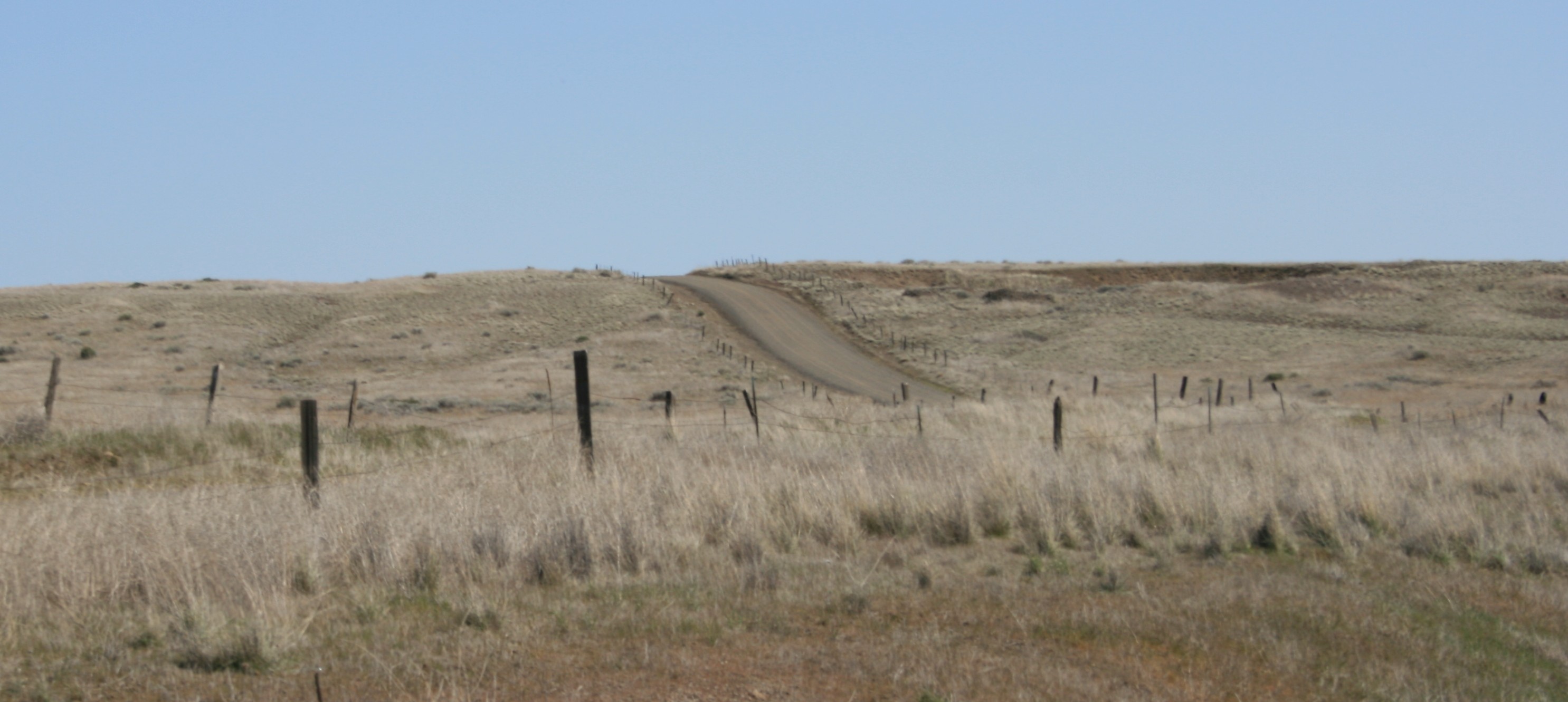
 Looking north at one of the few remaining gravel stretches of the Mullan Road as it crosses Washington State Route 26 near Washtucna, Washington. The portion south of SR 26 has reverted to grazing.
Nearest city: St. Maries, Idaho; Coeur d'Alene, Idaho Built: 1853 Governing body: Forest Service NRHP Reference#: 90000548 [1] Added to NRHP: April 5, 1990 Mullan Road was the first wagon road to cross the Rocky Mountains to the Inland of the Pacific Northwest. It was built by US Army Lieut. John Mullan between the spring of 1859 and summer 1860. It led from Fort Benton, Montana, the navigational head of the Missouri River (and once farthest inland port in the world) to Fort Walla Walla, Washington Territory, near the Columbia River. The road previewed the route approximately followed of modern-day Interstate 15 and Interstate 90 through what are now Montana, Idaho and Washington.
Parts of the Mullan Road can still be traveled. One such section is near Washtucna, Washington.
A segment of the Mullan Road in the vicinity of Benton Lake was listed on the National Register of Historic Places in 1975,[2] and the American Society of Civil Engineers designated it a historic civil engineering landmark in 1977. Three segments of the road in Idaho were also listed on the National Register in 1990. In 2009, the Point of Rocks segment in Montana was also listed on the National Register as part of the Point of Rocks Historic Transportation Corridor.
Contents
History
As early as 1852 the US government began to think about building an overland route to the Pacific Ocean to help settle the area with pioneers and eliminate any claims that France, England or Russia had on the disputed territories. Despite the Lewis and Clark expedition, little detail was known about the country. Isaac Ingalls Stevens, a West Point graduate appointed the first governor of the Washington Territory, was ordered to survey a route from the Missouri River to the Columbia River suitable for building a railroad. Stevens assumed the task, but also kept in mind that the route should be suitable for a wagon road.
In the spring of 1853, Congress authorized a US Army expedition, led by Stevens. It was made up of engineers and explorers; they organized near St. Paul, Minnesota. They were to detail the geographical and topographical character of the country. Among them was a small, dark-haired young man, Lieutenant John Mullan; just a year out of West Point, he was anxious to prove his mettle as an engineer.
Mullan was placed in charge of surveying, and later improving, a wagon route (now commonly called the Mullan Road) between Fort Benton (Montana) and Fort Walla Walla (Washington). Lieutenant Mullan, a topographical engineer, began gathering information in 1854. Delayed by the Yakima War which ended in 1858, construction began in 1859 from Fort Walla Walla. In what was then Washington Territory, Lieutenant Mullan commanded a workforce of more than 200, including civilian workers, surveyors, engineers, and soldiers who carved a 25-foot (7.6 m) wide road across the region.[3][4]
After the difficult project was completed in 1860, floods wiped out substantial stretches of the road. It was re-routed in 1861. Floods again damaged the road, and ultimately, no provision for maintenance was provided.[3][4]
Although the road was never heavily used by the military, it was an important conduit for civilian passage, which hastened settling of the northwestern United States. In the first year after completion, it was used by an estimated 20,000 people, 6,000 horses and mules, 5,000 cattle and 83 wagons. The Mullan Road helped Walla Walla become the largest town in Washington Territory by 1870, with a population of 1,394. The road continued to serve as an important route until the completion of the Northern Pacific Railroad in 1883 provided faster and more convenient access to the region.[3]
Route of the Mullan Road
From the origin at Fort Benton, Montana, the Mullan Road proceeded:
- West from Fort Benton, Montana
- Passing North of Great Falls, Montana
- Dropping south to cross the continental divide west of Helena, Montana (following a path through Mullan Pass, immediately north of that now traveled by U.S. Route 12)
- Along the Clark Fork River, near the ghost town of Bearmouth, Montana
- Just west of Garrison, Montana, it joined the route of present-day Interstate 90 (similar to the U.S. Route 12 transition to join Interstate 90 today)
- It remained with the Interstate 90 route as it passed Missoula proceeding west through Montana. The Mullan Road through the Missoula Valley fostered rapid growth for the burgeoning city, and allowed the U.S. Army to establish Fort Missoula there in 1877.
- The road then crossed the border into Idaho near Mullan, Idaho (followed by the later Interstate 90). The highest elevation of the road is a second Mullan Pass at 5168 feet (1575 m), which lies about 7 miles (10 km) east of Mullan, Idaho on the Idaho-Montana border.
- From the middle of the Idaho crossing, the road deviates from present-day major roads. The Mullan Road went southwesterly in Idaho to pass south of Lake Coeur d'Alene
- The road then passed into Washington some distance south of Spokane, Washington
- From there, the Mullan Road passed through the Palouse country and then the scablands of eastern Washington.
- It passed through Benge, Washington. The Benge section of the road was completed May 22, 1861; the wagon ruts were still visible in 2008 just northeast of town at the site of the First Benge School.
- South of Benge, there is a stretch of the former road still labeled 'Mullan Road'. This gravel section of the Mullan Road travels southwesterly until it meets Washington State Route 26 near Washtucna, Washington.
- The portion of Mullan Road south of SR 26 in Washington, which follows the course of the Palouse River as it descends to the Snake River, has been reverted to grazing and is not accessible to the public.
- After crossing the Snake River near the confluence with the Palouse River, the Mullan Road continues south to its terminus at Fort Walla Walla near Walla Walla, Washington.
References
- ^ "National Register Information System". National Register of Historic Places. National Park Service. 2007-01-23. http://nrhp.focus.nps.gov/natreg/docs/All_Data.html.
- ^ "Montana - Cascade County". National Register of Historic Places. http://www.nationalregisterofhistoricplaces.com/MT/Cascade/state.html. Retrieved 2007-04-18.
- ^ a b c Trafzer, Clifford E. & Scheuerman, Richard D. (1986). Renegade Tribe: The Palouse Indians and the Invasion of the Inland Northwest. Washington State University Press, Pullman, Washington. ISBN 0-87422-027-0.
- ^ a b HistoryLink.org Essay 5225
- Mullan, John (1865) (DJVU). Miners and travelers' guide to Oregon, Washington, Idaho, Montana, Wyoming, and Colorado : via the Missouri and Columbia rivers : accompanied by a general map of the mineral region of the northern sections of the Rocky Mountains. Washington State Library's Classics in Washington History collection. Wm. M. Franklin for the author. OCLC 56760403. http://www.secstate.wa.gov/history/publications%5Fdetail.aspx?p=41.
- Jackson, W. Turrentine (1938). Wagon Roads West. Berkley, California: University of California Press. pp. 257–278. ISBN 0803294026.
External links
- Letter from the Secretary of War transmitting Lieut. Mullan's report, 1861
- Essay on Mullan Road at historylink.org, by Priscilla Long, February 16, 2003
- Blazing the Mullan Road by Mineral County, Montana
- Jon Axline, "Mullan's Point of Rocks", Montana: The Magazine of Western History (Montana Historical Society), Winter 1999
- "Who was Mullan? Answers are many", ruralnorthwest.com, originally in Coeur d'Alene Press, 1963
- The Mullan Road History of its Construction and Early Use J. William T. Youngs, Professor of History, Eastern Washington University
U.S. National Register of Historic Places Topics Lists by states Alabama • Alaska • Arizona • Arkansas • California • Colorado • Connecticut • Delaware • Florida • Georgia • Hawaii • Idaho • Illinois • Indiana • Iowa • Kansas • Kentucky • Louisiana • Maine • Maryland • Massachusetts • Michigan • Minnesota • Mississippi • Missouri • Montana • Nebraska • Nevada • New Hampshire • New Jersey • New Mexico • New York • North Carolina • North Dakota • Ohio • Oklahoma • Oregon • Pennsylvania • Rhode Island • South Carolina • South Dakota • Tennessee • Texas • Utah • Vermont • Virginia • Washington • West Virginia • Wisconsin • WyomingLists by territories Lists by associated states Other  Category:National Register of Historic Places •
  Portal:National Register of Historic Places
Coordinates: 46°46′8.3″N 118°12′22.6″W / 46.768972°N 118.206278°W
Categories:- Historic trails and roads in Washington (state)
- National Register of Historic Places in Idaho
- National Register of Historic Places in Montana
- Roads on the National Register of Historic Places
- Historic Civil Engineering Landmarks
Wikimedia Foundation. 2010.