- Missoula, Montana
-
"Missoula" redirects here. For other uses, see Missoula (disambiguation).
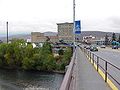
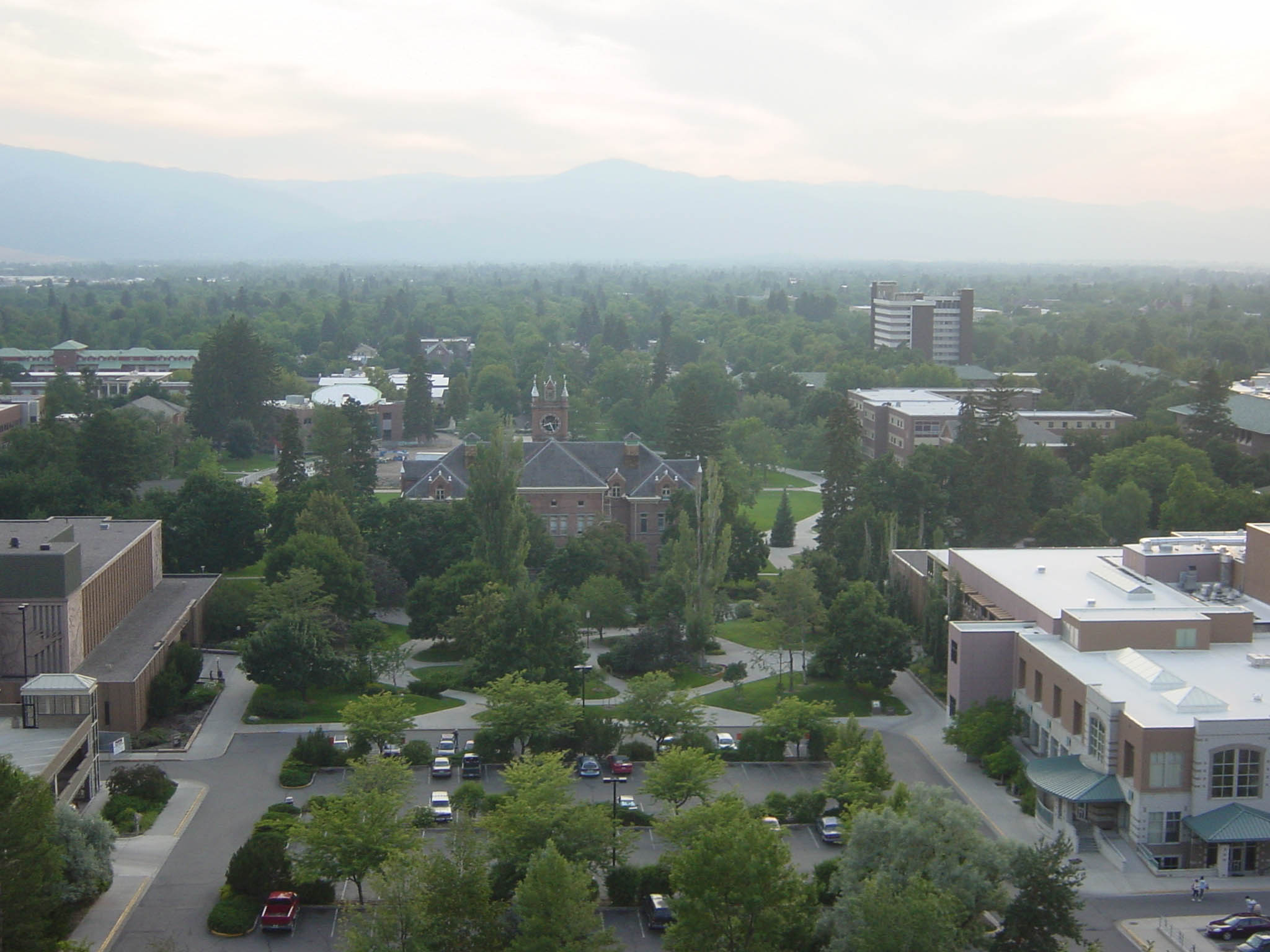
City of Missoula, Montana — City — Overlooking Downtown Missoula

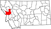
SealNickname(s): The Garden City, Zoo Town Motto: "The Discovery Continues", "A place, sort of." Location of Missoula in Montana location of Missoula County
Coordinates: 46°51′45″N 114°0′42″W / 46.8625°N 114.01167°WCoordinates: 46°51′45″N 114°0′42″W / 46.8625°N 114.01167°W Country United States State Montana County Missoula Founded 1866 Government - Mayor-council government John Engen (D) Area - City 23.9 sq mi (61.9 km2) - Land 23.8 sq mi (61.6 km2) - Water 0 sq mi (0 km2) - Urban 36.4 sq mi (94.2 km2) Elevation 3,209 ft (978 m) Population (2010) - City 66,788 - Density 2,795/sq mi (1,079.2/km2) - Metro 109,299 Demonym Missoulian Time zone Mountain (UTC-7) - Summer (DST) Mountain (UTC-6) ZIP code 59801, 59802, 59803, 59804, 59806, 59807, 59808 U of M ZIP code 59812 Area code(s) 406 FIPS code 30-50200 GNIS feature ID 0787504 Highways 


Website ci.missoula.mt.us Missoula
 i/mɨˈzuːlə/ is a city located in western Montana and is the county seat of Missoula County. The 2010 Census put the population of Missoula at 66,788[1] and the population of Missoula County at 109,299.[1] Missoula is the principal city of the Missoula Metropolitan Area. Since 1920 Missoula has seen a steady pace of growth. In 2000 Missoula became the second largest city in Montana. Since 2000 it has had the third largest actual growth amongst Montana's Cities, with an increase in population of 9,735.[1]
Missoula was founded in 1860 as Hellgate Trading Post before being renamed Missoula Mills ("Missoula" from the Salish name for the area, "Nemissoolatakoo", and "Mills" after the prosperous flour mill and sawmill that served as Missoula's first industry). "Mills" was dropped from the name and in 1877, the establishment of Fort Missoula ensured the survival of the city.[2]
Missoula is nicknamed the "Garden City", in reference to the large number of orchard homes that once lined its periphery and an extensive vegetable and flower garden owned by Cyrus and William McWhirk that formed the eastern entrance to the city.[3][4]Downtown Missoula is the central business district of the of the city. Though founded as a lumber and agricultural center as well as a trading post, the basis of Missoula's modern economy is the University of Montana, government, healthcare, tourism, and the service industry.[5]
Missoula is a college town, home to the University of Montana. Missoula is also known for being the birthplace of Jeannette Rankin, the first woman elected to the U.S. Congress. Missoula is the headquarters of Montana Rail Link and home to Montana's largest brewery.
Contents
History
Earliest Missoula
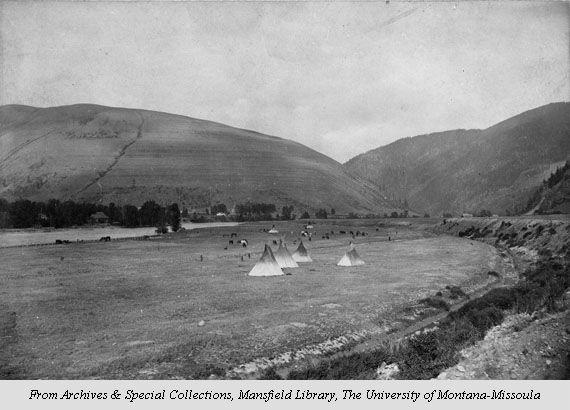
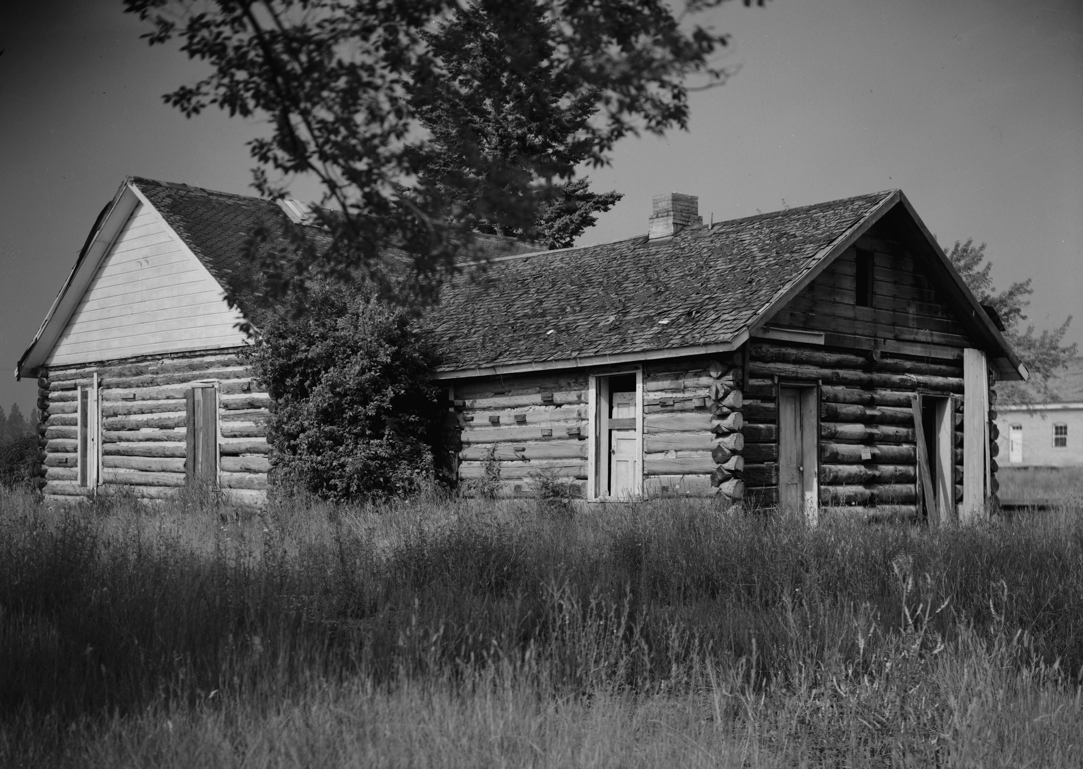
 Teepees set up in modern-day Missoula south of the Clark Fork River, facing east
Today's Missoula lies at the bottom of what once was Glacial Lake Missoula, a 3,000-square-mile (7,800 km2) proglacial lake which stretched from 60 miles (97 km) south and east of Missoula north to today's Flathead Lake and west to Idaho's Lake Pend Oreille. Held in place by a glacial dam, this lake drained and refilled repeatedly over 2,000 years during the past Ice Age. When the flood waters cleared, the resultant Missoula Valley became a geographic hub of five mountain valleys formed by the Bitterroot Mountains, Sapphire Range, Garnet Range, Rattlesnake Mountains, and Reservation Divide.[6]
The oldest artifacts date from the end of the glacial lake period around 12,000 years ago with the first-known settlements dating from 3,500 BCE. From the 1700s until European settlement, the region was used by Salish, Kootenai, Pend d'Oreille, Blackfoot, and Shoshone tribes.
As a natural corridor through the mountains, the valley was the scene of great conflict between local Native American tribes and those traversing the region to and from Montana's eastern plains, which were rich with buffalo. The narrow valley at Missoula's eastern entrance was so strewn with human bones from repeated ambushes that French fur trappers would later refer to this area as "Porte d' Enfer," translated as "Hell's Gate". Hell Gate would remain the name of the area until it was renamed "Missoula" in 1866.[7]
Early explorers
The first European Americans to visit what would become Missoula were members of the Lewis and Clark Expedition. The expedition stopped twice just south of Missoula at Traveler's Rest; first from September 9–11, 1805, and again from June 30-July 3, 1806.[8] From here, the Lewis and Clark Expedition split up on the return from the Pacific, with Clark taking the southern route along the Bitterroot River and Lewis travelling north through Hellgate Canyon on July 4.[9]
 Missoula Barracks
The region was first surveyed by Washington Territory governor Isaac Stevens in the 1850s by Congressional request as a means of developing a transcontinental rail route. Stevens would also negotiate the Treaty of Hellgate through which the Native American tribes of western Montana relinquished their territories to the U.S. government. Stevens was assisted by Lieutenant John Mullan who would build the Mullan Road in 1853. The wagon road was the first to cross the Rocky Mountains to the inland of the Pacific Northwest, and would enable the establishment of Fort Missoula in 1877.[7]
Hell Gate Village
Main article: Hell Gate, MontanaSettlement in Missoula began five miles (8 km) to the west near modern Frenchtown in 1860 as a trading post founded by Christopher P. Higgins, who had been present at the Treaty of Hellgate, and business partner Francis L. Worden, with the expectation that the Mullan Road and any future railroad would necessarily pass through the valley. Their gamble was correct and Hell Gate became the Missoula County seat in 1860; the first post office was established on November 25, 1862, with Worden as the first postmaster.[10] The settlement moved upstream to its modern location in 1864 as Higgins and Worden's desire to build a lumber and flour mill required a more convenient water supply to power the gristmill.[11]
The Missoula Mills replaced Hell Gate Village as the economic power of the valley and replaced it as the county seat in 1866. The name "Missoula" comes from the Salish name for the Clark Fork River, which runs through the city. The name ‘’nmesuletkʷ’’, though often mistakenly believed to translate as "River of Ambush" as a reflection of the inter-tribal fighting common to the area, actually has the approximate meaning of "place of freezing/cold liquid", or more roughly "cold water" (cf. Interior Salishan locative marker n-, Southern Interior Salishan sul, 'cold/frozen', and -etkʷ, 'liquid'). This name is thought by some Salish tribal members to refer to Glacial Lake Missoula.
City

Missoula never "boomed" as many western Montana towns did as a consequence of the gold rush, though the town did grow rapidly, and by 1872 the town had 66 new buildings. Higgins and Worden established the town's first stores and banks, but by 1876 the pair faced its largest competition and rivalry from Eddy, Hammond and company, who established the Missoula Mercantile Company.[12]
By the 1880s growth had slowed, but the arrival of the Northern Pacific Railway in 1883 caused growth to accelerate again and Territorial Governor Benjamin F. Potts approved a charter for the Town of Missoula. The need for lumber for the railway and its bridges spurred the opening of multiple saw mills in the area and, in turn, the beginning of Missoula's lumber industry. The economic frenzy led to the construction of many of the historic buildings in downtown today. In particular, architect A. J. Gibson arrived in the late 1880s and designed many of Missoula's most recognizable buildings, including the Missoula County Courthouse and the University of Montana's Main Hall.[13]
Establishment of the University of Montana
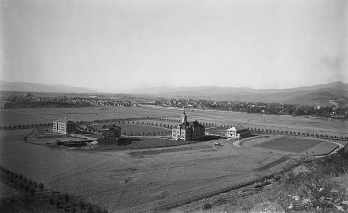
 University of Montana campus around 1900Main article: University of Montana
In an agreement with Helena that Missoula would not enter a bid to become the new state of Montana's capital and not openly support nearer by Anaconda, Missoula was able to win the vote to be the home of the state's university in 1893. Land south of the Clark Fork River (Downtown had established itself north of the river) was donated for the construction of the campus.[14]
20th century to present
The continued economic windfall from railroad construction and lumber mills led to a further boom in Missoula's population. A.B. Hammond and Copper Kings Marcus Daly and William A. Clark competed fiercely in the region over lumber share and Missoula investments, and in 1908 Missoula became the district, and later a regional, headquarters for the United States Forest Service, which also began training smokejumpers in 1942.
In the 1930s, Missoula was able to obtain fourteen Civil Works Administration projects that helped build the airport, Orange Street Bridge, several schools, and four major buildings at the university.[15]
Logging remained a mainstay of industry in Missoula with the groundbreaking of the Hoerner-Waldorf pulp mill in 1956, which led to subsequent protests over the resultant air pollution.[16] In 1979, almost 40% of the county's labor income came from the wood and paper products sector.[17] By the early 1990s, however, many of the region's log yards, along with legislation, had cleaned the skies, though the valley's topography still makes the city susceptible to lingering smoke from forest fires and winter smog.[18]
Modern era
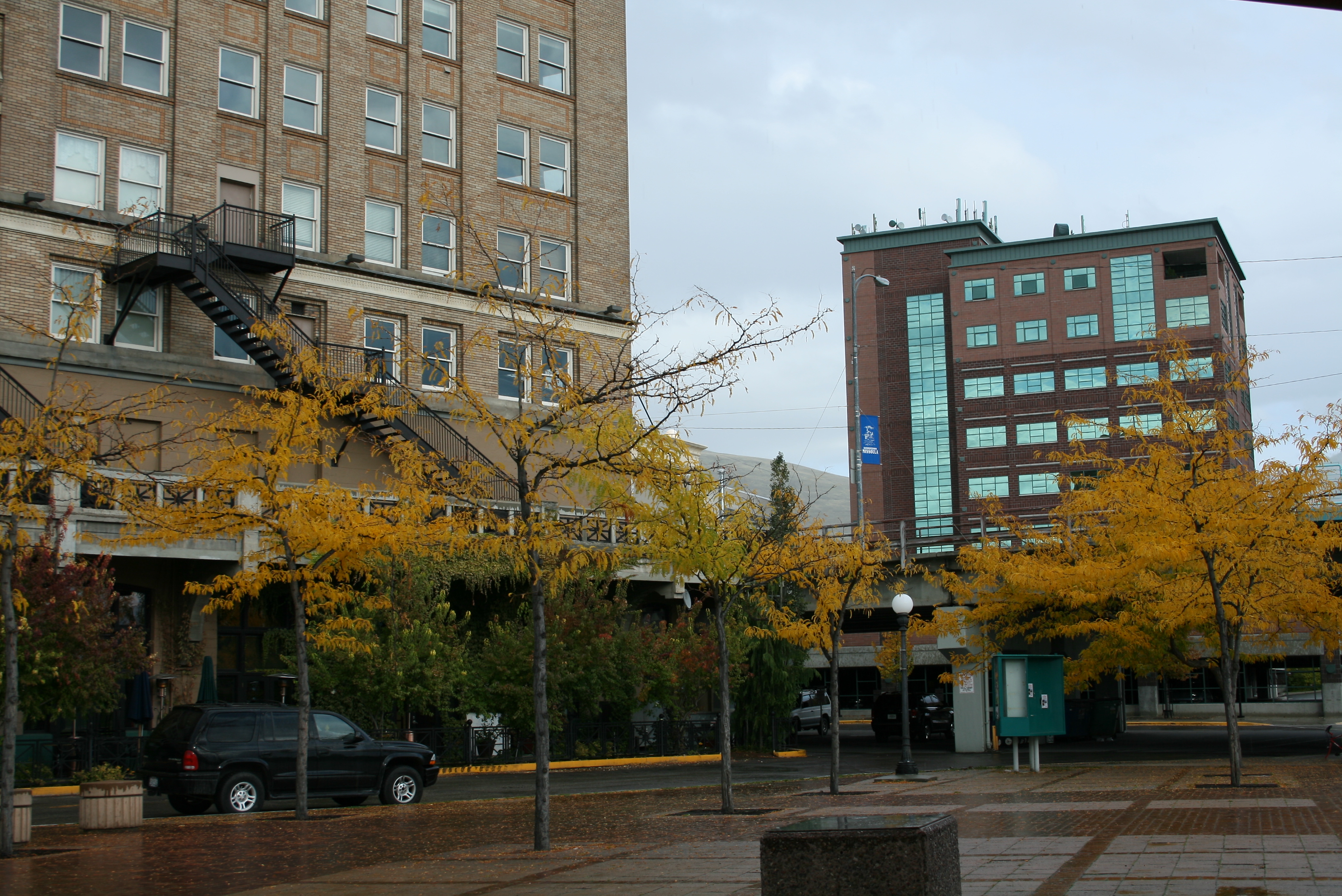
The start of the modern era began when all the logging yards in Missoula, which had once completely driven the city's economy, vanished. Once logging vanished, the Missoula Downtown Association was born and downtown Missoula became what it is today. With the completion of the First Interstate Bank, the First Security Bank, the new St. Patrick Hospital and Health Sciences Center, and the Millenium Building, the second tallest building in Missoula, downtown finally started to have a contemporary feel. In 2010 the Garlington Building completed its construction further increasing the number of contemporary buildings in Missoula.
Cityscape
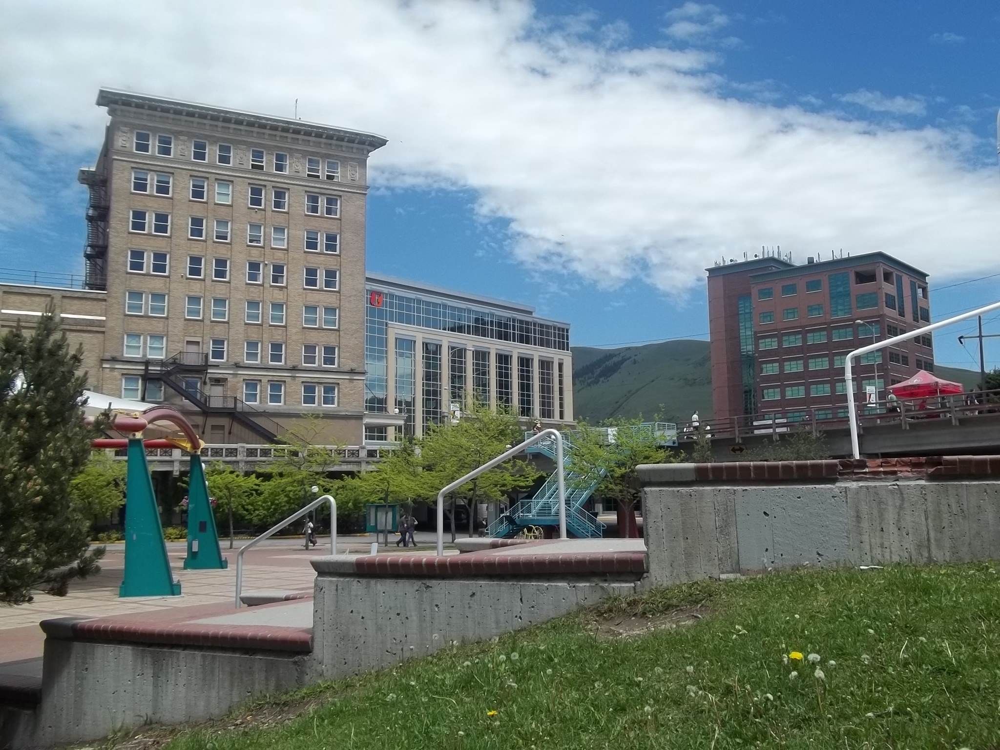
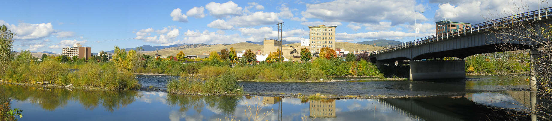
 Panorama of Downtown Missoula looking north.
Geography
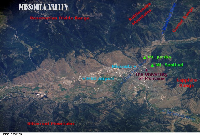
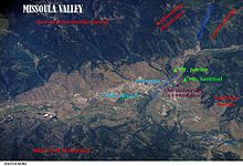 Missoula Valley
Missoula is located at 46°51′45″N 114°0′42″W / 46.8625°N 114.01167°W (46.872146, -113.9939982),[19] at an altitude of 3,209 feet (978 m).[20]
According to the United States Census Bureau, the city has a total area of 23.9 square miles (62 km2), of which 23.8 square miles (62 km2) is land and 0.1 square miles (0.26 km2) (0.46%) is water. Missoula is located in a deep valley in the western part of the state, near where the Clark Fork River is joined by the Bitterroot and Blackfoot Rivers.
Glacial Lake Missoula
Main article: Glacial Lake Missoula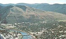 Ancient wave-cut shorelines can still be seen on the edge of Mount Sentinel. Where the University of Montana now stands, the lake was once 950 feet deep
During the last Ice Age, the Purcell lobe of the Cordilleran Ice Sheet blocked the Clark Fork river near what is now Clark Fork, Idaho creating Glacial Lake Missoula which extended approximately 320 kilometers (200 mi) eastward, filling the Missoula Valley and connecting today's Flathead and Pend Oreille Lakes. The ice dam holding back waters periodically thawed and refroze causing the Missoula Floods that swept across Eastern Washington and down the Columbia River Gorge approximately 40 times during from 15,000 to 13,000 years ago leaving behind giant ripple marks across the valley.[21] These 15–30 foot ripple marks were first noted as evidence of the rapid draining of Glacial Lake Missoula by USGS employee Joseph Pardee in his 1942 publication Unusual Currents in Glacial Lake Missoula and supporting J Harlen Bretz's popularly dismissed 1923 theory of the Missoula Floods forming the Channeled Scablands of Eastern Washington.[22]
Evidence of the city of Missoula's lake bottom past can be seen in the form of ancient wave-cut shorelines that can now be seen as horizontal lines on nearby mountains Mount Sentinel and Mount Jumbo.[23] At the location of present-day University of Montana, the lake once had a depth of 950 feet (290 m).[24]
Terrain
As could be expected for a former lake bottom, the layout of Missoula is relatively flat and surrounded by steep hills. The Clark Fork River enters the Missoula Valley from the east just after it joins with the Blackfoot River at the site of the former Milltown Dam. The Bitterroot River and multiple smaller tributaries join the Clark Fork after the river enters Missoula.
The surrounding terrain also gives Missoula its moniker of being the "Hub of Five Valleys" in reference to the five mountain ranges and valleys that converge in the valley: The Bitterroot Mountains, Sapphire Range, Garnet Range, Rattlesnake Mountains, and the Reservation Divide.
Flora and fauna
Wildlife
Missoula's location in the Northern Rockies has endowed the region with a typical Rocky Mountain ecology. Local wildlife includes populations of white-tailed deer, black bears, osprey, and bald eagles. During the winter months, Mount Jumbo is home to grazing elk and mule deer, preferred for because of its rapid snow melt due to its steep slope.
The rivers around Missoula provide nesting habitats for bank swallows, northern rough-winged swallows and belted kingfishers. Killdeer and spotted sandpipers can be seen foraging insects along the gravel bars. Other species include song sparrows, catbirds, several species of warblers, and the pileated woodpecker.
The rivers also provide cold, high quality water for native fish such as westslope cutthroat trout and bull trout. The meandering streams also attract beaver and wood ducks.[25]
Plant life
Native riparian plant life includes sandbar willows and cottonwoods with Montana's state tree, the Ponderosa Pine, also being prevalent. Other native plants include wetland species such as cattails and beaked-sedge as well as shrubs and berry plants such as Douglas hawthorn, chokecherry, and western snowberries.[25]
Missoula is also unfortunately home to several noxious weeds which multiple programs have set out to eliminate. Notable ones include dalmatian toadflax, spotted knapweed, leafy spurge, St. John's wort, and sulfur cinquefoil.[26]
Climate
Missoula has a semi-arid climate (Köppen climate classification BSk), with cold and moderately snowy winters, hot and dry summers, and spring and autumn are short and crisp in between. Winter conditions are usually far milder than much of the rest of the state due to its western position within the state. However the mildness is also induced by the dampness, as unlike much of the rest of the state, precipitation is not at a strong minimum during winter. Winter snowfall averages 43 inches (109 cm), with most years seeing very little of it from April to October. Summers see very sunny conditions, with highs peaking at 84 °F (28.9 °C) in July. However, temperature differences between day and night are large during this time and from April to October, due to the relative aridity.
Climate data for Missoula, Montana (Missoula Airport) Month Jan Feb Mar Apr May Jun Jul Aug Sep Oct Nov Dec Year Record high °F (°C) 59
(15)66
(19)75
(24)87
(31)95
(35)98
(37)107
(42)105
(41)99
(37)85
(29)73
(23)60
(16)107
(42)Average high °F (°C) 30.8
(−0.67)37.4
(3.0)48.1
(8.9)58.0
(14.4)66.1
(18.9)74.5
(23.6)83.6
(28.7)83.2
(28.4)71.5
(21.9)57.4
(14.1)40.0
(4.4)30.3
(−0.94)56.7 Average low °F (°C) 16.2
(−8.8)20.5
(−6.4)27.1
(−2.7)32.4
(0.2)39.3
(4.1)45.9
(7.7)50.2
(10.1)49.3
(9.6)40.6
(4.8)31.4
(−0.33)24.0
(−4.4)16.5
(−8.6)32.8 Record low °F (°C) −33
(−36)−27
(−33)−13
(−25)14
(−10)21
(−6.1)30
(−1.1)31
(−0.6)30
(−1.1)20
(−6.7)0
(−18)−23
(−31)−30
(−34)−33
(−36)Precipitation inches (mm) 1.06
(26.9).77
(19.6).96
(24.4)1.09
(27.7)1.95
(49.5)1.73
(43.9)1.09
(27.7)1.15
(29.2)1.08
(27.4).83
(21.1).96
(24.4)1.15
(29.2)13.82
(351)Snowfall inches (cm) 10.8
(27.4)7.0
(17.8)5.4
(13.7)1.4
(3.6).4
(1)0
(0)0
(0)0
(0)0
(0).9
(2.3)6.2
(15.7)11.2
(28.4)43.3
(110)Avg. precipitation days (≥ 0.01 in) 13.3 10.1 11.7 10.7 11.9 11.3 8.0 7.9 7.8 7.6 11.6 12.8 124.7 Avg. snowy days (≥ 0.1 in) 10.5 7.2 5.8 2.0 .3 0 0 0 0 1.1 6.1 10.6 43.6 Sunshine hours 96.1 135.6 210.8 246.0 279.0 312.0 390.6 334.8 264.0 195.3 99.0 83.7 2,646.9 Source: NOAA (normals 1971−2000),[27][28] HKO (sun 1961−1990) [29] City layout
In the mid-1860s C.P. Higgins and Francis Worden began plotting what would become the town of Missoula along the Mullan military road along the northern bank of the Clark Fork River. This road, which today in downtown Missoula is known as Front St. was then intersected by Higgins Ave. which continued as a bridge to the southern side of the river. From this intersection of Higgins and Front, which continues as the numerical center of the city, development spread along the road with homes to the north toward the surrounding hills. The arrival of the railroad in 1883 brought with it a rapid increase in population which settled along the track. When the university was founded in 1893, the land donated for its cause south of the Clark Fork was still little more than farm land.[30] Development continued east along Mullan Road and south along the road to Lolo, Montana which today is known as Brooks St.
The city primarily follows a standard north-south grid pattern, though newer subdivisions and residential areas located on hills often do not follow the established pattern. Notable exceptions to the grid pattern are Downtown where the grid follows the contour of the river and a section of the Rose Park Neighborhood where the grid instead aligns with Brooks St. (Highway 12), one of only two arterials (the other being Stephens Ave.) to traverse the city diagonally. The Bitterroot Branch of Montana Rail Link also traverses Missoula diagonally south of the river while the main branch as well as Interstate-90 move with the river and hill's terrain north of the Clark Fork.
Neighborhoods
The city of Missoula is divided into eighteen neighborhood councils of which all Missoula residents are a member.[31] The city further contains ten historical districts.[32]
Main article: Neighborhoods and Zones of Missoula, MontanaNeighborhood General Location
within MissoulaNotable Features Captain John Mullan Northwest, South of the railroad More commonly known as the west side of North Reserve. This is part of Missoula's "Big-box store" district with an adjacent housing development. Fairviews/ Pattee Canyon Extreme Southeast hills and canyon Surrounds the Highlands Golf Club and is adjacent to the undeveloped land of Pattee Canyon Franklin to the Fort West of the Bitterroot Spur Home of Big Sky High School, Community Medical Center, and Fort Missoula Grant Creek Northeast, North of the railroad Rural valley region along the road to Montana Snowbowl Ski Resort Heart of Missoula Downtown Home of the Downtown Missoula and East Pine Street historical districts Lewis and Clark South Central Home of the Western Montana Fair Grounds historical district, Sentinel High School, and the UM-COT Lower Rattlesnake Northeast, Just north of the railroad Home of Greenough Park and Lower Rattlesnake historical district. Miller Creek Extreme Southwest Hills South Hills Moose Can Gully Southwest Hills South Hills Northside North Central, North of the railroad Redevelopment area isolated between the railroad and I-90. Home of the Northside historical district. Riverfront North Central, South of the river Home of the McCormick and Southside historical districts as well as the Old Sawmill District River Road West, Just south of the river Formerly Orchard Homes Rose Park Central Residential area known for its angled streets South 39th St. Southwest Developing southern commercial district Southgate Triangle Central, south of the railroad Location of Southgate Mall University District East Home to the University of Montana, neighboring homes, Hellgate High School, and the University Area historical district. Upper Rattlesnake Extreme Northeast Rural northeast hills and forest nearest Mount Jumbo Westside Northwest, North of the river, South of the railroad redevelopment commercial area Historical Districts
- Downtown Missoula
- Lower Rattlesnake
- Northside
- East Pine Street
- McCormick
- University Area
- Fort Missoula
- Southside
- University of Montana Campus
- Missoula County Fairgrounds
Surrounding Communities
Missoula is the primary city of the Missoula Metropolitan Statistical Area with all other communities within Missoula County also being part of said area.
Main article: Suburbs of Missoula, MontanaArchitecture
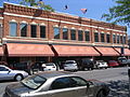
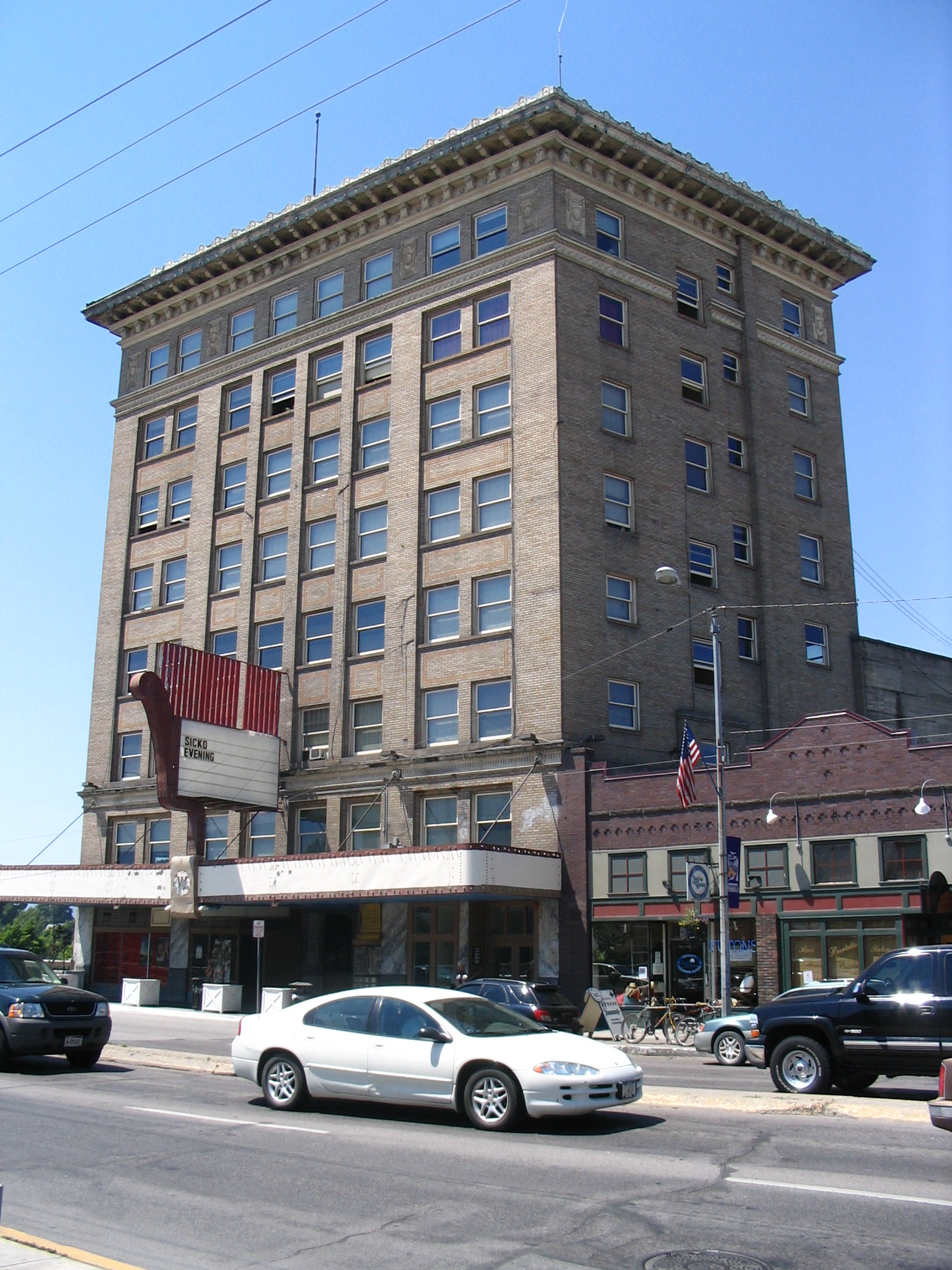
Main article: Buildings and structures in Missoula, MontanaMissoula is home to over 60 buildings on the National Register of Historic Places beginning with the A.J. Gibson designed County Courthouse constructed in 1908 and added to the list in 1976. The Post Office, Wilma Theatre and Higgin's Block were all added a couple years later. In the early 1990s both the Gleim Building, a former brothel, was added to the list along with the University District.[33][34]
List of Tallest Buildings
For a full list of Missoula's tallest buildings in the city; List of tallest buildings in Missoula.
Demographics
Metropolitan Statistical Area
Historical populations Census Pop. %± 1870 400 — 1880 347 −13.3% 1890 3,426 887.3% 1900 4,366 27.4% 1910 12,896 195.4% 1920 12,668 −1.8% 1930 14,657 15.7% 1940 18,449 25.9% 1950 22,485 21.9% 1960 27,090 20.5% 1970 29,497 8.9% 1980 33,388 13.2% 1990 42,918 28.5% 2000 57,053 32.9% 2010 66,788 17.1% source:[1][35][36] The Missoula Metropolitan Statistical Area is the second largest metropolitan area in the U.S. state of Montana. Located in the West-central portion of the state. The 2010 census shows its population at 109,299[1]
It is one of the largest metropolitan area between Boise, Idaho, and Calgary, Alberta, Canada, and Coeur d'Alene, Idaho[37] and Billings, Montana. It is also the second largest media market in the state of Montana, and also has one of the best Health care facility programs in its surrounding area.
The 2010 Census put Missoula's population at 66,788. There currently are 57,053 people, 24,141 households, and 12,336 families residing in the city. The population density was 2,397.1 people per square mile (925.6/km²) in 2000. There were 25,225 housing units at an average density of 1,059.8 per square mile (409.2/km²). The racial makeup of the city was 93.57% White, 2.35% Native American, 1.23% Asian, 0.36% African American, 0.10% Pacific Islander, 0.51% from other races, and 1.87% from two or more races. Hispanic or Latino of any race were 1.76% of the population.
There were 24,141 households out of which 24.6% had children under the age of 18 living with them, 37.9% were married couples living together, 10.0% had a female householder with no husband present, and 48.9% were non-families. 33.6% of all households were made up of individuals and 8.9% had someone living alone who was 65 years of age or older. The average household size was 2.23 and the average family size was 2.88.
In the city the population was spread out with 19.7% under the age of 18, 20.7% from 18 to 24, 29.4% from 25 to 44, 19.8% from 45 to 64, and 10.4% who were 65 years of age or older. The median age was 30 years. For every 100 females, there were 98.8 males. For every 100 females age 18 and over, there were 97.1 males.
The median income for a household in the city was $30,366, and the median income for a family was $42,103. Males had a median income of $30,686 versus $21,559 for females. The per capita income for the city was $17,166. About 11.7% of families and 19.7% of the population were below the poverty line, including 20.5% of those under age 18 and 9.3% of those age 65 or over. 40.3% of Missoula residents age 25 and older have a bachelor's or advanced college degree.
Economy
Missoula began in the 1860s as a trading post on the Mullan Military Road to take advantage of the road's purpose of being the first route across the Bitterroot Mountains to the plains of Eastern Washington. The arrival of Fort Missoula (1877), the Northern Pacific Railroad (1883), and U.S. Forest Service offices (1877) solidified Missoula's economy with a steady stream of employment.
Timber demand for the railroad lead to the setting up of numerous saw mills, which were gradually consolidated, and the lumber industry remained important to the Missoula economy for much of the 20th century.
Today, Missoula's economy has diversified with Education, health care, retail, government, and professional services all playing an important part in the economy at large.[38] In particular, the University of Montana is the region's largest employer, while St. Patrick Hospital and the Community Medical Center follow making Missoula the regional medical center.[39]
Missoula is also a regional economic center; as of 2006 one survey showed Missoula as having a primary trade area of 100,086 and a secondary trade area of 93,272..[40][41]
Fastest Growing Occupations and Industries
According to the Montana Department of Labor, the fastest growing occupations for the state as a whole are Forensic Science Technicians, Medical Assistants, Industrial Engineers, Food Prep and Service, and Physical Therapist Assistants. The fastest growing industries are Administrative & Support Services, Administrative & Waste Services, Arts Entertainment & Recreation, Professional & Business Services, Professional & Technical Services, and Health Care & Social Assistance.[42]
Missoula Payroll Employment Numbers[43] Employment Sector Subsector 2009
# employed% of Missoula jobs % of sector Annual Percentage Change Total 54,348 100% -2.1 Construction 2,794 5% -19 Specialty Trade Contractors 1,438 3% 51% -20 Manufacturing 2,187 4% -10 Durable Goods Manufacturing 1,000 2% 46% -17 Nondurables Manufacturing 1,187 2% 54% -3.7 Wholesale Trade 1,862 3% -7 Retail Trade 7,917 15% -5.8 Auto Dealers 908 2% 11% -7.9 Building Material Dealers 794 1% 10% -9.3 Transportation and Warehousing 1,690 3% -1.7 Truck Transportation 649 1% 38% -7.7 Information 1,153 2% -1.2 Finance and Insurance 1,784 3% 1.1 Real Estate 766 1% -6.2 Professional and Business Services 6,523 12% 6.8 Educational Services 2,540 5% 1.6 Health Care 8,680 16% 5.2 Ambulatory Health Care 2,852 5% 33% 5.8 Social Assistance 1,966 4% 23% 6.5 Arts, Entertainment and Recrecation 1,416 3% -8.4 Accommodation and Food Services 5,906 11% -3.2 Accommodations 1,319 2% 22% -3.9 Food Services 4,588 8% 78% -3 Other Services 2,448 5% -3.1 Public Administration 2,453 5% 48 Environmental Quality Programs 889 2% 36% 2.9 Unemployment = 6.6% 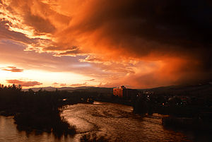 The Clark Fork River in downtown Missoula
Major employers
- University of Montana
- St. Patrick Hospital
- Community Medical Center (Montana)
- Missoula County Public Schools
- DirecTV Call Center
Tourism
Missoula is home to the Missoula Convention and Visitors Bureau, which was founded in 2003. The Missoula Convention and Visitors Bureau has been formed exclusively for the promotion of tourism, the development of effective methods of attracting and hosting conventions and events for Missoula and the surrounding area, and to educate the local community of the significance of the tourism as an economic driver.
Southgate Mall
The mall is one of the most popular shopping destinations in the city, servicing over 7 million customers each year. At 580,674 square feet (53,946.4 m2) of GLA Southgate Mall is the largest enclosed regional shopping Mall in Western Montana and third largest in the entire state.
Culture
Arts
Missoula has a thriving arts scene. The Big Sky Documentary Film Festival,[44] the largest film event in Montana, takes place each February and showcases over 100 non-fiction films from around the world. The International Wildlife Film Festival,[45] is held annually at the historic Wilma Theatre. The Missoula Children's Theater [1] is an international touring program that visits nearly 1,000 communities per year. The Children's Theater routinely has residencies in all fifty states, Canada, Japan, Germany, Italy, and many other countries. The Missoula Art Museum [2], exhibits a variety of contemporary art. The museum was founded in 1975, and in 2005 the facilities were renovated and expanded. The museum offers art classes, tours, gallery talks, and has free admission.
The city is frequently mentioned in novels of Ernest Hemingway, Stephen Frey, Chuck Palahniuk, James Lee Burke, James Crumley, and former resident Norman Maclean. In his novel, A River Runs Through It, Maclean wrote that "The world is full of bastards, the number increasing rapidly the further one gets from Missoula, Montana."
Missoula is home to a diverse and influential music scene. Members of bands such as Deranged Diction (Jeff Ament), which formed in Missoula, later moved to Seattle and became key members of groups such as Green River, Mother Love Bone, Pearl Jam, Silkworm, and Love Battery, playing an important role in the birth of the grunge movement. The city is prominently featured in "Apology Song" by Oregon indie-band The Decemberists. Prior to moving to Portland, Decemberist frontman Colin Meloy studied at the University of Montana. In Missoula, Meloy formed the pop band Tarkio.[citation needed] Wantage Record hosts Totalfest, a yearly diy music festival featuring local and touring acts, in Missoula.
Museums
In addition the Missoula Art Museum, other museums include:
- Historical Museum at Fort Missoula - located Fort Missoula
- Montana Museum of Art & Culture at the University of Montana - Missoula - collections include American and European art, textiles, Asian art, ceramics, photographs
- Rocky Mountain Museum of Military History, located at Fort Missoula adjacent to the Historical Museum at Fort Missoula
- Montana Natural History Center - a natural history and environmental education center
- Families First Children's Museum
- National Conservation Legacy and Education Center - the planned museum of the National Museum of Forest Service History with exhibits about the U.S. Forest Service
Points of interest
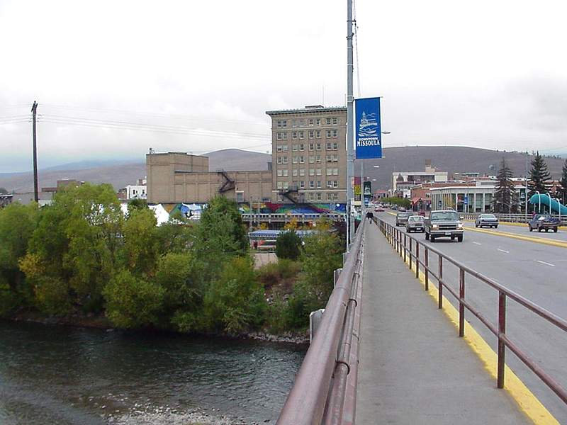
Missoula is located near the Rattlesnake Wilderness and Rattlesnake National Recreation Area, two areas that protect Missoula's municipal watershed and serve as wildlife habitat and recreational areas. The Forest Service's smokejumper base, the largest of its kind, is located near the Missoula airport. Free tours of the base are popular with tourists during the summer wildfire season. A walking bridge over the downtown yards of the Montana Rail Link railroad is a popular destination for railfans.
In April, 2011, the National Park Service officially recognized the Westside Railroad District, adding it to the National Register of Historic Places. This addition once again expands Missoula's Downtown Historic District, after the February, 2011 addition of Free Speech Corner at Higgens Avenue and West Front Street. Free Speech Corner commemorates the free speech fights of the Industrial Workers of the World, a union formed in 1905 which sought to organize timber, lumber and mining workers into one worldwide union.[46]
University of Montana
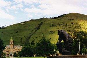
 University of Montana from Mt. Sentinel
- The University of Montana is a state university located in Missoula, Montana, U.S. The school was founded in 1893. It is the largest campus in the four-campus University of Montana System.
Sports
Missoula is Home to the Missoula Osprey, Missoula Phoenix, the Missoula Maulers, and the Hellgate Rollergirls. The Missoula Osprey has won two League Championships in 11 years at Missoula, and 4 division titles. The Missoula Phoenix have won 1 championship, and the Missoula Maulers have won 1 division title since starting its franchise in 2005.
Professional sports teams in Missoula include
- The Missoula Phoenix, a AAA semi-pro football team in the Rocky Mountain Football League.
- The Missoula Osprey, a minor league baseball team, affiliated with the Arizona Diamondbacks.
- The Missoula Maulers, a Tier III Junior A hockey team.
- The Hellgate Rollergirls, a roller derby league.
Sport teams in Missoula
Team Sport League Established Venue Championships Montana Grizzlies football American-Football Division I Football Championship Subdivision 1897 Washington Grizzly Stadium 3 Missoula Osprey Baseball Pioneer League 1999 Ogren Park at Allegiance Field 2 Missoula Phoenix American-Football Rocky Mountain Football League 2006 Washington Grizzly Stadium 1 Missoula Maulers Hockey American West Hockey League 2007 Glacier Ice Rink 0 Hellgate Rollergirls Roller Derby Regional Competitions 2009 The Adams Center(Missoula, Montana) 0 University of Montana Griz
The sports teams of the University of Montana play in Missoula:[47]
- Football
- Basketball (men and women)
- Cross Country (men and women)
- Tennis (men and women)
- Golf (women)
- Soccer (women)
- Volleyball (women)
- Hockey (men and women)
Parks and Recreation
Caras Park
The Caras Park Pavilion, located in the heart of Downtown Missoula on the Clark Fork River, is the epicenter of Downtown Missoula. With the help of the Missoula Downtown Association, Caras Park has been the venue for these events:[48]
 Caras Park in the center of Downtown Missoula
- Out to Lunch
- Downtown ToNight
- Garden City River Rod
- International Wildlife Film Festival
- WildFest
- Parks & Recreation Kids Fest
- YMCA Riverbank Run
- First Night Missoula
- Garden City BrewFest
- Hemp Fest
- GermanFest
- Concerts by Jewel
- Chris Isaak
- Los Lobos
- Santana
- Ziggy Marley and
- B.B. King
Adjacent to Caras Park is A Carousel for Missoula, a wooden, hand-carved and volunteer-built carousel.
Outdoor activities
Missoula is an outdoor enthusiast's paradise throughout the entire year. Throughout the year, activities like skiing, hiking, biking, golf and fly fishing are available.
Missoula bicycling system
Missoula is a focal point of bicycle travel, because of the presence of Adventure Cycling Association,[49] North America's largest cycling membership organization. Thousands of cyclists come through Missoula and stop at Adventure Cycling's downtown headquarters (in a former church at 150 E. Pine Street) for free ice cream, advice, and the chance to be photographed.
Government and politics
Missoula is governed via the mayor-council system. There are twelve members of the city council who are elected from one of six wards. Each ward elects two council members. The mayor is elected in a citywide vote.[50] Missoula is known as a more liberal area than the rest of the state, having 14 Democrats and one Republican in its state legislative delegation.[51] In 2004, Missoula County was one of only six Montana counties to vote for John Kerry. That same year Missoula voted in favor of the state's medical marijuana law by the largest margin (73%-23%) and the ban on same-sex marriage (which passed in every county) by the lowest margin (51%-49%). Missoula's Mayor has been John Engen since 2006 and is currently the 50th mayor of Missoula, Montana[52]
Presidential Election Voting Trends
However, though Missoula is the largest liberal-leaning county, it is not the most liberal county in Montana. That title belongs to Deer Lodge County which has not voted for a Republican Presidential candidate since 1924 when Robert LaFollette chose Democratic Montana Senator Burton K. Wheeler as his running mate on the Progressive Party ticket and split the Democratic vote. Silver Bow County, with a similar voting record (with the exception of a a 146 Eisenhower victory in 1956) is a close second.[53] In fact, Missoula's more liberal tendencies are relatively recent development with the county voting at least 6% more for the Democratic candidate than the rest of the state since 1980 (this excludes 2000 where Ralph Nader received 15% of the county's vote). In fact, only since 1988 (excluding 2000) has the Democratic candidate received more votes than the Republican candidate. (It should be noted, however, that over 30% of Missoula County's population lives outside the city of Missoula). Before this, Missoula voted very closely with the rest of Montana or, actually, heavier Republican.
Presidential Election Results[53][54]
Missoula (MSO), Montana (MT), and United States (US)Year Democrat Republican Other Year . Candidate MSO MT US . Candidate MSO MT US . Candidate MSO MT US 2008 Barack Obama 61 47 53 John McCain 35 49 46 2004 John Kerry 51 39 48 George W. Bush 46 59 51 2000 Al Gore 37 33 48 George W. Bush 46 58 48 Ralph Nader (Green) 15 6 3 1996 Bill Clinton 49 41 49 Bob Dole 36 44 41 Ross Perot (Independent) 13 14 8 1992 Bill Clinton 47 38 43 George Bush 30 35 37 Ross Perot (Reform) 23 26 19 1988 Michael Dukakis 54 46 46 George Bush 45 52 53 1984 Walter Mondale 45 38 41 Ronald Reagan 54 60 59 1980 Jimmy Carter 38 32 41 Ronald Reagan 47 57 51 John B. Anderson (Independent) 11 8 7 1976 Jimmy Carter 47 45 50 Gerald Ford 51 53 48 1972 George McGovern 46 38 38 Richard Nixon 52 58 61 John Schmitz (American Ind.) 2 4 1 1968 Hubert Humphrey 41 42 43 Richard Nixon 48 51 43 George Wallace (American Ind.) 8 7 14 1964 Lyndon Johnson 61 59 61 Barry Goldwater 38 41 39 1960 John F. Kennedy 46 49 50 Richard Nixon 54 51 50 1956 Adlai Stevenson 39 43 42 Dwight Eisenhower 61 57 57 1952 Adlai Stevenson 40 40 44 Dwight Eisenhower 59 59 55 1948 Harry Truman 51 53 50 Thomas Dewey 46 43 45 Henry A. Wallace (Progressive) 3 3 2 1944 Franklin D. Roosevelt 50 54 53 Thomas Dewey 49 45 46 1940 Franklin D. Roosevelt 57 59 55 Wendell Willkie 42 40 45 1936 Franklin D. Roosevelt 71 69 61 Alfred Landon 25 28 37 1932 Franklin D. Roosevelt 55 59 58 Herbert Hoover 40 36 40 Norman Thomas (Socialist) 6 4 2 1928 Alfred Smith 39 41 41 Herbert Hoover 60 58 58 1924 John W. Davis 13 19 29 Calvin Coolidge 30 43 54 Robert LaFollette (Progressive) 58 38 17 1920 James Cox 39 32 60 Warren G. Harding 53 61 34 Parley P. Christensen (Farmer-Labor) 8 7 1 1916 Woodrow Wilson 54 57 49 Charles Evans Hughes 39 38 46 Allan L. Benson (Socialist) 7 5 3 1912 Woodrow Wilson 33 35 42 William Taft 13 23 23 Theodore Roosevelt (Progressive 38 28 27 1908 William Jennings Bryan 44 43 43 William Taft 46 47 52 Eugene Debs (Socialist) 9 9 3 1904 Alton B. Parker 36 34 38 Theodore Roosevelt 45 54 56 Eugene Debs (Socialist) 17 9 3 1900 William Jennings Bryan 57 59 46 William McKinley 42 40 52 1896 William Jennings Bryan 86 80 47 William McKinley 14 20 51 1892 Grover Cleveland 46 40 46 Benjamin Harrison 40 42 43 James B. Weaver (Populist) 14 17 9 ♦ Montana became a state in 1889
Missoula (MSO), Montana (MT), and United States (US)Local Politics
 Further information: List of mayors of Missoula, Montana
City Council Mayor John Engen Ward 1 Dave Strohmaier/Jason Wiener Ward 2 Pam Walzer/Roy Houseman Ward 3 Stacy Rye/Bob Jaffe Ward 4 Jon Wilkins/Lyn Hellegaard Ward 5 Dick Haines/Renee Mitchell Ward 6 Ed Childers/Marilyn Marler In 2010, the City Council proposed and approved a non-discrimination ordinance, prohibiting discrimination on the basis of sexual orientation, gender identity, and gender expression in employment, housing, and public accommodations. Although the ordinance, proposed by councilmembers Stacy Rye and Dave Strohmaier, received some opposition from members of the Missoula community and surrounding areas, it passed by a 10-2 margin, making Missoula the first city in the state with such non-discrimination protection.
Currently the City of Missoula is undergoing a rewrite of the zoning and subdivision regulations, is undertaking a study of the Urban Fringe Development Area (UFDA), is working in partnership on the Downtown Master Plan, and is finalizing a long-range transportation plan.
Marijuana
In 2006, voters in Missoula County passed Initiative 2, which made marijuana possession the lowest priority for law enforcement. However, in 2008 a volunteer citizen committee[55] established to oversee progress on the initiative found that marijuana arrests rose in the 2 years since its passage. It also concluded, "In short, the lowest priority recommendation issued to public officials by voters in 2006 continues to be mostly disregarded."[56]
City police chief Mark Muir defended criticism of the rising number of arrests, saying the rise could be attributed to "some people [being] more flagrant in their pot smoking because they wrongly believe the initiative protects them within the city."[57]
Most of the legislative districts that approved of medical marijuana overwhelmingly include the city of Missoula within their boundaries.[58]
A statewide chapter[59] of NORML was founded in 1998 and is based out of Missoula.
Organizations and non-profits
Notable organizations and non-profits based in Missoula [60] exemplify the city's fondness for the outdoors and reputation for promoting more liberal social causes. Included are state offices for the National Organization for the Reform of Marijuana Laws, Montana Hemp Council, National Endowment for the Humanities's affiliate Humanities Montana, Montana Justice Foundation, Forward Montana, the Montana Meth Project, and the Western Montana Gay & Lesbian Community Center.[61]
Beyond the state level, Missoula is also home of the International Wildlife Film Festival, the Adventure Cycling Association, the Jeannette Rankin Peace Center,[62] American Indian Business Leaders,[63] Boone and Crockett Club, the Rocky Mountain Elk Foundation, and the Outdoor Writers Association of America.[64]
Also located in Missoula are the Poverello Center, the largest emergency homeless shelter and soup kitchen in Montana, and Missoula Correctional Services, a non-profit company that runs a Pre-Release Center for the Montana Department of Corrections and coordinates various city and county programs such as Community Service, Misdemeanor Probation, Pretrial Supervision and the Alternative Jail Program.
Education
History
Missoula's first school was opened in 1869 with 16 students from around the region and Emma C. Slack as their teacher who had come via a two-month trip by horseback, railroad, and boat at the invitation of her brother. Upon marriage to W.H.H. Dickinson she was required to quit teaching as married women were not allowed to teach, and was replaced by Elizabeth Countryman would later marry (1871) Judge Frank H. Woody who would become Missoula's first mayor in 1883.[65]
The first public high school was opened in 1904, but was quickly overran with students and was converted back to a grade school when the Missoula County High School, designed by A.J. Gibson, was opened in 1908. Expansions were made, but in 1951 it was decided that another campus was needed, and a new school was opened in 1957. Initially the two campuses separated between upper and lower classmen, but in 1965 they became two separate schools. By student vote, the original Missoula County High School became Hellgate High School and the new campus became Sentinel High School.[66] In 1980, Missoula became the first city in Montana to have four secondary schools when it Big Sky High School was established. Missoula's forth secondary school is Loyola Sacred Heart High School, a private Catholic school created from a merger in 1974 of the all-girls Sacred Heart Academy (est. 1873) and the all-boys Loyola High School (est. 1911).[67]
Primary and Secondary Education
Missoula's public schools are part of the Missoula County Public School [3] (MCPS) District 1 which is overseen by the Montana Office of Public Instruction. MCPS operates nine Elementary Schools (Chief Charlo, Cold Springs, Franklin, Hawthorne, Lewis and Clark, Lowell, Paxon, Rattlesnake, and Russell) grades K-5, three Middle Schools (CS Porter, Meadow Hill, and Washington) grades 6-8, and five High Schools (Big Sky, Hellgate, Sentinel, Seeley-Swan, and Willard Alternative).[68][69][70] Missoula High Schools also encompass the elementary school districts of Bonner, Clinton, DeSmet, Hellgate, Lolo, and Target Range.[71] Private schools include Missoula International (k-8, Spanish), Mountain View Elementary (k-8), Sussex (k-8), St. Joseph's Elementary (k-8, Catholic), Loyola Sacred Heart High School (9-12), and Valley Christian High School (k-12). In 2009, Next Step Prep, a summer theater arts academy for high schoolers, was opened by the Missoula Children's Theatre.
Higher Education
Higher education in Missoula is dominated by the main campus of University of Montana. The university, established in 1893 is the first and largest (15,642 students in 2010) university in Montana. The campus houses 6 colleges (Arts & Sciences, Education, Forestry, Health Professions & Biomedical Sciences, and Visual & Performing Arts) and 3 schools (Business, Journalism, and Montana's only Law School). Also located in Missoula is the University of Montana College of Technology which was established in 1956 and known as the Missoula Vocational Technical Center until it became affiliated with the University of Montana in the Fall of 1994.
Missoula is also home to several vocational schools not affiliated with a university education. These include The Rocky Mountain School of Photography, Connole-Morton Insurance School, The Dickinson Lifelong Learning Center, The Osher Lifelong Learning Institute at UM (MOLLI) (non-credit), Modern Beauty School, Montana Academy of Skin Care, Montana School of Massage, and Sage Truck Driving School.[72]
Highest Educational Attainment
(2009)Missoula[73] Montana[74] U.S.[75] Billings[76] Great Falls[77] Bozeman[78] Butte[79] Helena[80] Less than High School Diploma 8.6% 9.6% 15.5% 8.8%% 9.3% 3.4% 9.6% 5.3% High School Diploma or equivalent 22.9% 31.9% 29.3% 29.7% 30.9% 15.9% 38.8% 21.8% Some College 22.0% 23.8% 20.3% 24.5% 27.5% 23.4% 21.6% 22.5% Associates Degree 6.2% 7.6% 7.4% 7.3% 8.6% 6.0% 7.5% 7.6% Bachelor's Degree 25.3 18.7% 17.4% 21.2% 16.2% 32.6% 15.4% 25.8% Graduate or Professional Degree 14.9% 8.3% 10.1% 8.6% 7.5% 18.7% 7.1% 17.0% High School or higher 91.3% 90.4% 84.6%% 91.2% 90.7% 96.6% 90.4% 94.7% Bachelor's Degree or higher 40.3% 27% 27.5%% 29.7% 23.7% 51.3% 22.5% 42.8% Media
Main article: Media in Missoula, MontanaBroadcast: Missoula's television media market has been the largest in the state of Montana since 2002 and ranked #166 nationally (2010).[81] Though Missoula itself is second in population to Billings, Montana, Missoula's media market includes all of Missoula, Ravalli, Granite, Mineral, Lake, Flathead, and Sanders Counties in the more densely populated western region of Montana and serves over 113,000 television homes (2011).[82][83] Missoula is home to three local affiliate channels: KPAX-TV (CBS/MTN, The CW; founded 1970; ch. 8), KECI-TV (NBC; founded 1954 as KGVO-TV; ch. 13, and KTMF (ABC, FOX; founded 1991). Also based in Missoula at the University of Montana is Montana PBS (founded 1984; ch. 11). There are also 4 AM and 17 FM radio stations licensed in the city (List of Stations).
Print: Missoula has four main sources of print media: the Missoulian (primary daily), Missoula Independent (alternative weekly), Montana Kaimin (college), and New West (digital, progressive). The Missoulian was founded as a weekly publication in 1870 as the Missoula & Cedar Creek Pioneer. It was converted to a weekly and changed to the current Missoulian in 1891 by the founder of the Missoula Mercantile Co., A. B. Hammond.[84] Today, the Missoulian remains Missoula's most popular newspaper with a circulation of over 26,000.[85] It is also the third most read newspaper in Montana behind the Billings Gazette and the Great Falls Tribune. The Missoula Independent (founded 1991) is the largest weekly newspaper in Montana and the states only member of the Association of Alternative Newsweeklies. With over 21,000 readers it has twice the circulation of second place Billings Outpost. The newspaper is distributed free to more than 600 locations across Western Montana from Hamilton in the south to Whitefish in the north.[86] The Montana Kaimin (founded 1891) is likewise distribute free throughout parts of Missoula with heavy student traffic from the University of Montana where the newspaper is printed M-F during the school year. New West was founded in 2005 as a left-leaning "next-generation media company" that focused on culture, environment, economy, and politics in the Rocky Mountain West.[87]
Infrastructure
Transportation
Highways
 -- Interstate 90 --
Interstate 90 runs east to west along the northern edge of Missoula at the base of the North Hills. All but a small portion of the city (the Upper and Lower Rattlesnake neighborhoods) is located south of the highway. Completed in 1965 at the expense of 60 homes, the Garden City Brewery and the Greenough Mansion,[88] the Missoula portion of Interstate 90 has five exits: Exit 96 - connection to U.S. 93 North and MT 200, Exit 99 (Airway Boulevard) - access to Missoula International Airport, Exit 101 (Reserve Street) - connection to U.S. 93 South, access to west Missoula, and I-90 Business Loop, Exit 104 (Orange Street) - access to Downtown Missoula, and Exit 105 (Van Buren Street) - access to the University of Montana, connection to U.S. 12 South, and I-90 Business Loop. -- U.S. Route 12 --
US 12 enters Montana at Lolo Pass, 7 miles (11 km) southwest of Lolo Hot Springs in the Lolo National Forest before meeting with US 93 at Lolo and continuing as a concurrency northeast for 7.5 miles (12.1 km) to Missoula. Here U.S. 12 breaks off U.S. 93 and continues Northeast to Downtown Missoula along Brooks Street before cutting through the University District and across the Madison Street Bridge. U.S. 12 joins Interstate 90 East at Exit 105 (Van Buren Street) and overlaps I-90 for 69 miles (111 km) , until reaching Garrison.The original U.S. 12 was approved by the American Association of State Highway and Transportation Officials (AASHO) in 1939 to extend into Wyoming and Montana. The route, would not include Missoula, however, until U.S. 12 was rerouted along State Route 6 in October 1959. In 1962, the route was extended from Missoula southeast toward Idaho along U.S. 93.[89]
 -- U.S. Route 93 -- U.S. 93
U.S. 93 enters Montana from Idaho at Lost Trail Pass and travels north descending through the Bitterroot National Forest. The highway continues along the Lewis and Clark trail into the Bitterroot Valley until it joins U.S. 12 at Lolo as a concurrency northeast for 7.5 miles (12.1 km) to Missoula. The highway runs along Reserve Street on the western edge of Missoula before meeting Interstate 90 at Exit 101 and following it before breaking off north at Exit 96.U.S. 93 was approved by AASHO in 1927 beginning at the Canadian International Boundary through Missoula and exiting Montana near Gibbonsville.[90]
 -- Montana Highway 200 --
MT Highway 200 enters Missoula along Broadway Street in northern Missoula just south of Interstate 90. MT 200 joins I-90 at Exit 105 (Van Buren Street) and continues together west before breaking off at Exit 96 and heading north along U.S. 93 toward Flathead Lake.Air Travel
The Missoula International Airport (Johnson-Bell Field) is a public airport run by the Missoula County Airport Authority and is the largest airport in western Montana, serving 575,584 passengers in 2010.[91] The current building contain three boarding gates ((3 jet bridges, 3 ground-level), offers year-round direct flights to 7 destinations (Denver, Las Vegas, Los Angeles, Minneapolis, Phoenix, Salt Lake City, and Seattle) and seasonal flights to 3 others (Chicago, Portland, and San Francisco). Four airlines operate out of Missoula (Allegiant Air, Delta Air Lines, Horizon/Alaska Airlines, and United Airlines) in addition to the Air Cargo Carriers of FedEx, and UPS.[92]
The airport is also home to Homestead Helicopters and Fixed-Base Operators Minuteman Jet Center (an Exxon Mobil Avitat fuel provider), and Northstar Jet (a Phillips 66 fuel provider).
History: Missoula's first landing strip was laid out in 1923 south of the university. An additional strip near the Western Montana Fair Grounds on what is now Sentinel High School was sold to the county in 1927 at the request of the Missoula chapter of the National Aeronautic Association and would become Missoula's first true airport. The current airfield is named after that chapter's first president, Harry O. Bell along with mountain flying pioneer Bob Johnson of Johnson Flying Service (now Minuteman Aviation). The original Garden City Airport was renamed Hale Field in 1935 and would operate as such until closing forever in 1954. The airport was gradually replaced by the Missoula County Airport opened in 1941 with WPA funds and the cooperation of the US Forest Service who needed access to an airport. The new airport was renamed Johnson-Bell Field in 1968 and today serves nearly 600,000 passengers a year.[93]
Bus system
Missoula is served by Mountain Line, a public transit agency created by public vote in 1976 as part of the Missoula Urban Transportation District (MUTD) that began operation in December 1977. Mountain Line operates twelve bus routes within a 36-square-mile (93 km2) area, serving Missoula, East Missoula, Bonner, Target Range, Rattlesnake, Mullan Road, and the airport. Additionally the line has offered paratransit services since 1991 to assist the disabled, senior van since 2008, and has four park-n-ride lots throughout Missoula.[94]
Special bus service is offered to the University of Montana through three of city's park-n-ride lots in addition to late-night UDASH shuttle that offers service to Downtown. Bus fair for university students is prepaid as part of the university's transportation fee.[95] Missoula is also served by Greyhound Lines, and Rimrock Trailways that provide intercity bus transportation to and from Missoula.
Trail System
There is a network of bicycle and pedestrian trails throughout the community extending over 22 miles (35 km). Primary trails used for commuting in addition to recreation are those following the path of the former Milwaukee Railroad east-west along the Clark Fork River and southeast along the Bitterroot Branch Railroad.[96]
Rail
Missoula has not has passenger rail service since 1979 when Amtrak discontinued its North Coast Hiawatha route which ran through southern Montana along present-day Interstates 90 and 94. The North Coast Hiawatha was operated by Amtrak from 1971–1979 and had replaced the Northern Pacific Railway that had serviced Missoula since 1883. In 2008 a bill was passed in Congress that would require Amtrak to study the North Coast Hiawatha route and consider returning service to the area, prompting some to believe that there is a great chance of service restoration.[97]
Utilities
In Missoula the following utilities of Power, water, sewer and garbage disposal are: Electricity is provided by Missoula Electric Cooperative or NorthWestern Energy, which also supplies natural gas service. Allied Waste services and Grant Creek Water Systems handles trash pickup. Telephone service in the area is proved by Qwest Communications and Blackfoot Telecommunications Group. Sewer services is handled by the City of Missoula Wastewater Division, and Alltel, Verizon, and Cellular One is the most used cell phone services in Missoula.
Health Care
St. Patrick Hospital and Health Sciences Center
History
St. Patrick Hospital opened in 1873 under the sponsorship of the Sisters of Providence. The present facility opened in 1984, the fourth St. Pat's on this site above the Clark Fork River. In May 2000, they changed the name from "St. Patrick Hospital" to "St. Patrick Hospital and Health Sciences Center" to reflect an increasing involvement with national medical research and education. The hospital has 195 acute-care beds, and 18 transitional-care beds. In 2003, St. Pat's admitted over 9,705 patients and provided more than 49,986 days of patient care. Approximately 95% of patients come from our 17-county service area.
In November 1999, after imploding the old hospital called the Broadway Building, construction began for a new outpatient services building next to the present hospital building. The Broadway Building opened in March 2002, with two underground floors of parking and six stories of physician offices and outpatient services. Physicians include those from the Western Montana Clinic, the Montana Neuroscience Institute, and the Montana Cancer Center, among others. Outpatient services include physical, occupational, and speech therapy, diabetes services, and cardiac rehabilitation.
Sponsorship
St. Patrick Hospital and Health Sciences Center is a not-for-profit medical center under the sponsorship of the Sisters of Providence. The Sisters share sponsorship responsibilities with community leaders in the form of a governing board, which helps direct the hospital in its endeavors. This governing board, in turn, reports to and is directed by Providence Health and Services. Providence Health and Services is a holding company that represents the Sisters of Providence in leading their sponsored healthcare, higher education, and human services ministries in eastern Washington and western Montana. Sponsorship is a special type of not-for-profit ownership. As sponsors, the Sisters of Providence and Providence Health and Services are accountable to the community, the Catholic Church, and state and federal governments for fulfilling the missions of each sponsored organization.[98]
Community Hospital
History
The Community Medical Center (Montana) and its adjacent medical facilities stand as a gleaming monument to the dedication and vision of hundreds of Montanans and, in particular, two doctors who came west in the early 1900s.
Situated on a grassy plain near historic Fort Missoula, Community Hospital is part of a modern complex that includes a nursing home, the Missoula Crippled Children's Center and private offices.
The story of Community Hospital begins with two brothers who were prominent in the early history of Western Montana medicine.
Dr. Charles Thornton (known affectionately as "Dr. Charles") came west in 1905 to begin a practice in Corvallis, Montana. At that time the mortality rate of spotted or "tick" fever was 80 to 90 per cent. Of the first 11 cases Dr. Charles treated, only one patient died. He subsequently became known throughout the Bitterroot Valley for his ability to treat the dreaded Rocky Mountain Spotted Fever.
An ardent sportsman, Dr. Charles was among the first to introduce Chinese and Hungarian pheasants to Western Montana. He also imported and bred German shorthaired pointers to hunt the wily pheasants. At one time, he had more than 30 German pointers in his kennels. Dr. Charles also imported Belgian horses and brown Swiss dairy cattle.
Dr. Charles' brother, Dr. Will Thornton ("Dr. Will") came west in 1907 and started a practice in Stevensville, Montana. He had been a professor of anatomy and had worked with Dr. J. H. Kellogg, the surgeon who established the Battle Creek sanitarium in Michigan. Dr. Kellogg was the older brother of W. K. Kellogg, who developed the corn flake into a multi-million-dollar industry.
Dr. Will performed more than 15,000 major operations in 36 years of active practice, and he participated in the construction and operation of three private hospitals in Western Montana.
In 1910 he built the first hospital in the Bitterroot Valley and ran it until 1917, when he moved to Missoula. At that time, he built the Thornton Hospital, now the Thornton Apartments at the corner of Third and Orange Streets.[99]
Notable residents
Main article: List of people from Missoula, MontanaSister cities
Missoula has three sister cities, as designated by Sister Cities International:
 Neckargemünd, Germany
 Palmerston North, New Zealand
 Beaune, France
Gallery
-

The Wilma Theater in Missoula Montana, built in 1921.
-

Downtown Missoula Winter- 1996
-
Missoula
-
Historic Building in Downtown Missoula
-
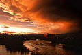
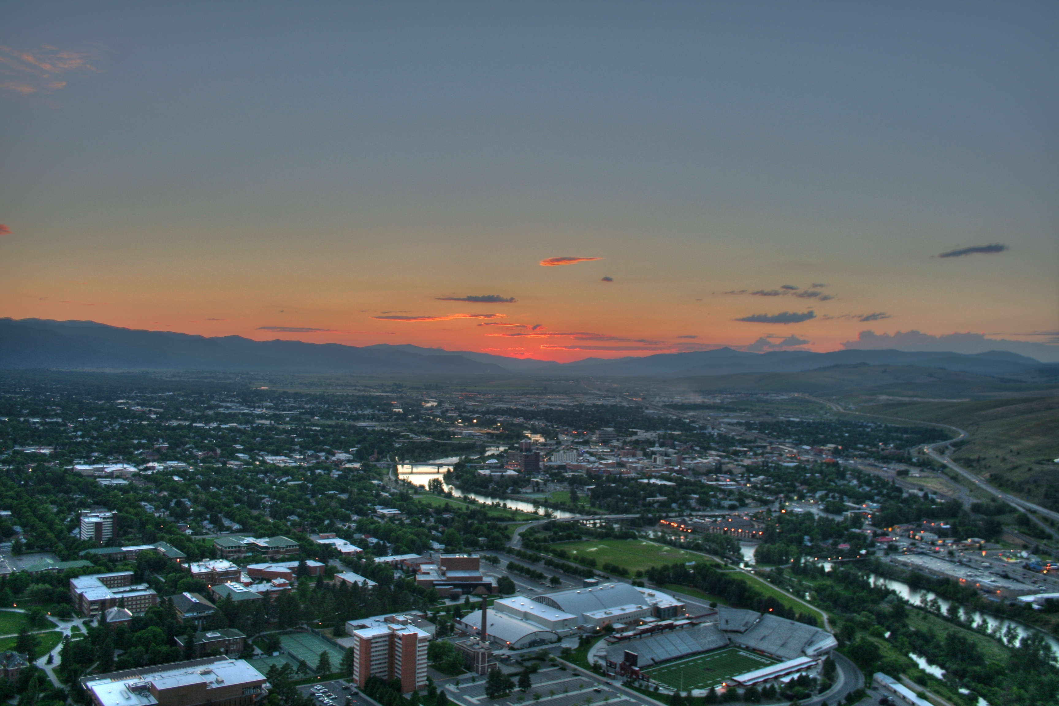
Missoula Sunset in Downtown Missoula
-
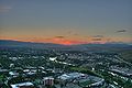
Sunset over Missoula area
Missoula, Montana Climate • Demographics • Economy • Government • Neighborhoods • Downtown Missoula Education High SchoolsBig Sky • Hellgate • Sentinel • Loyola Sacred Heart High School • Valley Christian • Willard Alternative High School • Sussex School • Clark Fork School • Next Step PrepHigher EducationUniversity of Montana • UM-College of TechnologyMuseumsFort Missoula • Montana Museum of Art & Culture • Missoula Art Museum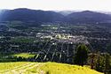
Geography MountainsRiversHistory Media TelevisionPrintBreweries Bayern Brewing • Big Sky Brewing • Kettle House Brewing • Taproom only: Tamarack Brewing • Flathead Lake BrewingServices Health CareSt. Patrick Hospital and Health Sciences Center • Community Medical CenterTransportationSports TeamsMontana Grizzlies • Osprey (baseball) • Phoenix (semi-pro football) • Maulers (hockey) • Hellgate RollergirlsVenuesWashington–Grizzly Stadium (football) • Ogren Park at Allegiance Field (baseball) • Glacier Ice Rink (hockey) • Dornblaser Field (soccer) • Dahlberg Arena (basketball) • Western Montana Fair Grounds (horse racing)University of Montana Category • People from Missoula Municipalities and communities of Missoula County, Montana County seat: Missoula City Missoula
CDPs Bonner-West Riverside | Clinton | East Missoula | Evaro | Frenchtown | Lolo | Orchard Homes | Seeley Lake | Wye
Unincorporated
communitiesGhost town Hell Gate | Coloma
Indian reservation Footnotes ‡This populated place also has portions in an adjacent county or counties
 State of Montana
Helena (capital) Topics Index · History · Governors · People · Geography · State Government · Delegations · Visitor Attractions
Society Crime · Demographics · Economy · Education · Politics
Regions The Flathead · Glacier National Park · Regional designations of Montana · Western Montana · Yellowstone
Largest cities Counties Beaverhead · Big Horn · Blaine · Broadwater · Carbon · Carter · Cascade · Chouteau · Custer · Daniels · Dawson · Deer Lodge · Fallon · Fergus · Flathead · Gallatin · Garfield · Glacier · Golden Valley · Granite · Hill · Jefferson · Judith Basin · Lake · Lewis and Clark · Liberty · Lincoln · Madison · McCone · Meagher · Mineral · Missoula · Musselshell · Park · Petroleum · Phillips · Pondera · Powder River · Powell · Prairie · Ravalli · Richland · Roosevelt · Rosebud · Sanders · Sheridan · Silver Bow · Stillwater · Sweet Grass · Teton · Toole · Treasure · Valley · Wheatland · Wibaux · Yellowstone
Glacier Country
(Northwest)MissoulaGold West Country
(Southwest)Russel Country
(North Central)Yellowstone Country
(South Central)Missouri River Country
(Northeast)Custer Country
(Southeast)Beaver Creek Brewery
Coeur d'Alene, Idaho Pablo, Montana Seeley Lake, Montana Lolo National Forest 
Lincoln, Montana  Missoula, Montana

Lolo National Forest Hamilton, Montana Deer Lodge, Montana References
- ^ a b c d e "U.S. Census Bureau Delivers Montana's 2010 Census Population Totals, Including First Look at Race and Hispanic Origin Data for Legislative Redistricting", Census 2010 News, http://2010.census.gov/news/releases/operations/cb11-cn85.html
- ^ Missoula History
- ^ Overland monthly and the Out West magazine: Making of America Project. Vol. LIII - Second Series. (1909)
- ^ Mathews, Allan James. Montana Mainstreets, Volume 6: A Guide to Historic Missoula (2002)
- ^ Missoula Economic Development
- ^ Mountain Ranges of Montana, c0278592.cdn.cloudfiles.rackspacecloud.com
- ^ a b "Early, Early Missoula", Historic Missoula, http://www.historicmissoula.org/History/FromtheBeginning/EarlyEarlyMissoula/tabid/192/Default.aspx
- ^ Traveler's Rest in Montana on the Lewis and Clark Trail, http://www.lewisandclarktrail.com/section3/montanacities/missoula/travelerrest.htm
- ^ Meriwether Lewis, tworivershistory.net
- ^ Lutz, Dennis J. (1986). Montana Post Offices & Postmasters, p. 26, p. 35. Minot, North Daokta: published by the author & Montana Chapter No. 1, National Association of Postmasters of the United States.
- ^ "Hell Gate Village Era (1860-65)", Historic Missoula, http://www.historicmissoula.org/History/FromtheBeginning/HellGateVillageEra18601865/tabid/193/Default.aspx
- ^ "Early Missoula (1864-1883)", Historic Missoula, http://www.historicmissoula.org/History/FromtheBeginning/EarlyMissoula18641883/tabid/194/Default.aspx
- ^ "Arrival of the Railroad (1883-1893)", Historic Missoula, http://www.historicmissoula.org/History/FromtheBeginning/TheArrivaloftheRailroad18831893/tabid/195/Default.aspx
- ^ "Slow and Steady Growth (1893-1900)", Historic Missoula, http://www.historicmissoula.org/History/FromtheBeginning/SlowandSteadyGrowth18931900/tabid/196/Default.aspx
- ^ "Great Depression & Thereafter (1930-2005)", Historic Missoula, http://www.historicmissoula.org/History/FromtheBeginning/GreatDepressionThereafter19302005/tabid/199/Default.aspx
- ^ Missoula anti-pollution group celebrates its victories, helenair.com
- ^ http://www.maedc.org/about
- ^ Missoula Carbon Monoxide SIP Case History, deq.mt.gov
- ^ "US Gazetteer files: 2010, 2000, and 1990". United States Census Bureau. 2011-02-12. http://www.census.gov/geo/www/gazetteer/gazette.html. Retrieved 2011-04-23.
- ^ U.S. Geological Survey Geographic Names Information System: Missoula, Montana
- ^ Allen, John Eliot; Burns, Marjorie and Sargent, Sam C. (c1986). Cataclysms on the Columbia : a layman's guide to the features produced by the catastrophic Bretz floods in the Pacific Northwest. Portland, Oregon: Timber Press. pp. 104. ISBN 0881920673.
- ^ Glacial Lake Missoula
- ^ "Section D: Background". Nps.gov. 1993-02-17. http://www.nps.gov/iceagefloods/d.htm. Retrieved 2009-02-09.
- ^ Glacial Lake Missoula, nps.gov
- ^ a b Missoula Conservation Land Management Plan, (2010 June 01).
- ^ UM Natural Areas: Integrated Plant Management Program
- ^ "Climatography of the United States No. 20 (1971–2000)" (PDF). National Oceanic and Atmospheric Administration. 2004. http://cdo.ncdc.noaa.gov/climatenormals/clim20/mt/245745.pdf. Retrieved 2010-06-07.
- ^ "July 2007 was a record setting month in terms of temperatures across western Montana and north central Idaho". National Weather Service. 2007-08-12. http://www.wrh.noaa.gov/mso/climate/month/2007/July/Records/prelimrecords.htm. Retrieved 2007-09-09.
- ^ "Climatological Normals of Missoula". Hong Kong Observatory. http://www.weather.gov.hk/wxinfo/climat/world/eng/n_america/us/Missoula_e.htm. Retrieved 2010-06-07.
- ^ Mathews, Allan James. Montana Mainstreets: A Guide to Historic Missoula. vol 6 (2002)
- ^ Missoula Neighborhood Councils
- ^ Historic Districts, Historic Missoula
- ^ National Register of Historic Places: Missoula County
- ^ Architecture, Historic Missoula
- ^ Moffatt, Riley. Population History of Western U.S. Cities & Towns, 1850-1990. Lanham: Scarecrow, 1996, 133.
- ^ "Subcounty population estimates: Montana 2000-2007" (CSV). United States Census Bureau, Population Division. 2009-03-18. http://www.census.gov/popest/cities/files/SUB-EST2007-30.csv. Retrieved 2009-05-08.
- ^ Kootenai County QuickFacts, the US Census Bureau
- ^ Missoula economy stands on many legs, billingsgazette.com
- ^ http://www.ourfactsyourfuture.org/admin/uploadedPublications/3368_CF09_Missoula.pdf
- ^ http://www.missouladowntown.com/wp-content/uploads/Missoula-Employment-Analysis-FINAL_Review-Draft12-10-08.pdf
- ^ "Missoula Area Fall 2006 Statistics". Missoula Area Economic Development Corporation. http://www.maedc.org/uploads/editor/Fall%202006.pdf. Retrieved 1 June 2011.
- ^ Montana Workforce Informer, Labor Market Info, ourfactsyourfuture.org
- ^ Missoula County Covered Employment, bber.umt.edu
- ^ "Big Sky Documentary Film Fest". bigskyfilmfest.org. http://www.bigskyfilmfest.org/. Retrieved 2009-02-09.
- ^ "International Wildlife Media Center: Wildlife, Habitat & Culture". Wildlifefilms.org. http://www.wildlifefilms.org/. Retrieved 2009-02-09.
- ^ Kim Briggeman, Missoulian, "Missoula downtown historic district expands", published April 27, 2011, retrieved April 29, 2011
- ^ "Montana Grizzlies homepage". http://www.montanagrizzlies.com/.
- ^ "Caras Park". missouladowntown.com. http://www.missouladowntown.com/about/caras-park/. Retrieved 27 November 2010.
- ^ "Adventure Cycling homepage". http://www.adventurecycling.org/.
- ^ "City of Missoula Charter". ci.missoula.met.us. http://www.ci.missoula.mt.us/DocumentView.aspx?DID=461. Retrieved 27 November 2010.
- ^ "Missoula reputation tough to overcome for local candidates.". Missoulian. 2007-12-23. http://www.missoulian.com/articles/2007/12/23/news/local/news02.txt. Retrieved 2009-02-09.
- ^ John Engen
- ^ a b http://www.americanpast.org/voting/interactive/
- ^ Dave Leip's Atlas of U.S. Presidential Elections
- ^ "Missoula County Initiative No. MCSO2006-02 Community Oversight Committee". co.missoula.mt.us. http://www.co.missoula.mt.us/initiative2/. Retrieved 27 November 2010.
- ^ Initiative 2 Community Oversight Committee (2009-08-01). "Report on the Implementation of Missoula Marijuana Initiative". http://www.co.missoula.mt.us/initiative2/reports/2008/I2-report-2008-2.pdf. Retrieved 2010-01-18.
- ^ Matthew Frank, New West Missoula (2008-12-05). "Missoula Marijuana Arrests Up, Report Suggests". http://www.newwest.net/city/article/missoula_marijuana_busts_up_report_suggests/C8/L8/. Retrieved 2009-05-15.
- ^ State of Montana (2004). "Montana Election Results". http://sos.mt.gov/elections/Results/index.asp. Retrieved 2010-09-16.
- ^ "A legislative battle over whether to repeal or rewrite Montana's medical marijuana law is upon us. You can help by registering to receive legislative alerts here". mtnorm.org. http://mtnorml.org. Retrieved 27 November 2010.
- ^ Missoula Montana Non Profit Organizations, NonProfitList.org
- ^ The Western Montana Community Center, gaymontana.org
- ^ Jeannette Rankin Peace Center, jrpc.org
- ^ 18th Annual National Conference, aibl.org
- ^ Outdoor Writers Association of America, owaa.org
- ^ The Historical Museum at Fort Missoula » Missoula History Minutes
- ^ Hallowed halls: Missoula high school celebrates 100 years and two names, missoulian.com
- ^ http://test.missoulacatholicschools.org/library/Forms%20and%20Documents/Fall%20Newsletter%202010.pdf
- ^ Goals & Data
- ^ MCPS District Maps
- ^ Missoula County Public Schools
- ^ Missoula Independent School Districts
- ^ Missoula Specialty Schools, makeitmissoula.com
- ^ Missoula city, Montana - Selected Social Characteristics in the United States: 2005-2009
- ^ Montana - Selected Social Characteristics in the United States: 2005-2009
- ^ United States - Selected Social Characteristics in the United States: 2005-2009
- ^ factfinder.census.gov: Billings city, Montana
- ^ factfinder.census.gov: Great Falls city, Montana
- ^ factfinder.census.gov: Bozeman city, Montana
- ^ factfinder.census.gov: Butte-Silver Bow (balance), Montana
- ^ factfinder.census.gov: Helena city, Montana
- ^ http://www.tvjobs.com/cgi-bin/markets/market2.cgi Nielsen Media 2010-2011 Local Market Estimates
- ^ http://dishuser.org/TVMarkets/Maps/montana.gif MT television market map
- ^ http://www.nielsen.com/content/dam/corporate/us/en/public%20factsheets/tv/2010-2011%20DMA%20Ranks.pdf Nielsen TV Market Estimates
- ^ Wilhelm, Honor L. "Missoula, Montana" The Coast. Seattle. The Coast Publishing Company. 08- 1909. Vol. 12, No. 6. (Dec. 1906).
- ^ http://www.mondonewspapers.com/usa/circulation/montana.html Montana Newspaper Circulation Data
- ^ Missoula Independent | About Us
- ^ www.newwest.net
- ^ NMCDC | History of Missoula's Northside and Westside neighborhoods
- ^ U.S. 12 Michigan to Washington - Highway History - FHWA
- ^ U.S. 93 Reaching For The Border - Highway History - FHWA
- ^ Missoula airport saw record number of passengers in 2010
- ^ Facts and Figures
- ^ Airport History
- ^ Mountain Line
- ^ Buses - The University of Montana
- ^ ftp://ftp.ci.missoula.mt.us/Maps%20and%20Graphics/Parks%20and%20Rec/Trails/mapside11-9-final_s2_web-small.PDF
- ^ Straub, Noelle (24 February 2008). "Tester gets OK for Amtrak route study". Independent Record. http://www.helenair.com/articles/2008/02/24/top/55st_080224_amtrak.txt. Retrieved 2009-02-03.
- ^ "About St. Patrick Hospital". saintpatrick.org. http://www.saintpatrick.org/index.aspx/About_St_Patrick_Hospital. Retrieved 27 November 2010.
- ^ "N". communitymed.org. http://www.communitymed.org/History.[dead link]
External links
Categories:- Cities in Montana
- County seats in Montana
- Metropolitan areas of Montana
- Populated places in Missoula County, Montana
- Missoula, Montana
- Industrial Workers of the World
- Populated places established in 1860
- University towns in the United States


Wikimedia Foundation. 2010.