- Missoula County, Montana
-
Missoula County, Montana 
Location in the state of Montana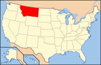
Montana's location in the U.S.Founded 1864 Seat Missoula Largest city Missoula Area
- Total
- Land
- Water
2,618 sq mi (6,781 km²)
2,598 sq mi (6,729 km²)
20 sq mi (52 km²), 0.78%Population
- (2010)
- Density
109,299
36/sq mi (14/km²)Website www.co.missoula.mt.us Missoula County is a county located in the U.S. state of Montana, with Missoula as its county seat and largest city[1]. It is the only county in the Missoula Metropolitan Area. The 2010 census put the Missoula County population at 109,299 making it the second most populous county in Montana.
Contents
Geography
According to the United States Census Bureau, Missoula County has a total area of 2,618 square miles (6,780 km2), of which, 2,598 square miles (6,730 km2) of it is land and 20 square miles (52 km2) of it (0.78%) is water. Five large valleys and two major rivers wind through this mountainous region.
Major highways
Adjacent counties
- Mineral County - west
- Sanders County - northwest
- Lake County - north
- Flathead County - northeast
- Powell County - east
- Granite County - southeast
- Ravalli County - south
- Idaho County, Idaho - southwest
- Clearwater County, Idaho - southwest

Sanders County Lake County Flathead County Mineral County 
Powell County  Missoula County, Montana

Idaho County, Idaho, and Clearwater County, Idaho Ravalli County Granite County National protected areas
- Bitterroot National Forest (part)
- Flathead National Forest (part)
- Lolo National Forest (part)
- Rattlesnake National Recreation Area
Demographics
Historical populations Census Pop. %± 1870 2,554 — 1880 2,537 −0.7% 1890 14,427 468.7% 1900 13,964 −3.2% 1910 23,596 69.0% 1920 24,041 1.9% 1930 21,782 −9.4% 1940 29,038 33.3% 1950 35,493 22.2% 1960 44,663 25.8% 1970 58,263 30.5% 1980 76,016 30.5% 1990 78,687 3.5% 2000 95,802 21.8% 2010 109,299 14.1% sources:[2][3][4] As of the 2000 census[5], there were 95,802 people, 38,439 households, and 23,140 families residing in Missoula County. The population density was 37 people per square mile (14/km²). There were 41,319 housing units at an average density of 16 per square mile (6/km²). The racial makeup of the county was:
- 94.02% White
- 0.27% Black or African American
- 2.29% Native American
- 1.02% Asian
- 0.08% Pacific Islander
- 0.45% from other races
- 1.86% from two or more races.
1.61% of the population were Hispanic or Latino of any race. 22.7% were of German, 13.0% Irish, 10.4% English, 8.5% Norwegian and 5.6% American ancestry according to Census 2000.
There were 38,439 households out of which 29.20% had children under the age of 18 living with them, 47.40% were married couples living together, 9.20% had a female householder with no husband present, and 39.80% were non-families. 28.00% of all households were made up of individuals and 7.50% had someone living alone who was 65 years of age or older. The average household size was 2.40 and the average family size was 2.96.
In the county the age distribution of the population shows 22.90% under the age of 18, 15.40% from 18 to 24, 29.20% from 25 to 44, 22.60% from 45 to 64, and 10.00% who were 65 years of age or older. The median age was 33 years. For every 100 females there were 99.90 males. For every 100 females age 18 and over, there were 98.00 males.
The median income for a household in the county was $34,454, and the median income for a family was $44,865. Males had a median income of $31,605 versus $21,720 for females. The per capita income for the county was $17,808. About 8.80% of families and 14.80% of the population were below the poverty line, including 14.60% of those under age 18 and 8.20% of those age 65 or over.
Communities
City
Census-designated places
Other community
History
Missoula County, Washington Territory was incorporated in 1860. Missoula County encompassed present-day Missoula and Deer Lodge Counties, as well as a good portion of land north and south of present-day Missoula County. Hell Gate Town, the county seat, was located at the confluence of the Clark Fork and Bitterroot Rivers.
In 1863, Missoula County reverted to the Idaho Territory when it was created in that year. Missoula County then shifted its boundaries to look more like its present-day boundaries dividing the Bitterroot Mountains from the Rocky Mountains. Missoula County became a part of Montana Territory when the territory was organized out of the existing Idaho Territory by Act of Congress and signed into law by President Abraham Lincoln on May 26, 1864. This early Missoula County was one of the eleven original counties of Montana Territory and consisted of part or all of the lands now occupied by the current Ravalli, Missoula, Granite, Mineral, Lake, Sanders, Lincoln, Flathead, and Glacier Counties.
Notable residents
- Marc Racicot, former Governor of Montana, previously served as deputy county attorney here.
- Diane Sands, member of the Montana House of Representatives
- Edgar Samuel Paxson, frontier artist of the Old West
See also
- List of cemeteries in Missoula County, Montana
- List of lakes in Missoula County, Montana
- List of mountains in Missoula County, Montana
- National Register of Historic Places listings in Missoula County, Montana
References
- ^ "Find a County". National Association of Counties. http://www.naco.org/Counties/Pages/FindACounty.aspx. Retrieved 2011-06-07.
- ^ census.gov Montana population by county, 1900-90 - accessed 2009-05-02
- ^ quickfacts.census.gov - Missoula County - accessed 2009-05-02
- ^ "Missoula County QuickFacts from the US Census Bureau". Quickfacts.census.gov. http://quickfacts.census.gov/qfd/states/30/30063.html. Retrieved 2011-11-14.
- ^ "American FactFinder". United States Census Bureau. http://factfinder.census.gov. Retrieved 2008-01-31.
External links
Municipalities and communities of Missoula County, Montana City 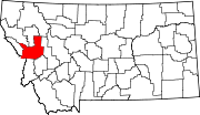
CDPs Bonner-West Riverside | Clinton | East Missoula | Evaro | Frenchtown | Lolo | Orchard Homes | Seeley Lake | Wye
Unincorporated
communitiesGhost town Hell Gate | Coloma
Indian reservation Footnotes ‡This populated place also has portions in an adjacent county or counties
 State of Montana
Topics - Index
- History
- Governors
- People
- Geography
- State Government
- Delegations
- Visitor Attractions
Society - Crime
- Demographics
- Economy
- Education
- Politics
Regions - The Flathead
- Glacier National Park
- Regional designations of Montana
- Western Montana
- Yellowstone
Largest cities Counties - Beaverhead
- Big Horn
- Blaine
- Broadwater
- Carbon
- Carter
- Cascade
- Chouteau
- Custer
- Daniels
- Dawson
- Deer Lodge
- Fallon
- Fergus
- Flathead
- Gallatin
- Garfield
- Glacier
- Golden Valley
- Granite
- Hill
- Jefferson
- Judith Basin
- Lake
- Lewis and Clark
- Liberty
- Lincoln
- Madison
- McCone
- Meagher
- Mineral
- Missoula
- Musselshell
- Park
- Petroleum
- Phillips
- Pondera
- Powder River
- Powell
- Prairie
- Ravalli
- Richland
- Roosevelt
- Rosebud
- Sanders
- Sheridan
- Silver Bow
- Stillwater
- Sweet Grass
- Teton
- Toole
- Treasure
- Valley
- Wheatland
- Wibaux
- Yellowstone
Categories:- Montana counties
- Missoula County, Montana


Wikimedia Foundation. 2010.