- Kalispell, Montana
-
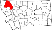
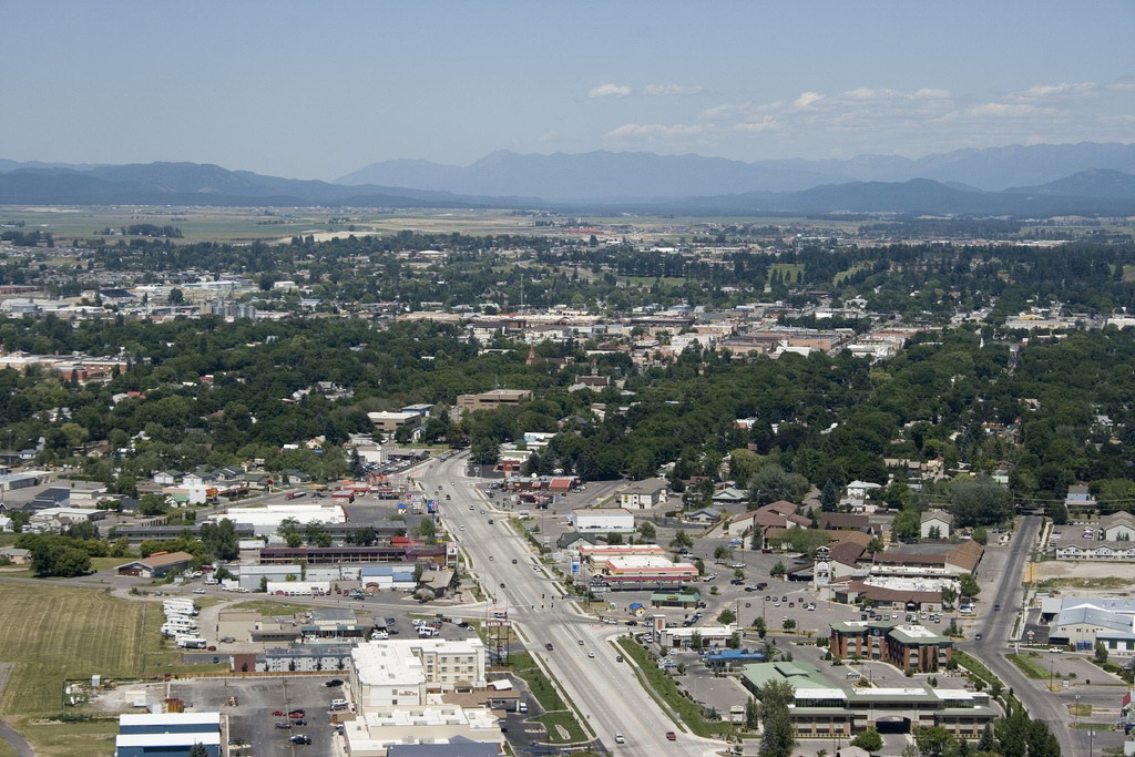
Kalispell, Montana — City — Kalispell skyline Location of Kalispell, Montana
Coordinates: 48°11′52″N 114°18′58″W / 48.19778°N 114.31611°WCoordinates: 48°11′52″N 114°18′58″W / 48.19778°N 114.31611°W Country United States State Montana County Flathead Government – Mayor Pam Kennedy Area – Total 25.5 sq mi (14.1 km2) – Land 25.5 sq mi (14.1 km2) – Water 0.0 sq mi (0.0 km2) Elevation 2,956 ft (901 m) Population (2010) – Total 19,927 – Density 2,605.7/sq mi (1,006.1/km2) Time zone Mountain (MST) (UTC-7) – Summer (DST) MDT (UTC-6) ZIP codes 59901-59904 Area code(s) 406 FIPS code 30-40075 GNIS feature ID 0785622 Website Official city website Kalispell is a city in and the county seat of Flathead County, Montana, United States.[1] The 2010 census put Kalispell's population at 19,927 up 5,704 over 2000.[2] At 40.1% this is the largest percentage of growth of any Montana city. Kalispell is the largest city and commercial center of Northwest Montana. The name Kalispell is a Salish word meaning "flat land above the lake". Kalispell is the principal city of the Kalispell Micropolitan Statistical Area the largest Micropolitan Statistical Area in Montana and the third largest of all of the Montana census statistical areas. Kalispell is also the gateway to Glacier National Park.
Contents
History
James J. Hill of the Great Northern Railroad founded Kalispell in 1891.[3] It was officially incorporated as a city the following year.[4] Since that time, the city of Kalispell has continued to grow in population reaching 19,927 in 2010. As the largest city in Northwest Montana, Kalispell serves as the county seat and commercial center of Flathead County. The city is considered a secondary trade center with a trade area of approximately 130,000. The city also is home to Kalispell Regional Medical Center, which boasts a 150-bed facility.[5]
Nestled in a valley, Kalispell is only 31 miles from Glacier National Park and 22 miles from Hungry Horse Dam. Skiers have access to Whitefish Mountain Resort and Blacktail Mountain Ski Area each only 17 miles away. Flathead Lake is only 7 miles away.[6]
Geography and climate
Kalispell is located at 48°11′52″N 114°18′58″W / 48.19778°N 114.31611°W (48.197801, −114.316068),[7] at an altitude of 2,956 feet (901 m).[8]
According to the United States Census Bureau, in 2000, the city had a total area of 25.5 square miles (66 km2), all of it land.[7] Kalispell has been expanding since at least 1990: in that year, its area was 4.4 square miles (11 km2), while by December 31, 2008, its area had increased to approximately 11.4 square miles (30 km2).[9]
Kalispell is located 7 miles (11 km) north of Flathead Lake, which is the largest natural freshwater lake in the continental United States west of the Mississippi River.
Kalispell experiences a continental climate (Köppen Dfb).
Climate data for Kalispell Month Jan Feb Mar Apr May Jun Jul Aug Sep Oct Nov Dec Year Record high °F (°C) 56
(13)64
(18)73
(23)85
(29)95
(35)96
(36)104
(40)105
(41)99
(37)86
(30)69
(21)58
(14)105
(41)Average high °F (°C) 28.9
(−1.7)35.2
(1.8)44.9
(7.2)56.0
(13.3)64.7
(18.2)71.9
(22.2)80.2
(26.8)80.5
(26.9)69.0
(20.6)55.3
(12.9)38.6
(3.7)30.1
(−1.1)54.6 Average low °F (°C) 13.8
(−10.1)18.4
(−7.6)24.8
(−4)30.8
(−0.7)37.9
(3.3)43.5
(6.4)46.7
(8.2)45.8
(7.7)37.1
(2.8)28.4
(−2)23.2
(−4.9)16.1
(−8.8)30.5
(−0.81)Record low °F (°C) −38
(−39)−36
(−38)−29
(−34)−8
(−22)17
(−8.3)26
(−3.3)30
(−1.1)8
(−13.3)7
(−14)−4
(−20)−28
(−33)−35
(−37)−38
(−39)Precipitation inches (mm) 1.47
(37.3)1.15
(29.2)1.11
(28.2)1.22
(31)2.04
(51.8)2.30
(58.4)1.41
(35.8)1.25
(31.8)1.20
(30.5).96
(24.4)1.45
(36.8)1.65
(41.9)17.21
(437.1)Snowfall inches (cm) 14.5
(36.8)9.9
(25.1)6.8
(17.3)2.3
(5.8).2
(0.5)0
(0)0
(0)0
(0)0
(0)1.4
(3.6)9.9
(25.1)16.8
(42.7)61.8
(157)Avg. precipitation days (≥ 0.01 in) 14.3 11.3 11.8 10.2 12.3 12.0 8.1 7.9 7.7 8.3 13.2 15.1 132.2 Avg. snowy days (≥ 0.1 in) 12.0 8.8 6.8 2.9 .3 0 0 0 .1 1.5 8.4 12.6 53.4 Source no. 1: NOAA (normals, 1971–2000) [10] Source no. 2: The Weather Channel (Records) [11] Demographics
Historical populations Census Pop. %± 1890 1,000 — 1900 2,526 152.6% 1910 5,549 119.7% 1920 5,147 −7.2% 1930 6,094 18.4% 1940 8,425 38.3% 1950 9,737 15.6% 1960 10,151 4.3% 1970 10,526 3.7% 1980 10,648 1.2% 1990 11,917 11.9% 2000 14,223 19.4% 2010 19,927 40.1% source:[12][13] As of the census[14] of 2000, there were 14,223 people, 6,142 households, and 3,494 families residing in the city. The population density was 2,605.7 people per square mile (1,005.8/km²). There were 6,532 housing units at an average density of 1,196.7 per square mile (461.9/km²). The racial makeup of the city was 95.84% White, 0.28% African American, 1.22% Native American, 0.56% Asian, 0.04% Pacific Islander, 0.39% from other races, and 1.66% from two or more races. Hispanic or Latino of any race were 1.55% of the population. 21.7% were of German, 12.0% Irish, 11.3% Norwegian, 10.7% English and 6.6% United States or American ancestry according to Census 2000.
There were 6,142 households out of which 28.9% had children under the age of 18 living with them, 42.0% were married couples living together, 11.2% had a female householder with no husband present, and 43.1% were non-families. 36.8% of all households were made up of individuals and 15.5% had someone living alone who was 65 years of age or older. The average household size was 2.209 and the average family size was 2.92.
In the city the age distribution of the population shows 24.0% under the age of 18, 10.0% from 18 to 24, 26.8% from 25 to 44, 20.9% from 45 to 64, and 18.3% who were 65 years of age or older. The median age was 38 years. For every 100 females there were 87.7 males. For every 100 females age 18 and over, there were 82.1 males.
The median income for a household in the city was $28,567, and the median income for a family was $36,554. Males had a median income of $29,431 versus $20,122 for females. The per capita income for the city was $16,224. About 10.1% of families and 15.9% of the population were below the poverty line, including 17.1% of those under age 18 and 13.0% of those age 65 or over.
Transportation
Kalispell is located at the intersection of U.S. Routes 2 and 93. Commercial air service is offered at Glacier Park International Airport, located approximately eight miles northeast of Kalispell off U.S. Route 2 between Kalispell and Columbia Falls.
Kalispell City Airport, located in the southern part of the city, offers general aviation service.
Amtrak's Empire Builder service between Chicago and either Seattle, Washington, or Portland, Oregon, is available in Whitefish, approximately 15 miles (24 km) north.
Eagle Transit, an agency of Flathead County, offers local transit service within and connecting Kalispell, Columbia Falls and Whitefish, as well as paratransit demand-responsive service.
Media
Kalispell is one of the largest media markets in Montana. It is the second largest over the air radio market in Montana, behind only Billings.[15]
Newspapers
- Daily Inter Lake
- Flathead Beacon
AM radio
FM radio
- KLKM 88.7 EMF Broadcasting
- KUKL-FM 90.1, University of Montana-Missoula
- KFLF 91.3, Fresh Life Radio
- KQRK 92.3, Anderson Radio Broadcasting, Inc.
- KHNK 95.9, Bee Broadcasting, Inc.
- KALS 97.1, Kalispell Christian Radio Fellowship
- KBBZ 98.5, Bee Broadcasting, Inc.
- KKMT 99.7, Anderson Radio Broadcasting, Inc.
- KIBG 100.7, Anderson Radio Broadcasting, Inc.
- KXZI-LP 101.9, Scott Johnston
- KANB-LP 102.3, Flathead Adventist Radio
- KRVO 103.1, Bee Broadcasting, Inc.
- KQJZ 103.5, Anderson Radio Broadcasting, Inc.
- KZMN 103.9, KOFI, Inc.
- KWOL-FM 105.1, Bee Broadcasting, Inc.
- KDBR 106.3, Bee Broadcasting, Inc.
Television
Notable natives and residents
- Brock Osweiler, Starting Quarterback for the Arizona State Sun Devils
- Brad Bird, Academy Award-winning director of animated films and television programs
- Robert Bray, film and television actor
- Fr. John Corapi, Catholic priest and speaker
- William Cumming, 20th century artist and founder of the Northwest School
- Rick Dennison, offensive coordinator of the Houston Texans
- John Edward Erickson, Governor of Montana
- Robin Lee Graham, circumnavigated the world at age 16
- Tanner Hall, Professional Skier, Winter X-Games gold medalist in Slope-Style, Big Air and Half-pipe
- Lex Hilliard, Miami Dolphins running back
- L. Ron Hubbard, author and founder of Scientology
- Dorothy M. Johnson, noted author of Western fiction
- Amanda Kimmel, Survivor: China, Micronesia, and Heroes vs. Villains contestant
- Sam McCullum, NFL football player
- Dylan McFarland – former Buffalo Bills offensive lineman.
- Andrew J. Moonen, former employee of Blackwater USA accused of murder in Iraq
- Mary Oppen, activist, photographer, wife of George Oppen
- Eugene H. Peterson, author of The Message, a contemporary rendition of the Bible
- Shad Petosky, cartoonist and animator
- Monsignor Alexander King Sample, Roman Catholic Bishop of Marquette, Michigan
- Robert Burns Smith, Governor of Montana
- Thatcher Szalay, former Seattle Seahawks offensive lineman
- Michelle Williams (*1980), actress
- Brad Ludden, professional kayaker
References
- ^ "Find a County". National Association of Counties. http://www.naco.org/Counties/Pages/FindACounty.aspx. Retrieved 2011-06-07.
- ^ http://bloximages.chicago2.vip.townnews.com/missoulian.com/content/tncms/assets/editorial/4/a6/ea7/4a6ea76a-4f4f-11e0-b304-001cc4c03286-revisions/4d7fe0e8755ee.pdf.pdf
- ^ "Kalispell facts". City of Kalispell. http://www.kalispell.com/facts.cfm.
- ^ "Brief History of the Flathead Valley". Flathead Convention & Visitor Bureau. http://www.fcvb.org/historyoftheflathead.php.
- ^ About Us : Kalispell Regional Medical Center : Northwest Healthcare
- ^ Kalispell Montana History
- ^ a b "US Gazetteer files: 2010, 2000, and 1990". United States Census Bureau. 2011-02-12. http://www.census.gov/geo/www/gazetteer/gazette.html. Retrieved 2011-04-23.
- ^ U.S. Geological Survey Geographic Names Information System: Kalispell, Montana
- ^ 2008 Construction, Subdivision and Annexation Report (PDF), City of Kalispell, January 2009. Accessed 2009-02-17.
- ^ "Climatography of the United States No. 20 1971–2000: KALISPELL GLACIER PK AP, MT" (PDF). National Oceanic and Atmospheric Administration. http://cdo.ncdc.noaa.gov/climatenormals/clim20/mt/244558.pdf. Retrieved 2011−01−26.
- ^ "Monthly Averages for Kalispell, MT". The Weather Channel. http://www.weather.com/outlook/travel/businesstraveler/wxclimatology/monthly/USMT0188. Retrieved January 15, 2011.
- ^ Moffatt, Riley. Population History of Western U.S. Cities & Towns, 1850–1990. Lanham: Scarecrow, 1996, 132.
- ^ "Subcounty population estimates: Montana 2000–2007" (CSV). United States Census Bureau, Population Division. March 18, 2009. http://www.census.gov/popest/cities/files/SUB-EST2007-30.csv. Retrieved May 8, 2009.
- ^ "American FactFinder". United States Census Bureau. http://factfinder.census.gov. Retrieved 2008-01-31.
- ^ Arbitron Radio Market Rankings - Fall 2011
External links
- City website
- Historic Downtown Kalispell website
- Kalispell Chamber of Commerce
- Kalispell Montana info on the All Glacier National Park site.
Municipalities and communities of Flathead County, Montana County seat: KalispellCities Columbia Falls | Kalispell | Whitefish
CDPs Bigfork | Coram | Evergreen | Hungry Horse | Lakeside | Martin City | Niarada‡ | Somers
Unincorporated
communitiesIndian reservation Footnotes ‡This populated place also has portions in an adjacent county or counties
 State of Montana
Topics - Index
- History
- Governors
- People
- Geography
- State Government
- Delegations
- Visitor Attractions
Society - Crime
- Demographics
- Economy
- Education
- Politics
Regions - The Flathead
- Glacier National Park
- Regional designations of Montana
- Western Montana
- Yellowstone
Largest cities Counties - Beaverhead
- Big Horn
- Blaine
- Broadwater
- Carbon
- Carter
- Cascade
- Chouteau
- Custer
- Daniels
- Dawson
- Deer Lodge
- Fallon
- Fergus
- Flathead
- Gallatin
- Garfield
- Glacier
- Golden Valley
- Granite
- Hill
- Jefferson
- Judith Basin
- Lake
- Lewis and Clark
- Liberty
- Lincoln
- Madison
- McCone
- Meagher
- Mineral
- Missoula
- Musselshell
- Park
- Petroleum
- Phillips
- Pondera
- Powder River
- Powell
- Prairie
- Ravalli
- Richland
- Roosevelt
- Rosebud
- Sanders
- Sheridan
- Silver Bow
- Stillwater
- Sweet Grass
- Teton
- Toole
- Treasure
- Valley
- Wheatland
- Wibaux
- Yellowstone
Categories:- Cities in Montana
- Populated places in Flathead County, Montana
- County seats in Montana


Wikimedia Foundation. 2010.