- Liberty County, Montana
-
Liberty County, Montana 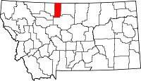
Location in the state of Montana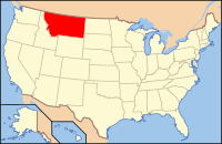
Montana's location in the U.S.Founded 1919 Seat Chester Largest city Chester Area
- Total
- Land
- Water
1,447 sq mi (3,748 km²)
1,430 sq mi (3,704 km²)
17 sq mi (44 km²), 1.21%Population
- (2010)
- Density
2,339
2/sq mi (0.6/km²)Website www.co.liberty.mt.us Liberty County is a county located in the U.S. state of Montana. As of 2010, the population was 2,339. Its county seat is Chester.[1] It was established in 1920.
Contents
Geography
According to the U.S. Census Bureau, the county has a total area of 1,447 square miles (3,747.7 km2), of which 1,430 square miles (3,703.7 km2) is land and 17 square miles (44.0 km2) (1.21%) is water.
Adjacent Counties
- Toole County, Montana - west
- Pondera County, Montana - southwest
- Chouteau County, Montana - south
- Hill County, Montana - east
- Forty Mile County No. 8, Alberta - north

Forty Mile County No. 8, Alberta, Canada Toole County 
Hill County  Liberty County, Montana

Pondera County Chouteau County Demographics
Historical populations Census Pop. %± 1920 2,416 — 1930 2,198 −9.0% 1940 2,209 0.5% 1950 2,180 −1.3% 1960 2,624 20.4% 1970 2,359 −10.1% 1980 2,329 −1.3% 1990 2,295 −1.5% 2000 2,158 −6.0% 2010 2,339 8.4% As of the census[2] of 2000, there were 2,158 people, 833 households, and 583 families residing in the county. The population density was 2 people per square mile (1/km²). There were 1,070 housing units at an average density of 1 per square mile (0/km²). The racial makeup of the county was 99.21% White, 0.09% Native American, 0.32% Asian, 0.09% from other races, and 0.28% from two or more races. 0.19% of the population were Hispanic or Latino of any race. 39.0% were of German, 20.0% Norwegian, 7.2% English, 5.8% American and 5.0% Irish ancestry according to Census 2000. 84.5% spoke English and 15.5% German as their first language.
There were 833 households out of which 30.40% had children under the age of 18 living with them, 62.70% were married couples living together, 5.60% had a female householder with no husband present, and 29.90% were non-families. 27.90% of all households were made up of individuals and 14.00% had someone living alone who was 65 years of age or older. The average household size was 2.51 and the average family size was 3.11.
In the county the population was spread out with 25.80% under the age of 18, 5.80% from 18 to 24, 24.70% from 25 to 44, 24.10% from 45 to 64, and 19.70% who were 65 years of age or older. The median age was 42 years. For every 100 females there were 97.10 males. For every 100 females age 18 and over, there were 93.60 males.
The median income for a household in the county was $30,284, and the median income for a family was $37,361. Males had a median income of $23,158 versus $16,579 for females. The per capita income for the county was $14,882. About 19.00% of families and 20.30% of the population were below the poverty line, including 28.90% of those under age 18 and 15.50% of those age 65 or over.
Researchers William P. O'Hare and Kenneth M. Johnson described the county as typical of the northern Great Plains in being very thinly settled, almost fully dependent on agriculture, and lacking in urban areas. They noted that income can fluctuate substantially from year to year, depending on rainfall (which affects harvest yields) as well as grain and cattle prices, and that the 2000 Census recorded low incomes in 1999 after several years of drought. Also, the presence of Hutterite colonies in the county depresses per capita incomes because Hutterite families have significantly more children than the general population.[3]
Communities
Town
Census-designated place
Other communities
- Lothair
- Whitlash
See also
- List of cemeteries in Liberty County, Montana
- List of lakes in Liberty County, Montana
- List of mountains in Liberty County, Montana
- National Register of Historic Places listings in Liberty County, Montana
References
- ^ "Find a County". National Association of Counties. http://www.naco.org/Counties/Pages/FindACounty.aspx. Retrieved 2011-06-07.
- ^ "American FactFinder". United States Census Bureau. http://factfinder.census.gov. Retrieved 2008-01-31.
- ^ Facing Child Poverty in Rural America by William P. O'Hare and Kenneth M. Johnson, Population Reference Bureau, January 2004
Municipalities and communities of Liberty County, Montana Town 
CDP Unincorporated
community State of Montana
Topics - Index
- History
- Governors
- People
- Geography
- State Government
- Delegations
- Visitor Attractions
Society - Crime
- Demographics
- Economy
- Education
- Politics
Regions - The Flathead
- Glacier National Park
- Regional designations of Montana
- Western Montana
- Yellowstone
Largest cities Counties - Beaverhead
- Big Horn
- Blaine
- Broadwater
- Carbon
- Carter
- Cascade
- Chouteau
- Custer
- Daniels
- Dawson
- Deer Lodge
- Fallon
- Fergus
- Flathead
- Gallatin
- Garfield
- Glacier
- Golden Valley
- Granite
- Hill
- Jefferson
- Judith Basin
- Lake
- Lewis and Clark
- Liberty
- Lincoln
- Madison
- McCone
- Meagher
- Mineral
- Missoula
- Musselshell
- Park
- Petroleum
- Phillips
- Pondera
- Powder River
- Powell
- Prairie
- Ravalli
- Richland
- Roosevelt
- Rosebud
- Sanders
- Sheridan
- Silver Bow
- Stillwater
- Sweet Grass
- Teton
- Toole
- Treasure
- Valley
- Wheatland
- Wibaux
- Yellowstone
Categories:- Montana counties
- Liberty County, Montana


Wikimedia Foundation. 2010.