- Joplin, Montana
Infobox Settlement
official_name = Joplin, Montana
settlement_type = CDP
nickname =
motto =
imagesize =
image_caption =
image_
imagesize =
image_caption =
image_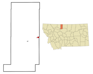
mapsize = 250px
map_caption = Location of Joplin, Montana
mapsize1 =
map_caption1 =subdivision_type = Country
subdivision_name =United States
subdivision_type1 = State
subdivision_name1 =Montana
subdivision_type2 = County
subdivision_name2 = Liberty
government_footnotes =
government_type =
leader_title =
leader_name =
leader_title1 =
leader_name1 =
established_title =
established_date =unit_pref = Imperial
area_footnotes =area_magnitude =
area_total_km2 = 3.3
area_land_km2 = 3.3
area_water_km2 = 0.1
area_total_sq_mi = 1.3
area_land_sq_mi = 1.3
area_water_sq_mi = 0.0population_as_of = 2000
population_footnotes =
population_total = 210
population_density_km2 = 64.3
population_density_sq_mi = 166.6timezone = Mountain (MST)
utc_offset = -7
timezone_DST = MDT
utc_offset_DST = -6
elevation_footnotes =
elevation_m = 1013
elevation_ft = 3323
latd = 48 |latm = 33 |lats = 37 |latNS = N
longd = 110 |longm = 46 |longs = 13 |longEW = Wpostal_code_type =
ZIP code
postal_code = 59531
area_code = 406
blank_name = FIPS code
blank_info = 30-39775
blank1_name = GNIS feature ID
blank1_info = 0772901
website =
footnotes =Joplin is a
census-designated place (CDP) in Liberty County,Montana ,United States . The population was 210 at the 2000 census.Geography
Joplin is located at coor dms|48|33|37|N|110|46|13|W|city (48.560363, -110.770255)GR|1.
According to the
United States Census Bureau , the CDP has a total area of 1.3square mile s (3.3km² ), of which, 1.3 square miles (3.3 km²) of it is land and 0.04 square miles (0.1 km²) of it (2.33%) is water.Demographics
As of the
census GR|2 of 2000, there were 210 people, 91 households, and 66 families residing in the CDP. Thepopulation density was 166.6 people per square mile (64.4/km²). There were 105 housing units at an average density of 83.3/sq mi (32.2/km²). The racial makeup of the CDP was 99.52% White, 0.48% from other races. Hispanic or Latino of any race were 1.90% of the population.There were 91 households out of which 22.0% had children under the age of 18 living with them, 64.8% were married couples living together, 7.7% had a female householder with no husband present, and 26.4% were non-families. 24.2% of all households were made up of individuals and 13.2% had someone living alone who was 65 years of age or older. The average household size was 2.31 and the average family size was 2.70.
In the CDP the population was spread out with 22.4% under the age of 18, 5.7% from 18 to 24, 23.8% from 25 to 44, 25.2% from 45 to 64, and 22.9% who were 65 years of age or older. The median age was 43 years. For every 100 females there were 110.0 males. For every 100 females age 18 and over, there were 96.4 males.
The median income for a household in the CDP was $38,281, and the median income for a family was $40,625. Males had a median income of $28,750 versus $17,500 for females. The
per capita income for the CDP was $24,014. About 4.6% of families and 4.4% of the population were below thepoverty line , including none of those under the age of eighteen and 5.6% of those sixty five or over.Education
The former Joplin School was closed in 2005 when the consolidated Chester-Joplin-Inverness public school district was formed.
References
External links
Wikimedia Foundation. 2010.