- Dawson County, Montana
-
Dawson County, Montana 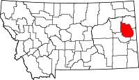
Location in the state of Montana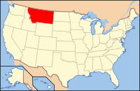
Montana's location in the U.S.Founded 1870 Seat Glendive Largest city Glendive Area
- Total
- Land
- Water
2,383 sq mi (6,172 km²)
2,373 sq mi (6,146 km²)
10 sq mi (26 km²), 0.42%Population
- (2010)
- Density
8,966
3/sq mi (1/km²)Website www.dawsoncountymontana.org Dawson County is a county located in the U.S. state of Montana. As of 2010, the population was 8,966.[1] Its county seat is Glendive.[2]
Contents
History
Dawson County was created in 1869 from the northern half of the original Big Horn County. The name comes from Major Andrew Dawson, manager of the Fort Benton Trading Post for the American Fur Company from 1856 to 1864.[3]
Geography
According to the U.S. Census Bureau, the county has a total area of 2,383 square miles (6,171.9 km2), of which 2,373 square miles (6,146.0 km2) is land and 10 square miles (25.9 km2) (0.42%) is water.
Dawson County contains part of Montana's badlands. Makoshika State Park is a great example of the unusual rock formations. Yellowstone River runs through the county.
Major highways
 Interstate 94
 U.S. Highway 10 (Former)
 Montana Highway 16
 Montana Highway 200
- Montana Highway 200 (Alternate)
- 20px Montana Highway 254
Adjacent counties
- Richland County, Montana - north
- Wibaux County, Montana - east
- Prairie County, Montana - south
- McCone County, Montana - west

Richland County McCone County 
Wibaux County  Dawson County, Montana

Prairie County Economy
Dawson County is known for its dryland grain, coal mines and gas and oil wells.[4] There are 522 current farms and ranches, and 296 commercial businesses.[5]
Demographics
Historical populations Census Pop. %± 1900 2,443 — 1910 12,725 420.9% 1920 9,239 −27.4% 1930 9,881 6.9% 1940 8,618 −12.8% 1950 9,092 5.5% 1960 12,314 35.4% 1970 11,269 −8.5% 1980 11,805 4.8% 1990 9,505 −19.5% 2000 9,059 −4.7% 2010 8,966 −1.0% U.S. Decennial Census As of the census[6] of 2000, there were 9,059 people, 3,625 households, and 2,475 families residing in the county. The population density was 4 people per square mile (1/km²). There were 4,168 housing units at an average density of 2 per square mile (1/km²). The racial makeup of the county was 97.43% White, 0.25% Black or African American, 1.23% Native American, 0.13% Asian, 0.01% Pacific Islander, 0.31% from other races, and 0.64% from two or more races. 0.89% of the population were Hispanic or Latino of any race. 39.7% were of German, 17.0% Norwegian, 7.3% Irish and 6.5% English ancestry according to Census 2000. 97.0% spoke English, 1.4% German and 1.0% Spanish as their first language.
There were 3,625 households out of which 29.70% had children under the age of 18 living with them, 58.50% were married couples living together, 6.80% had a female householder with no husband present, and 31.70% were non-families. 28.40% of all households were made up of individuals and 12.20% had someone living alone who was 65 years of age or older. The average household size was 2.37 and the average family size was 2.90.
In the county the population was spread out with 23.10% under the age of 18, 8.80% from 18 to 24, 24.90% from 25 to 44, 25.40% from 45 to 64, and 17.70% who were 65 years of age or older. The median age was 41 years. For every 100 females there were 98.30 males. For every 100 females age 18 and over, there were 99.90 males.
The median income for a household in the county was $31,393, and the median income for a family was $38,455. Males had a median income of $29,487 versus $18,929 for females. The per capita income for the county was $15,368. About 11.70% of families and 14.90% of the population were below the poverty line, including 18.70% of those under age 18 and 11.20% of those age 65 or over.
Communities
City
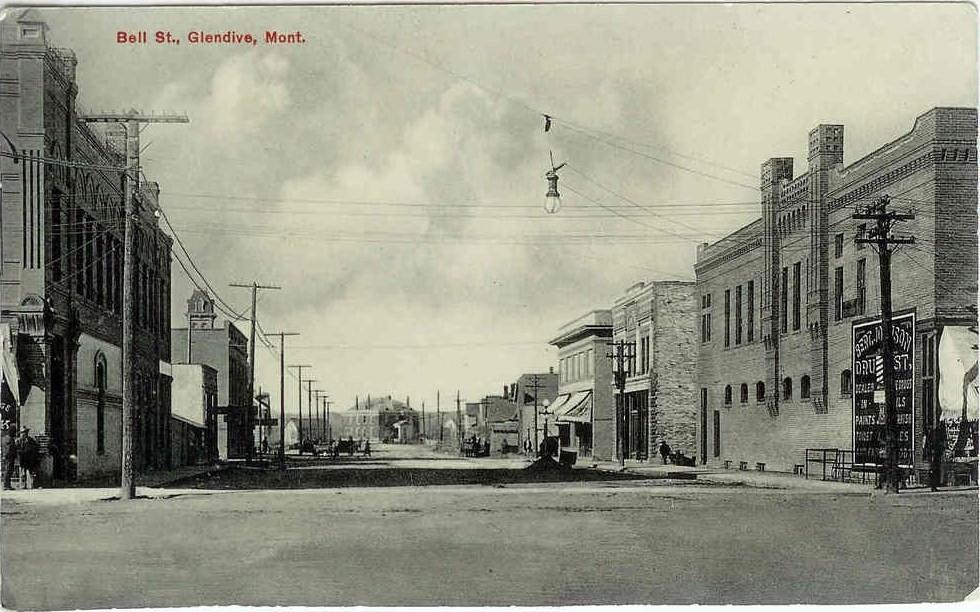
 1913 postcard of Glendive
Town
Census-designated place
Education
Dawson Community College is located in Glendive.
See also
- List of cemeteries in Dawson County, Montana
- List of lakes in Dawson County, Montana
- List of mountains in Dawson County, Montana
- National Register of Historic Places listings in Dawson County, Montana
References
- ^ "2010 Census Redistricting Data (Public Law 94-171) Summary File". American FactFinder. United States Census Bureau. http://factfinder2.census.gov/faces/tableservices/jsf/pages/productview.xhtml?pid=DEC_10_PL_GCTPL2.ST05&prodType=table. Retrieved 3 May 2011.
- ^ "Find a County". National Association of Counties. http://www.naco.org/Counties/Pages/FindACounty.aspx. Retrieved 2011-06-07.
- ^ "Montana Place Names Companion". Montana Place Names From Alzada to Zortman. Montana Historical Society Research Center. http://mtplacenames.org/. Retrieved 9 May 2011.
- ^ Merrill, Andrea; Judy Jacobson (1997). Montana almanac. Helena, Montana: Falcon Publishing. ISBN 1-56044-493-2.
- ^ Dawson County EDC. "Welcome". http://dawsonedc.com/. Retrieved 24 July 2011.
- ^ "American FactFinder". United States Census Bureau. http://factfinder.census.gov. Retrieved 2008-01-31.
Municipalities and communities of Dawson County, Montana City 
Town CDP  State of Montana
Topics - Index
- History
- Governors
- People
- Geography
- State Government
- Delegations
- Visitor Attractions
Society - Crime
- Demographics
- Economy
- Education
- Politics
Regions - The Flathead
- Glacier National Park
- Regional designations of Montana
- Western Montana
- Yellowstone
Largest cities Counties - Beaverhead
- Big Horn
- Blaine
- Broadwater
- Carbon
- Carter
- Cascade
- Chouteau
- Custer
- Daniels
- Dawson
- Deer Lodge
- Fallon
- Fergus
- Flathead
- Gallatin
- Garfield
- Glacier
- Golden Valley
- Granite
- Hill
- Jefferson
- Judith Basin
- Lake
- Lewis and Clark
- Liberty
- Lincoln
- Madison
- McCone
- Meagher
- Mineral
- Missoula
- Musselshell
- Park
- Petroleum
- Phillips
- Pondera
- Powder River
- Powell
- Prairie
- Ravalli
- Richland
- Roosevelt
- Rosebud
- Sanders
- Sheridan
- Silver Bow
- Stillwater
- Sweet Grass
- Teton
- Toole
- Treasure
- Valley
- Wheatland
- Wibaux
- Yellowstone
Categories:- Montana counties
- Dawson County, Montana


Wikimedia Foundation. 2010.