- Seeley Lake, Montana
Infobox Settlement
official_name = Seeley Lake, Montana
settlement_type = CDP
nickname =
motto =
imagesize =
image_caption =
image_
imagesize =
image_caption =
image_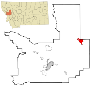
mapsize = 250px
map_caption = Location of Seeley Lake, Montana
mapsize1 =
map_caption1 =subdivision_type = Country
subdivision_name =United States
subdivision_type1 = State
subdivision_name1 =Montana
subdivision_type2 = County
subdivision_name2 = Missoula
government_footnotes =
government_type =
leader_title =
leader_name =
leader_title1 =
leader_name1 =
established_title =
established_date =unit_pref = Imperial
area_footnotes =area_magnitude =
area_total_km2 = 28.6
area_land_km2 = 28.2
area_water_km2 = 0.4
area_total_sq_mi = 11.0
area_land_sq_mi = 10.9
area_water_sq_mi = 0.1population_as_of = 2000
population_footnotes =
population_total = 1436
population_density_km2 = 50.9
population_density_sq_mi = 131.9timezone = Mountain (MST)
utc_offset = -7
timezone_DST = MDT
utc_offset_DST = -6
elevation_footnotes =
elevation_m = 1225
elevation_ft = 4019
latd = 47 |latm = 10 |lats = 1 |latNS = N
longd = 113 |longm = 28 |longs = 1 |longEW = Wpostal_code_type =
ZIP code
postal_code = 59868
area_code = 406
blank_name = FIPS code
blank_info = 30-67150
blank1_name = GNIS feature ID
blank1_info = 0799011
website =
footnotes =Seeley Lake is a
census-designated place (CDP) in Missoula County,Montana ,United States . It is part of the 'Missoula, Montana Metropolitan Statistical Area '. The population was 1,436 at the 2000 census.Geography
Seeley Lake is located at coor dms|47|10|1|N|113|28|1|W|city (47.166892, -113.466817)GR|1.
According to the
United States Census Bureau , the CDP has a total area of 11.0square mile s (28.6km² ), of which, 10.9 square miles (28.2 km²) of it is land and 0.2 square miles (0.4 km²) of it (1.36%) is water.Demographics
As of the
census GR|2 of 2000, there were 1,436 people, 589 households, and 411 families residing in the CDP. Thepopulation density was 131.9 people per square mile (50.9/km²). There were 938 housing units at an average density of 86.2/sq mi (33.3/km²). The racial makeup of the CDP was 96.94% White, 0.07% African American, 1.46% Native American, 0.21% Asian, 0.49% from other races, and 0.84% from two or more races. Hispanic or Latino of any race were 1.46% of the population.There were 589 households out of which 29.2% had children under the age of 18 living with them, 59.4% were married couples living together, 5.1% had a female householder with no husband present, and 30.1% were non-families. 24.3% of all households were made up of individuals and 6.3% had someone living alone who was 65 years of age or older. The average household size was 2.44 and the average family size was 2.89.
In the CDP the population was spread out with 25.3% under the age of 18, 5.2% from 18 to 24, 28.3% from 25 to 44, 29.5% from 45 to 64, and 11.8% who were 65 years of age or older. The median age was 41 years. For every 100 females there were 113.4 males. For every 100 females age 18 and over, there were 112.1 males.
The median income for a household in the CDP was $35,101, and the median income for a family was $38,188. Males had a median income of $30,000 versus $18,269 for females. The
per capita income for the CDP was $18,825. About 7.0% of families and 10.6% of the population were below thepoverty line , including 14.4% of those under age 18 and 4.8% of those age 65 or over.References
External links
* [http://www.seeleylakechamber.com/ Seeley Lake Chamber of Commerce]
Wikimedia Foundation. 2010.