- Coloma, Montana
-
Coloma — Ghost town — Location of Coloma in Montana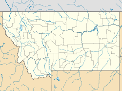
 Coloma
Coordinates: 46°50′35″N 113°22′50″W / 46.84306°N 113.38056°WCoordinates: 46°50′35″N 113°22′50″W / 46.84306°N 113.38056°W[1] Country United States State Montana County Missoula Established 1893 Abandoned 1930s Elevation 5,928 ft (1,807 m) Coloma is a ghost town located in the area of the Garnet Range in Missoula County, Montana. Not much is known about the settlement, which appears to have been founded in 1893. Records of the period indicate high gold mining activity from 1896 onwards, with an estimated $200,000 to $250,000 in gold being extracted. 1916 saw additional activity when a mill was built on the site and additional surveys on the ore veins were conducted, apparently without success.[2] Additional prospecting activity occurred between 1932 and 1950.[3]
As of 2009, the site was under archeological study by Dr. Kelly Dixon and a group of graduate students from the University of Montana.[3][4]
Notes
- ^ "Coloma". Geographic Names Information System, U.S. Geological Survey. http://geonames.usgs.gov/pls/gnispublic/f?p=gnispq:3:::NO::P3_FID:770040.
- ^ "Coloma - Mystery Camp of Garnet Range". http://visitmt.com/categories/moreinfo.asp?IDRRecordID=6725&SiteID=1. Retrieved 2009-02-12.
- ^ a b McClanahan, M.S.. "Coloma - Montana Ghost Town". http://www.ghosttowns.com/states/mt/coloma.html. Retrieved 2009-02-12.
- ^ "Coloma Flyer" (PDF). http://www.anthro.umt.edu/field/Coloma.pdf. Retrieved 2009-02-12.[dead link]
See also
Municipalities and communities of Missoula County, Montana County seat: Missoula City 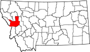
CDPs Bonner-West Riverside | Clinton | East Missoula | Evaro | Frenchtown | Lolo | Orchard Homes | Seeley Lake | Wye
Unincorporated
communitiesGhost town Hell Gate | Coloma
Indian reservation Footnotes ‡This populated place also has portions in an adjacent county or counties
Categories:- Ghost towns in Montana
- Geography of Missoula County, Montana
- Montana geography stubs


Wikimedia Foundation. 2010.