- Lolo, Montana
Infobox Settlement
official_name = Lolo, Montana
settlement_type = CDP
nickname =
motto =
imagesize =
image_caption =
image_
imagesize =
image_caption =
image_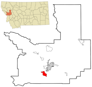
mapsize = 250px
map_caption = Location of Lolo, Montana
mapsize1 =
map_caption1 =subdivision_type = Country
subdivision_name =United States
subdivision_type1 = State
subdivision_name1 =Montana
subdivision_type2 = County
subdivision_name2 = Missoula
government_footnotes =
government_type =
leader_title =
leader_name =
leader_title1 =
leader_name1 =
established_title =
established_date =unit_pref = Imperial
area_footnotes =area_magnitude =
area_total_km2 = 25.2
area_land_km2 = 24.6
area_water_km2 = 0.5
area_total_sq_mi = 9.7
area_land_sq_mi = 9.5
area_water_sq_mi = 0.2population_as_of = 2000
population_footnotes =
population_total = 3388
population_density_km2 = 137.5
population_density_sq_mi = 356.2timezone = Mountain (MST)
utc_offset = -7
timezone_DST = MDT
utc_offset_DST = -6
elevation_footnotes =
elevation_m = 975
elevation_ft = 3199
latd = 46 |latm = 45 |lats = 55 |latNS = N
longd = 114 |longm = 5 |longs = 9 |longEW = Wpostal_code_type =
ZIP code
postal_code = 59847
area_code = 406
blank_name = FIPS code
blank_info = 30-44650
blank1_name = GNIS feature ID
blank1_info = 0786464
website =
footnotes =Lolo is a
census-designated place (CDP) in Missoula County,Montana ,United States . It is part of the 'Missoula, Montana Metropolitan Statistical Area '. The population was 3,388 at the 2000 census.Geography
Lolo is located at coor dms|46|45|55|N|114|5|9|W|city (46.765210, -114.085892)GR|1.
According to the
United States Census Bureau , the CDP has a total area of 9.7square mile s (25.2km² ), of which, 9.5 square miles (24.6 km²) of it is land and 0.2 square miles (0.5 km²) of it (2.16%) is water.Demographics
As of the
census GR|2 of 2000, there were 3,388 people, 1,218 households, and 936 families residing in the CDP. Thepopulation density was 356.2 people per square mile (137.6/km²). There were 1,263 housing units at an average density of 132.8/sq mi (51.3/km²). The racial makeup of the CDP was 96.69% White, 0.24% African American, 0.89% Native American, 0.24% Asian, 0.21% from other races, and 1.74% from two or more races. Hispanic or Latino of any race were 1.03% of the population.There were 1,218 households out of which 44.0% had children under the age of 18 living with them, 61.6% were married couples living together, 10.3% had a female householder with no husband present, and 23.1% were non-families. 17.3% of all households were made up of individuals and 4.5% had someone living alone who was 65 years of age or older. The average household size was 2.78 and the average family size was 3.15.
In the CDP the population was spread out with 31.3% under the age of 18, 8.2% from 18 to 24, 32.9% from 25 to 44, 20.8% from 45 to 64, and 6.8% who were 65 years of age or older. The median age was 32 years. For every 100 females there were 100.2 males. For every 100 females age 18 and over, there were 96.5 males.
The median income for a household in the CDP was $43,846, and the median income for a family was $46,629. Males had a median income of $30,392 versus $22,188 for females. The
per capita income for the CDP was $18,369. About 2.5% of families and 4.7% of the population were below thepoverty line , including 5.8% of those under age 18 and 4.2% of those age 65 or over.Notable residents
*
James Lee Burke , bestselling mystery writer, maintains a home here.
*Richard Manning , award winning environmentalist author and journalist, resides here.References
External links
* [http://www.lolodays.org Lolo Days]
Wikimedia Foundation. 2010.