- Clearwater County, Idaho
-
Clearwater County, Idaho 
Seal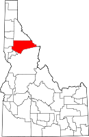
Location in the state of Idaho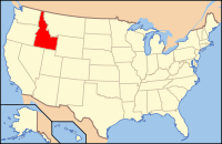
Idaho's location in the U.S.Founded February 27, 1911 Named for Clearwater River Seat Orofino Largest city Orofino Area
- Total
- Land
- Water
2,488.10 sq mi (6,444 km²)
2,461.40 sq mi (6,375 km²)
26.70 sq mi (69 km²), 1.07%Population
- (2000)
- Density
8,930
3.6/sq mi (1.5/km²)Time zone Pacific: UTC-8/-7 Website www.clearwatercounty.org Clearwater County is a county located in the U.S. state of Idaho. Established in 1911, the county was named after the Clearwater River. As of the 2000 Census the county had a population of 8,930 (2005 estimate: 8,373).[1] The county seat is Orofino.[2]
The county is home to North Fork of the Clearwater River, and a small portion of the South Fork and the main Clearwater. The Clearwater River and Lolo Pass, in the southeast corner of the county, were made famous by the exploration of Lewis and Clark in the early 19th century. Following an arduous trek through the Bitterroot Mountains, suffering through a mid-September snowstorm and near starvation, the Corps of Discovery expedition camped with the Nez Perce tribe on the Weippe Prairie outside of present-day Weippe in 1805. With the assistance of the Nez Perce, the expedition recuperated and constructed burned-out canoes at Canoe Camp in October 1805 and then paddled down the Clearwater, Snake, and Columbia rivers, meeting the Pacific Ocean a month later at present-day Astoria, Oregon.
Elias D. Pierce and Wilbur F. Bassett made the first discovery of gold in Idaho, on Orofino Creek (Canal Gulch) in 1860, 1 mile (2 km) north of present-day Pierce. Also in the county are the Dworshak Reservoir, Dworshak State Park, Dworshak National Fish Hatchery, and the Dworshak Dam, third highest dam in the U.S. The modest Bald Mountain ski area is located between Orofino and Pierce.
Contents
Geography
According to the 2000 census, the county has a total area of 2,488.10 square miles (6,444.1 km2), of which 2,461.40 square miles (6,375.0 km2) (or 98.93%) is land and 26.70 square miles (69.2 km2) (or 1.07%) is water.[3] It is part of the Palouse, a wide and rolling prairie-like region of the middle Columbia basin.
Adjacent counties
- Shoshone County, Idaho - (north)
- Latah County, Idaho - (west 1)
- Nez Perce County, Idaho - (west 2)
- Lewis County, Idaho - (southwest)
- Idaho County, Idaho - (south)
- Missoula County, Montana - (east)
- Mineral County, Montana - (east)
Cities and towns
National protected areas
- Caribou-Targhee National Forest (part)
- Nez Perce National Historical Park (part)
- St. Joe National Forest (part)
Ski area
- Bald Mountain Ski Area
Highways
Government and infrastructure
The Idaho Department of Correction operates the Idaho Correctional Institution-Orofino in Orofino.[4][5]
Demographics
Historical populations Census Pop. %± 1920 4,993 — 1930 6,599 32.2% 1940 8,243 24.9% 1950 8,217 −0.3% 1960 8,548 4.0% 1970 10,871 27.2% 1980 10,390 −4.4% 1990 8,505 −18.1% 2000 8,930 5.0% Est. 2008 8,176 −8.4% sources:[6][7] As of the census[8] of 2000, there were 8,930 people, 3,456 households, and 2,481 families residing in the county. The population density was 3.6 people per square mile (1.5/km²). There were 4,144 housing units at an average density of 2 per square mile (1/km²). The racial makeup of the county was 94.82% White, 0.15% Black or African American, 2.03% Native American, 0.37% Asian, 0.06% Pacific Islander, 0.63% from other races, and 1.96% from two or more races. 1.85% of the population were Hispanic or Latino of any race. 24.0% were of German, 14.0% English, 11.7% Irish and 10.5% American ancestry according to Census 2000.
There were 3,456 households out of which 28.90% had children under the age of 18 living with them, 60.50% were married couples living together, 6.90% had a female householder with no husband present, and 28.20% were non-families. 24.00% of all households were made up of individuals and 10.00% had someone living alone who was 65 years of age or older. The average household size was 2.41 and the average family size was 2.84.
In the county the population was spread out with 23.00% under the age of 18, 5.90% from 18 to 24, 26.30% from 25 to 44, 29.20% from 45 to 64, and 15.60% who were 65 years of age or older. The median age was 42 years. For every 100 females there were 113.40 males. For every 100 females age 18 and over, there were 115.90 males.
The median income for a household in the county was $32,071, and the median income for a family was $37,259. Males had a median income of $31,426 versus $21,694 for females. The per capita income for the county was $15,463. About 9.70% of families and 13.50% of the population were below the poverty line, including 18.90% of those under age 18 and 8.20% of those age 65 or over.
See also
References
- ^ United States Census Bureau - State and County Quick Facts - Clearwater County, Idaho. Retrieved on 13 April 2007.
- ^ "Find a County". National Association of Counties. http://www.naco.org/Counties/Pages/FindACounty.aspx. Retrieved 2011-06-07.
- ^ "Census 2000 U.S. Gazetteer Files: Counties". United States Census. http://www.census.gov/tiger/tms/gazetteer/county2k.txt. Retrieved 2011-02-13.
- ^ "Locations." Idaho Department of Correction. Retrieved on June 4, 2011. "Idaho Correctional Institution-Orofino (ICIO) 381 West Hospital Drive Orofino ID 83544 "
- ^ "Orofino city, Idaho." U.S. Census Bureau. Retrieved on June 4, 2011.
- ^ quickfact.ensus.gov - Clearwater County, Idaho
- ^ census.gov Idaho population by county, 1900-90 - accessed 2010-02-13
- ^ "American FactFinder". United States Census Bureau. http://factfinder.census.gov. Retrieved 2008-01-31.
External links
- Clearwater County - official site
- Clearwater Museum - official site
- Idaho History.net - Pierce
- Idaho Mining.org - history

Shoshone County Latah County and Nez Perce County 
Missoula County, Montana and Mineral County, Montana  Clearwater County, Idaho

Lewis County Idaho County Municipalities and communities of Clearwater County, Idaho Cities 
Unincorporated
communitiesAhsahka | Cavendish | Greer | Headquarters
 State of Idaho
Topics - Index
- Geography
- Government
- Delegations
- Governors
- History
- Symbols
- Images
- People
- Visitor Attractions
Society Regions Larger
citiesSmaller
citiesCounties - Ada
- Adams
- Bannock
- Bear Lake
- Benewah
- Bingham
- Blaine
- Boise
- Bonner
- Bonneville
- Boundary
- Butte
- Camas
- Canyon
- Caribou
- Cassia
- Clark
- Clearwater
- Custer
- Elmore
- Franklin
- Fremont
- Gem
- Gooding
- Idaho
- Jefferson
- Jerome
- Kootenai
- Latah
- Lemhi
- Lewis
- Lincoln
- Madison
- Minidoka
- Nez Perce
- Oneida
- Owyhee
- Payette
- Power
- Shoshone
- Teton
- Twin Falls
- Valley
- Washington
Categories:- Idaho counties
- Clearwater County, Idaho
- 1911 establishments in the United States
- Populated places established in 1911


Wikimedia Foundation. 2010.