- Oneida County, Idaho
-
Oneida County, Idaho 
Seal
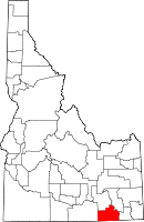
Location in the state of Idaho
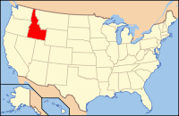
Idaho's location in the U.S.Founded January 22, 1864 Named for Oneida Lake, New York; the area from which most of the early settlers had emigrated. Seat Malad City Largest city Malad City Area
- Total
- Land
- Water
1,201.61 sq mi (3,112 km²)
1,200.33 sq mi (3,109 km²)
1.28 sq mi (3 km²), 0.11%Population
- (2000)
- Density
4,125
3.4/sq mi (1.3/km²)Time zone Mountain: UTC-7/-6 Website www.co.oneida.id.us Oneida County is a county located in the U.S. state of Idaho. As of the 2000 Census the county had a population of 4,125 (2008 estimate: 4,130).[1] The county seat and largest city is Malad City.[2] The Oneida County Courthouse is listed on the National Register of Historic Places.
Most of the county's population lives in Malad City and the surrounding Malad Valley. The county is named for Oneida Lake, New York, the area from which most of the early settlers had emigrated.[3]
Oneida County was organized on January 22, 1864, as part of Idaho Territory. The original county seat was at Soda Springs in present-day Caribou County. The county seat was moved to Malad City in 1866 because of its population growth and location on the freight road and stagecoach line between Corinne, Utah, and the mines in Butte, Montana.
Contents
Geography
According to the 2000 census, the county has a total area of 1,201.61 square miles (3,112.2 km2), of which 1,200.33 square miles (3,108.8 km2) (or 99.89%) is land and 1.28 square miles (3.3 km2) (or 0.11%) is water.[4]
Elkhorn Peak is the county's highest point, at 9,095 feet (2772 m) above sea level. Alternating valleys and ridges of mountains or hills typify the topography, with grassland and sagebrush covering most areas. The Curlew National Grassland lies within the county.
Adjacent counties
- Power County - north
- Bannock County - northeast
- Franklin County - east
- Cache County, Utah - southeast
- Box Elder County, Utah - south
- Cassia County - west
National protected areas
- Caribou National Forest (part)
- Curlew National Grassland (part)
- Sawtooth National Forest (part)
Highways
 - Interstate 15
 - Interstate 84
 - SH-36
 - SH-38
Demographics
Historical populations Census Pop. %± 1900 8,933 — 1910 15,170 69.8% 1920 6,723 −55.7% 1930 5,870 −12.7% 1940 5,417 −7.7% 1950 4,387 −19.0% 1960 3,603 −17.9% 1970 2,864 −20.5% 1980 3,258 13.8% 1990 3,492 7.2% 2000 4,125 18.1% Est. 2008 4,125 0% sources:[1] [5] As of the census[6] of 2000, there were 4,125 people, 1,430 households, and 1,092 families residing in the county. The population density was 3 people per square mile (1/km²). There were 1,755 housing units at an average density of 2 per square mile (1/km²). The racial makeup of the county was 97.50% White, 0.12% Black or African American, 0.32% Native American, 0.15% Asian, 0.07% Pacific Islander, 1.36% from other races, and 0.48% from two or more races. 2.30% of the population were Hispanic or Latino of any race. 27.2% were of English, 20.0% Welsh, 12.0% American, 7.1% German and 6.8% Danish ancestry according to Census 2000.
There were 1,430 households out of which 38.40% had children under the age of 18 living with them, 68.50% were married couples living together, 4.50% had a female householder with no husband present, and 23.60% were non-families. 22.50% of all households were made up of individuals and 11.90% had someone living alone who was 65 years of age or older. The average household size was 2.85 and the average family size was 3.35.
In the county the population was spread out with 32.00% under the age of 18, 7.70% from 18 to 24, 23.10% from 25 to 44, 21.40% from 45 to 64, and 15.90% who were 65 years of age or older. The median age was 36 years. For every 100 females there were 103.10 males. For every 100 females age 18 and over, there were 100.40 males.
The median income for a household in the county was $34,309, and the median income for a family was $38,341. Males had a median income of $29,730 versus $19,808 for females. The per capita income for the county was $13,829. About 6.70% of families and 10.80% of the population were below the poverty line, including 13.00% of those under age 18 and 10.80% of those age 65 or over.
Communities
City
Unincorporated communities
- Holbrook
- Pleasantview
- Samaria
- Stone
See also
References
- ^ a b Oneida County QuickFacts, United States Census Bureau, 2009-02-20, accessed 2009-05-29.
- ^ "Find a County". National Association of Counties. http://www.naco.org/Counties/Pages/FindACounty.aspx. Retrieved 2011-06-07.
- ^ Idaho.gov - Oneida County accessed 2009-05-29
- ^ "Census 2000 U.S. Gazetteer Files: Counties". United States Census. http://www.census.gov/tiger/tms/gazetteer/county2k.txt. Retrieved 2011-02-13.
- ^ census.gov Idaho population by county, 1900-90 - accessed on 2009-05-29
- ^ "American FactFinder". United States Census Bureau. http://factfinder.census.gov. Retrieved 2008-01-31.
External links

Power County Bannock County 
Cassia County 
Franklin County  Oneida County, Idaho

Box Elder County, Utah Cache County, Utah Municipalities and communities of Oneida County, Idaho City Unincorporated
communitiesCherry Creek | Holbrook | Pleasantview | Samaria | Stone
 State of Idaho
Topics - Index
- Geography
- Government
- Delegations
- Governors
- History
- Symbols
- Images
- People
- Visitor Attractions
Society Regions Larger
citiesSmaller
citiesCounties - Ada
- Adams
- Bannock
- Bear Lake
- Benewah
- Bingham
- Blaine
- Boise
- Bonner
- Bonneville
- Boundary
- Butte
- Camas
- Canyon
- Caribou
- Cassia
- Clark
- Clearwater
- Custer
- Elmore
- Franklin
- Fremont
- Gem
- Gooding
- Idaho
- Jefferson
- Jerome
- Kootenai
- Latah
- Lemhi
- Lewis
- Lincoln
- Madison
- Minidoka
- Nez Perce
- Oneida
- Owyhee
- Payette
- Power
- Shoshone
- Teton
- Twin Falls
- Valley
- Washington
Categories:- Idaho counties
- Oneida County, Idaho
- 1864 establishments
Wikimedia Foundation. 2010.
