- Nez Perce County, Idaho
-
Nez Perce County, Idaho 
Seal
Location in the state of Idaho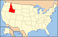
Idaho's location in the U.S.Founded February 4, 1864 Named for The Nez Percé tribe of Native Americans Seat Lewiston Largest city Lewiston Area
- Total
- Land
- Water
856.36 sq mi (2,218 km²)
849.08 sq mi (2,199 km²)
7.28 sq mi (19 km²), 0.85%Population
- (2010)
- Density
39,265
46/sq mi (19/km²)Time zone Pacific: UTC-8/-7 Website www.co.nezperce.id.us Nez Perce County [Eng. pron. Nezz Purse] is a county located in the U.S. state of Idaho. The population was 39,265 at the 2010 Census.[1] The county seat is Lewiston.[2] The county is named for the Nez Percé tribe.
Nez Perce County was originally organized in 1861, when the area was part of Washington Territory. It was reorganized in 1864 by the Idaho Territorial Legislature.
Nez Perce County is part of the Lewiston, ID-WA Metropolitan Statistical Area, which includes the entire county and all of Asotin County, Washington.
Contents
Geography
According to the 2000 census, the county has a total area of 856.36 square miles (2,218.0 km2), of which 849.08 square miles (2,199.1 km2) (or 99.15%) is land and 7.28 square miles (18.9 km2) (or 0.85%) is water.[3]
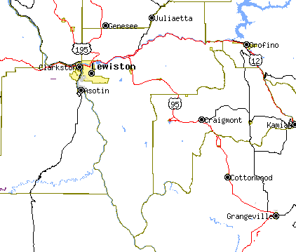
Nez Perce County has two rivers, the Clearwater and the Snake, which meet in Lewiston and then flow west. The Clearwater flows from the east and the Snake from the south, creating the state border with Washington (and further upstream, Oregon). The lowest point in the state of Idaho is located on the Snake River in Lewiston in Nez Perce County, where it flows out of Idaho and into Washington. North of Lewiston, Idaho's western border is a political line.
The northern portion of the county is part of the Palouse, a wide and rolling agricultural region of the middle Columbia basin.
Adjacent counties
- Latah County - north
- Clearwater County - northeast
- Lewis County - east
- Idaho County - southeast
- Wallowa County, Oregon - southwest
- Asotin County, Washington - west
- Whitman County, Washington - northwest
National protected areas
- Clearwater National Forest (part)
- Nez Perce National Historical Park (part)
- Wallowa–Whitman National Forest (part)
Highways
Government and politics
Nez Perce county is a strongly Republican county. In 2004 Republican George W. Bush defeated Democrat John Kerry 62% to 36%. In 2008 Republican John McCain defeated Democrat Barack Obama by a slightly smaller margin of 58% to 39%.[4]
Demographics
Nez Perce County 
As of the census[5] of 2000, there were 37,410 people, 15,286 households, and 10,149 families residing in the county. The population density was 44 people per square mile (17/km²). There were 16,203 housing units at an average density of 19 per square mile (7/km²). The racial makeup of the county was 91.58% White, 0.28% Black or African American, 5.31% Native American, 0.65% Asian, 0.07% Pacific Islander, 0.50% from other races, and 1.60% from two or more races. 1.93% of the population were Hispanic or Latino of any race. 25.1% were of German, 11.3% English, 11.0% American, 8.9% Irish and 5.6% Norwegian ancestry according to Census 2000.
Historical populations Census Pop. %± 1900 13,748 — 1910 24,860 80.8% 1920 15,253 −38.6% 1930 17,591 15.3% 1940 18,873 7.3% 1950 22,568 19.6% 1960 27,066 19.9% 1970 30,276 11.9% 1980 33,220 9.7% 1990 33,754 1.6% 2000 37,410 10.8% 2010 39,265 5.0% sources:[1][6] There were 15,286 households out of which 29.00% had children under the age of 18 living with them, 52.80% were married couples living together, 9.30% had a female householder with no husband present, and 33.60% were non-families. 26.70% of all households were made up of individuals and 11.30% had someone living alone who was 65 years of age or older. The average household size was 2.40 and the average family size was 2.90.
In the county the population was spread out with 23.80% under the age of 18, 10.00% from 18 to 24, 26.70% from 25 to 44, 23.00% from 45 to 64, and 16.50% who were 65 years of age or older. The median age was 38 years. For every 100 females there were 96.70 males. For every 100 females age 18 and over, there were 93.80 males.
The median income for a household in the county was $36,282, and the median income for a family was $44,212. Males had a median income of $34,688 versus $23,014 for females. The per capita income for the county was $18,544. About 8.60% of families and 12.20% of the population were below the poverty line, including 15.40% of those under age 18 and 6.70% of those age 65 or over.
Communities
Cities
Unincorporated communities
- Cavendish
- Gifford
- Jacques
- Lenore
- Myrtle
- Southwick
- Spalding
- Sweetwater
- Waha
See also
- List of Idaho counties
- National Register of Historic Places listings in Nez Perce County, Idaho
References
- ^ a b quickfacts.census.gov Nez Perce County, U.S. Census Bureau, 2009-02-20. Accessed 2009-03-29.
- ^ "Find a County". National Association of Counties. http://www.naco.org/Counties/Pages/FindACounty.aspx. Retrieved 2011-06-07.
- ^ "Census 2000 U.S. Gazetteer Files: Counties". United States Census. http://www.census.gov/tiger/tms/gazetteer/county2k.txt. Retrieved 2011-02-13.
- ^ US Election Atlas.org
- ^ "American FactFinder". United States Census Bureau. http://factfinder.census.gov. Retrieved 2008-01-31.
- ^ census.gov Idaho population by county, 1900-90 - accessed 2009-05-25

Whitman County, Washington Latah County Clearwater County Asotin County, Washington 
Lewis County  Nez Perce County, Idaho

Wallowa County, Oregon Idaho County Municipalities and communities of Nez Perce County, Idaho Cities 
CDP Sweetwater
Unincorporated
communitiesGifford | Lenore | Spalding
 State of Idaho
Topics - Index
- Geography
- Government
- Delegations
- Governors
- History
- Symbols
- Images
- People
- Visitor Attractions
Society Regions Larger
citiesSmaller
citiesCounties - Ada
- Adams
- Bannock
- Bear Lake
- Benewah
- Bingham
- Blaine
- Boise
- Bonner
- Bonneville
- Boundary
- Butte
- Camas
- Canyon
- Caribou
- Cassia
- Clark
- Clearwater
- Custer
- Elmore
- Franklin
- Fremont
- Gem
- Gooding
- Idaho
- Jefferson
- Jerome
- Kootenai
- Latah
- Lemhi
- Lewis
- Lincoln
- Madison
- Minidoka
- Nez Perce
- Oneida
- Owyhee
- Payette
- Power
- Shoshone
- Teton
- Twin Falls
- Valley
- Washington
Categories:- Idaho counties
- Nez Perce County, Idaho
- 1864 establishments
- Lewiston metropolitan area


Wikimedia Foundation. 2010.