- Elmore County, Idaho
-
Elmore County, Idaho 
Seal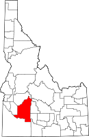
Location in the state of Idaho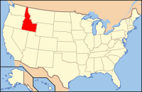
Idaho's location in the U.S.Founded February 7, 1889 Named for The Ida Elmore mines;
the area's greatest producer
of silver and gold in the 1860s.Seat Mountain Home Largest city Mountain Home Area
- Total
- Land
- Water
3,100.51 sq mi (8,030 km²)
3,077.57 sq mi (7,971 km²)
22.93 sq mi (59 km²), 0.74%Population
- (2010)
- Density
27,038
8.8/sq mi (3.5/km²)Time zone Mountain: UTC-7/-6 Website elmorecounty.org Elmore County is a county located in the U.S. state of Idaho. As of the 2010 Census the county had a population of 27,038, down 7.2% from 29,130 in 2000.[1] The largest city and county seat is Mountain Home.[2]
Elmore County comprises the Mountain Home, ID Micropolitan Statistical Area.
Contents
History
Established February 7, 1889, with its county seat at Rocky Bar. Named for the Ida Elmore mines, the area's greatest silver and gold producer of the 1860s, located near Silver City in Owyhee County.[3][4]
The Oregon Trail crossed the Snake River in Elmore County, at Three Island Crossing near Glenns Ferry. A station on the overland stage route, originally named Rattlesnake, was moved west to the railroad line and became Mountain Home. On February 4, 1891, the county seat was moved to Mountain Home.[5]
Construction of what would become Mountain Home Air Force Base was begun in October 1942, 12 miles (19 km) southwest of Mountain Home. The base officially opened in August 1943 as a training base for bombers, and was an operational base under SAC through 1965. It became a fighter base in 1966 under TAC, now the Air Combat Command.
Anderson Ranch Dam is east of Mountain Home on the South Fork of the Boise River. At the time of its completion in 1950, it was the world's highest earthfill dam.[6]
Geography
According to the 2000 census, the county has a total area of 3,100.51 square miles (8,030.3 km2), of which 3,077.57 square miles (7,970.9 km2) (or 99.26%) is land and 22.93 square miles (59.4 km2) (or 0.74%) is water.[7] Elmore County's highest point is Snowyside Peak at 10,651 feet (3,246 m) above sea level, located in the northeast corner of the county in the Sawtooth Wilderness. The lowest elevation in the county is the Snake River in the southwest corner, at less than 2,500 feet (760 m).
Adjacent counties
- Boise County - north
- Ada County - west
- Owyhee County - south
- Twin Falls County - southeast
- Gooding County - east
- Camas County - east
- Blaine County - northeast
National protected areas
- Boise National Forest (part)
- Sawtooth National Forest (part)
- Sawtooth National Recreation Area (part)
- Sawtooth Wilderness (part)
- Snake River Birds of Prey National Conservation Area (part)
Highways
 - Interstate 84
 - US 20
 - US 26
 - US 30
 - SH-51
 - SH-67
Demographics
Historical populations Census Pop. %± 1900 2,286 — 1910 4,785 109.3% 1920 5,087 6.3% 1930 4,491 −11.7% 1940 5,518 22.9% 1950 6,687 21.2% 1960 16,719 150.0% 1970 17,479 4.5% 1980 21,565 23.4% 1990 21,205 −1.7% 2000 29,130 37.4% 2010 27,038 −7.2% sources:[1][8] As of the census[9] of 2000, there were 29,130 people, 9,092 households, and 6,846 families residing in the county. The population density was 10 people per square mile (4/km²). There were 10,527 housing units at an average density of 3 per square mile (1/km²). The racial makeup of the county was 85.37% White, 3.25% Black or African American, 0.89% Native American, 1.66% Asian, 0.19% Pacific Islander, 5.39% from other races, and 3.25% from two or more races. 11.99% of the population were Hispanic or Latino of any race. 16.8% were of German, 12.0% English, 9.2% American and 8.3% Irish ancestry according to Census 2000.
There were 9,092 households out of which 43.00% had children under the age of 18 living with them, 64.10% were married couples living together, 7.50% had a female householder with no husband present, and 24.70% were non-families. 20.70% of all households were made up of individuals and 6.40% had someone living alone who was 65 years of age or older. The average household size was 2.76 and the average family size was 3.21.
In the county the population was spread out with 28.00% under the age of 18, 13.90% from 18 to 24, 36.00% from 25 to 44, 15.00% from 45 to 64, and 7.10% who were 65 years of age or older. The median age was 29 years. For every 100 females there were 123.20 males. For every 100 females age 18 and over, there were 130.60 males.
The median income for a household in the county was $35,256, and the median income for a family was $37,823. Males had a median income of $26,248 versus $21,309 for females. The per capita income for the county was $16,773. About 8.80% of families and 11.20% of the population were below the poverty line, including 15.00% of those under age 18 and 10.80% of those age 65 or over.
Communities
Cities
Census-designated place
Other communities
- Atlanta
- Featherville
- Pine
- Rocky Bar - ghost town
See also
References
- ^ a b Elmore County QuickFacts, United States Census Bureau, 2010-06-03, accessed 2011-09-27
- ^ "Find a County". National Association of Counties. http://www.naco.org/Counties/Pages/FindACounty.aspx. Retrieved 2011-06-07.
- ^ Idaho State Historical Society - J. Marion More - accessed 2009-06-15.
- ^ "Idaho for the Curious", by Cort Conley, ©1982, ISBN 0-9603566-3-0, p.374-379
- ^ idaho.gov - about Elmore County - accessed 2009-05-15
- ^ USBR.gov - Anderson Ranch Dam - accessed 2011-09-27
- ^ "Census 2000 U.S. Gazetteer Files: Counties". United States Census. http://www.census.gov/tiger/tms/gazetteer/county2k.txt. Retrieved 2011-02-13.
- ^ census.gov Idaho population by county, 1900-90 - accessed 2009-05-15
- ^ "American FactFinder". United States Census Bureau. http://factfinder.census.gov. Retrieved 2008-01-31.
External links

Boise County Blaine County Ada County 
Gooding County and Camas County  Elmore County, Idaho

Owyhee County Twin Falls County Municipalities and communities of Elmore County, Idaho Cities 
CDP Unincorporated
communities State of Idaho
Topics - Index
- Geography
- Government
- Delegations
- Governors
- History
- Symbols
- Images
- People
- Visitor Attractions
Society Regions Larger
citiesSmaller
citiesCounties - Ada
- Adams
- Bannock
- Bear Lake
- Benewah
- Bingham
- Blaine
- Boise
- Bonner
- Bonneville
- Boundary
- Butte
- Camas
- Canyon
- Caribou
- Cassia
- Clark
- Clearwater
- Custer
- Elmore
- Franklin
- Fremont
- Gem
- Gooding
- Idaho
- Jefferson
- Jerome
- Kootenai
- Latah
- Lemhi
- Lewis
- Lincoln
- Madison
- Minidoka
- Nez Perce
- Oneida
- Owyhee
- Payette
- Power
- Shoshone
- Teton
- Twin Falls
- Valley
- Washington
Categories:- Idaho counties
- Elmore County, Idaho
- 1889 establishments


Wikimedia Foundation. 2010.