- Oneida Lake
-
Oneida Lake 
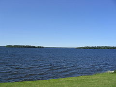
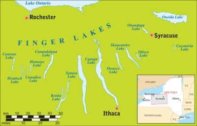
View of Frenchman's Island and Durham Island from Cicero, a suburban Syracuse town Location Oneida / Oswego counties, New York, USA Coordinates 43°12′0″N 75°54′0″W / 43.2°N 75.9°WCoordinates: 43°12′0″N 75°54′0″W / 43.2°N 75.9°W Primary inflows Oneida Creek Primary outflows Oneida River Basin countries United States Max. length 21 mi (33 km) Max. width 5 mi (8.7 km) Average depth 22 ft (6.7 m) Surface elevation 369 feet (112 m) Islands Big Isle, Dunham's Island, Frenchman's Island, Little Island, Long Island, Wantry Island Settlements (see article) Oneida Lake is the largest lake entirely within New York State (79.8 square miles (207 km2)).[1][2] The lake is located northeast of Syracuse and near the Great Lakes. It serves as one of the links in the Erie Canal. It empties into the Oneida River which flows into the Oswego River which in turn flows into Lake Ontario. While not included as one of the Finger Lakes, it is sometimes referred to as their "thumb".
The lake is about 21 miles (33 km) long and about 5 miles (8.7 km) wide with an average depth of 22 feet (6.4 m). The shoreline is about 55 miles (89 km). Portions of six counties and sixty-nine communities are in the watershed. Oneida Creek, which flows past the cities of Oneida and Sherrill, empties into the southeast part of the lake at South Bay.
Because it is shallow, it is warmer than the deeper Finger Lakes in summer, and freezes solidly in winter, making it relatively safe and popular for ice fishing and snowmobiling.
Contents
Name
The lake is named in honor of the Oneida, the Iroquoian native American tribe that occupied the region. Previously, the lake had been called Tsioqui, meaning "White Water" in the Oneida language.[3]
Geology
Oneida Lake is a remnant of Lake Iroquois, a large prehistoric lake formed when glaciers blocked the current outlet of the Great Lakes, the St. Lawrence River.
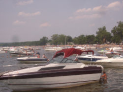
 Located on the eastern shore of Oneida Lake, Sylvan Beach, New York is a popular summer boating destination, thanks to its shallow water and sandy bottom.
When the Erie Canal was enlarged for a final time in the early 20th century, the new route used natural rivers and lakes when possible to save money. Barges were driven by steam and diesel, rather than animals, which allowed them to cross open water and travel against a current. The new route entered the lake at Sylvan Beach, where it straightened Fish Creek, and exited with the Oneida River in Brewerton. The towns along the shorelines of Oneida Lake thrived; terminal walls in Sylvan Beach, Cleveland, and Brewerton allowed boats to load and unload cargo and stay overnight. The break wall, which protects the entrance to the canal, was created to prevent waves from entering the canal as well as to prevent shoaling.
New York counties and towns bordering Oneida Lake
Counties
Towns and Villages
- Cicero — Southwest.
- Constantia — North.
- Hastings — West.
- Lenox — South.
- Sullivan — South.
- Verona — East.
- Vienna — North.
- West Monroe — Northwest.
- Brewerton — Southwest
- Cleveland — North
- South Bay — Southeast
- Jewel — Northeast
 Canada Geese gather to migrate on Oneida Lake at Verona Beach State Park
List of New York state parks on Oneida Lake
- Frenchman's Island State Park
- Verona Beach State Park
References
External links
- NYCanals.com: A guide to boating on Oneida Lake and surrounding waterways.
- Barbagallo, Tricia (June 1, 2005). "Black Beach: The Mucklands of Canastota, New York" (PDF). http://www.archives.nysed.gov/apt/magazine/MagSummer05FeatureArticle_000.pdf. Retrieved 2008-06-04.
- Information about Oneida Lake
- Oneida Lake Association
- History of the Erie Canal through Oneida Lake
Categories:- Finger Lakes
- Geography of Oneida County, New York
- Geography of Oswego County, New York
- Visitor attractions in Oneida County, New York
- Visitor attractions in Oswego County, New York
- Geography of Madison County, New York
- Geography of Onondaga County, New York
- Visitor attractions in Madison County, New York
- Visitor attractions in Onondaga County, New York
Wikimedia Foundation. 2010.

