- Onondaga County, New York
-
Onondaga County, New York 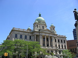 Onondaga County Courthouse at Columbus Circle in Syracuse
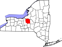
Location in the state of New York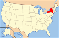
New York's location in the U.S.Founded 1794 Seat Syracuse Area
- Total
- Land
- Water
806 sq mi (2,088 km²)
780 sq mi (2,020 km²)
25 sq mi (65 km²), 3.15%Population
- (2010)
- Density
467,026
599/sq mi (231.2/km²)Website www.ongov.net Onondaga County (
 /ˈɒnənˈdɑːɡə/ on-ən-dah-gə) is a county located in the U.S. state of New York. As of the 2010 census, the population was 467,026. The county seat is Syracuse.
Onondaga County is part of the Syracuse, NY Metropolitan Statistical Area.
The name Onondaga derives from the name of the Native American people who historically lived in the area at the time of European contact, one of the original Five Nations of the Haudenosaunee. They called themselves (autonym) Onoda'gega, sometimes spelled Onontakeka. The word means "People of the Hills." Sometimes the term was Onondagaono ("The People of the Hills"). The federally recognized Onondaga Nation has a reservation of about 9.3 square miles (24 km2) within the county, on which they have self-government.
Contents
History
When counties were established in New York State in 1683, the present Onondaga County was part of Albany County. This was an enormous county, including the northern part of New York State as well as all of the present State of Vermont and, in theory, extending westward to the Pacific Ocean. This county was reduced in size on July 3, 1766 by the creation of Cumberland County, and further on March 16, 1770 by the creation of Gloucester County, both containing territory now in Vermont.
On March 12, 1772, what was left of Albany County was split into three parts, one remaining under the name Albany County. One of the other pieces, Tryon County, contained the western portion (and thus, since no western boundary was specified, theoretically still extended west to the Pacific). The eastern boundary of Tryon County was approximately 5 miles (8 km) west of the present city of Schenectady, and the county included the western part of the Adirondack Mountains and the area west of the West Branch of the Delaware River. The area then designated as Tryon County now includes 37 counties of New York State. The county was named for William Tryon, colonial governor of New York.
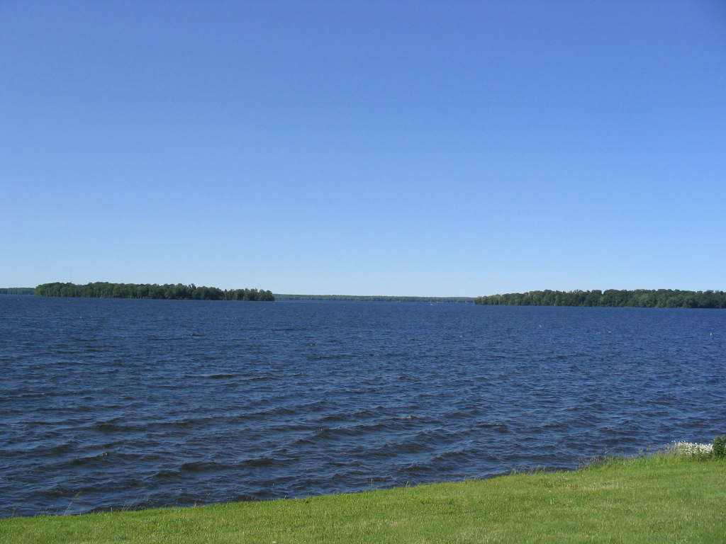
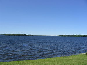 Oneida Lake borders Onondaga County to the northeast. It is the largest lake wholly within the State of New York. This picture was taken from the town of Cicero, a northern suburban town in the northeast part of Onondaga County.
In the years prior to 1776, most of the Loyalists in Tryon County fled to Canada. The Onondaga were among four Iroquois tribes that allied with the British against the American colonists, as they hoped to end their encroachment. Instead, they were forced to cede most of their land in New York to the United States after the war. Many Onondaga went with Joseph Brant and other nations to Canada, where they received land grants in compensation and formed the Six Nations of the Grand River First Nation.
In 1784, following the peace treaty that ended the American Revolutionary War, the name of Tryon County was changed to Montgomery County. It honored General Richard Montgomery, who had captured several places in Canada and died attempting to capture the city of Quebec, and replaced the name of the hated British governor.
In 1789, Montgomery County was reduced by the splitting off of Ontario County from Montgomery. The actual area split off from Montgomery County was much larger than the present county, also including the present Allegany, Cattaraugus, Chautauqua, Erie, Genesee, Livingston, Monroe, Niagara, Orleans, Steuben, Wyoming, Yates, and part of Schuyler and Wayne Counties.
In 1791, Herkimer County was one of three counties split off from Montgomery (the other two being Otsego, and Tioga County). This was much larger than the present county, however, and was reduced by a number of subsequent splits.
In 1794, Onondaga County was split off from Herkimer County. This county was larger than the current Onondaga County, including the present Cayuga, Cortland, and part of Oswego Counties.
In 1799, Cayuga County was split off from Onondaga.
In 1808, Cortland County was split off from Onondaga.
In 1816, parts of Oneida and Onondaga Counties were taken to form the new Oswego County.
At the time Onondaga County was originally organized, it was divided into eleven towns: Homer, Pompey, Manlius, Lysander, Marcellus, Ulysses, Milton, Scipio, Ovid, Aurelius and Romulus.[1]
Central New York developed rapidly after the New Military Tract provided land in lieu of payment to Revolutionary War veterans. Migration was largely from the east, mostly from New England states. The Genesee Road, which became the Seneca Turnpike in 1800, provided access. Generally settlers preferred higher land, since they associated lowlands with disease. In time, as hillside soil was eroded by early clearing and farming, valley lands were more fertile and highly prized for agriculture as well as for water power, which was the origin of many communities. An early settler of 1823 was James Hutchinson Woodworth, a native of Washington County, NY. He helped clear land for his family's farm in this region before going on to Chicago where he became Mayor.
The city of Syracuse, New York developed relatively late, due to its marshy situation. It was incorporated as a village in 1825 and as a city in 1847; by contrast, the Village of Manlius, along the Cherry Valley and Seneca Turnpikes, was incorporated in 1813. Population of rural towns was greatest in the late nineteenth century, when more people cultivated land and farms were relatively small, supporting large households.
Since that time, agriculture has declined in the county. Some Onondaga County towns like Spafford, New York were largely depopulated, many villages becoming veritable ghost towns. Onondaga County highlands now are more heavily reforested, with public parks and preserves providing recreation. Two Finger Lakes in the county, Skaneateles and Otisco, also attract visitors. The village of Skaneateles on scenic Route 20 has become a major tourist destination.
At the turn of the twenty-first century, population declined in the City of Syracuse while suburban communities generally grew, particularly with tract developments north of the city. Elsewhere, scattered commuter houses appeared, generally on fairly large parcels. The Village of Skaneateles and shores of Skaneateles Lake attracted rapid development, demand for property increasing property values remarkably.
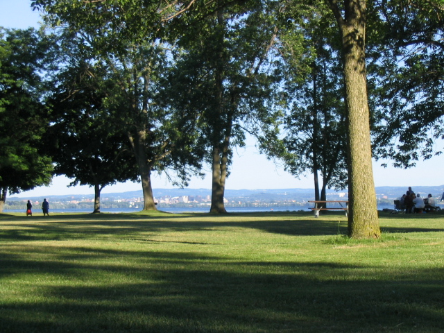
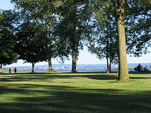 Onondaga Lake Park in the northern suburbs of Syracuse. Picture captures Onondaga Lake with the Syracuse skyline in the background. Onondaga Lake Park attracts over one million visitors each year.
Geography
Onondaga County is in the west central portion of New York State, west of Utica, east of Rochester and north of Ithaca. According to the U.S. Census Bureau, the county has a total area of 806 square miles (2,100 km2), of which 780 square miles (2,000 km2) is land and 25 square miles (65 km2) (3.15%) is water. Onondaga Lake is bordered by many of the larger communities in the county.
The northern part of the county is fairly level lake plain, extending northward to Lake Ontario. Oneida Lake three rivers, as well as the Erie and subsequent Barge Canals are in the lake plain. The main line of the New York Central Railroad and the New York State Thruway extend east and west across the county through the lake plain. The southern part of the county is Appalachian Plateau, with high hills rising at the southern edge of Syracuse. This is the eastern part of the Finger Lakes region. Skaneateles Lake and Otisco Lake are both in Onondaga County. US 20 extends east and west across the county, traversing dramatic hill-and-valley terrain. Between the lake plain and Appalachian highlands is a zone noted for drumlins, smaller, scattered hills formed as mounds of debris left by the last glacier. Tully is geologically noted for the terminal moraine deposited there by the glacier, filling the deep Tully Valley, which might have been another Finger Lake, had the moraine been left closer to Syracuse, impounding water. Tully is at the divide between two major watersheds, one flowing northward to the Atlantic Ocean by way of the St. Lawrence River and the other southward to the ocean vie the Susquehanna River. Onieda Lake, the Finger Lakes, and smaller bodies of water provide recreation. Several ski slopes are located in the Appalachian hills, where there are waterfalls and historic villages as attractions, as well as parks and large forest preserves.
Adjacent counties
- Oswego County – north
- Madison County – east
- Cortland County – south
- Cayuga County – west
Major highways
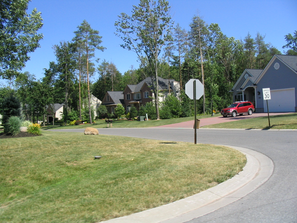
 Lysander, a northwest suburb of Syracuse, New York
 Interstate 81
 Interstate 481 (Veterans Memorial Highway)
 Interstate 90 (New York State Thruway)
 Interstate 690
 U.S. Route 11
 U.S. Route 20
 New York State Route 5
 New York State Route 31
 New York State Route 41
 New York State Route 92
 New York State Route 481 (Veterans Memorial Highway)
 New York State Route 690
Demographics
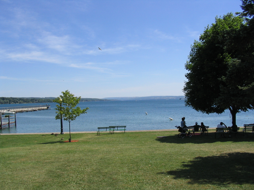
Historical populations Census Pop. %± 1800 7,406 — 1810 25,987 250.9% 1820 41,467 59.6% 1830 58,973 42.2% 1840 67,911 15.2% 1850 85,890 26.5% 1860 90,686 5.6% 1870 104,183 14.9% 1880 117,893 13.2% 1890 146,247 24.1% 1900 168,735 15.4% 1910 200,298 18.7% 1920 241,465 20.6% 1930 291,606 20.8% 1940 295,108 1.2% 1950 341,719 15.8% 1960 423,028 23.8% 1970 472,746 11.8% 1980 463,920 −1.9% 1990 468,973 1.1% 2000 458,336 −2.3% 2010 467,026 1.9% Source[2][3] 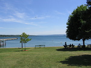 Skaneateles Lake is one of the Finger Lakes located in Onondaga County.
As of the census[4] of 2000, there were 458,336 people, 181,153 households, and 115,394 families residing in the county. The population density was 587 people per square mile (227/km²). There were 196,633 housing units at an average density of 252 per square mile (97/km²). The racial makeup of the county was 84.78% White, 9.38% African American, 0.86% Native American, 2.09% Asian, 0.03% Pacific Islander, 0.89% from other races, and 1.97% from two or more races. Hispanic or Latino of any race were 2.44% of the population. 17.5% were of Italian, 16.2% Irish, 12.4% German, 9.4% English and 6.0% Polish ancestry according to Census 2000. 91.4% spoke English, 2.4% Spanish and 1.1% Italian as their first language.
There were 181,153 households out of which 31.90% had children under the age of 18 living with them, 46.90% were married couples living together, 12.90% had a female householder with no husband present, and 36.30% were non-families. 29.40% of all households were made up of individuals and 10.80% had someone living alone who was 65 years of age or older. The average household size was 2.46 and the average family size was 3.07.
In the county the population was spread out with 25.80% under the age of 18, 9.50% from 18 to 24, 28.80% from 25 to 44, 22.10% from 45 to 64, and 13.80% who were 65 years of age or older. The median age was 36 years. For every 100 females there were 91.70 males. For every 100 females age 18 and over, there were 87.70 males.
The median income for a household in the county was $40,847, and the median income for a family was $51,876. Males had a median income of $39,048 versus $27,154 for females. The per capita income for the county was $21,336. About 8.60% of families and 12.20% of the population were below the poverty line, including 15.50% of those under age 18 and 7.10% of those age 65 or over.
Demographic trends (2006): County population has decreased from a high in 1970. Increasing number of housing units apparently is due to smaller family units and more individuals living alone. While the City of Syracuse population has declined, some suburban towns have grown.
Government and politics
Presidential elections results Year Republican Democrat 2008 38.94% 84,972 59.25% 129,317 2004 43.81% 94,006 54.23% 116,381 2000 41.09% 83,678 53.97% 109,896 1996 37.84% 73,771 51.40% 100,190 1992 36.13% 77,642 42.18% 90,645 1988 51.91% 104,080 47.26% 94,751 1984 59.64% 121,857 40.03% 81,777 1980 50.65% 97,887 38.00% 73,453 1976 59.95% 115,474 39.51% 76,097 1972 69.18% 140,039 30.58% 61,895 1968 50.46% 95,806 44.02% 83,576 1964 32.92% 63,205 66.99% 128,630 1960 54.08% 107,170 45.84% 90,836 Onondaga County was governed exclusively by a board of supervisors until 1961, when voters approved the creation of the county executive.[5] In 1968, the board reorganized into a 24-seat county legislature.[6] In 2001, the legislature was reduced to 19 seats. All 19 members are elected from individual districts. Currently, there are 12 Republicans and 7 Democrats. The county executive is elected in a countywide vote. In a 2010 referendum, voters approved a measure to reduce the legislature to 17 seats.
Onondaga County Executives Name Party Term John H. Mulroy Republican January 1, 1962 – December 31, 1987 Nicholas J. Pirro Republican January 1, 1988 – December 31, 2007 Joanne M. Mahoney Republican January 1, 2008 – Onondaga County Legislature District Legislator Party 1 Richard Lesniak majority leader Republican 2 John C. Dougherty Republican 3 William H. Meyer Republican 4 Judith Tassone Republican 5 Kathleen Rapp Republican 6 James Rhinehart chairman Republican 7 Thomas Buckel Democrat 8 James A. Corbett Republican 9 Mark Stanczyk minority leader Democrat 10 Kevin Holmquist Republican 11 Patrick Kilmartin Republican 12 Robert Cox Republican 13 Robert D. Warner Republican 14 Casey E. Jordan Republican 15 William Kinne Democrat 16 Sam Laguzza Democrat 17 Martin Masterpole Democrat 18 Monica Williams Democrat 19 Linda Ervin Democrat Cities, towns, villages, and hamlets
 A map of towns and cities located in Onondaga County, NY
Syracuse is the only city in Onondaga County. The following is a complete list of official towns and villages, and principal hamlets:[7]
-
-
Towns Villages Hamlets Camillus Camillus Amboy, Belle Isle, Fairmount, Memphis (in part), Warners (in part) Cicero North Syracuse (in part) Brewerton, Bridgeport, Cicero, Cicero Center, South Bay Clay North Syracuse (in part) Bayberry, Belgium, Clay, Euclid, Moyers Corners, Oak Orchard, Three Rivers, Woodard DeWitt East Syracuse (Messina) Barton's Corners, Collamer (Brittons Settlement), DeWitt (Orville), Jamesville, Lyndon, Messina Springs Elbridge Elbridge, Jordan Halfway, Hart Lot Fabius Fabius Apulia, Apulia Station Geddes Solvay Lakeland, New York State Fairgrounds, Westvale LaFayette Bailey's Settlement, Cardiff, Collingwood, LaFayette, Onativia Lysander Baldwinsville (in part) Baird Corners, Cold Springs, Hortontown, Jacksonville, Lampson, Little Utica, Lysander, Plainville, Radisson, West Phoenix, Wrights Corners Manlius Fayetteville, Manlius, Minoa Eagle Village, Freemont, Highbridge, Kirkville, Manlius Center, North Manlius, Polkville, Poolsbrook Marcellus Marcellus Clintonville, Marcellus Falls, Marietta, Rose Hill, Thorn Hill Onondaga Cedarvale, Howlett Hill, Indian Village, Navarino, Nedrow, Onondaga Hill, South Onondaga, Southwood, Split Rock, Taunton[8] Otisco Amber, Marietta, Otisco Pompey Delphi, Delphi Falls, Oran, Pompey, Pompey Center, Watervale Salina Liverpool Galeville, Hinsdale, Long Branch, Mattydale Skaneateles Skaneateles Long Bridge, Mandana, Marysville, Mottville, Shepard Settlement, Skaneateles Falls, Skanondaga Heights, Willow Glen, Spafford Borodino, South Spafford, Spafford Tully Tully Vesper Van Buren Baldwinsville (in part) Memphis (in part), Van Buren, Warners (in part)
-
-
- Villages and hamlets labeled "(in part)" span the border between multiple towns.
Indian reservations
Lakes
See also
- List of counties in New York
- National Register of Historic Places listings in Onondaga County, New York
- Public health concerns in Onondaga County
References
- ^ History of Onondaga County, Professor W. W. Clayton, 1878, http://www.archive.org/stream/historyofonondag00clay/historyofonondag00clay_djvu.txt, retrieved 2010-08-25
- ^ New York State Department of Economic Development
- ^ http://factfinder2.census.gov
- ^ "American FactFinder". United States Census Bureau. http://factfinder.census.gov. Retrieved 2008-01-31.
- ^ Onondaga County Charter Commission (1961-09-05), PROPOSED ONONDAGA COUNTY CHARTER ADOPTED BY THE BOARD OF SUPERVISORS SEPTEMBER 5, 1961 SUBJECT TO APPROVAL BY REFERENDUM NOVEMBER 7, 1961, Syracuse, New York, pp. 3–4
- ^ Board Executive Office (1967), "LOCAL LAW NO. 2—1966", Journal of the Board of Supervisors of the County of Onondaga for 1966 (Syracuse, New York): 182–187
- ^ New York State Gazetteer, Albany, NY: New York State Department of Health, 1995 Available at New York State Library Digital Image Project.
- ^ While the New York State Gazetteer lists Onondaga Valley as a hamlet in Onondaga, it in fact was annexed to Syracuse in 1926. Source: "Welcome to the Valley", pamphlet published by City of Syracuse, August 2006.
External links
- Onondaga County at the Open Directory Project
- Onondaga County, NY US GenWeb Project
- Onondaga County, NY U.S. Census Page
- Brief early history of Onondaga County and its towns
- Onondaga County Historical Aerial Photographs of New York , Cornell University Library & Cornell Institute for Resource Information Sciences

Oswego County Cayuga County 
Madison County  Onondaga County

Cortland County Municipalities and communities of Onondaga County, New York City 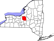
Towns Villages Baldwinsville | Camillus | East Syracuse | Elbridge | Fabius | Fayetteville | Jordan | Liverpool | Manlius | Marcellus | Minoa | North Syracuse | Skaneateles | Solvay | Tully
CDPs Brewerton‡ | Bridgeport‡ | Fairmount | Galeville | Lakeland | Lyncourt | Mattydale | Nedrow | Seneca Knolls | Village Green | Westvale
Other
hamletsAmber | Amboy | Apulia | Apulia Station | Borodino | Cardiff | Cedarvale | Clintonville | Collingwood | Delphi | Delphi Falls | Geddes | Hart Lot | Hinsdale | Howlett Hill | Indian Village | Jack's Reef | Jamesville | Long Branch | Marietta | Memphis | Messina Springs | Mottville | Mycenae | Navarino | Onondaga Hill | Oran | Otisco | Plainville | Pompey Center | Rose Hill | Shepard Settlement | Skaneateles Falls | South Onondaga | South Spafford | Southwood | Spafford Valley | Split Rock | State Fair Grounds | Taunton | Thorn Hill | Vesper | Warners | Watervale
Indian
reservationFootnotes ‡This populated place also has portions in an adjacent county or counties
Categories:- New York counties
- Onondaga County, New York
- 1794 establishments
- Syracuse metropolitan area


Wikimedia Foundation. 2010.