- Cicero, New York
-
Cicero, New York — Town — Location within the state of New York
 Cicero, New York
Coordinates: 43°8′5″N 76°7′49″W / 43.13472°N 76.13028°WCoordinates: 43°8′5″N 76°7′49″W / 43.13472°N 76.13028°W Country United States State New York County Onondaga Government – Type Town Council – Town Supervisor Judy Boyke (D) – Town Council Members' ListArea – Total 48.5 sq mi (125.6 km2) – Land 48.5 sq mi (125.5 km2) – Water 0.0 sq mi (0.1 km2) Elevation 413 ft (126 m) Population (2000) – Total 27,982 – Density 577.4/sq mi (222.9/km2) Time zone Eastern (EST) (UTC-5) – Summer (DST) EDT (UTC-4) ZIP code 13039 Area code(s) 315 FIPS code 36-15704 GNIS feature ID 0978826 Cicero is a town in Onondaga County, New York, USA. The population was 27,982 at the 2000 census. The name of the town was assigned by a clerk interested in the classics, honoring Cicero, a Roman statesman.
The Town of Cicero is in the central part of New York, north of Syracuse. It is a northern suburb of Syracuse and is located in the northeast part of Onondaga County.
Contents
History
Cicero was one of the townships of the former Central New York Military Tract, land reserved for soldiers of the American Revolution.
The Town of Cicero was formed in 1790 as a Township in the Military Tract, but was part of the Town of Lysander when Onondaga County was formed in 1794 and was separated from Lysander in 1807. The first settler to arrive was John Leach, who established a tavern at Cody's Corners.
In 1827 the town was split approximately in half, with the western portion of Cicero becoming the town of Town of Clay.
Geography
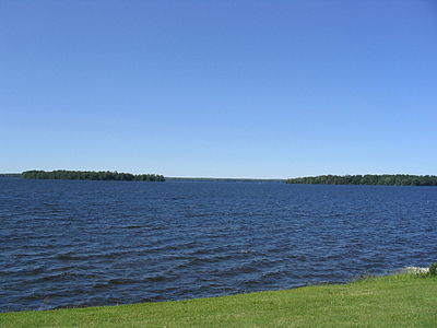
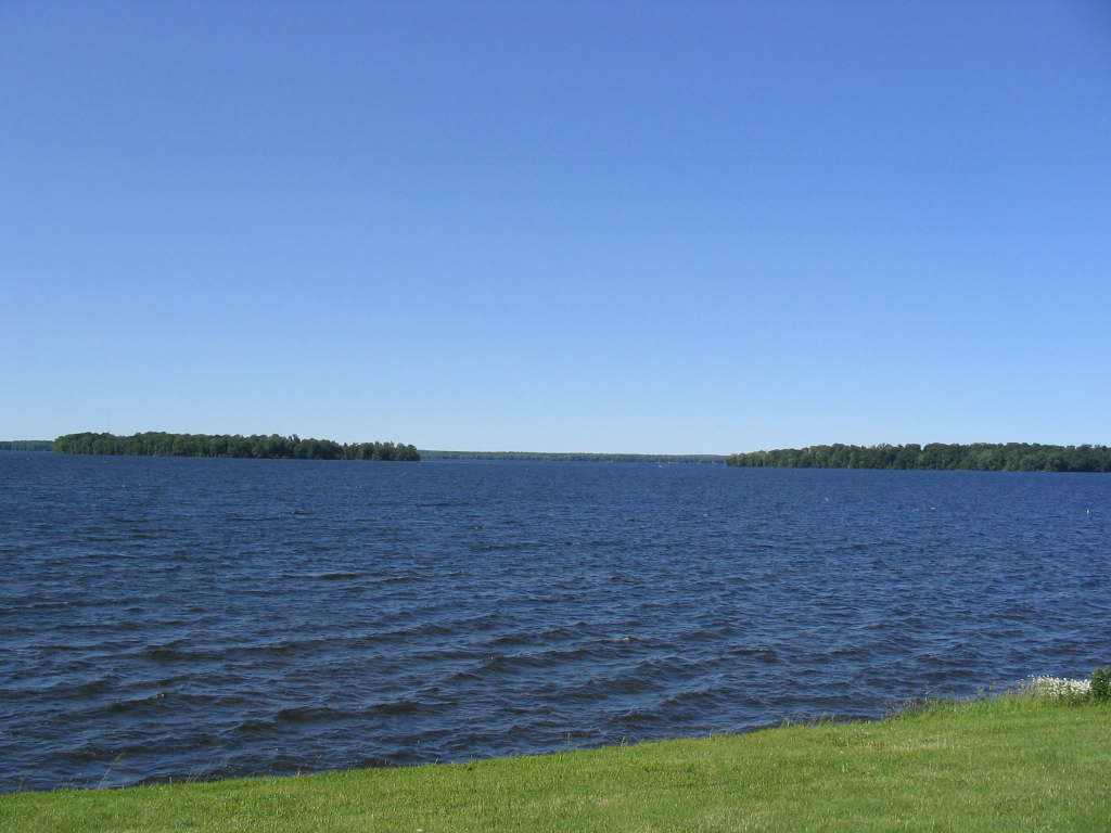
 Oneida Lake taken from the Yacht Club in Cicero. Two small islands in the lake can be seen from this shoreline.
According to the United States Census Bureau, the town has a total area of 48.5 square miles (126 km2), of which, 48.5 square miles (126 km2) of it is land and 0.1 square miles (0.26 km2) of it (0.10%) is water.
The north town line of Cicero, marked by the Oneida River is the border of Oswego County. The east town line is the border of Madison County, marked by the Chittenango Creek.
At the Northern border of Cicero is Oneida Lake, one of the largest bodies of water located within New York State. Also within Cicero is a fairly large swamp named Cicero Swamp. Cicero consists of mainly wetland, forests, farms and a large and growing number of housing developments encroaching on farmland. The soils are mostly brown silt loams and loams with slight to moderate acidity in surface layers (subsoils may be somewhat alkaline); their drainage varies.
U.S. Route 11, Interstate 81, Interstate 481, and New York State Route 31 pass through Cicero. New York State Route 298 intersects NY-31 near the east town line. Michael Airfield, a single runway general aviation airport, is located within Cicero.
The reconstructed Erie Canal follows the Oneida River along the north town line.
Demographics
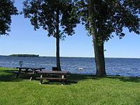 Oneida Lake from Williams Park in Cicero.
As of the census[1] of 2000, there were 27,982 people, 10,538 households, and 7,692 families residing in the town. The population density was 577.4 people per square mile (222.9/km²). There were 11,033 housing units at an average density of 227.7 per square mile (87.9/km²). The racial makeup of the town was 96.31% White, 1.19% African American, 0.38% Native American, 0.71% Asian, 0.02% Pacific Islander, 0.22% from other races, and 1.17% from two or more races. Hispanic or Latino of any race were 0.88% of the population.
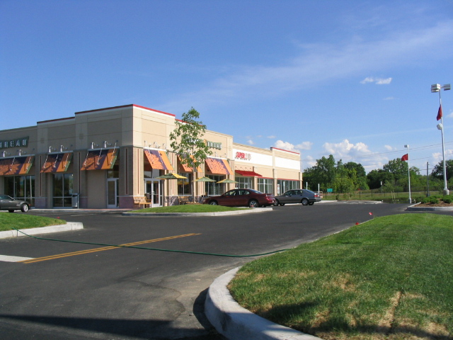
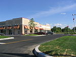 Cicero is currently undergoing a retail renaissance. Old run-down properties are redeveloped into new retail plazas like this one called The Maketplace.
There were 10,538 households out of which 38.7% had children under the age of 18 living with them, 58.9% were married couples living together, 10.1% had a female householder with no husband present, and 27.0% were non-families. 21.3% of all households were made up of individuals and 8.3% had someone living alone who was 65 years of age or older. The average household size was 2.65 and the average family size was 3.10.
In the town the population was spread out with 28.1% under the age of 18, 5.9% from 18 to 24, 33.2% from 25 to 44, 22.1% from 45 to 64, and 10.7% who were 65 years of age or older. The median age was 36 years. For every 100 females there were 96.5 males. For every 100 females age 18 and over, there were 93.6 males.
The median income for a household in the town was $50,055, and the median income for a family was $57,531. Males had a median income of $41,038 versus $26,983 for females. The per capita income for the town was $21,527. About 3.9% of families and 5.1% of the population were below the poverty line, including 6.0% of those under age 18 and 3.5% of those age 65 or over.
Communities and locations within Cicero
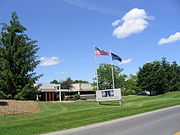 Syracuse Research Corporation Headquarters is located in Cicero.
- Boyson Bay – A bay of Oneida Lake west of Kraus Landing.
- Brewerton – A hamlet near the north town line on US Route 11, by Interstate 81.
- Bridgeport – A hamlet. It is also located in Madison County.
- Brown Center – A hamlet south of Cicero Center.
- Cedar Point – A fairly large subdivision located north of Lakeshore Road, and south of McKinley Road.
- Cicero – The hamlet of Cicero is in the southwest part of the town on US Route 11 near Interstate 81.
- Cicero Center-- A hamlet on NY-31 in the eastern part of the town.
- Cicero Swamp Wildlife Management Area – A conservation area in the southeast part of Cicero.
- Ciceroville-- originally a hamlet, now a historical location.
- Darby Farms – A location in the southwest part of the town by Interstate 81, one of the oldest subdivisions in Cicero
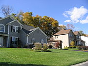 Picture of a typical residential neighborhood in Cicero.
 - Drivers Village – An auto retail outlet in the location formerly known as Penn-Can Mall.
- Forest Beach – A hamlet on the shore of Oneida Lake east of Brewerton.
- Harbour Village – A location by the east town line on NY-31.
- Henryk Woods – A small subdivision on the east side of Thompson Road across from the Bragman estate.
- Hiller Heights – A location in the southwest part of the town near Interstate 81.
- John's Landing – A small subdivision located on the north side of the town near Snowshoe Trail.
- Kraus Landing – A hamlet on the shore of Oneida Lake north of Cicero Center.
- Long Point – A short, narrow peninsula south of Forest Beach.
- Lower South Bay – A hamlet on the shore of Oneida Lake on the south shore of a small bay also called Lower South Bay.
- Maple Bay – A bay of Oneida Lake east of Kraus Landing.
- Muskrat Bay – A small bay north of Sandy Bay village.
- Mystic Woods – A subdivision on the west side of Thompson Road.
- North Syracuse – The Village of North Syracuse is partly in the town at the west town line.
- Oneida Park – A location by the east town line on NY-298.
- Oneida Shores County Park – A park by Oneida Lake.
- Renee Gardens – A small subdivision located on the north side of the town near Persian Terrace.
- Sandy Bay – A hamlet on the shore of Oneida Lake southeast of Brewerton.
- Syracuse Hancock International Airport – A small, northern part of the airport is at the south town line.
- Valentine's Beach – A hamlet on the shore of Oneida Lake north of Cicero Center.
- Wallington Meadows – A small neighborhood located just off Lakeshore Road. It's less than a mile from Oneida Lake and is currently undergoing an expansion project.
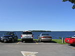
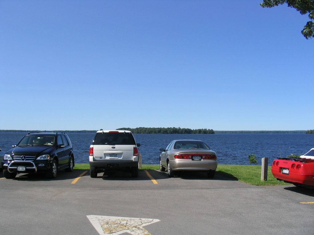
 This picture was taken from the Cicero Yacht Club parking lot. Two islands can be seen.
References
- ^ "American FactFinder". United States Census Bureau. http://factfinder.census.gov. Retrieved 2008-01-31.
External links
Municipalities and communities of Onondaga County, New York City 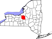
Towns Villages Baldwinsville | Camillus | East Syracuse | Elbridge | Fabius | Fayetteville | Jordan | Liverpool | Manlius | Marcellus | Minoa | North Syracuse | Skaneateles | Solvay | Tully
CDPs Brewerton‡ | Bridgeport‡ | Fairmount | Galeville | Lakeland | Lyncourt | Mattydale | Nedrow | Seneca Knolls | Village Green | Westvale
Other
hamletsAmber | Amboy | Apulia | Apulia Station | Borodino | Cardiff | Cedarvale | Clintonville | Collingwood | Delphi | Delphi Falls | Geddes | Hart Lot | Hinsdale | Howlett Hill | Indian Village | Jack's Reef | Jamesville | Long Branch | Marietta | Memphis | Messina Springs | Mottville | Mycenae | Navarino | Onondaga Hill | Oran | Otisco | Plainville | Pompey Center | Rose Hill | Shepard Settlement | Skaneateles Falls | South Onondaga | South Spafford | Southwood | Spafford Valley | Split Rock | State Fair Grounds | Taunton | Thorn Hill | Vesper | Warners | Watervale
Indian
reservationFootnotes ‡This populated place also has portions in an adjacent county or counties
Categories:- Towns in New York
- Syracuse metropolitan area
- Populated places in Onondaga County, New York


Wikimedia Foundation. 2010.