- Syracuse, New York
-
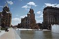
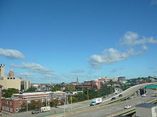
Syracuse — City — A view of the Downtown Syracuse skyline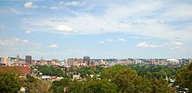
Nickname(s): Salt City, The 'Cuse, Emerald City Location of Syracuse within the state of New York
 Syracuse
Coordinates: 43°02′49″N 76°08′39″W / 43.04694°N 76.14417°W Country United States State New York County Onondaga Incorporated 1825 (village) Incorporated 1847 (city) Government – Type Mayor-Council – Mayor Stephanie A. Miner (D) – Common Council Members' ListArea – City 26.6 sq mi (66.4 km2) – Land 26 sq mi (65 km2) – Water 0.6 sq mi (1.4 km2) 2.15% Elevation 380 ft (116 m) Population (2010) – City 145,170 – Density 5,583.5/sq mi (2,233.4/km2) – Metro 742,603 Time zone Eastern (UTC−5) – Summer (DST) Eastern Daylight Time (UTCv4) Area code(s) 315 Twin Cities – Chiayi City  Taiwan
– Tampere  Finland
FIPS code 36-73000 GNIS feature ID 0966966 Website www.syracuse.ny.us
Syracuse (
 /ˈsɪrəkjuːs/ or local /ˈsɛrəkjuːs/)[1] is a city in and the county seat of Onondaga County, New York, United States,[2] the largest U.S. city with the name "Syracuse", and the fifth most populous city in the state.[3] At the 2010 census, the city population was 145,170, (making it the 170th largest city in the country) and its metropolitan area had a population of 742,603. It is the economic and educational hub of Central New York, a region with over a million inhabitants. Syracuse is also well-provided with convention sites, with a downtown convention complex and, directly west of the city, the Empire Expo Center, which hosts the annual Great New York State Fair. The city derives its name from Siracusa, a city on the eastern coast of the Italian island of Sicily.
The city has functioned as a major crossroads over the last two centuries, first between the Erie Canal and its branch canals, then of the railway network. Today, Syracuse is located at the intersection of Interstates 81 and 90, and its airport is the largest in the region. Syracuse is home to Syracuse University, a major research university, as well as several smaller colleges and professional schools. In 2010 Forbes rated Syracuse 4th in the top 10 places to raise a family.[4]
History
Salt and limestone
See also: Onondaga FormationAround 399 million years ago, during the middle Devonian Period, the land now occupied by the city of Syracuse was south of the equator and covered by a salty sea. Eventually, the sea water evaporated leaving behind layers of halite and seashells which were eventually buried in the earth. From this prehistoric period, two products emerged as major resources in the 19th century; salt and limestone.[5]
Many geological events occurred over the centuries which shaped the land. The most recent was the Great Ice Age which took place approximately 20,000 years ago. The last sheet of ice formed the Finger Lakes, the Adirondack Mountains, and Onondaga Lake, in addition to other land formations in Upstate New York.[5]
Iroquois confederacy
See also: Onondaga people and IroquoisThe land around Onondaga Lake had been inhabited by Native Americans for 4,000 to 5,000 years before the arrival of Europeans. The Five Nations of the Iroquois Confederacy inhabited this land in the 1600s. The nation was composed of the Mohawks, the Senecas, the Onondagas, the Oneidas, and the Cayugas. Each nation oversaw a different part of New York. The Onondagas lived in the area around Onondaga Lake in Central New York.[5]
By 1722, the Tuscarora people joined with the Iroquois and the confederacy was then known as the Six Nations.[5]
French missions
See also: French in Syracuse, New YorkThe first Europeans in the area were the French who arrived in 1615 when Samuel de Champlain launched an attack against the Oneidas with the aid of the Huron and Algonquian Indians who were bitter enemies of the Iroquois.[5]
During the 1640s, which were years of "troubling" battles between the French, Huron and Iroquois, many Jesuit priests were killed. Many French missionaries who arrived in the area from Canada, retreated to the north.[6]
On August 5, 1654, Father Simon LeMoyne, a Jesuit missionary, arrived in the Onondaga village. The French were the first to discover salt in Onondaga Lake. During his short stay, LeMoyne drank from a spring which the Onondagas believed to be foul due to an evil spirit. He found it to be a salt water spring and he returned to Canada with salt made from the spring water.[5]
British arrive
See also: British in Syracuse, New YorkThe British began to take an active interest in the land around Onondaga Lake in the early 1700s. They befriended the Onondagas by giving them guns, which were highly prized. A British agent, William Johnson, acquired 200,000 acres (810,000,000 m2) of land in the Mohawk country near present day Johnstown, New York. In 1751, Johnson heard that the French intended on securing a military post in the vicinity of the salt springs. He discussed the consequences of that action with the Onondagas and proposed that they grant him rights to all of Onondaga Lake and a two-mile (3 km) band of land around it. The Onondagas agreed and were paid £350 sterling.[5]
Revolutionary War
See also: American Revolutionary War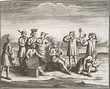 Iroquois engaging in trade with Europeans (1722)
As the Revolutionary War approached, both the British and the Americans sought Iroquois support. The British succeeded and by the end of the war, only the Oneidas and Tuscaroras, a recent addition to the nation, had remained neutral or friendly to the Americans.[5]
The end result of the American Revolutionary War was the Treaty of Fort Stanwix (1784) enacted by the United States on October 22, 1784. The lands of the natives were distributed by treaties soon after. In 1788, the lands around Onondaga Lake were transferred from the Onondaga Nation to local salt producers.[7]
The Oneidas and the Tuscaroras were able to secure the lands which they inhabited. Offers of reservations were made to the four nations that opposed the Americans. The Onondagas, Senecas, and Cayugas accepted the offer. The Mohawks refused and sought refuge in Canada similar to other British sympathizers.[5]
In later years the Onondagas began selling their land in order to gain items brought by white men to the area. Their reservation diminished slowly over time.[5]
Early settlers
See also: Notable citizens of Syracuse, New YorkAfter the American Revolutionary War, more settlers came to the area, mostly to trade with the Onondaga Nation. Ephraim Webster left the Continental Army to settle in 1784, along with Asa Danforth, another participant in the war. Comfort Tyler, whose engineering skill contributed to regional development, arrived four years later. All three settled in Onondaga Hollow south of the present city center at the head of Onondaga Lake, which was then marshy.
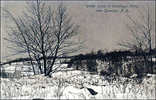 Onondaga Valley outside Syracuse, New York
In late 1788, after the enactment of the Treaty of Fort Stanwix (1784) in which the Onondaga Nation relinquished part of their reservation including Onondaga Hollow to the local salt producers. The land was now open to settlers and the natives were left with only hunting and fishing rights. Tyler and Danforth began making salt for the family, but did not produce it to sell. Danforth built a sawmill and gristmill and Tyler laid the first roads and built bridges, and in the future would support the building of churches and schools.[5]
Swamp land
The ground upon which the city of Syracuse now stands was originally part of the Onondaga Salt Springs Reservation. The first locality which received a name was called Webster's Landing after early settler, Ephraim Webster who was an Indian trader on the banks of the Onondaga Creek.[8]
By 1793, the Westside of the future city was described as "dark, gloomy, and almost impenetrable swamp that was a favorite resort for wolves, bears, wildcats, mud-turtles, and swamp rattlesnakes." The western portion of the valley about Syracuse was originally timbered with hemlock, birch and soft maple; the eastern portion with cedar and pine.[8]
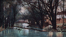
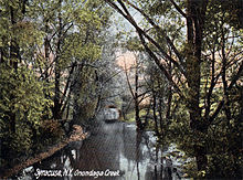 Onondaga Creek in Syracuse, New York
During 1804, an act was passed that directed the sale of 250 acres (1,000,000 m2) of the Onondaga Salt Springs Reservation for the purpose of "laying out and improving a road" running from lot 49, Manlius, to lot 38, Onondaga, east and west through the reservation. James Geddes laid out the design of the new road in "rather an irregular form so that as much dry land might be secured as possible."[8] The land, now the central portion of the city of Syracuse, was purchased by Abraham Walton for $6,650[9] and the area was later named the Walton Tract. Michael Hogan and Charles Walton bought a portion of the tract in 1804 and sold it in 1814.[8]
The swamp was almost impassable, but gradually it was drained, cleared, and settled. A gristmill, called the old red mill, was erected in 1805 followed by a sawmill and tannery. Soon after, a settler named Bogardus opened a tavern and across Walton's land James Geddes laid out a 10-mile (16 km) corduroy road, which later became part of the Genesee Turnpike.[9]
By spring of 1819, the water did not sufficiently subside to allow passage until late May or June. Those going from Onondaga to Salina were "obliged" to pass around the area on the high ground east of the city "over by-ways" which were cut in every direction through the reservation for the purpose of collecting wood in the winter for the salt works. Early residents preferred to travel on the road in the winter because it was frozen and covered with hard pack snow.[8]
Original settlement
See also: John Wilkinson (Syracuse pioneer)
The original settlement went through several name changes until 1824, first being called Salt Point (1780), then Webster's Landing (1786), Bogardus Corners (1796), Milan (1809), South Salina (1812), Cossits’ Corners (1814), and Corinth (1817). The U.S. Postal Service rejected the name Corinth upon its application for a post office, stating there was already a post office by this name in New York.
The village of Syracuse was laid out into streets and lots in 1819, but the first election of village officers did not occur until 1825. At the time of incorporation, the village had 15 merchants, one newspaper, a fire department, and several small industries.[9] The first schoolhouse was erected in 1820, the first church (Baptist) was built in 1821, and the First Presbyterian Church in 1824. The first grist mill occupied the ground where Syracuse High School later stood. This was also the site of Central High School. The village of Lodi consisted of a cluster of homes, groceries, and small businesses situated on the Erie Canal, east of Syracuse.[10]
Because of similarities such as a salt industry and a neighboring village named Salina, the name Syracuse was chosen by village planner, John Wilkinson,[11] after Syracuse, Sicily. In 1825, the village of Syracuse was officially incorporated. By 1832, the city had four wards.[10]
During the winter of 1847–48 discussions about the incorporation of the three villages, Salina, Lodi and Syracuse began.
The period between 1830 and the incorporation of the city in 1847 was one of remarkable growth in all directions in the village of Syracuse. From a population of about 7,000 in 1830 it grew to 11,014 in 1840, and to 22,271 in 1850. Business industries multiplied, churches and schools were established, and from the small community which has been described, living in quite primitive conditions, Syracuse became a large and thriving village, with a reputation for enterprise and progressiveness that was reaching out over New York State.[10]
Erie Canal
 Erie Canal at Salina StreetSee also: Erie Canal
The opening of the Erie Canal in 1825 caused a steep increase in the sale of salt, not only because of the improved and lower cost of transportation, but additionally, the ease of canal shipment caused New York State farms to change from wheat to pork production and curing pork required a lot of salt.[7]
After the War of 1812, it became difficult to obtain salt from abroad and commercial salt production became an important Syracuse industry. The Erie Canal allowed the bulky and low-priced Onondaga salt to be transported to Chicago and beyond via the Great Lakes relatively quickly and inexpensively.[12]
By 1830, the Erie Canal, which ran through the village, was completed. The Village of Syracuse and the Village of Salina were combined into the City of Syracuse on December 14, 1847. Harvey Baldwin was the first mayor of the new city.[13]
Salt industry
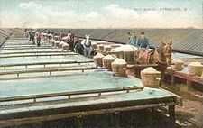 Salt sheds c. 1908See also: Salt industry in Syracuse, New York
The Jesuit missionaries visiting the Syracuse, New York region in the mid 17th century reported salty brine springs around the southern end of "Salt Lake", known today as Onondaga Lake. The 1788 Treaty of Fort Stanwix (1784), and the subsequent designation of the area by the State of New York as the Onondaga Salt Springs Reservation, provided the basis for commercial salt production from the late 18th century through the early 20th century.[7]
The end result of the French and Indian War was the Treaty of Fort Stanwix (1784) enacted by the United States on October 22, 1784. The lands of the natives were distributed soon after. In 1788, the lands around Onondaga Lake were transferred from the Onondaga Nation to local salt producers with the stipulation that the property would be used to produce salt "for the common use of everyone."[7]
Until 1900, the bulk of the salt used in the United States came from Syracuse.[14]
Abolitionism and the Underground Railroad in Syracuse
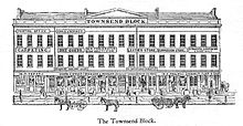 Townsend Block in Syracuse, New York in Clinton Square – Tbe Jerry Rescue Building constructed in 1843See also: Jerry Rescue
Syracuse became an active center for the abolitionist movement, due in large part to the influence of Gerrit Smith and a group allied with him, mostly associated with the Unitarian Church and their pastor The Reverend Samuel May in Syracuse, as well as with Quakers in nearby Skaneateles, supported as well by abolitionists in many other religious congregations.[15] Prior to the Civil War, due to the work of Jermain Wesley Loguen and others in defiance of federal law, Syracuse was known as the "great central depot on the Underground Railroad".
On October 1, 1851, William Henry, a freed slave known as "Jerry" was arrested under the Fugitive Slave Law. The anti-slavery Liberty Party was holding its state convention in the city, and when word of the arrest spread, several hundred abolitionists including Charles Augustus Wheaton broke into the city jail and freed Jerry. The event came to be widely known as the Jerry Rescue. In the aftermath, the Congregationalist minister Samuel Ringgold Ward had to flee to Canada to escape persecution because of his participation.[15]
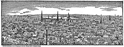
Exponential city growth
 McCarthy Building – c.1895 (later Hunter-Tuppen Department Store)See also: Downtown Syracuse and Clinton Square
The first telegraphic message was received in the city via Albany, New York in 1840. The population by 1848 had grown to 18,741.[16]
During 1850, Henry A. Dillare, erected a five-story block where the McCarthy Department Store later stood.[16] The city market in the City Hall building was abandoned the latter part of 1852.[16]
By 1853, the city was divided into eight wards and in 1856, the ten city banks reported an aggregate capital of $1,535,000.[16]
On May 23, 1869, the Onondaga County Savings Bank building was opened for business. The first levy for city taxes collected was $58,441. John Greenway, brewer, gave a public barbecue in Clinton Square on New Year's Day, 1870.[16]
During 1875, there were 200 smallpox deaths in the city.[16] In 1879, the city population had grown to 62,243.[17]
The telephone was first exhibited in Syracuse on June 12, 1879. The cornerstone of the County Clerk's building was laid on August 11, 1880. Shortly after, the electric light system was introduced into the central parts of the city in 1883.[16]
Geddes was annexed to the city on May 17, 1886 and on February 3, 1887, the village of Danforth became part of the city.[16]
By 1887, the city was divided into 11 wards, by 1891 it had split to 14 and by 1893 there were 19 wards. The City Hall building was completed in 1892.[16]
The New York State Fair permanently located in the city limits in 1888.[16]
City streets
James Geddes was hired in 1797 to survey Onondaga Salt Springs Reservation and lay out the first road in Salt Point.[9]
 View of the Boulevard c. 1908
In 1798, Salt Point became the village of Salina. The Surveyor-General, Simeon DeWitt employed Geddes to design the streets. Although Geddes had no formal training in surveying, DeWitt saw great potential in him. Soon Geddes sold his interest in the Geddes salt works to pursue other interests and surveying continued to be an important role for much of his life.[9]
Geddes later surveyed and laid out the village of Geddes with approximately 20 lots on either side of West Genesee Street in 1807.[18]
In 1812, early settler Comfort Tyler, then a state assemblyman, secured a charter for the Seneca Turnpike Company. With $100,000 he initiated the construction of a turnpike road (a toll road) on the old state road between Utica and Canandaigua. The road was finished in late 1812 and was "fairly flat and improved communications between the eastern and western areas" and was commonly known as the Seneca Turnpike. This road is known today as Genesee Street in Syracuse.[9]
From 1803 through 1804, the Cherry Valley Turnpike, which passed through Cazenovia and intersected the Seneca Turnpike at Manlius was under construction. In 1807, roads around Onondaga Hill and Oswego to Salina were in the planning stages.[9]
 James Street in Syracuse, New York about 1921
A road was approved in 1809 from Free Street and Salt Street in Salina to the town of Cicero. The Cold Spring Road was approved in 1817, from Liverpool to the Seneca River at Cold Springs. In 1820, Geddes laid a road between Salina and the Geddes Works. To deal with the swampy bogs he first filled the area with brush and debris from the swamp. This road is now called Hiawatha Boulevard.[9]
A swing bridge in Salina Street was built in 1874, according to an act of the Legislature that year. The first asphalt pavement in the city was laid in 1880.[16]
James Street was an exclusive residential thoroughfare by the late 19th century. The architectural styles of its homes varied from modified Spanish Revival and Italian Renaissance Revival to Greek Revival and Queen Anne, from Victorian Gothic to Georgian Colonial. West Genesee Street, part of the original Genesee Turnpike, had been through many changes since the "old red mill" was built on the banks of Onondaga Creek. For years, it was a choice residential street. Later, with the invention of the automobile, it became a busy commercial thoroughfare.[9]
The official opening of the new State Fair Boulevard took place on September 2, 1916. Visitors to the New York State Fair that year were "pleased" with the 40-foot (12 m) wide smooth concrete surface of the road that ran from Hiawatha Avenue to the fairgrounds. The old boulevard had caused much trouble with its "mud holes and sticky surface when wet and clouds of dust when dry."[19]
Exhibitors at the fair who had to haul over the boulevard found their trips cut in half and "the horses drawing loads will be saved greatly."[19]
Railroad influence
See also: Railroads in Syracuse, New York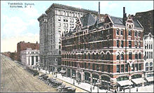 Vanderbilt Square in Syracuse about 1920
The first railroad station in Syracuse was in Vanderbilt Square, along East Washington Street between Salina and Warren Streets which was named for Commodore Cornelius Vanderbilt, a railroad magnate and millionaire whose New York Central Railroad "dominated Washington Street for 100 years."
From 1839 on, Syracuse life for many years revolved around Vanderbilt Square, the magnet was the railroad station, and the hostelries that grew up around it. In the old station Henry Clay was welcomed on his visit to the New York State Fair in 1849. Daniel Webster, General Winfield Scott, Louis Kossuth, John Brown, Stephen A. Douglas, and other notables were greeted there.
The first street railway was built in Salina street in 1859[16] and Syracuse was soon known "far and wide" as the city where the trains passed through the middle of downtown. Travelers caught "intimate glimpses" of Syracuse, its people, stores and houses as the trains slowed on their way through town.[9]
On February 18, 1861, Abraham Lincoln, on the way to his inauguration, bowed from a coach platform.[20] and on April 26, 1865, his funeral train stopped for 30 minutes.[20]
During the 1930s, the city's fourth rail station was constructed along Erie Boulevard East when the rail line through Syracuse was elevated. In Syracuse, the trains ran through the center of downtown, along Washington Street. That elevated section later was abandoned and replaced by Interstate 690.[21]
Interurban and Streetcar railway
See also: Interurban and Streetcar railway in Syracuse, New York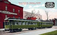 Empire United Railways – Halloran Building – Clinton and Warren Streets in Syracuse, New York – 1912
In addition to the multitude of rail services in the area, interurban and streetcar railway in Syracuse flourished in the city until the automobile, airplane and bus took their place by the early 1940s.[22]
The trolley or streetcar served travel within the city limits of Syracuse as early as 1859. In the early days they were either horse-drawn or fueled by steam and by the end of the 19th century they were electric driven. The city was one of the first in the United States to adopt electricity as a transportation motive power.[22]
Interurban were suburban railways with rights-of-way for higher speed traffic. They linked the city with the countryside[22] which allowed people who lived in the suburbs and farming communities to work in Syracuse. The era was short-lived, however, lasting just over 40 years. The first interurban line was built in the city in 1885 with services to Oneida and the last line completed to Oswego in 1911. By 1932, "every bit" of track had been removed and the entire era was over.[22]
City services
By 1839, the "turbulent element" of the population became too unruly to be controlled by the old constabulary, and a committee consisting of the trustees of the village, with Thomas T. Davis, John Wilkinson and David S. Colvin, was appointed early in 1840 "to report amendments to the ordinances that will give the village a more vigorous police."[10]
 South Salina Street c. 1905
In May 1839, it was resolved by the trustees that "there shall hereafter be a police justice in Syracuse, who shall be appointed in the same manner as the judges of the County Courts," and an act of Legislature was procured for this purpose.[10]
The first gas company in the city began business in 1849.[16]
The Syracuse Fire Department built Engine House 1 in 1859 and a watch tower was constructed in the rear of Engine House 2 in 1862. The department added two steam engines to their fleet in 1866. By 1878, expenses for the fire department were $30,000 per year.[16]
The matter of a stable city water supply from either Tully Lake or Skaneateles Lake was discussed during 1870 and 1871.[16] Skaneateles Lake was chosen and in 1894 the modern water supply system was finally operational.[9]
Industrial growth
See also: Syracuse (industry) and Syracuse (manufactured products)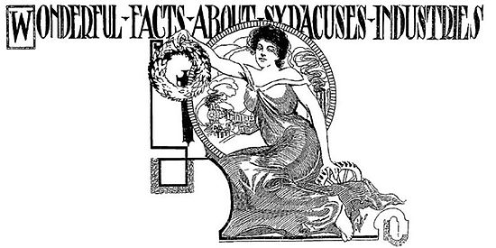 Wonderful Facts about Syracuse Industries – Syracuse Herald in 1908
The salt industry declined after the Civil War, but a new manufacturing industry arose in its place. Manufacturing proliferated in Syracuse, New York from the late 1870s through the early 20th century, a period known as the Industrial Revolution. Franklin Chase, author of the 1924 history "Syracuse and Its Environs," summed up the early 20th century in Syracuse with this claim: "In truth, Syracuse manufactured more different articles numerically than even New York City itself."[23]
During the early years, numerous businesses and stores were established, including the Franklin Automobile Company, which produced automobiles with air-cooled engines. In 1902, the Franklin (automobile) Model A attained the distinction of being the first four-cylinder automobile produced in the United States.[24]
Other important industries included the Crouse-Hinds Company, manufacturer of traffic signals; and the Craftsman Workshops, the center of Gustav Stickley's handmade furniture empire.
The first Solvay Process Company plant in the United States, was erected on the southeastern shore of Onondaga lake in 1884 and the village was given the name Solvay, New York to commemorate its inventor, Ernest Solvay. In 1861, he developed the ammonia-soda process for the manufacture of soda ash {anhydrous sodium carbonate, a rare chemical called natrite, to distinguish it from natural natron of antiquity} from brine wells dug in the southern end of Tully valley (as a source of sodium chloride) and limestone (as a source of calcium carbonate).[25] The process was an improvement over the earlier Leblanc process.
The Syracuse Solvay plant was the incubator for a large chemical industry complex owned by Allied Signal in Syracuse, the result of which made Onondaga Lake the most polluted in the nation.
Early public education
The first public education in the area occurred in 1797 in Salt Point, later the first ward of the city, where school was held in a salt block, a special building erected for processing salt. The first district school organized within the present city limits was in the village of Geddes where the earliest known schoolhouse was erected in 1804 on the site that was later occupied by Porter School.[26]
The first schoolhouse to annex into the city was constructed in 1805 in the town of Salina which was incorporated in 1809. The building, designated as "No. 1," was constructed "according to the fashion of the day" with the faces of the children turned toward the four walls and the instructor in the middle of the room. The village of Salina was incorporated in 1824 and the school remained "No. 1" until the city of Syracuse was incorporated in 1848. At that time, the spring term opened with about 50 pupils in all grades of the "elementary studies." During the winter, the older students, many of them larger than the teacher, increased the total to over 100. The number increased so that it became necessary to "seat some of the pupils on the wood-pile."[26]
The first school house in the village of Syracuse limits was built on Church Street (West Willow Street) at the corner of Franklin Street about 1826. Local schools passed into the control of the Syracuse Board of Education in the spring of 1848.[26]
The first high school building was erected in 1868 and was called High School.[9]
Night schools for adults were established in the 1890. By 1936, under the depression era WPA, funding was provided to hire 300 teachers to instruct 15,000 adults.[9]
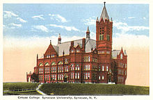 Syracuse University – Crouse College about 1920
In 1930, the city opened a special school for crippled children and by 1932 the Children's court was established.[9]
Syracuse university chartered
Main article: Syracuse UniversitySyracuse University was chartered in 1870 as a Methodist-Episcopal institution and opened its doors for instruction in September 1871.[9]
Geneva Medical College was founded in 1834 in Geneva, New York.[27] It is now known as Upstate Medical University, the most prestigious medical college in the Syracuse area, one of only four in the State University of New York system, and one of only five medical schools in the state north of New York City.
Health care
The first public hospital opened in the city in 1870. The Milbank Memorial Fund, provided approximately $450,000 for public health projects during a nine-year period from 1923 through 1931 and "helped give Syracuse a high rank in health standards."[9]
Telephone service
 Empire State Express (New York Central Railroad) coming thru Washington Street - View of early telephone wires in Downtown Syracuse - 1900-1915Main article: Syracuse Telephonic Exchange
The Syracuse Telephonic Exchange was founded after Frederick C. Brower introduced the Bell telephone to Syracuse in 1878.[28] He had seen the device exhibited at the Philadelphia Exposition of 1876 and secured Central New York rights from the Bell system.[29] His father, Hiram C. Brower, was credited with installing the first "speaking tubes" in Syracuse and also the first enunciators and began the first telephone exchange which had about 1,000 subscribers.[30]
During 1879, Mathew J. Myers, who operated a local telegraph and messenger service in the city, opened an exchange in the tower of the Gridley Building after sub-leasing the rights from Brower.[31] D. L. Pyke, superintendent of Western Union, opened a rival exchange in the Wieting Block in Downtown Syracuse. During 1880, the two rival exchanges merged and named the Syracuse Telephonic Exchange which was eventually consolidated into the New York Telephone Company.[31]
Twentieth century
See also: List of tallest buildings in Syracuse, New York Fayette Street c. 1920
By the 20th century, Syracuse University was no longer sectarian and had grown from a few classrooms located in downtown Syracuse into a major research institution. It is nationally recognized for its college basketball, college football, and college lacrosse teams. In 1911, under the leadership of Syracuse University trustee, Louis Marshall, the New York State College of Forestry was re-established in close association with Syracuse University; it since has evolved into the SUNY-ESF. Le Moyne College was founded in 1946; Onondaga Community College in 1962.
World War II sparked significant industrial expansion in the area: specialty steel, fasteners, custom machining. After the war, two of the Big Three automobile manufacturers (General Motors & Chrysler) had major operations in the area. Syracuse was headquarters for Carrier Corporation, Crouse-Hinds traffic signal manufacturing, and General Electric had its main television manufacturing plant at Electronics Parkway in Syracuse.
Mid century
Syracuse's population peaked at 221,000 in 1950. Immigration from abroad introduced many ethnic groups to the city, particularly German, Jewish, Irish, Italian, and Polish. African Americans had lived in Syracuse since Revolutionary War days, but between 1940 and 1960, some of the three million African Americans who migrated from the south to northern cities also settled in Syracuse. In the 1980s, many immigrants from Africa and Central America also moved to Syracuse, as they did to many northern cities — sometimes under the auspices of several religious charities. However, these new Syracusans could not make up for the flow of residents out of Syracuse, either to its suburbs or out of state, due to job loss.
Much of the city fabric changed after World War II, although Pioneer Homes, one of the earliest government housing projects in the US, had been completed earlier, in 1941. Many of Syracuse's landmark buildings were demolished in the 1950s and 1960s. The federal Urban Renewal program cleared large sectors that remained undeveloped for many decades, although several new museums and government buildings were built.
The manufacturing industry in Syracuse began to falter in the 1970s. Many small businesses failed during this time, which contributed to an already increasing unemployment rate. Rockwell International moved their factory outside New York state. General Electric moved its television manufacturing operations to Suffolk, Virginia and later to Singapore. The Carrier Corporation moved its headquarters out of Syracuse and outsourced manufacturing to Asian locations. Nevertheless, although city population has declined since 1950, the Syracuse metropolitan area population has remained fairly stable, even growing by 2.5 percent since 1970. While this growth rate is greater than much of Upstate New York, it is far below the national average during that period.
Geography and climate
 Onondaga Creek in Syracuse, New York about 1900
Geography
See also: Onondaga LakeSyracuse is located at 43°2′49″N 76°8′40″W / 43.04694°N 76.14444°W (43.046899, −76.144423).[32]
According to the United States Census Bureau, the city has a total area of 25.6 square miles (66 km2), of which, 25.1 square miles (65 km2) of it is land and 0.6 square miles (1.6 km2) of it (2.15%) is water.
The city stands at the northeast corner of the Finger Lakes Region. The city has many neighborhoods which were originally various villages that joined the city over the years. Although the central part of Syracuse is flat, many of its neighborhoods are located on small hills such as University Hill and Tipperary Hill. Land to the north of Syracuse is generally flat while land to the south is hilly.
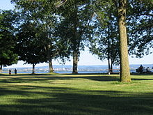 Onondaga Lake Park in the northern suburbs of Syracuse. Onondaga Lake with the Syracuse skyline in the background. Onondaga Lake Park attracts over one million visitors each year.
About 27 percent of Syracuse's land area is covered by 890,000 trees — a higher percentage than in Albany, Rochester or Buffalo. This is despite the Labor Day Storm of 1998, a derecho which destroyed approximately 30,000 trees. The sugar maple accounts for 14.2 percent of Syracuse's trees, followed by the Northern white cedar (9.8 percent) and the European buckthorn (6.8 percent). The most common street tree is the Norway maple (24.3 percent) followed by the honey locust (9.3 percent). The densest tree cover in Syracuse is in the two Valley neighborhoods, with 46.6 percent of their land covered by trees. The lowest tree cover percentage is found downtown, which consists of only 4.6 percent trees.[33]
Syracuse's main water source is Skaneateles Lake, one of the country's cleanest lakes[citation needed], located 15 miles (24 km) southwest of the city. Water from nearby Onondaga Lake is not drinkable due to industrial dumping that spanned many decades, leaving the lake heavily polluted. Incoming water is left unfiltered[citation needed], and chlorine is added to prevent bacterial growth. For periods of drought, there is also a backup line which uses water from Lake Ontario.[34]
Onondaga Creek, a waterway that runs through downtown, flows northward through the city. There are plans and aspirations to create a creek walk that will connect the Lakefront and Inner Harbor to Franklin Square, Armory Square, The Valley, and ultimately the Onondaga Nation. The creek is navigable, yet can be quite a challenge as its channelized nature speeds up its flow, particularly in the spring, when it may be dangerous. Drownings of youngsters resulted in fencing of the creek through some residential areas.
Climate
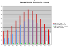 Syracuse's weather averages
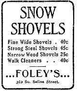 Snow shovels – Syracuse Post-Standard, February 6, 1902
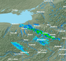
Syracuse has a humid continental climate (Köppen Dfb) [35] and is known for its snowfall. Boasting 121.2 inches (308 cm) on average,[36] the Syracuse metro area receives more snow on average than any other large city in the United States.[37][38] Syracuse continually wins the Golden Snowball Award, among Upstate cities. Its record so far is 192.1 inches (488 cm). The high snowfall is a result of the city receiving both lake effect from nearby Lake Ontario and nor'easter snow. Snow most often falls in small (about 1–3 inches/2.5–7.6 centimetres), almost daily doses, over a period of several days. Larger snowfalls do occur occasionally, and even more so in the northern suburbs.
One notable blizzard was the Blizzard of 1993, during which 42.9 inches (109 cm) fell on the city within 48 hours, with 35.6 inches (90 cm) falling within the first 24 hours. Syracuse received more snow than any other city in the country during this storm, which shattered a total of eight local records, including the most snow in a single snowstorm.[39]
A second notable snowfall was the Blizzard of 1966, with 42.3 inches (107 cm). The Blizzard of '58 occurred in February (16–17th) across Oswego and Onondaga counties. This storm was an actual blizzard due to the high winds, blowing snow and cold. 26.1 inches (66 cm) of snow was measured at Syracuse N.Y. and drifts reached 20 feet (600 cm) in Oswego County. (See Thirtieth Publication of the Oswego County Historical Society, (1969) and The Climate and Snow Climatology of Oswego N.Y., (1971)
 Lake effect snow band over Syracuse
January 2004 was the snowiest month ever in Syracuse, with a record 78.1 inches (198 cm) recorded in 31 days. December 2010 became Syracuse's second snowiest December ever on record with 72.8 inches (184.9 cm)[40] and 45.1 inches (114.6 cm) fell in 4 days.[41] In February 1958, Syracuse shivered under a white blanket that averaged 4 feet (120 cm) on February 19. Syracuse declared a snow emergency under a new law that allowed municipalities to demand that streets be cleared of vehicles to help with plowing operations.[42]
Syracuse's hottest month is historically July, with an average high temperature of 82 °F (28 °C), while its coldest month is historically January, with an average high temperature of 31 °F (−1 °C). The Record high of 102 °F (39 °C) was recorded on July 9, 1936 and record low of −26 °F (−32 °C) has been witnessed three times since 1922, the last being February 18, 1979.[36]
While the average high during summer is around the low 80s, when adding humidity, the apparent temperature highs extend upward in the range of mid-80s to mid-90s in the city. Days just shy of 100 °F (38 °C), such as 96 or 97 °F (36 °C), are not uncommon in and around the city with the humidity factored in. However, days above 100 °F (38 °C) are more rare, even with humidity taken into account.
A few recent summers in Syracuse have been warmer than previous ones in the city and, like in some other places in the nation, previous records have been broken. For example, the summers of 2005 and 2002 were, respectively, the hottest and second-hottest summers on record.[43]
Climate data for Syracuse, New York (Syracuse Airport, 1971–2000) Month Jan Feb Mar Apr May Jun Jul Aug Sep Oct Nov Dec Year Record high °F (°C) 70
(21)69
(21)87
(31)92
(33)96
(36)100
(38)102
(39)100
(38)97
(36)87
(31)81
(27)72
(22)102
(39)Average high °F (°C) 31.4
(−0.3)33.5
(0.8)43.1
(6.2)55.7
(13.2)68.5
(20.3)77.0
(25.0)81.7
(27.6)79.6
(26.4)71.4
(21.9)59.8
(15.4)47.4
(8.6)36.3
(2.4)57.1 Average low °F (°C) 14.0
(−10.0)15.5
(−9.2)24.2
(−4.3)34.9
(1.6)45.8
(7.7)54.6
(12.6)60.1
(15.6)58.8
(14.9)51.1
(10.6)40.4
(4.7)32.0
(0.0)20.9
(−6.2)37.7 Record low °F (°C) −26
(−32)−26
(−32)−16
(−27)7
(−14)15
(−9)34
(1)44
(7)40
(4)25
(−4)18
(−8)1
(−17)−26
(−32)−26
(−32)Precipitation inches (mm) 2.60
(66)2.12
(53.8)3.02
(76.7)3.39
(86.1)3.39
(86.1)3.71
(94.2)4.02
(102.1)3.56
(90.4)4.15
(105.4)3.20
(81.3)3.77
(95.8)3.12
(79.2)40.05
(1,017.3)Snowfall inches (cm) 33.6
(85.3)24.0
(61)18.8
(47.8)4.8
(12.2).1
(0.3)0
(0)0
(0)0
(0)0
(0).5
(1.3)11.1
(28.2)28.3
(71.9)121.2
(307.8)Avg. precipitation days (≥ 0.01 in) 19.7 15.5 16.5 14.0 12.7 12.2 11.3 11.1 12.6 13.2 16.8 18.3 173.9 Avg. snowy days (≥ 0.1 in) 17.2 13.3 9.7 3.0 0.1 0 0 0 0 0.7 6.3 14.0 64.3 Sunshine hours 102.3 118.7 173.6 204.0 241.8 261.0 288.3 248.0 192.0 145.7 78.0 68.2 2,121.6 Source no. 1: NOAA [36] Source no. 2: Hong Kong Observatory [44] Demographics
Historical populations Census Pop. %± 1850 22,271 — 1860 28,119 26.3% 1870 43,051 53.1% 1880 51,792 20.3% 1890 88,143 70.2% 1900 108,374 23.0% 1910 137,249 26.6% 1920 171,717 25.1% 1930 209,326 21.9% 1940 205,967 −1.6% 1950 220,583 7.1% 1960 216,038 −2.1% 1970 197,208 −8.7% 1980 170,105 −13.7% 1990 163,860 −3.7% 2000 147,306 −10.1% 2010 145,170 −1.5% [45][46] Syracuse Compared
(monetary values in United States dollars)2000 Census Syracuse NY State U.S. Total population 147, 306 18,976,457 281,421,906 Population, percent change, 1990 to 2000 −10.4% +5.5% +13.1% Population density 5,871/sq mi 402/sq mi 80/sq mi Median household income (1999) $25,000 $43,393 $41,994 Per capita income $15,168 $23,389 $21,587 Bachelor's degree or higher 23% 27% 24% Foreign born 8% 20% 11% White 64% 62% 69% Black 25% 16% 12% Hispanic 5% 15% 13% Asian 10% 6% 4% As of the census[47] of 2000, there were 147,306 people, 59,482 households, and 30,335 families residing in the city. The population density was 5,871.0 people per square mile (2,266.8/km²). There were 68,192 housing units at an average density of 2,717.8 per square mile (1,049.4/km²).
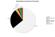
The racial and ethnic makeup of the city reported in the 2000 Census was as follows: 64.26% White, 25.35% African American, 1.13% Native American, 3.37% Asian, 0.05% Pacific Islander, 2.23% from other races, and 3.61% from two or more races. Hispanic or Latino of any race were 5.27% of the population.
There were 59,482 households out of which 30.46% had children under the age of 18 living with them, 12.65% were married couples living together, 14.84% had a female householder with no husband present, and 48.58% were non-families. 38.2% of all households were made up of individuals and 11.9% had someone living alone who was 65 years of age or older. The average household size was 2.29 and the average family size was 3.11.
In the city the population was spread out with 25.0% under the age of 18, 16.8% from 18 to 24, 27.9% from 25 to 44, 17.5% from 45 to 64, and 12.9% who were 65 years of age or older. The median age was 30 years. For every 100 females there were 88.9 males. For every 100 females age 18 and over, there were 84.7 males.
The median income for a household in the city was $25,000, and the median income for a family was $33,026. Males had a median income of $30,312 versus $23,997 for females. The per capita income for the city was $15,168. About 21.7% of families and 27.3% of the population were below the poverty line, including 35.1% of those under age 18 and 12.4% of those age 65 or over.
 Syracuse's racial makeup in 2000
Ethnic diversity
See also: Ethnic groups in Syracuse, New YorkOver the course of 400 years, immigrants from all over the world have been attracted to the Central New York area, including the African, Asian, Bosnian, British, French, German, Greek, Hispanic, Irish, Italian, Jewish, Lebanese, Pacific Islander, Polish, Syrian, Ukrainian, and Welsh communities. Native Americans also continue to have a presence in the area, as they have for centuries.
Recent demographics indicate that the largest ancestries represented in the city includes African American (27.9%), Irish (15.9%), Italian (14.1%), German (12.2%), English (7.6%), Hispanic (6.5%), Polish (5.0%), Asian (4.0%) and Pacific Islander (1.1%).[48]
Economy
Syracuse's economy has faced challenges over the past decades as industrial jobs have left the area. The number of local and state government jobs also has been declining for several years. Syracuse's top employers are now primarily in education and the service industry. University Hill is Syracuse's fastest growing neighborhood, fueled by expansions by Syracuse University and Upstate Medical University (a division of the State University of New York), as well as dozens of small medical office complexes.
Top employers
 Gridley Building in downtown Syracuse, New York in 2008
The top employers in the Syracuse region and the size of their workforce, as of January 1, 2008:[49]
- State University of New York Upstate Medical University: 6,400
- Syracuse University: 5,925
- Wegmans Food Markets: 3,760
- St. Joseph's Hospital Health Center: 3,150
- Magna International: 600
- Crouse Hospital: 2,400
- Lockheed Martin Corp.: 2,350
- National Grid USA: 1,860
- Loretto: 1,825
Bristol-Myers Squibb, founded by alums of nearby Hamilton College, has a complex near the Eastwood district.[50] Time Warner Cable has based one of its divisions in Syracuse.[51]
Today the Syracuse area has few extremely large employers, but rather many smaller ones, which provides for a certain amount of stability. Additionally, eight of the area's top eleven employers are in education or the service industry, which tend to be much more stable than the manufacturing industry.
The Syracuse area's unemployment rate of 5.0 percent is comparable to the national rate of 4.8 (March 2006). Throughout 2006, the area has continued to gain jobs over the previous year's figures. During February and March 2006, the area's job growth rate tied with New York City for the highest in the state.[52]
Tallest buildings
 The State Tower Building (rear), the city's tallest building, completed in 1928Main article: List of tallest buildings in Syracuse
Since 1927 the State Tower Building has been the tallest in Syracuse.
Name Height Floors Use Built The State Tower Building 95 m 23 Office 1928 AXA Tower I 82 m 19 Commercial office 1966 AXA Tower II 82 m 19 Commercial office 1973 Toomey Abbott Towers 70 m 24 Senior living 1968 Jefferson Tower 69 m 23 Residential 1967 Lawrinson Hall ? m 21 Neighborhoods
See also: Category:Neighborhoods in Syracuse, New York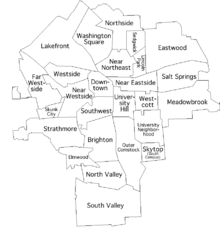 The 26 Syracuse neighborhoods
The City of Syracuse officially recognizes 26 neighborhoods within its boundaries. Some of these have small additional neighborhoods and districts inside of them. In addition, Syracuse also owns and operates Syracuse Hancock International Airport, located on the territory of four towns north of the city.
Syracuse's neighborhoods reflect the historically divided population. Traditionally, Irish, Polish and Ukrainian Americans settled on its westside; Jewish Americans on its eastside; German and Italian Americans on the northside; and African-Americans on its southside.
Business districts
In addition to the dominant Carousel Center shopping mall in the Syracuse's Lakefront neighborhood, many of the city's more traditional neighborhoods continue to have active business districts:
- Downtown: Armory Square has replaced South Salina Street as the main retail and dining area of Downtown Syracuse. Armory Square has around 30 dining establishments, around 20 pubs, bars and clubs, and over 50 other retail stores. Similarly, but on a smaller scale, there is the Hanover Square area. A number of professional firms are also located in Armory Square, including Eric Mower and Associates, O'Brien & Gere, and the Sugarman Law Firm.
- Eastwood: Calling itself "the village within the city", this former village still has a retail corridor along James Street.
- Little Italy: A neighborhood with Italian origins, Little Italy (part of the Near Northeast neighborhood) has several blocks of bakeries, restaurants, pizzerias, shops, and services.
- University Hill: Marshall Street, along with its terminus South Crouse Avenue, is lined with stores, bars, and restaurants, primarily catering to the student population on "The Hill", as well as the over 25,000 people who work there daily. East Genesee Street at the northwestern corner of the neighborhood has several retail establishments, as well.
- Westcott: This neighborhood, located east of University Hill, is inhabited by a wide variety of people, increasingly including some college students as the University grows but still primarily local families and residents. Single-family homes and two-unit apartments comprise the majority of housing. Westcott is known as a bohemian and liberal quarter, and each September hosts the Westcott Street Cultural Fair. The main business district is on Westcott Street between Beech and Dell streets and includes restaurants, bars, an independent bookstore, a consignment shop, The Westcott Theater, and other businesses.
Neighborhoods of Syracuse, New York Brighton • Downtown (Armory Square, Hanover Square) • Elmwood • Eastwood • Far Westside (Tipperary Hill) • Lakefront (Franklin Square, Inner Harbor) • Lincoln Park • Meadowbrook • Near Eastside • Near Northeast (Hawley-Green, Little Italy) • Near Westside • North Valley • Northside • Outer Comstock • Salt Springs • Sedgwick • Skytop (South Campus) • Skunk City • South Valley • Southwest • Strathmore • University Hill (Marshall Street) • University Neighborhood • Westcott • Westside • Washington Square-
Clinton Square
-
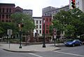
Hanover Square
 Vocational High School at 312 Oswego Street in Syracuse in 1922 – Constructed in 1915 and designed by Architect James A. Randall
Education
See also: Category:Education in Syracuse, New York and Syracuse City School DistrictPrimary and secondary schools
Public schools
Residents are assigned to schools in the Syracuse City School District.[53]
Colleges and universities
One of Syracuse's major research universities is Syracuse University, located on University Hill. It had an enrollment of 19,084 for the 2006–2007 academic year[54]
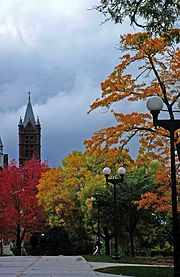 Syracuse University looking toward Crouse College, 2010
Immediately adjacent to Syracuse University are two doctoral-degree granting State University (SUNY) schools, the SUNY College of Environmental Science and Forestry and SUNY Upstate Medical University. Both institutions have long-standing ties to Syracuse University. SUNY Upstate Medical University is also one of Syracuse's major research universities and is one of only about 125 academic medical centers in the country. It is the region's largest employer[55]
Other institutions of higher education which are based in Syracuse include Le Moyne College a Jesuit college founded in 1946 and named after the 17th century missionary and diplomat Simon Le Moyne who first discovered the value of the Onondaga salt springs (see "French missions" above). Le Moyne College was the first Jesuit college to be founded as coeducational, and is located on the city's eastern border. In addition, Onondaga Community College has its main campus in the adjacent Town of Onondaga and has two smaller campuses downtown and in Liverpool. A branch of SUNY's Empire State College is located in East Syracuse; a campus of the nationwide Bryant & Stratton College is located Downtown. A campus of ITT Technical Institute also calls the Syracuse metropolitan area home, also located in Liverpool. There are also Crouse Hospital School of Nursing and Saint Joseph's School of Nursing
Other colleges and universities in the area include Cornell University and Ithaca College in Ithaca, Hamilton College in Clinton, Oswego State University in Oswego, SUNY Cortland in Cortland, Morrisville State College in Morrisville, Colgate University in Hamilton, Cazenovia College in Cazenovia, Wells College in Aurora, and both Utica College and SUNY Institute of Technology in Utica.
See also
- Education in Syracuse, New York
Public libraries
Onondaga County Public Library operates Syracuse's public libraries.[56]
Arts and culture
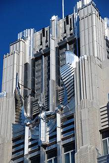 The Niagara Mohawk Building (now owned by National Grid USA), an example of art deco.
An up-to-date directory and events calendar covering all of the visual and performing arts in Syracuse is available at SyracuseArts.net.
Performing arts
Live jazz music is the centerpiece of two annual outdoor festivals in Syracuse, the M&T Syracuse Jazz Festival, Polish Festival as well as the CNY Jazz Arts Foundation's Jazz In The Square Festival. Performers in the last five years have included Chuck Mangione, Joshua Redman, Smokey Robinson, Branford Marsalis, The Bad Plus, Randy Brecker, Stanley Clarke, Jimmy Heath, Terrence Blanchard, Slide Hampton, Bobby Watson, Dr. John, and Aretha Franklin. The Polish Festival hosted Grammy winners Jimmy Sturr and his Orchestra, Polish music legend Stan Borys and Irena Jarocka, Grammy nominee Lenny Goumulka, LynnMarie, Dennis Polisky & The Maestro's Men, Jerry Darlak and the Buffalo Touch & The John Gora Band.
Syracuse was home to the 79-member Syracuse Symphony Orchestra (SSO), founded in 1961. In early April 2011, the orchestra announced plans to file for bankruptcy under Chapter 7, a chapter of the U.S. bankruptcy code that indicates that the organization plans to liquidate itself and go out of operation. Unfunded pension obligations were blamed.[57] The SSO's last Music Director was Daniel Hege; former Music Directors include Frederik Prausnitz and Kazuyoshi Akiyama. At its peak, the orchestra performed over 200 concerts annually for an audience of over 250,000.
The Clinton String Quartet has been active for over 15 years and is based in the Syracuse area. All four members were also members of the Syracuse Symphony Orchestra until its dissolution in early 2011.
The Syracuse Friends of Chamber Music for more than a half century have presented a series of concerts by various chamber ensembles.
The Society for New Music, founded in 1982, is the oldest new music organization in the state outside of New York City, and the only year-round new music group in upstate New York. The Society commissions at least one new work each year from a regional composer, awards the annual Brian Israel Prize to a promising composer under 30 years of age, and produces the weekly "Fresh Ink" radio broadcast for WCNY-FM.
The Syracuse Opera Company is a professional company that generally performs three operas each season. It was founded in 1963 as the Opera Chorus of the Syracuse Symphony Orchestra and became independent in 1973. In addition to full performances, it offers several free outdoor concerts each year in Armory Square, Thornden Park, and elsewhere. The company has an annual budget of US$1 million and is the only professional opera company in upstate New York.
The Syracuse Shakespeare Festival is a charitable, educational, not-for-profit corporation dedicated to performing the works of William Shakespeare. It was founded in 2002 and is best known for its annual free Shakespeare-in-the-Park program at the Thornden Park Amphitheatre that has attracted more than 17,000 people since its inception. SSF also produces three other major programs including Shakespeare-Under-A-Roof, (indoor shows at SU's Warehouse Theatre and NYS Fairgrounds' New Times Theatre) Kids Doing Shakespeare (Spring and Summer one-week, vacation theatre camps for students in grades 3–12) and the Avon Repertory Theatre. (one hour versions of Shakespeare classics touring at schools and businesses in CNY)
Syracuse Stage presents experimental and creative theater; a number of its productions have been world premieres and have moved to Broadway[citation needed]. The venue was designed by its most famous former artistic director Arthur Storch. Its current artistic director is Timothy Bond.
The Red House Arts Center is one of Syracuse's newest cultural venues. Opened in 2004, Redhouse is a small theatre housed in a converted hotel, that offers performances by local, national, and international artists, and hosts regular exhibits in its art gallery, and screenings of independent films.
Syracuse is also known for a large contemporary music scene, particularly in the heavy metal, Hardcore, Ska, and Punk rock genres.[citation needed]
Metal 'Cuse - Syracuse is also home to this yearly charity benefit music festival that showcases Hard Rock and Heavy Metal artists from around Syracuse and around the country. Metal 'Cuse Website
Museums and art galleries
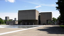 Back of the Everson Museum, Syracuse, NY in 2008
- Everson Museum of Art, which opened in 1968 in a building designed by I.M. Pei, features one of the most extensive pottery collections in the United States along with works of American art, dating from the 18th century to the present. This collection includes paintings, sculptures, drawings, photography, and video.
- Erie Canal Museum is a museum dedicated to preserving the history of the Erie Canal and its role in Syracuse's growth.
- International Mask and Puppet Museum is a museum in Little Italy focusing on masks and puppets, the later of which are also used in educational performances for children.
- Milton J. Rubenstein Museum of Science and Technology is a museum located in the Armory Square neighborhood that features exhibits in science and technology and also houses the city's only IMAX theater.
- Onondaga Historical Association Museum & Research Center, located at 321 Montgomery Street downtown, features exhibits on the past of the Syracuse region, and contains historical archives relating to the area's history. Its exhibits include a presentation of the history of the Underground Railroad.
 Erie Canal Museum in Syracuse, New York – Former weighlock building, built in 1850
- The Warehouse Gallery is located at 350 West Fayette Street in The Warehouse. It is a part of the Coalition of Museum And Art Centers (CMAC). This new contemporary art center exhibits, commissions, and promotes work by emerging and accomplished artists in a variety of media. The programming attempts to engage the community in a dialogue regarding the role the arts can play in illuminating the critical issues of our times.
- Spark Contemporary Art Space is located at 1005 E. Fayette St. in the Downtown area. Spark is run by Syracuse University graduate art students, but is a venue for a diversity of non-university affiliated events. The gallery's directors curate and organize art and music related events, while local artists can rent the space to hold their own events. With the initiation of a monthly video screening series in 2001, Spark became one of the leading venues for video art in Syracuse. Spark Video provides the community an opportunity to see video work from local and international artists.
- Delavan Art Gallery is located at 501 West Fayette Street in an old farm equipment factory. The gallery is currently being refashioned into an Art Shop Complex known as "The Art Shops at Delavan Center".[58] Delavan Gallery has 3,800 square feet (350 m2) of exhibit space, and, on several other floors in the building, houses the studios of a number of area artists. Its shows have typically opened the first Thursday of the month. Showcases have featured a wide variety of work, from multi-media sculpture to hyperealism.
- Point of Contact Gallery is located at 914 East Genesee Street. The newest member of the Coalition of Museums and Art Centers at Syracuse University, it is a space dedicated to the exploration of the verbal and visual arts and home of the Point of Contact Art Collection. It is a cross-disciplinary open forum for the essential discussion of contemporary art. A showcase for contemporary artists from around the world, with a strong prevalence from Latin America. The Point of Contact collection comprises over 200 original pieces created especially for "Point of Contact", the book series, since 1975. Photography, collage, drawings, paintings and three-dimensional works form this rare collection.
Recreation
See also: Category:Parks in Syracuse, New York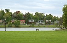 Upper Onondaga Park in Strathmore
The City of Syracuse maintains over 170 parks, fields, and recreation areas, totaling over 1,000 acres (4.0 km2).[59] Burnet Park includes the first public golf course in the United States (1901) and Rosamond Gifford Zoo. Other major parks include Thornden Park, Schiller Park, Sunnycrest Park, James Pass Arboretum and the joined Onondaga Park and Kirk Parks. There are 12 public pools, two public ice rinks, and two public nine-hole golf courses in the city.
Right outside the city proper, along the east side and north end of Onondaga Lake, is Onondaga Lake Park. The adjacent Onondaga Lake Parkway is closed to vehicular traffic several hours on Sundays during the summer months, so it can be used for walking, running, biking, and rollerblading. During the holiday season, the park hosts Lights on the Lake, a two-mile (3 km) drive-through light show.
Transportation
See also: Category:Transportation in Syracuse, New YorkPublic transportation
Syracuse is served by the Central New York Regional Transportation Authority, or CNYRTA. The CNYRTA operates bus service in Syracuse and its suburbs, as well as to outlying metropolitan area cities such as Auburn, Fulton, and Oswego.
The Pyramid Companies have also proposed a monorail linking Syracuse University to Hancock International Airport to via downtown,(Downtown Syracuse) to their proposed Destiny Resort to the William F. Walsh Regional Transportation Center and their proposed Destiny Technology Park. The cost of such a line has been estimated at $750 million.
In 2005, local millionaire Tom McDonald proposed an aerial tramway system, called Salt City Aerial Transit (S.C.A.T.), to link the university to the transportation center. The first segment from Syracuse University to downtown has been estimated to cost $5 million, which McDonald plans to raise himself. Due to the perceived low operating costs, the system could run continuously. As of late 2006, the project remains in the planning stage.[60]
Commute
According to the 2000 Census, this is how people aged 16 and over commute to work:
Syracuse currently ranks 50th in the United States for high transit ridership and 12th for most pedestrian commuters. 38,332 people commute daily into Onondaga County from the four adjoining counties (2006).[61]
Rail
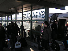 Amtrak platform at the Regional Transportation Center, February 2009.
Syracuse lies on three Amtrak lines—the Empire Service, the Maple Leaf, and the Lake Shore Limited.
The Empire Service runs several times daily from Niagara Falls to New York Penn Station, with major stops in Buffalo, Rochester, Utica, and Albany along the way.
The Maple Leaf follows the path of the Empire Service train, but continues to Toronto. This train completes one roundtrip daily.
Also completing one roundtrip a day, the Lake Shore Limited connects Syracuse to the same cities as above (except Niagara Falls), but continues westward from Buffalo to Chicago via Cleveland and Toledo, and eastward to Boston, with a branch extending south to New York.
The Amtrak station is part of the William F. Walsh Regional Transportation Center.
A regional commuter rail service, OnTrack, was active from 1994 until it was discontinued in 2007 due to low ridership. Its sole route connected the Carousel Center to southern Syracuse, often extending to Jamesville in the summer.
Bus
 Syracuse Hancock International Airport in 1993
Greyhound Lines and Trailways provide long-distance bus service. Both also use the William F. Walsh Regional Transportation Center located in the northern area of the city.
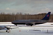
Air service
Syracuse is served by the Syracuse Hancock International Airport in nearby Salina, near Mattydale. The airport is served by 17 airlines (9 major), which provide non-stop flights to destinations as far away as Orlando, FL, as well as several daily flights to other important airline hubs and business centers such as Atlanta, Boston, Charlotte, Chicago, Cincinnati, Cleveland, Detroit, New York City, Philadelphia, Pittsburgh, Washington, DC, Toronto. Six cargo carriers also serve the airport. New York City can be reached in under an hour flight.
Major highways and roads that serve the Syracuse area
Four Interstate Highways run through the Syracuse area:
 Syracuse's four interstate highways link the city with its suburbs and other cities throughout the country.
 Interstate 81 (Highway 401 via Highway 137 in Ontario to Knoxville) runs north-south through Syracuse, and provides access to Canada, Pennsylvania and points south. Its downtown portion is extremely narrow, only consisting of four lanes and essentially no onramps. It forms a physical and psychological[citation needed] border between downtown and University Hill, an issue both Syracuse University and local politicians are trying to address. Moreover, it essentially marks the boundary between two State Senate districts.
 Interstate 90 (Seattle to Boston), also known as the New York State Thruway runs east-west, just north of the city. It is a toll highway that provides access to Rochester, Buffalo, Albany, and the north-south (Interstate 87) part of the Thruway which leads to New York City.
 Interstate 690 runs east-west through the city, and provides access to Interstate 90, as well as to Syracuse's northwestern and eastern suburbs. A spur off I-690 directly west of the city, NY 695, provides freeway access to the southwestern suburbs. It meets Interstate 81 in downtown Syracuse in a highly-complex and incomplete intersection. Most of its routing through the city directly replaced elevated rail lines, a fact quite notable by the city's former main rail terminal, where the freeway spans the width between the terminal and its outermost platform. In 1981 artist Duke Epolito erected sculptures of "passengers" on the far platform. The piece is entitled "Waiting for a Night Train."
 Interstate 481 forms an eastern loop around the city and continues to the northwest as NY 481 to Fulton and Oswego, on the shore of Lake Ontario.
Two US Highways run through the Syracuse area:
 U.S. Highway 11 (Route 223 in Quebec to New Orleans) passes through Syracuse, including downtown, and it follows the route of Salina and State Streets.
 U.S. Highway 20 (Boston to Newport, Oregon) passes south of Syracuse.
New York State Route Expressways:
 New York State Route 481 – Travels from NY 104 in Oswego to the junction of Interstate 81 and Interstate 481 north of Syracuse.
 New York State Route 690 – Was built as an extension of Interstate 690 in the northwest suburbs of Syracuse. The route is a four-lane divided highway from its southern end at I-690, where it meets Interstate 90 (NYS Thruway), to its end northwest of Baldwinsville in Lysander at NY 48 and NY 631.
 New York State Route 695 – Is a short state highway located west of Syracuse in the town of Solvay in Onondaga County. The number of the highway was derived from the two highways that NY 695 links, Interstate 690 and NY 5.
Government
Executive
 Syracuse City Hall
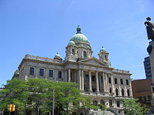 Courthouse at Columbus Circle
The city is headed by an elected mayor who is limited to two four-year terms. The incumbent is Stephanie Miner elected mayor on November 3, 2009[62][63] The previous mayor was former Syracuse Common Council President Matthew J. Driscoll,[64] who first assumed the position in 2001 after the former mayor, Roy Bernardi, resigned upon his appointment by President George W. Bush to a position in the Department of Housing and Urban Development. After serving the remaining term, Driscoll was re-elected that year, and again in 2005. Driscoll is a member of the Mayors Against Illegal Guns Coalition,[65] a bi-partisan group with a stated goal of "making the public safer by getting illegal guns off the streets." The Coalition is co-chaired by Boston Mayor Thomas Menino and New York City Mayor Michael Bloomberg.
Legislative
The legislative branch of Syracuse is the Syracuse Common Council. It consists of a president and nine members, currently:
- Hon. Van B. Robinson (D) – President
- Hon. Lance Denno (D) – Councilor at Large
- Hon. Pamela Hunter (D) – Councilor at Large
- Hon. Kathleen Joy (D) – Councilor at Large
- Hon. Jean Kessner (D) – Councilor at Large
- Hon. Matt Rayo (R) – 1st District
- Hon. Patrick J. Hogan (D) – 2nd District
- Hon. Ryan McMahon (R) – 3rd District
- Hon. Thomas M. Seals (D) – 4th District
- Hon. Nader P. Maroun (D) – 5th District
Judicial
The Onondaga County Supreme and County Court is the trial court of general jurisdiction for Syracuse. It is also the administrative court for the Fifth District of the New York State Unified Court System. Judges for these courts are elected at-large.
The U.S. District Court for the Northern District of New York also holds court in downtown Syracuse at the James Hanley Federal Building.
Media
Radio
Syracuse's flagship News/Talk Radio station: 570 WSYR [3]
See also: Category:Radio stations in Syracuse, New YorkNewspapers
See also: Category:Newspapers published in Syracuse, New York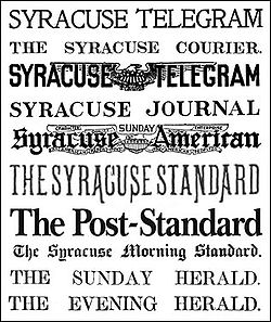
Syracuse has one major daily morning newspaper, The Post-Standard. Until 2001, Syracuse also had an evening paper, The Herald-Journal. Besides a Syracuse/Onondaga County edition, The Post-Standard publishes three additional editions: Cayuga, Madison, and Oswego for the other three counties of the metropolitan area, plus an additional edition on Sundays. It has six news bureaus throughout Central New York, as well as one in Albany (state capital) and Washington, DC.
Before the merger with the evening paper, The Post-Standard was named among the "10 best newspapers in America with a circulation of under 100,000" by Al Neuharth of USA Today (run by a competing organization). Since the merger, circulation has increased to over 120,000. Even outside of its four-county delivery area, the paper is available in many convenience stores and supermarkets from the Canadian to the Pennsylvanian border. The newspaper partly caters to this audience as well, covering many stories from the Ithaca, Utica, and Watertown areas. Since opening a new printing press in 2002, the paper calls itself "America's Most Colorful Newspaper," as almost every page contains color.
Syracuse New Times is a weekly, free, ad-supported arts and entertainment newspaper. Owned by Zimmer Ltd, Syracuse New Times is published in Syracuse, New York by Arthur Zimmer and distributed throughout the central New York region. The publication is released every Wednesday, with over 137,600 readers, and is distributed to over 950 locations in Central New York. Launched in 1969, it is one of the oldest alternative weekly newspapers in the country.
The Daily Orange, the newspaper of Syracuse University and SUNY ESF students, is read by over 20,000 people daily, and is widely distributed in the University Hill neighborhood and Armory Square. The Dolphin, the weekly student newspaper of Le Moyne College is also available, but read mainly by Le Moyne students.
There are other popular free newspapers, including Eagle Newspaper's downtown edition, the City Eagle, and Table Hopping, which focuses on the restaurant and entertainment scene.
Television
Syracuse has eight full-power broadcast television stations:
Syracuse's cable television provider is Time Warner Cable, which, as a part of its regular and digital offerings, provides a popular 24-hour local cable news television channel (YNN), local sports channel, Public-access television channel, and an additional PBS channel.
Additionally, other television networks are broadcast by low-power television stations.[66]
Syracuse University's student-run Educational-access television station is CitrusTV and programming is broadcast on the university campus on the Orange Television Network. The station also provides content to Time Warner Cable Sports. Online, CitrusTV programs can be found on CitrusTV.net.
Dish Network and DirecTV also provide local satellite television subscribers with local broadcast stations.
See also: Category:Television stations in SyracuseReligion
Buddhism: Buddhism has its presence in Syracuse with the Zen Center of Syracuse on the Seneca Turnpike; as well as a center on Park Street, on the city's north side.
Christianity: Syracuse has two cathedrals, the Episcopal St. Paul's Cathedral and the Roman Catholic Cathedral of the Immaculate Conception. Both are located at Columbus Circle. Both are home to their respective dioceses, the Diocese of Central New York (Episcopal) and the Diocese of Syracuse (Roman Catholic). The Assembly of God, Southern Baptist Convention, and the United Church of Christ have their State offices in the Greater Syracuse area. Syracuse is also home to the novitiate center of the Jesuit New York Province, as well as the Basilica of the Sacred Heart of Jesus (Roman Catholic, with Mass offered in English and Polish). In addition there are dozens of churches in Syracuse of nearly every Christian denomination, including Jehovah's Witness, Christian Science, Reformed Presbyterian and Metaphysical Christian. Complete List
Hinduism: Hindu houses of worship include the Hindu Mandir of Central New York in Liverpool.
Sikhism: Sikh The house of worship is the Sikh Foundation of Syracuse, in Liverpool.
Islam: Islam also has a presence in Syracuse, with the Islamic Society of Central New York Mosque on Comstock Avenue and Muhammad's Study Group on West Kennedy Street.
Judaism: There are several Jewish synagogues in Syracuse, including Beth Shalom-Chevra Chas, Temple Adath Yeshurun and the Temple Society of Concord, which is considered to be the ninth oldest Jewish House of Worship in the United States.
Unitarian Universalism: There are two Unitarian Universalist Societies in Syracuse including May Memorial Unitarian Society and First Unitarian Universalist Society of Syracuse.
A complete list of Syracuse's Houses of Worship
Sports
 Alliance Bank Stadium is home to the Syracuse Chiefs Triple A Baseball team. It was built in 1997 on the city's northside.
 Syracuse Chiefs – Alliance Bank StadiumMain article: Sports in Syracuse
Current teams
Sport League Club Founded Venue League championships Championship years Baseball IL Syracuse Chiefs 1935 Alliance Bank Stadium 8 1935, 1942, 1943, 1947, 1954, 1969, 1970, 1976 Hockey AHL Syracuse Crunch 1994 War Memorial at Oncenter 0 N/A Indoor soccer MISL Syracuse Silver Knights[67] 2010 War Memorial at Oncenter 0 N/A Professional
- Syracuse Chiefs (International League affiliate of the Washington Nationals) Stadium: Alliance Bank Stadium
- Syracuse Crunch (American Hockey League affiliate of the Anaheim Ducks) Arena: War Memorial at Oncenter
- Syracuse Silver Knights, a team in the Major Indoor Soccer League
- Syracuse has a rugby club known as the Syracuse Chargers http://www.syracuserugby.com/
- The Syracuse ShockWave American Basketball Association (2000) has been announced to play in Syracuse beginning December 2010.
Syracuse was from 1946 until 1963 home to the NBA's Syracuse Nationals, which are now the Philadelphia 76ers. They played seventeen seasons in Syracuse and won the NBA championship in 1955. The NBA's 24-second clock was invented in and first came into use in Syracuse. In March 2005 the city dedicated a monument to this fact. It is a 125% scaled model of the original shot clock used.
Syracuse has had several American Hockey League teams in the past, which traditionally did not last longer than three seasons. The Syracuse Blazers began play in the Eastern Hockey league in 1973. The league disbanded in 1973. The team then affiliated with the North America Hockey League. 1994 marked the introduction of a new team, the Syracuse Crunch, which have been playing at the War Memorial at Oncenter ever since.
Syracuse had a team in the National Lacrosse League(NLL) called the Syracuse Smash for three seasons from 1998 to 2000. They moved to Ottawa in 2001 and became the Ottawa Rebel
The Syracuse Spirit was a member of the American Lacrosse League, a short lived professional lacrosse league in 1988, based in Syracuse, New York. The Spirit played their home games at the Griffin Field in Liverpool, New York. The General Manager of the Spirit was Tom Scofield and the Head Coach was Jim Booth. The Spirit had a 4–1 record when the league folded.
The Syracuse Shock is a semi-professional American football team based in Syracuse, New York. They play in the North American Football League. The Syracuse Express were established in 1984 and were members of the Mid Continental Football League before that team contracted into the midwest. They joined the upstart New York Amateur Football League, where they became one of the league's premier teams, along with their rivals, the Buffalo Gladiators. After absorbing the Cortland Warriors in 1999 the team became the Central New York Express, although they still played their games in suburban Syracuse. The Express have won one NYAFL title in 2003. The NYAFL merged to become the Northeastern Football Alliance (NFA) and with the change, the team changed and was replaced by a new team named the Syracuse Shock.
Syracuse had a team for one season in the American Indoor Football League called the Syracuse Soldiers.
The Syracuse-based Monolith Athletic Club is working to return professional soccer to Syracuse. The Syracuse Salty Dogs existed for two seasons (2002–2004) until folding due to financial problems. The game attendance had been among the highest in the A-League.
Syracuse had a professional football team from 1890 to 1900 known as the Syracuse Athletic Association,[68] the independent All-Syracuse team which was known in 1921 as the Syracuse Pros in the APFA before leaving the league and reverting to the All-Syracuse team, and briefly in the 1936 American Football League season known as the Syracuse Braves.[69] In 1902, the first World Series of pro football was played at New York's original Madison Square Garden. The 5 teams in the tournament were the New York Knickerbockers, Syracuse AC, Warlow AC, the Orange (New Jersey) AC, and New York. Syracuse won the tournament 6-0 with Glen (Pop) Warner at guard.[70] The December 28, 1902 game where Syracuse defeated New York 5-0 at Madison Square Garden is credited as the first indoor pro football game.[71]
College
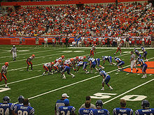 Syracuse University's football team is part of the Big East Conference and plays its games in the Carrier Dome.
- Syracuse University Orange (Division I-A) Stadium: Carrier Dome
- Le Moyne College Dolphins (Division II)
- Onondaga Community College Lazers (NJCAA)
- State University of New York College of Environmental Science and Forestry
Syracuse University sports are by far the most attended sporting events in the Syracuse area. Basketball games often draw over 30,000 fans, and football games over 40,000. The university has bred dozens of famous professional players since starting an athletics program in the late 19th century, including all-time greats Jim Brown, Larry Csonka and Dave Bing, and present professional stars Marvin Harrison, Carmelo Anthony, Dwight Freeney, Jason Hart, and Donovan McNabb. Both teams play in the Carrier Dome.
Famous Syracusans
Main article: List of people from Syracuse, New YorkSyracuse has been the residence of several celebrities,[72] among them:
- Terry Ettinger - horticulturist
- Dylan Baker – actor
- Ra Ra Riot – Indie rock band
- Kim Black – Olympic Gold Medal Swimmer
- Andray Blatche- Washington Wizards basketball player
- Rory Cochrane – actor
- Tim Connolly – Toronto Maple Leafs ice hockey player
- Mark Copani- wrestler under the name Muhammad Hassan
- Tom Cruise – actor
- Earth Crisis – part of the straight edge hardcore music movement
- J.Son Dinant – comedian, actor, reality TV personality
- Frank DiPino – MLB player for the Milwaukee Brewers, Houston Astros, Chicago Cubs, St. Louis Cardinals, and the Kansas City Royals
- Robert F. Engle – economist
- Thom Filicia – interior design expert for American TV show Queer Eye for the Straight Guy
- Jon Fishman – Musician, Percussionist/Drummer of PHISH
- Richard Gere – actor
- Bobcat Goldthwait – comedian
- Henry Grethel – clothing designer
- Siobhan Fallon Hogan – actress
- Grace Jones – model, singer, actress
- John Augustus Just – German-born 19th-century chemist and inventor
- Tom Kenny – comedian, actor (best known as the voice of SpongeBob SquarePants)
- Jay Leach – New Jersey Devils ice hockey player
- Dorsey Levens – NFL player for the Green Bay Packers, Philadelphia Eagles, and the New York Giants
- Mark Levinson – Producer of "Mystic Pizza" and "Home Alone".
- Edna May – singer, actress
- Terry McAuliffe – former chairman of the Democratic National Committee and confidant of President Bill Clinton
- Jeff Moleski – Record Producer, Engineer Mole Tracks East and West recorded Smashing Pumpkins and Blues Traveler.
- Honor Bright – Pop Punk Band
- Polar Bear Club – pop-punk/melodic hardcore band
- Jamel Richardson – Canadian Football League player for the Montreal Alouettes
- Danny Schayes – NBA player for the Utah Jazz, Denver Nuggets, Milwaukee Bucks, Los Angeles Lakers, Phoenix Suns, Miami Heat, and the Orlando Magic
- Dolph Schayes – NBA 12-time All-Star and Hall of Famer
- Rita Schiano – author
- Rod Serling – Screenwriter
- Craig Shirley – author and political consultant
- The Schubert brothers – Broadway entrepreneurs
- Gustav Stickley – furniture maker and American Craftsman spokesperson
- David Muir – ABC News Anchor
- Carmelo Anthony – player for New York Knicks – Went to Syracuse University for 1 year, but is from Brooklyn, New York
- Vice President Joe Biden – Went to Syracuse University, but is from Scranton, Pennsylvania
- Bradley Walker Tomlin, Abstract Expressionist
- Jimmy Van Heusen – songwriter
- Mikey Welsh – former bass player of Weezer
- Vanessa Williams – Model, actress, former Miss America attended Syracuse University, College of Visual & Performing Arts
- Happy Cassie - lead singer for Free Grass Union [73]
- Eric Morgan - percussionist for Free Grass Union [73]
Several other well-known individuals have ties to the Syracuse metropolitan area, including:
- Joey Belladonna-singer of heavy metal band Anthrax; born Joseph Belardini in Oswego, New York
- L. Frank Baum – author of The Wonderful Wizard of Oz; born in Chittenango, New York
- Daniel Rickli - entrepreneur and inventor; childhood resident of Liverpool, NY and graduate of SUNY Oswego.
- Grover Cleveland – two-term United States President; childhood resident of Fayetteville, New York
- Jonathan Murray – American television producer, born in Fayetteville, New York
- Gym Class Heroes – band from Geneva, New York
- David Foster Wallace – author, born in Ithaca, New York
- Beezie Madden – Olympic Gold Medal Equestrian Show Jumper, resident of Cazenovia, New York
- Leland Stanford – founder of Stanford University; graduate of Cazenovia Seminary
- Eliza Orlins, contestant on Survivor: Vanuatu, and Survivor: Micronesia
- Dave Mirra – Professional BMX bike rider, former resident of Chittenango, New York
- Robin Curtis – Actress of Star Trek films, resident of Cazenovia, New York
- Mark Callahan – Brown University football player, First Team All Ivy League, First Team ECAC, Academic All Ivy
- Kim Humphrey - guitarist for Free Grass Union resides in Oswego, New York
- Matilda Joslyn Gage - 19th century Fayetteville, New York feminist
Syracuse in film and television
Main article: Syracuse in film and televisionEvents
Main article: List of annual events in SyracuseLa Reine's Birthday (Annual) July 2, 1991.
Sister cities
Syracuse's sister cities are:
 Chiayi City, Taiwan[74]
 Tampere, Finland
Syracuse suburbs
 Aerial view from the USGS
 Town of Lysander just outside Baldwinsville, NY.
Towns and villages in Onondaga County make up most of the suburban communities in the Greater Syracuse area. Towns and villages in such surrounding counties as Oswego, Madison, Cortland, or Cayuga on the border of Onondaga County may also be considered Syracuse suburbs.
- Towns
- Villages
References
- ^ "Oxford Learning Dictionary". Oxford University Press. 2011. http://www.oxfordadvancedlearnersdictionary.com/dictionary/syracuse.
- ^ "Find a County". National Association of Counties. http://www.naco.org/Counties/Pages/FindACounty.aspx. Retrieved 2011-06-07.
- ^ http://www.census.gov/popest/cities/tables/SUB-EST2008-01.csv
- ^ Levy, Francesca (June 7, 2010). "America's Best Places to Raise a Family". Forbes.com. http://www.forbes.com/2010/06/04/best-places-family-lifestyle-real-estate-cities-kids.html.
- ^ a b c d e f g h i j k "Early History of Syracuse". Shades of Oakwood, 2010. http://www.shadesofoakwood.com/pages/syrhist.html. Retrieved November 5, 2010.
- ^ Jadran Pike, Farah. "A Path of History on Onondaga Lake". CNYlink Local News, March 7, 2010. http://cnylink.com/cnynews/view_news.php?news_id=1268838538. Retrieved December 3, 2010.
- ^ a b c d Bell, Valerie Jackson. "The Onondaga New York Salt Works (1654–1926)". Science Tribune, October 1998. http://www.tribunes.com/tribune/sel/bell.htm. Retrieved November 5, 2010.
- ^ a b c d e Bannan, Theresa. Pioneer Irish of Onondaga: (about 1776–1847). The Knickerbocker Press, New York, 1913. http://books.google.com/books?id=jioVAAAAYAAJ&pg=PA181&lpg=PA181&dq=the+irish+of+onondaga+county&source=bl&ots=8hD-T4lC05&sig=2ShuQP-5dhtaYzPBEilZuGLD_2o&hl=en&ei=Bg_BTJ66IZT0tgPS4r3KCw&sa=X&oi=book_result&ct=result&resnum=3&ved=0CBkQ6AEwAg#v=onepage&q=the%20irish%20of%20onondaga%20county&f=false. Retrieved October 23, 2010.
- ^ a b c d e f g h i j k l m n o p "New York, Syracuse". Atlantis, 2010. http://madeinatlantis.com/new_york/syracuse.htm. Retrieved November 3, 2010.
- ^ a b c d e Bruce, Dwight C.. Onondaga Centennial – The Village and City of Syracuse. The Boston History Company, Publishers, 1896, Vol. I, pp. 440–471.
- ^ "Revolutionary War veteran's son gave city its name". The Post-Standard (Syracuse, New York). August 27, 2002.
- ^ "Salt Mines and Brine Wells in the Finger Lakes". ILovetheFingerLakes.com, 2010. http://www.ilovethefingerlakes.com/basics/geology-saltmines.htm. Retrieved November 10, 2010.
- ^ "Our Founders" (PDF). City of Syracuse. 2004. http://www.syracuse.ny.us/Pdfs/Renewing%20Syracuse/Summer%202004/Issue%207%20Page%207.pdf.
- ^ Encyclopedia AMERICANA,vol.26,1968
- ^ a b Edward H. Knoblauch (2008-02-20). "The Jerry Rescue – New York History Net". Nyhistory.com. http://www.nyhistory.com/gerritsmith/jerry.htm. Retrieved 2011-01-28.
- ^ a b c d e f g h i j k l m n o "Events in City's History 1848–1897". Syracuse Herald (Syracuse, New York). October 10, 1897.
- ^ Boyd, Andrew (1879). Boyd's Syracuse City Directory. Syracuse, New York.
- ^ "Rich in Tradition, Village of Geddes Recalls Many Events as It Marks the 99th Anniversary of Its Incorporation". Syracuse Herald, April 19, 1931, Section 2, Pgs. 6 & 10. http://www.rootsweb.ancestry.com/~nysghs/99th_anniv_4_19_1931.htm. Retrieved August 24, 2010.
- ^ a b "Official Opening of State Fair Boulevard". Syracuse Herald (Syracuse, New York). September 3, 1916.
- ^ a b Faulkner, Darwin (February 12, 1962 pg.20). "Lincoln in Syracuse; Seen in Joy, Sorrow". The Post-Standard (Syracuse, New York).
- ^ Case, Dick (January 27, 2009). "Historians uncover old railroad tunnel under Syracuse's Fayette Street". The Post-Standard. http://www.syracuse.com/news/index.ssf/2009/01/historians_uncover_old_railroa.html. Retrieved October 27, 2010.
- ^ a b c d "Certification Review". Syracuse Metropolitan Transportation Council, November 2002. http://www.smtcmpo.org/docs/reports/SMTCFinalCert2002.pdf. Retrieved February 19, 2011.
- ^ "Industrial Age Fed Syracuse Boom". Syracuse Then and Now, 2010. http://syracusethenandnow.org/History/IndustrialAgeFedSyracuseBoom.htm. Retrieved July 29, 2010.
- ^ "1932–1934 Franklin V-12". HowStuffWorks, Inc., 2008–2010. http://auto.howstuffworks.com/1932-1934-Franklin-v122.htm. Retrieved July 17, 2010.
- ^ http://ny.water.usgs.gov/pubs/fs/fs13900/FS139-00.pdf
- ^ a b c Smith, Edward (January 1, 1893). A History of the Schools of Syracuse. C. W. Bardeen, Publisher. Syracuse, New York.
- ^ "History of the College of Medicine". SUNY Upstate Medical Center. http://www.upstate.edu/com/about/history.php. Retrieved June 4, 2010.
- ^ "F. C. Brower's Auto May Predate Duryea". Syracuse Herald-Journal (Syracuse, New York). September 26, 1954.
- ^ "Automobile Spurred Growth of Central N.Y. Industry". Farber and Associates, LLC 2009-2011. January 10, 1984.
- ^ "H. C. Brower Dies. In Same Place of Business 64 Years". Syracuse Journal (Syracuse, New York). November 20, 1911.
- ^ a b "Phones Here Soon After Invention". Syracuse Journal (Syracuse, New York). March 20, 1939.
- ^ "US Gazetteer files: 2010, 2000, and 1990". United States Census Bureau. 2011-02-12. http://www.census.gov/geo/www/gazetteer/gazette.html. Retrieved 2011-04-23.
- ^ Weiner, Mark: "Census of trees sees healthy population – Syracuse, one of Upstate's leafiest cities, is coming back after the devastating 1998 Labor Day Storm", The Post-Standard, April 27, 2001
- ^ City of Syracuse – Executive Summary (2003)
- ^ Peel, M. C., Finlayson, B. L., and McMahon, T. A.: Updated world map of the Köppen-Geiger climate classification, Hydrol. Earth Syst. Sci., 11, 1633–1644, 2007.
- ^ a b c "NCDC: U.S. Climate Normals". National Oceanic and Atmospheric Administration. http://cdo.ncdc.noaa.gov/climatenormals/clim20/ny/308383.pdf. Retrieved December 8, 2010.
- ^ Cappella, Chris: "Answers: 10 snowiest 'cities' aren't all in New York", USA Today, October 3, 2003
- ^ Kirst, Sean: "We won't buckle under the Snowbelt's blows", The Post-Standard, March 14, 2005
- ^ Staff Reports: "A Storm for the records – Blizzard of 1993 brought 42.9 inches", The Post-Standard, December 31, 2003
- ^ Hall, Peter (December 29, 2010). "Looks like the all time snow record is out of reach". CNYcentral.com. http://www.cnycentral.com/news/story.aspx?id=560563. Retrieved March 25, 2011.
- ^ Barrett, Terry (December 14, 2010). "USDA Weekly Weather and Crop Bulletin Report". Bloomberg. http://www.bloomberg.com/news/2010-12-14/usda-weekly-weather-and-crop-bulletin-report-text-.html. Retrieved March 25, 2011.
- ^ McKelvey, Blake (1995). Snow in the Cities: A History of America's Urban Response. Rochester, New York: University of Rochester Press. p. 133. ISBN 9781878822543. http://books.google.com/books?id=Xx9CZkssBfIC&lpg=PA133&ots=4QjLHxZLub&dq=february%201958%20snow%20syracuse&pg=PA133#v=onepage&q=february%201958%20snow%20syracuse&f=false. Retrieved August 15, 2010.
- ^ Weiner, Mark: "Season soars into record – Warmest summer may affect our winter", The Post-Standard, September 22, 2005
- ^ "Climatological Normals of Syracuse". Hong Kong Observatory. http://www.hko.gov.hk/wxinfo/climat/world/eng/n_america/us/syracuse_e.htm. Retrieved May 14, 2010.
- ^ Gibson, Campbell (June 1998). "Population of the 100 Largest Cities and Other Urban Places in the United States: 1790 to 1990". United States Census Bureau, Population Division. Detailed Tables 8—21. Archived from the original on August 15, 2010. http://www.webcitation.org/5s18ODkbi. Retrieved August 15, 2010.
- ^ "Syracuse city, New York – Population Finder". United States Census Bureau. Archived from the original on August 15, 2010. http://www.webcitation.org/5s19VUCzw. Retrieved August 15, 2010.
- ^ "American FactFinder". United States Census Bureau. http://factfinder.census.gov. Retrieved 2008-01-31.
- ^ "Syracuse, New York". CityData, 2010. http://www.city-data.com/city/Syracuse-New-York.html. Retrieved October 22, 2010.
- ^ "Greater Syracuse Economic Council". Syracusecentral.com. http://syracusecentral.com/market_data/major_employers/top25.htm. Retrieved 2011-01-28.
- ^ Bristol-Myers Squibb's Syracuse Campus
- ^ Time Warner Cable's Syracuse Division[dead link]
- ^ Moriarty, Rick: "CNY Leads in Job Growth", The Post-Standard, April 21, 2006
- ^ "The Syracuse City School District". Syracusecityschools.com. http://www.syracusecityschools.com/. Retrieved 2011-01-28.
- ^ Syracuse University Facts.
- ^ [1].
- ^ "Onondaga County Public Library". Onlib.org. http://www.onlib.org/. Retrieved 2011-01-28.
- ^ [|Johnson, Melinda] (2011-04-05). "Syracuse Symphony Orchestra will file for bankruptcy, board announces". Syracuse Online. http://www.syracuse.com/news/index.ssf/2011/04/post_411.html. Retrieved 2011-04-06.
- ^ Baker, Robert. "Delavan Art Gallery on Syracuse's Westside will close in May". news article. Syracuse.com. http://www.syracuse.com/news/index.ssf/2010/04/art_gallery_on_syracuses_wests.html. Retrieved 31 May 2011.
- ^ City of Syracuse Department of Parks[dead link]
- ^ Moriarty, Rick (September 26, 2006). "High flying idea stuck". The Post-Standard.
- ^ "Graphic of commuter traffic volume". Syracuse Central. http://www.syracusecentral.com/images/market_data/cnycommute_lg.jpg.
- ^ "Syracuse elects Miner as next mayor; she becomes City Hall's first woman in top job". syracuse.com. http://www.syracuse.com/news/index.ssf/2009/11/post_77.html. Retrieved 2011-01-28.
- ^ "Rebirth of a City". The New York Times. August 10, 2010. http://opinionator.blogs.nytimes.com/2010/08/10/rebirth-of-a-city/?ref=opinion.
- ^ "City of Syracuse". http://www.syracuse.ny.us/Mayors_Biography.aspx. Retrieved November 4, 2009.
- ^ "Mayors Against Illegal Guns: Coalition Members". http://www.mayorsagainstillegalguns.org/html/about/members.shtml.
- ^ CNY Media: Syracuse TV Stations Transmitters[dead link]
- ^ http://misl.uslsoccer.com/home/544127.html
- ^ http://www.wnypfra.org/index.htm
- ^ "History of Pro Football in Western New York-1930s". Billsbackers.com. http://www.billsbackers.com/1936.htm. Retrieved 2011-01-28.
- ^ "History: Chronology (1869 to 1939)". Profootballhof.com. http://www.profootballhof.com/history/general/chronology/1869-1939.jsp. Retrieved 2011-01-28.
- ^ "History Story » Football Firsts". Profootballhof.com. http://www.profootballhof.com/history/story.jsp?story_id=1476. Retrieved 2011-01-28.
- ^ The previous list of Syracusans was filtered to only include those with over a million Google hits for their name plus their profession.
- ^ a b [2]
- ^ "Mayoral Proclamation regarding sister City" (PDF). October 2001. http://www.syracuse.ny.us/mayorDocs/2/Taiwan.pdf. at Syracuse, Mayor Proclamations
External links
- City of Syracuse, New York
- Onondaga County Historical Association Museum & Research Center
- Syracuse Central
- Syracuse at the Open Directory Project
- Syracuse.com – News site affiliated with The Post-Standard
- Syracuse Arts
- Syracuse Then And Now (Historical Site)
- Buildings of Syracuse
- Collection of Central NY photos from davidmetraux.com
- German Immigrant Ancestors in Syracuse and Onondaga County, New York (Historical)
- Syracuse City Court information
- Syracuse history/genealogy
- Syracuse Wiki – Community Edited Area Resource
- Syracuse Nostalgia
- Syracuse (New York) travel guide from Wikitravel
Coordinates: 43°02′49″N 76°08′40″W / 43.046899°N 76.144423°W
Municipalities and communities of Onondaga County, New York County seat: SyracuseCity Syracuse
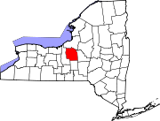
Towns Villages Baldwinsville | Camillus | East Syracuse | Elbridge | Fabius | Fayetteville | Jordan | Liverpool | Manlius | Marcellus | Minoa | North Syracuse | Skaneateles | Solvay | Tully
CDPs Brewerton‡ | Bridgeport‡ | Fairmount | Galeville | Lakeland | Lyncourt | Mattydale | Nedrow | Seneca Knolls | Village Green | Westvale
Other
hamletsAmber | Amboy | Apulia | Apulia Station | Borodino | Cardiff | Cedarvale | Clintonville | Collingwood | Delphi | Delphi Falls | Geddes | Hart Lot | Hinsdale | Howlett Hill | Indian Village | Jack's Reef | Jamesville | Long Branch | Marietta | Memphis | Messina Springs | Mottville | Mycenae | Navarino | Onondaga Hill | Oran | Otisco | Plainville | Pompey Center | Rose Hill | Shepard Settlement | Skaneateles Falls | South Onondaga | South Spafford | Southwood | Spafford Valley | Split Rock | State Fair Grounds | Taunton | Thorn Hill | Vesper | Warners | Watervale
Indian
reservationFootnotes ‡This populated place also has portions in an adjacent county or counties
Categories:- Neighborhoods in Syracuse, New York
- New York State Heritage Areas
- Populated places established in 1825
- Erie Canal
- Syracuse, New York
- Syracuse metropolitan area
- Underground Railroad locations
- County seats in New York
- Cities in New York
- Populated places in Onondaga County, New York
- Academic enclaves
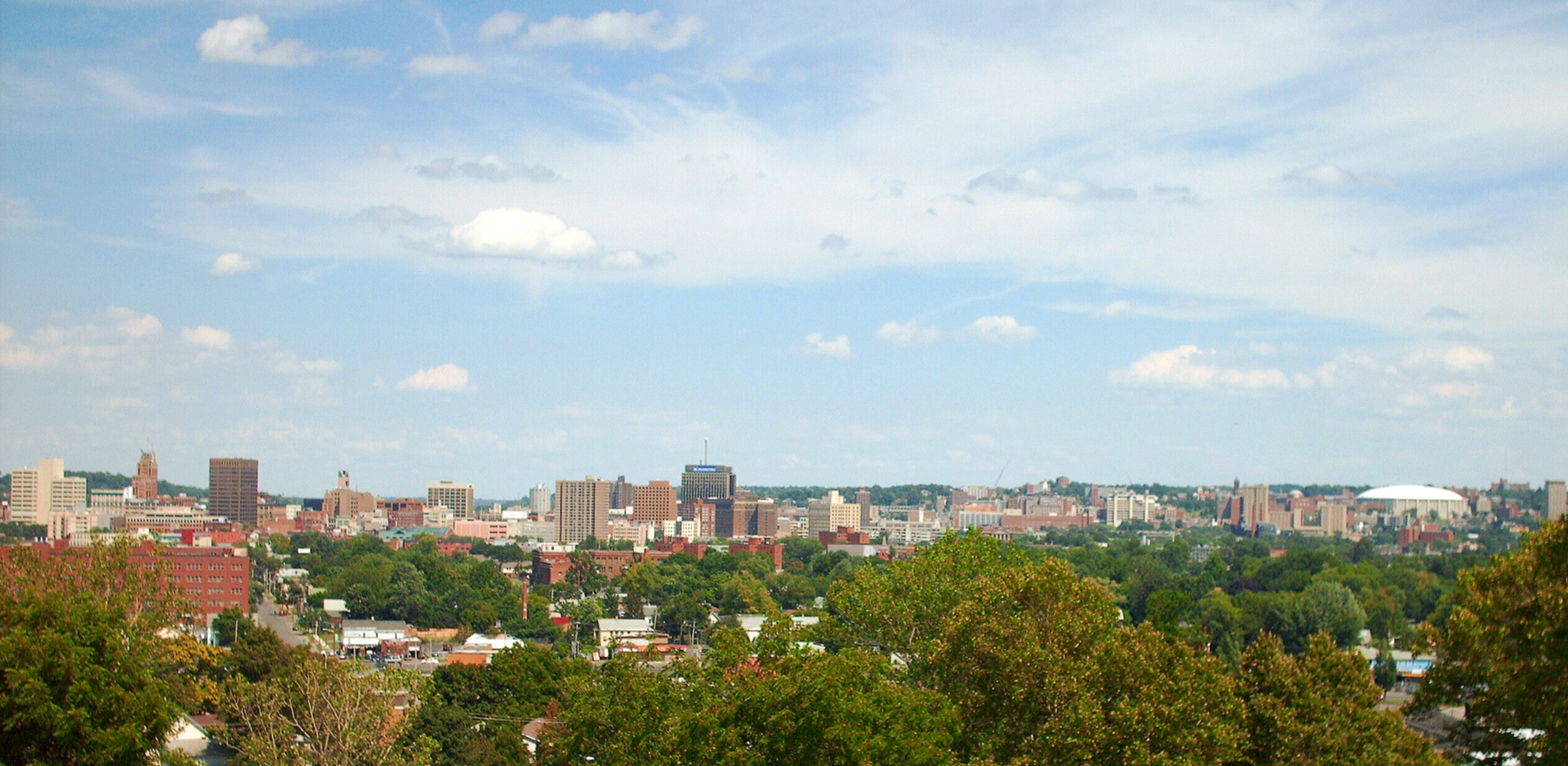

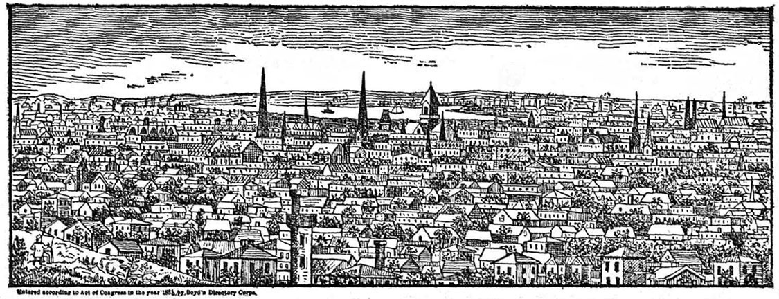
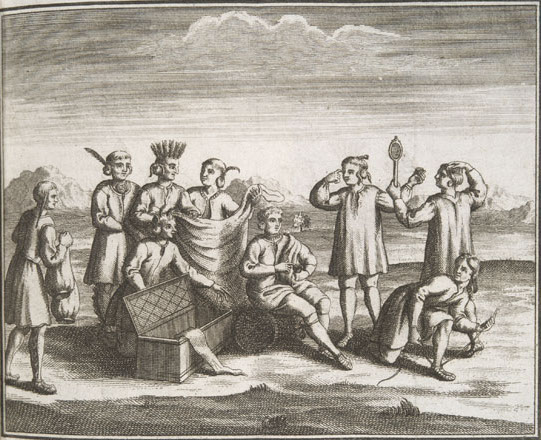
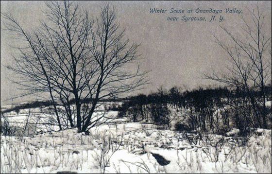
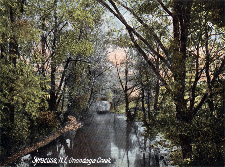


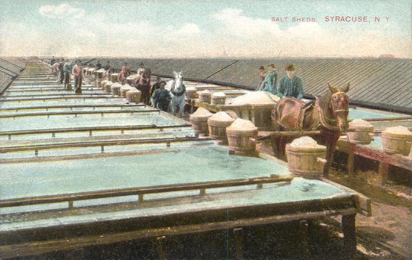
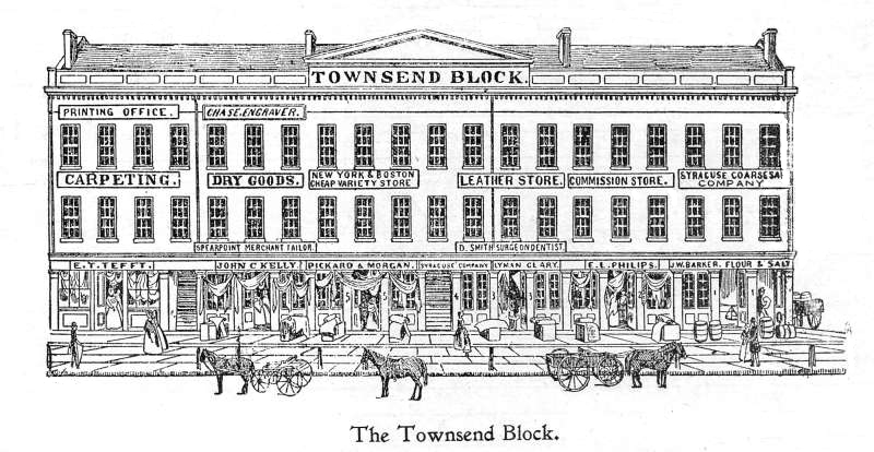
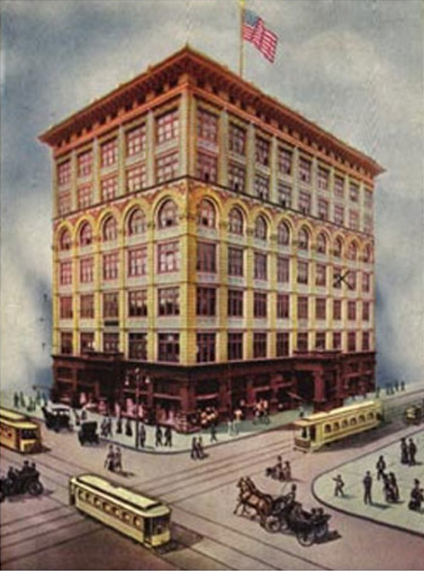


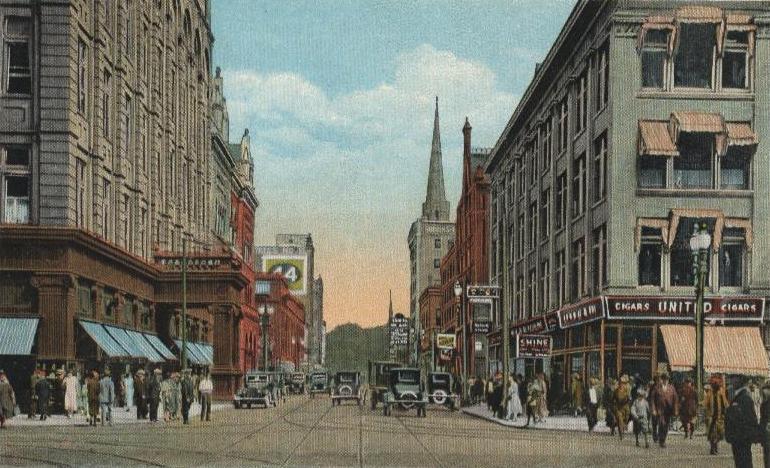

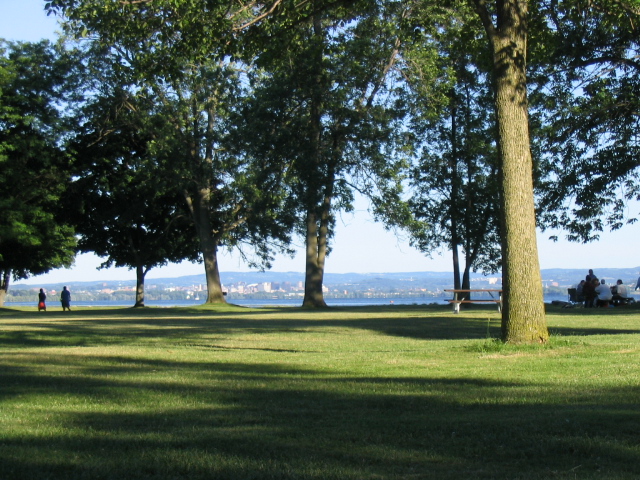
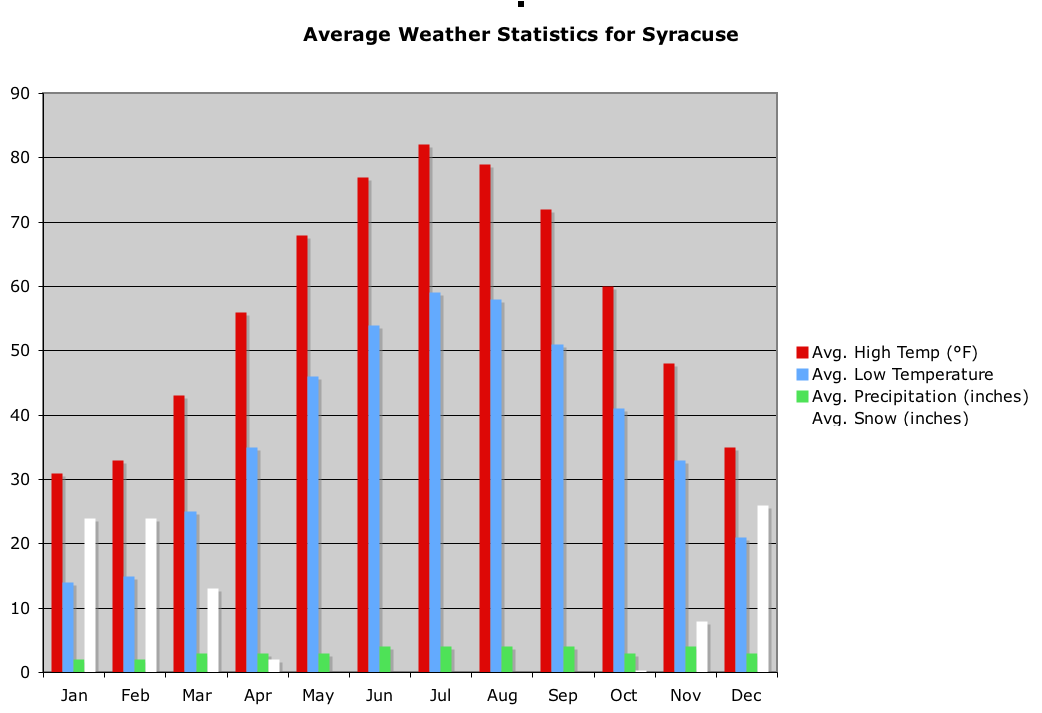
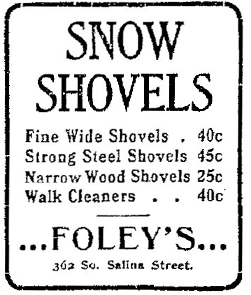

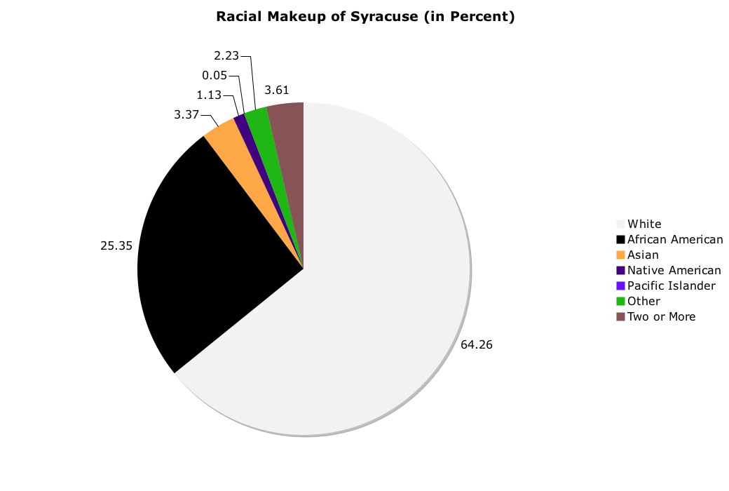

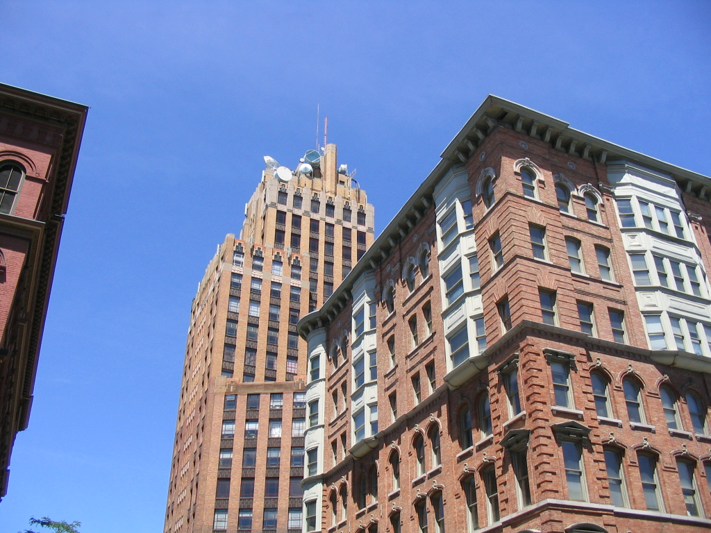
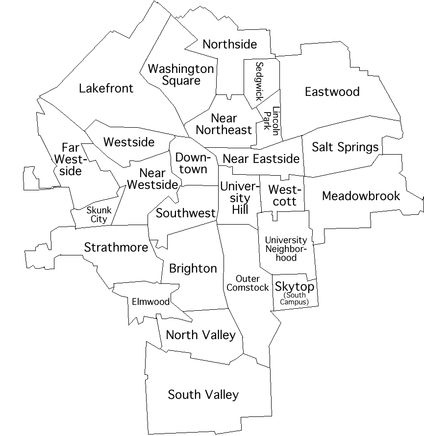
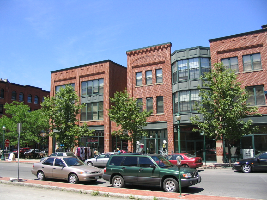

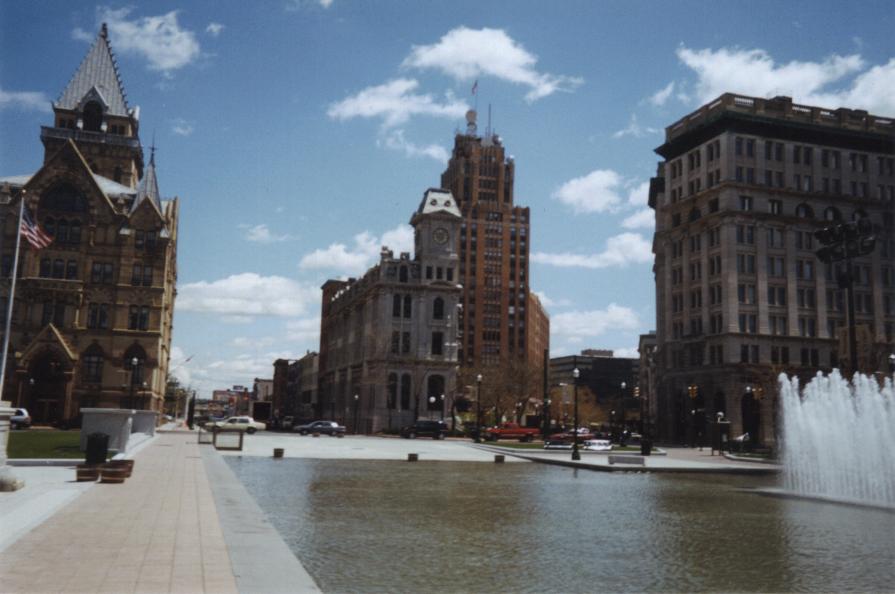
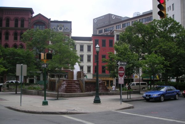

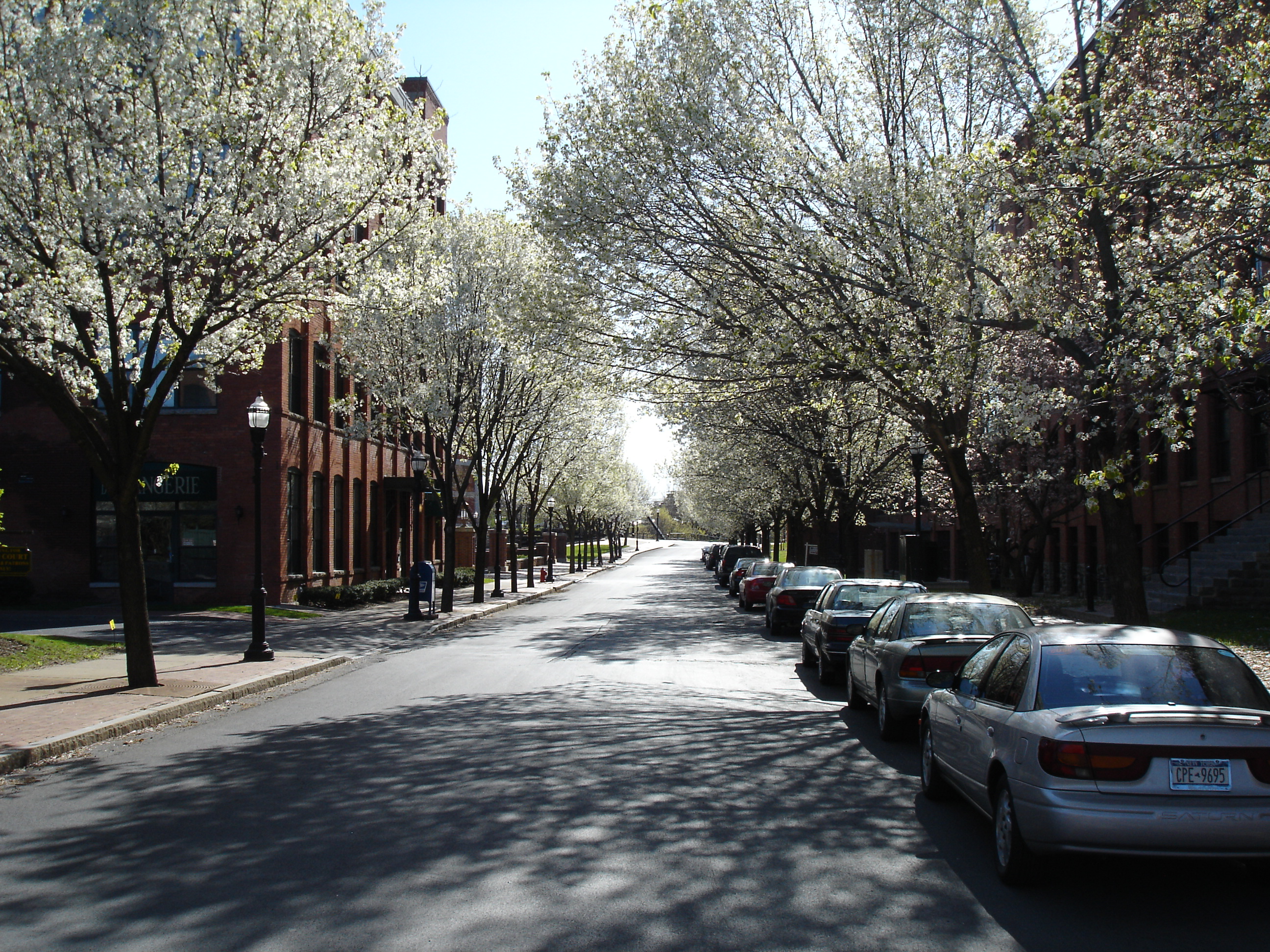
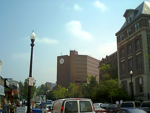

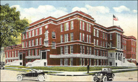


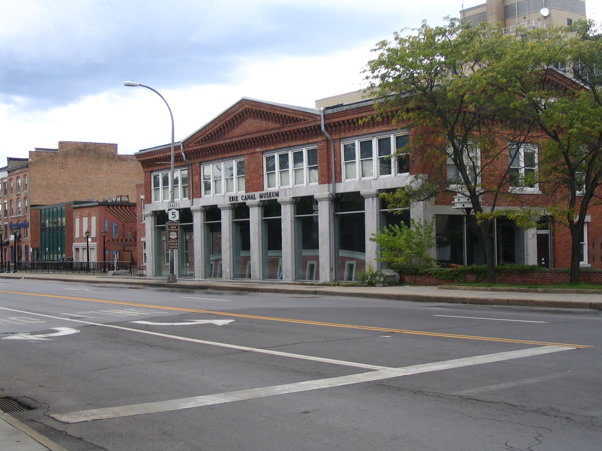
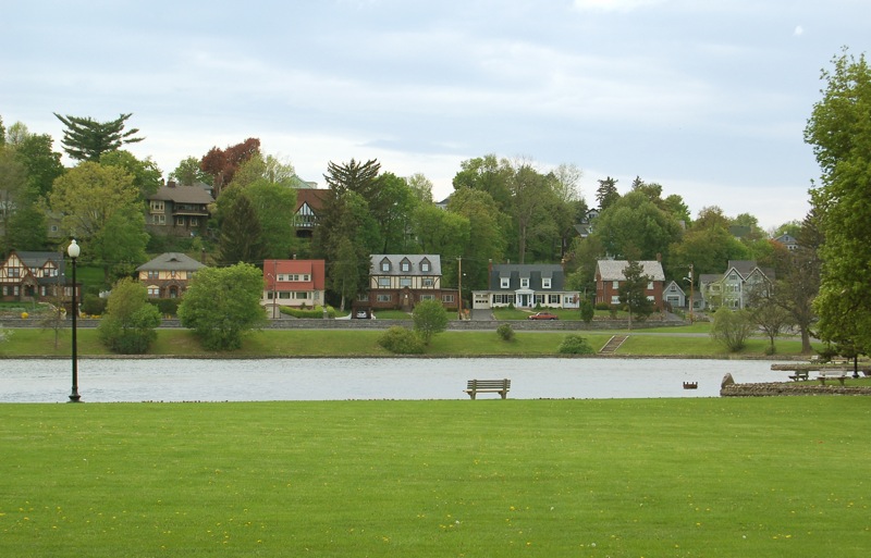
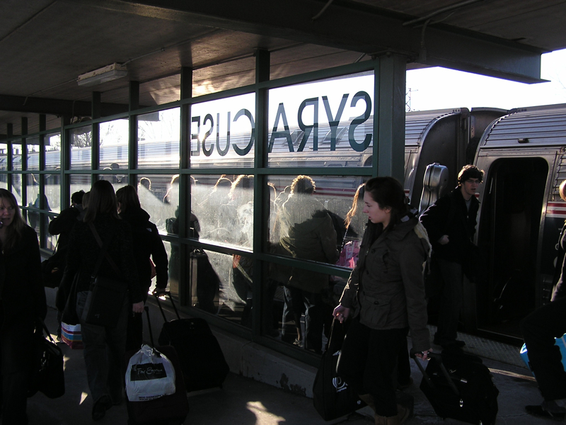
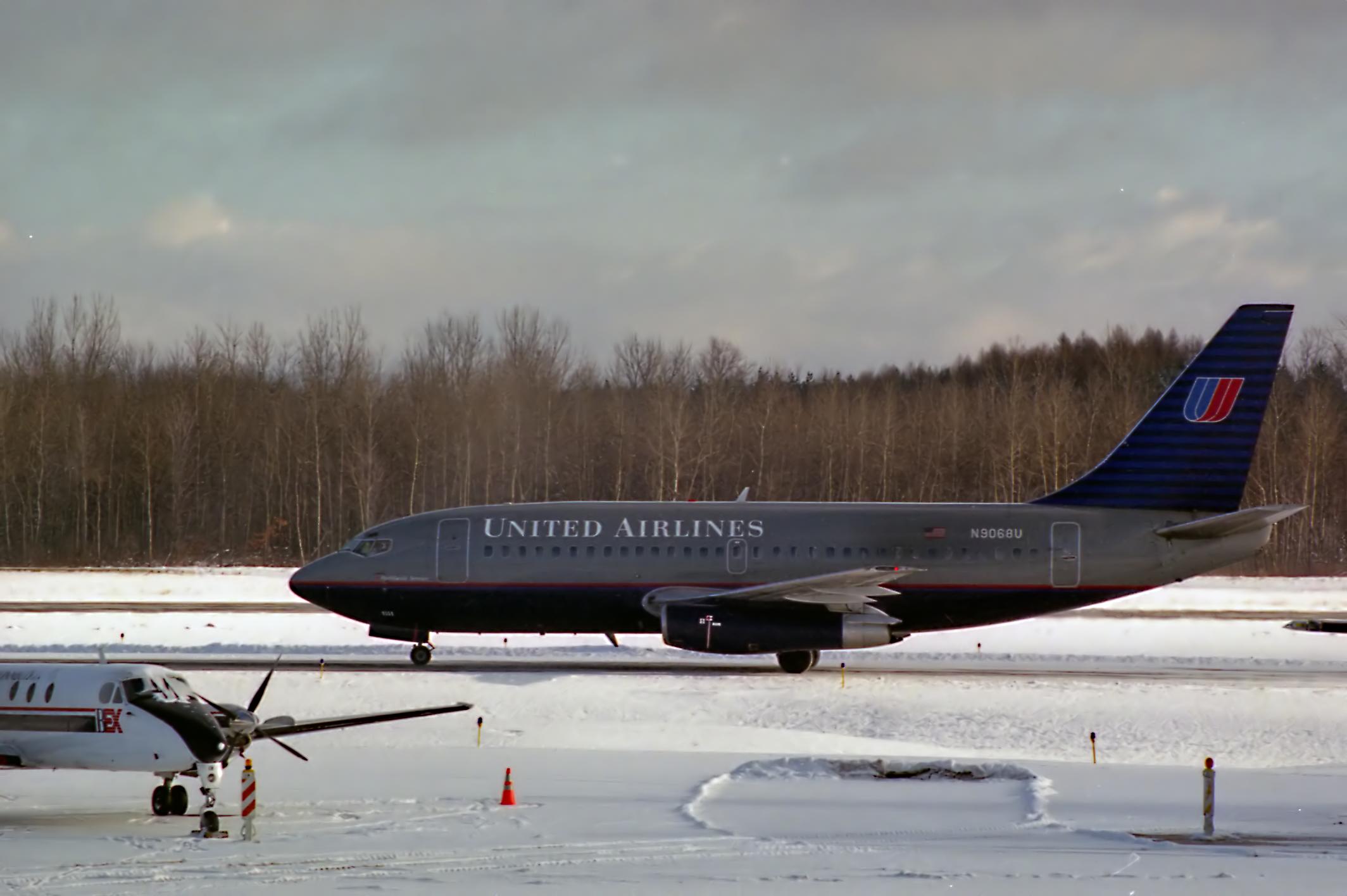
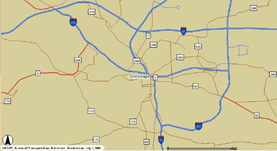


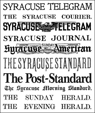


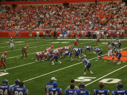


Wikimedia Foundation. 2010.