- Corning (city), New York
-
This article is about the city. For the adjacent town, see Corning (town), New York.
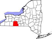
Corning — City — Location within the state of New York
 Corning
Coordinates: 42°8′53″N 77°3′25″W / 42.14806°N 77.05694°WCoordinates: 42°8′53″N 77°3′25″W / 42.14806°N 77.05694°W Country United States State New York County Steuben Government - Type Council-Manager - Mayor Richard P. Negri (R) - City Manager Mark L. Ryckman - City Council Members' ListArea - Total 3.3 sq mi (8.5 km2) - Land 3.1 sq mi (8.0 km2) - Water 0.2 sq mi (0.4 km2) Elevation 932 ft (284 m) Population (2010) - Total 11,183 - Density 3,489.5/sq mi (1,347.3/km2) Time zone Eastern (EST) (UTC-5) - Summer (DST) EDT (UTC-4) ZIP codes 14830-14831 Area code(s) 607 FIPS code 36-18256 GNIS feature ID 0947476 Corning is a city in Steuben County, New York, United States, on the Chemung River. The population was 10,842 at the 2000 census. It is named for Erastus Corning, an Albany financier and railroad executive who was an investor in the company that developed the community.
Contents
Overview
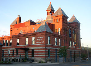 Rockwell Museum of Western Art.
The city of Corning is at the western edge of the town of Corning and in the southeast part of Steuben County.
The city is the headquarters of Fortune 500 company Corning Incorporated, formerly Corning Glass Works, a manufacturer of glass and ceramic products for industrial, scientific and technical uses.
It is also home to the Corning Museum of Glass, which houses one of the world's most comprehensive collections of glass objects from antiquity to the present. The museum houses the Rakow Library, one of the world's major glass research centers.
The city's other major cultural attraction is the Rockwell Museum of Western Art. It contains an important collection of Western American painting and sculpture assembled over the past 40 years by Robert F. and Hertha Rockwell.
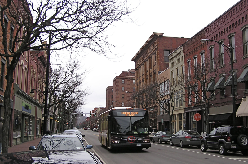
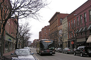 Market Street in Corning's Gaffer District.
The city has been cited several times by American Style magazine as one of the top twenty-five small city arts destinations in the U.S. – most recently in June 2010.[1] Many of the cultural events and historic landmarks in the city are in Corning's Gaffer District.
Corning Country Club annually hosted the Corning Classic, a stop on the Ladies Professional Golf Association tour, from 1979 to 2009. The city has commercial air service available at Elmira/Corning Regional Airport in the nearby town of Big Flats.
It is also home to the 2006 New York State Class A Football Champions.[2]
In 2003 Charles R. Mitchell and Kirk W. House produced Corning, a historic photo book in Arcadia Publishing's "Images of America" series. Photos were drawn from the archives of the Corning-Painted Post Historical Society.
History
The first settlement in the town of Corning was made near the site of the future city in 1796. The community was set apart from the town as a village in 1848. Corning was incorporated as a city in 1890. As the glass industry developed, Corning became known as the "Crystal City."
The Corning area's first real industry was lumber. The first settlers used the area's river systems to transport logs and finished lumber in fleets downstream to buyers. This gave rise to large mills which helped to develop the area. Rafting of lumber began to wane as timber was depleted. At one time the mills of the Corning area were reputed to be among the biggest in the world. After the lumber was depleted the great mills moved north to new forests.
East, across the Chemung River from Corning, lies Gibson, the site of a feeder canal for the Chemung Canal system. Some of Corning's early prosperity came from the feeder canal system exposure. Canal cargoes from Corning included soft coal, timber, tobacco, grain, and whiskey. From April 22 to December 11, 1850, the canal season that year, the newspaper reported that 1,116 boats left the port of Corning. Tolls for the year totaled $54,060.39. Among items shipped were 46,572,400 pounds of coal. The canal's best peacetime year was 1854 when 270,978 tons of freight was hauled. The Civil War brought an abnormal amount of business, with a peak of 307,151 tons hauled in one year.[3]
After the Civil War, an industrial boom occurred in the region. Ingersoll Rand opened during this period in Painted Post, just north of Corning.
Corning became a railroad town in the 1880s, many smaller railroad lines busily weaving webs of tracks connecting the major trunk line to smaller communities. In 1912 a train wreck three miles east of Corning in Gibson left 39 dead.
Main article: Corning train wreck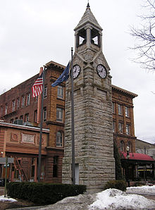 Corning Clock Tower at Market and Pine Streets in downtown Corning.
Geography
Corning is located at 42°8′53″N 77°3′25″W / 42.14806°N 77.05694°W (42.148142, -77.05697)[4].
According to the United States Census Bureau, the city has a total area of 3.3 square miles (8.5 km²), of which, 3.1 square miles (8.1 km²) of it is land and 0.2 square miles (0.4 km²) of it (5.18%) is water.
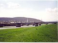
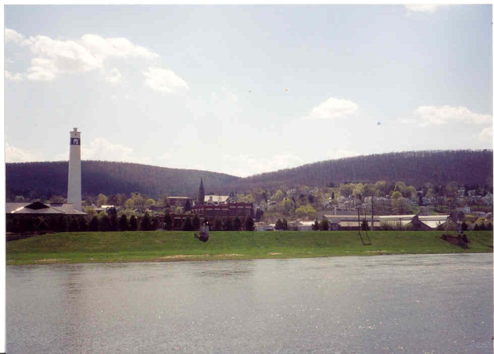
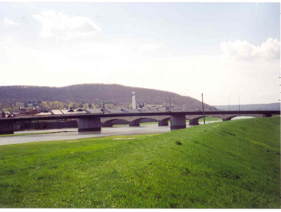
Just upstream from Corning, the Cohocton River and the Tioga River merge to form the Chemung River which flows through downtown. The river was an important source of power in the early history, and is part of the attractiveness of the region today. The river is prone to floods, as rain water runs off quickly from the steep hillsides of the area, the worst recent flood being in 1972, as the remnants of Hurricane Agnes dropped fifteen or more inches of rain in the area within a short time. The entire downtown area was flooded, with severe damage. Downtown has been refurbished and has become somewhat gentrified.
Flooding is now controlled by a system of dams upstream from Corning.
Interstate 86 (the Southern Tier Expressway), New York State Route 17, New York State Route 352, New York State Route 414, and New York State Route 415 are major highways connecting in Corning. County Road 40 leads into the city from the south and County Road 41 from the north. U.S. Route 15 proceeds southward from Painted Post, west of Corning.
Demographics
As of the census[5] of 2000, there were 10,842 people, 4,996 households, and 2,667 families residing in the city. The population density was 3,489.5 people per square mile (1,346.0/km²). There were 5,509 housing units at an average density of 1,773.1 per square mile (683.9/km²). The racial makeup of the city was 93.94% White, 2.84% Black or African American, 0.34% Native American, 1.49% Asian, 0.01% Pacific Islander, 0.24% from other races, and 1.13% from two or more races. Hispanic or Latino of any race were 0.79% of the population.
There were 4,996 households out of which 26.2% had children under the age of 18 living with them, 37.6% were married couples living together, 12.3% had a female householder with no husband present, and 46.6% were non-families. 40.1% of all households were made up of individuals and 15.5% had someone living alone who was 65 years of age or older. The average household size was 2.14 and the average family size was 2.89.
In the city the population was spread out with 23.3% under the age of 18, 8.6% from 18 to 24, 29.2% from 25 to 44, 21.1% from 45 to 64, and 17.8% who were 65 years of age or older. The median age was 38 years. For every 100 females there were 87.5 males. For every 100 females age 18 and over, there were 83.5 males.
The median income for a household in the city was $32,780, and the median income for a family was $46,674. Males had a median income of $39,805 versus $27,489 for females. The per capita income for the city was $22,056. About 9.1% of families and 13.0% of the population were below the poverty line, including 18.4% of those under age 18 and 3.8% of those age 65 or over.
Historical populations Census Pop. %± 1870 4,018 — 1880 4,802 19.5% 1890 8,590 78.9% 1900 11,061 28.8% 1910 13,730 24.1% 1920 15,820 15.2% 1930 15,777 −0.3% 1940 16,212 2.8% 1950 17,684 9.1% 1960 17,085 −3.4% 1970 15,792 −7.6% 1980 12,953 −18.0% 1990 11,938 −7.8% 2000 10,842 −9.2% 2010 11,183 3.1% Sources: 1790–1950,[6]
1960–1980,[7] 1990–2000[5]Politics
Most local officials are Republicans. The Corning area typically votes Republican, though some outsiders have deemed its constituents "moderate" Republicans.[citation needed] Amo Houghton, the area's long-serving U.S. congressman, was a moderate Republican.
Federal representatives
Corning is in New York's 29th congressional district, which is currently represented by Republican Tom Reed.
State representatives
Corning is in New York's 53rd Senate District, represented by Tom O'Mara, a Republican. Corning is in the 136th Assembly District, represented by Phil Palmesano, also a Republican.
City mayors
Republican Joseph Nasser served for many years as Corning's mayor, and the Nasser Civic Center, headquarters of city government, bears his name. In 2005 City Councilman Frank Coccho defeated incumbent Republican mayor Alan Lewis to become the first Democratic mayor since 1953. On November 6, 2007, Tom Reed, the head of the city's Republican Party, was elected to replace Coccho. [1] [2] Tom Reed completed his two-year term on December 31, 2009. Richard Negri was elected in November 2009 and took office January 1, 2010. Negri's term expires Dec. 31, 2011.
Government
Since 1995, the city of Corning operates under the Council-Manager form of government, with the City Manager serving as the Chief Executive Officer. The first City Manager was Suzanne Kennedy who served until July 1997. In July 1997, Mark L. Ryckman was appointed as the city's second City Manager. The city council consists of eight members. One member is elected from each of the eight wards.
Education
The Corning-Painted Post (CPP) School District currently has one early education center, six public elementary schools, two public middle schools, and two public high schools located in the greater Corning area.
In 2010 a referendum was passed that will reconfigure the school district's secondary schools; both middle schools will combine and move into the current West High School building while both of the high schools combine and move into the current East High School. This reconfiguration / building project is expected to be finished by the 2014-2015 school year.
Public early education center:
- Frank Pierce Early Childhood Center
Public elementary schools include:
- Hugh W. Gregg
- Winfield Street
- William E. Severn
- Calvin U. Smith
- Erwin Valley
- Frederick Carder
Public middle schools include:
- Corning Free Academy (CFA)
- Northside Blodgett
Public high schools include:
- East High School
- West High School
- High School Learning Center (HSLC)
Private schools in Corning include:
- The Alternative School for Math and Science (ASMS)
- All Saints Academy (a K-8 Catholic school)
Corning Community College (CCC) is also located in Corning.
Social
Recently, the Corning Area School District has implemented the International Baccalaureate Middle Years Program (grades 6-10) and the International Baccalaureate Diploma Program (grades 11-12). The Corning middle and high schools were authorized as "IB World Schools" in February 2005.
Places of interest
- Chimney Rocks – A group of tall rock formations that stood east of Corning. The rocks are no longer there but were so named because they were tall and narrow like chimneys.
- Bloody Run – An area near Gorton Creek, it was the site of a battle between forces of American generals John Sullivan and James Clinton and Native American villagers. This battle was part of a campaign directly ordered by George Washington to break the control of the Iroquois Indians in the area. It was called Bloody Run for the reports of bloody creek water coming from the battle scene.
- Horace D. Page Tunnel – A tunnel connecting the two divided areas of Denison Park, located on the city's South side. It was named after Page, who lost the naming rights to Elmira's Millers (formerly Page's) Pond in a 1912 horse racing bet at Tioga Downs, and was given naming rights to the tunnel as compensation.
The flood of 1972
The flood of 1972 was a major event for the area. On June 22, 1972, the storm that had been Hurricane Agnes struck the Southern Tier of New York. The storm combined with a storm system from Ohio to drop six to eight inches (203 mm) of rain in the Chemung River basin. This ultimately overwhelmed the flood control systems of the time, and the Chemung River broke through the dam system on Friday, June 23 at 4:00 a.m. By 9:00 a.m. the river crested and began to recede. In the Corning area, eighteen people were killed and untold millions of dollars of damage was incurred. An example of these expenses took place in the town of Bath, NY, where a local woman, Lila Marano cooked nearly 100 pizzas out of her home kitchen to accommodate students at the Haverling High School graduation reception. The river receded within hours, leaving mud which can still be found in basements of homes and businesses in Corning, and there is a section of the Corning Museum of Glass that indicates on the wall how high the flood waters rose.
Gallery
-
Corning's Gaffer Tower
-

Corning
-
Corning
Notable people
- Parag. A. Pathak (1980- ), MIT Associate Professor of Economics [3]
- Rick Bonnell, NBA writer for the Charlotte Observer
- Thomas S. Buechner (1926–2010), founding director of the Corning Museum of Glass
- Frederick Carder, glass artist
- Duane Eddy, guitarist
- Edd Hall, actor
- Mark F Hill, producer/director
- Katharine Houghton Hepburn (1878–1951), social activist, mother of Katharine Hepburn
- Alanson B. Houghton, congressman of New York
- Amory Houghton, United States ambassador
- Amory "Amo" Houghton Jr., politician
- James R. Houghton, chairman of Corning Incorporated
- William T. Kane, physicist
- Harvey Littleton, glass artist
- Jesse Littleton, Jr., developer of Pyrex
- Eric Massa, former US Congressman
- John McPherson, cartoonist of Close to Home
- Tom Reed, US Congressman
- Margaret Higgins Sanger (1879–1966), founder of the American Birth Control League
- Christie Wolf, champion female bodybuilder and former professional wrestler best known for her stint in World Championship Wrestling[8]
- John Tillman, Head Lacrosse Coach University of Maryland
- Ryan McWilson,former TIME magazine editor
- Shawn Burchard,olympic gold medalist snowborder
- Dylan Wolfe,former 6 time super bowl champion, leading the Pittsburgh Steelers to the best six super bowls of their career, also known for the quarterback for gold division A years 2009-11.
Sister cities
Corning has two sister cities, as designated by Sister Cities International:
 Lviv, Ukraine
 Kakegawa, Shizuoka, Japan (formerly Osuka which was annexed by Kakegawa)
 San Giovanni Valdarno, Italy
See also
References
- ^ American Style Magazine
- ^ http://www.section4football.com/
- ^ Corning, New York - The Crystal City - CorningNY.com
- ^ "US Gazetteer files: 2010, 2000, and 1990". United States Census Bureau. 2011-02-12. http://www.census.gov/geo/www/gazetteer/gazette.html. Retrieved 2011-04-23.
- ^ a b "American FactFinder". United States Census Bureau. http://factfinder.census.gov. Retrieved 2008-01-31.
- ^ United States Census Bureau. 1950 Census of Population; Volume 1: Characteristics of the Population; 1950 [cited 2010-09-06]; p. 32-8 (64 in PDF file).
- ^ 1980 Census of Population; Volume 1: Characteristics of the Population. United States Census Bureau; 1980 [cited 2010-09-06]. p. 34-10.
- ^ "Christie Wolf at the Almanac of Women's Bodybuilding". http://www.getbig.com/almanac/women/women-w.htm.
- History of the Corning Painted Post Area, 200 years in Painted Post Country. Author Thomas P Dimitroff & Lois S Janes 1990
External links
- Corning and the Finger Lakes Region
- City of Corning
- Gaffer District
- Chamber of Commerce website
- Corning Museum of Glass
- Rockwell Museum
- Corning Country Club
- Corning Community College official website
Municipalities and communities of Steuben County, New York County seat: Bath Cities Corning | Hornell
Towns Addison | Avoca | Bath | Bradford | Cameron | Campbell | Canisteo | Caton | Cohocton | Corning | Erwin | Fremont | Greenwood | Hartsville | Hornby | Hornellsville | Howard | Jasper | Lindley | Prattsburgh | Pulteney | Rathbone | Thurston | Troupsburg | Tuscarora | Urbana | Wayland | Wayne | West Union | Wheeler | Woodhull
Villages Addison | Almond‡ | Arkport | Avoca | Bath | Canisteo | Cohocton | Hammondsport | North Hornell | Painted Post | Riverside | Savona | South Corning | Wayland
CDP Footnotes ‡This populated place also has portions in an adjacent county or counties
Categories:- Cities in New York
- Populated places established in 1796
- Populated places in Steuben County, New York


Wikimedia Foundation. 2010.