- Clinton County, New York
-
Clinton County, New York 
Seal
Location in the state of New York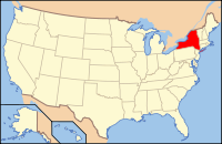
New York's location in the U.S.Founded 1788 Seat Plattsburgh Area
- Total
- Land
- Water
1,118 sq mi (2,896 km²)
1,039 sq mi (2,691 km²)
79 sq mi (205 km²), 7.04%Population
- (2010)
- Density
82,128
79/sq mi (30.5/km²)Website www.clintoncountygov.com Clinton County is a county located in the U.S. state of New York. As of the 2010 census, the population was 82,128. Its name is in honor of the first Governor of New York as a state, George Clinton. Its county seat is Plattsburgh.
Contents
History
When counties were established in New York State in 1683, the present Clinton County was part of Albany County. This was an enormous county, including the northern part of New York State as well as all of the present state of Vermont and, in theory, extending westward to the Pacific Ocean. This county was reduced in size on July 3, 1766, by the creation of Cumberland County, and further on March 16, 1770, by the creation of Gloucester County, both containing territory now in Vermont. On March 12, 1772, what was left of Albany County was split into three parts, one remaining under the name Albany County. One of the other pieces, Charlotte County, contained the eastern portion.
In 1784, the name "Charlotte County" was changed to Washington County to honor George Washington, the American Revolutionary War general and later President of the United States of America.
In 1788, Clinton County was split off from Washington County. This was a much larger area than the present Clinton County, including several other counties or county parts of the present New York State.
In 1799, Essex County was split off from Clinton County.
In 1802, parts of Clinton, Herkimer, and Montgomery counties were taken to form the new St. Lawrence County.
In 1808, Franklin County was split off from Clinton County.
Government and politics
Clinton County is considered a blue county. It is frequently won by Democratic candidates in both national and statewide election. In the 2008 U.S. Presidential election, Barack Obama carried the county by a 22.9% margin over John McCain (Obama won the county's every municipality), with Obama winning by a 26.9% margin over McCain statewide.[1] In 2006 both Eliot Spitzer and Hillary Clinton carried it winning 63 and 64 percent of vote. In 2010 Andrew Cuomo, and Senators Chuck Schumer and Kirsten Gillibrand carried the county with over 60 percent of the vote. However, local races are most often won by Republican candidates. For example, the region had never sent a Democrat to Congress until 2009, and has not sent a Democrat to Albany as a Senator or Assemblyperson since the 1960s.
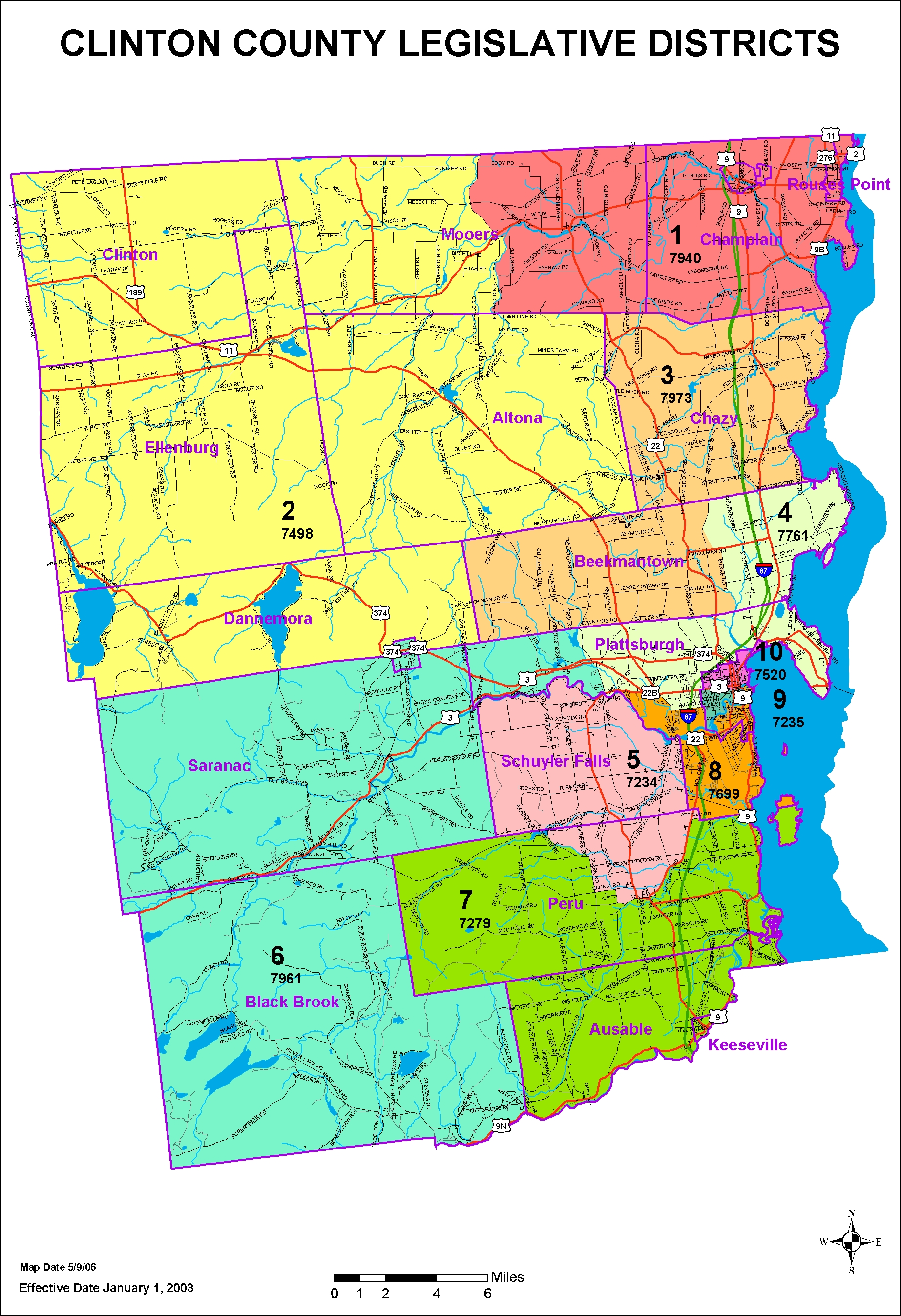
The Clinton County Legislature is the lawmaking body of the county. It consists of 10 members each elected from individual districts. Legislative District Maps The legislature currently consists of 7 Republicans and 3 Democrats. Clinton County does not have a county executive. (Clinton County does have a County Executive, Michael Zurlo is the County Adminstrator and runs the day to day operations of the County.)
Clinton County Legislature
- 01 - Harry McManus (D)
- 02 - Samuel Trombley (R), Majority Leader
- 03 - E. Tom Sears (R)
- 04 - Sara Rowden (D)
- 05 - Keith Defayette (R)
- 06 - Robert W. Butler (R), Deputy Chairman
- 07 - James Langley, Jr. (R), Chairman
- 08 - Jacqueline Walker (R)
- 09 - John W. Gallagher (D), Minority Leader
- 10 - Robert Heins (R)
Geography
Clinton County is in the northeastern part of New York State, just west of Vermont and south of the Canadian province of Quebec. The eastern boundary of Clinton County is Lake Champlain, which serves as the New York-Vermont border. The Ausable River forms a large part of the south county line.
According to the U.S. Census Bureau, the county has a total area of 1,118 square miles (2,895.6 km2), of which 1,039 square miles (2,691.0 km2) is land and 79 square miles (204.6 km2) (7.04%) is water.
The southwest part of the county is in the Adirondack Park.
Adjacent counties
- Grand Isle County, Vermont - east
- Chittenden County, Vermont - southeast
- Essex County, New York - south
- Franklin County, New York - west
- Le Haut-Richelieu Regional County Municipality, Quebec - north
- Le Haut-Saint-Laurent Regional County Municipality, Quebec - north
- Les Jardins-de-Napierville Regional County Municipality, Quebec - north
Demographics
Historical populations Census Pop. %± 1790 1,615 — 1800 8,514 427.2% 1810 8,002 −6.0% 1820 12,070 50.8% 1830 19,344 60.3% 1840 28,157 45.6% 1850 40,047 42.2% 1860 45,735 14.2% 1870 47,947 4.8% 1880 50,897 6.2% 1890 46,437 −8.8% 1900 47,430 2.1% 1910 48,230 1.7% 1920 43,898 −9.0% 1930 46,687 6.4% 1940 54,006 15.7% 1950 53,622 −0.7% 1960 72,722 35.6% 1970 72,934 0.3% 1980 80,750 10.7% 1990 85,969 6.5% 2000 79,894 −7.1% 2010 82,128 2.8% Source[2] As of the census[3] of 2000, there were 79,894 people, 29,423 households, and 19,272 families residing in the county. The population density was 77 people per square mile (30/km²). There were 33,091 housing units at an average density of 32 per square mile (12/km²). The racial makeup of the county was 93.33% White, 3.58% Black or African American, 0.36% Native American, 0.67% Asian, 0.02% Pacific Islander, 1.10% from other races, and 0.93% from two or more races. 2.46% of the population were Hispanic or Latino of any race. 23.7% were of French, 15.0% French Canadian, 12.5% American, 11.8% Irish, 7.6% English and 5.5% German ancestry according to Census 2000. 94.1% spoke English, 2.8% French and 1.7% Spanish as their first language.
There were 29,423 households out of which 32.00% had children under the age of 18 living with them, 51.00% were married couples living together, 10.20% had a female householder with no husband present, and 34.50% were non-families. 26.30% of all households were made up of individuals and 10.00% had someone living alone who was 65 years of age or older. The average household size was 2.47 and the average family size was 2.98.
In the county the population was spread out with 23.00% under the age of 18, 12.40% from 18 to 24, 30.60% from 25 to 44, 22.10% from 45 to 64, and 11.90% who were 65 years of age or older. The median age was 36 years. For every 100 females there were 104.90 males. For every 100 females age 18 and over, there were 104.60 males.
The median income for a household in the county was $37,028, and the median income for a family was $45,732. Males had a median income of $33,788 versus $25,520 for females. The per capita income for the county was $17,946. About 9.40% of families and 13.90% of the population were below the poverty line, including 15.30% of those under age 18 and 11.40% of those age 65 or over.
Cities, towns, villages, and other locations
The following table shows the 14 Clinton County towns and one city, and the villages, hamlets and census designated places within each of those towns.
Towns Cities Villages Hamlets and CDPs Altona (2,877) Altona Au Sable (3,146) Keeseville Beekmantown (5,545) Black Brook (1,497) Au Sable Forks Champlain (5,754) Champlain,
Rouses PointChazy (4,284) Clinton (737) Churubusco Dannemora (4,898) Dannemora Lyon Mountain Ellenburg (1,743) Mooers (3,592) Mooers Peru (6,998) Peru Plattsburgh (11,870)  Cumberland Head,**
Morrisonville,
Parc,
Plattsburgh West
Cliff HavenPlattsburgh* (19,989) Saranac (4,007) Redford Schuyler Falls (5,181) Morrisonville *The City of Plattsburgh is surrounded by the Town of Plattsburgh, but is not part of it.
** While some residents of Cumberland Head wish to form their own municipality, Cumberland Head remains a part of the Town of Plattsburgh, not its own Town or Village.Clinton County Information
- The State University of New York at Plattsburgh is located in the city of Plattsburgh.
- Clinton Correctional Facility, a maximum-security prison is location in the village of Dannemora.
Adjacent counties and locations
The northern boundary of Clinton County is shared with the Regional County Municipalities of Les Jardins-de-Napierville and Le Haut-Richelieu within the province of Quebec in Canada. The western boundary abuts Franklin County, and the southern boundary is shared with Essex County. Clinton county and the state of Vermont share the eastern boundary along with Lake Champlain.
See also
- Lake Champlain
- Town of Plattsburgh
- City of Plattsburgh
- Cumberland Head
- Schuyler Falls
- SUNY Plattsburgh
- List of counties in New York
- National Register of Historic Places listings in Clinton County, New York
References
- ^ http://www.uselectionatlas.org/RESULTS/ U.S. Election Atlas
- ^ New York State Department of Economic Development
- ^ "American FactFinder". United States Census Bureau. http://factfinder.census.gov. Retrieved 2008-01-31.
External links
- Clinton County, NY webpage
- Clinton County at the Open Directory Project
- Gazetter of Clinton County towns.
- Traffic Courts in Clinton County
- Summary early history of Clinton County and its towns
- Clinton County Historical Association Museum
Municipalities and communities of Clinton County, New York County seat: Plattsburgh City 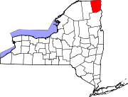
Towns Altona | Au Sable | Beekmantown | Black Brook | Champlain | Chazy | Clinton | Dannemora | Ellenburg | Mooers | Peru | Plattsburgh | Saranac | Schuyler Falls
Villages Champlain | Dannemora | Keeseville‡ | Rouses Point
CDPs Altona | Au Sable Forks | Churubusco | Cumberland Head | Lyon Mountain | Mooers | Morrisonville | Parc | Peru | Plattsburgh West | Redford
Footnotes ‡This populated place also has portions in an adjacent county or counties
Categories:- New York counties
- Clinton County, New York
- 1788 establishments


Wikimedia Foundation. 2010.