- Rensselaer County, New York
Infobox U.S. County
county = Rensselaer County
state = New York
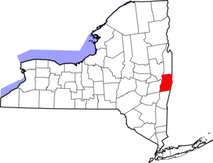
map size = 250
founded = 1791
seat = Troy | area_total_sq_mi =665
area_land_sq_mi =654
area_water_sq_mi =11
area percentage = 1.72%
census yr = 2000
pop = 152538
density_km2 =90
web = www.rensco.com
|Rensselaer County is a
county in theU.S. state ofNew York . As of the 2000 census, the population was 152,538. Its name is in honor of the family ofKilliaen Van Rensselaer , the original Dutch owner of the land in the area. Itscounty seat is Troy. It is part of the Albany-Schenectady-TroyMetropolitan Statistical Area .History
The county was a part of
Rensselaerwyck , an immense land holding purchased byKiliaen van Rensselaer from the Mohawk andMohican Indians, starting in 1630."For the history of Rensselaer County prior to 1791, see Albany County,
New York In 1791, Rensselaer County (as well as Saratoga County) was split off from Albany County.
Geography
Rensselaer County is in the eastern part of New York State. The eastern boundary of Rensselaer County runs along the
New York -Vermont andNew York -Massachusetts borders.According to the U.S. Census Bureau, the county has a total area of 665
square mile s (1,723km² ), of which, 654 square miles (1,694 km²) of it is land and 11 square miles (30 km²) of it (1.72%) is water.The terrain runs from level and flat near the Hudson and then rises into the
Rensselaer Plateau around Poestenkill and Sand Lake, then to theTaconic Mountains along the Massachusetts state line.The highest point is Berlin Mountain, convert|2818|ft|m|0) above sea level, in the town of Berlin. The lowest point is sea level at the Hudson.
The
Hoosic River , a tributary of theHudson River , is in the north part of the county.Adjacent counties
*Washington County,
New York - north
*Bennington County,Vermont - northeast
*Berkshire County,Massachusetts - southeast
*Columbia County,New York - south
*Greene County,New York - southwest
*Albany County,New York - west
*Saratoga County,New York - northwestDemographics
As of the
census GR|2 of 2000, there were 152,538 people, 59,894 households, and 39,050 families residing in the county. Thepopulation density was 233 people per square mile (90/km²). There were 66,120 housing units at an average density of 101 per square mile (39/km²). The racial makeup of the county was 91.13% White, 4.69% Black or African American, 0.23% Native American, 1.71% Asian, 0.02% Pacific Islander, 0.89% from other races, and 1.34% from two or more races. 2.11% of the population were Hispanic or Latino of any race. 22.3% were of Irish, 14.7% Italian, 12.8% German, 7.5% English, 6.2% French and 5.3% American ancestry according toCensus 2000 . 93.4% spoke English and 2.0% Spanish as their first language.There were 59,894 households out of which 31.30% had children under the age of 18 living with them, 48.80% were married couples living together, 12.00% had a female householder with no husband present, and 34.80% were non-families. 27.90% of all households were made up of individuals and 10.30% had someone living alone who was 65 years of age or older. The average household size was 2.46 and the average family size was 3.02.
In the county the population was spread out with 24.20% under the age of 18, 10.10% from 18 to 24, 29.10% from 25 to 44, 23.00% from 45 to 64, and 13.60% who were 65 years of age or older. The median age was 37 years. For every 100 females there were 95.90 males. For every 100 females age 18 and over, there were 93.70 males.
The median income for a household in the county was $42,905, and the median income for a family was $52,864. Males had a median income of $36,666 versus $28,153 for females. The
per capita income for the county was $21,095. About 6.70% of families and 9.50% of the population were below thepoverty line , including 11.90% of those under age 18 and 6.60% of those age 65 or over.Government and Politcs
Beginning in 1791 Rensselaer County was governed by a Board of Supervisors, which acted as the Legislature, with the chairman of the board serving as a de-facto Executive. In 1970, the Rensselaer County Legislature was created, which elected Edward J. "Ned" Quinn as Chairman. The Chairman served as the equivalent to an executive until the office of
County Executive was created in 1972. Since its creation, Democrats have never won the office, although they controlled the Legislature until 1994. One notable candidate for Executive wasEdward Pattison who was later elected to Congress, and whose son Mark served two terms as Mayor of Troy. The current county executive isKathleen M. Jimino . She is one of only four female county executives in New York State. Legislative authority is vested in the County Legislature, which consists of 19 members representing 16 different communities, separated into six districts. The current composition of the Legislature is as follows (13 Republicans and 6 Democrats):District 1,
Troy : Neil J. Kelleher, Chairman (R) Robert Mirch, Majority Leader (C) Laura Bauer (R) James Brearton (R) Peter Grimm (D) Nancy McHugh (R)District 2,
North Greenbush ,East Greenbush , andPoestenkill : Ginny O'Brien, Minority Leader (D) Keith Hammond, Deputy Minority Leader (D) W. Kenneth Harrington (D) Brian Zweig (D)District 3, Brunswick,
Schaghticoke , and Pittstown: Thomas Walsh, Vice Chairman (R) Ken Salisbury, Vice Chairman/Finance (R) Kenneth Harrington (R)District 4,
Schodack , Sand Lake, and Nassau: Flora Fasoldt (D) Martin Reid (R) Alex Shannon (R) [ [http://blogs.timesunion.com/localpolitics/?p=851 Albany Politics blog - Capital Region - Rensselaer - Saratoga - Schenectady - Albany County - NY - timesunion.com - Local politics » New legislator seated ] ]District 5,
Hoosick ,Berlin ,Stephentown , &Petersburgh : Stanley Brownell (R) Lester Goodermote (R)District 6,
Rensselaer : Mike Stammel (R)Cities, towns, villages, and other locations
*Averill Park
*Berlin (town)
*Brunswick (town)
*Castleton-on-Hudson (village)
*East Greenbush (town)
*East Nassau (village)
*Grafton (town)
*Hampton Manor
*Hoosick Falls (village)
*Hoosick (town)
*Nassau (town)
*Nassau (village)
*North Greenbush (town)
*Petersburgh (town)
*Pittstown (town)
*Poestenkill (town)
*Rensselaer (city)
*Sand Lake (town)
*Schaghticoke (town)
*Schaghticoke (village)
*Schodack (town)
*Stephentown (town)
*Troy (city)
*Valley Falls (village)
*West Sand Lake
*Wynantskill: "=> label in parentheses is official designation".North: Washington County West: Hudson River
Saratoga and
Albany CountiesRensselaer County East: Bennington County, Vermont and
Berkshire County,Massachusetts South: Columbia County ee also
References
External links
* [http://www.rensco.com Rensselaer County, NY]
*
Wikimedia Foundation. 2010.