- Morrisville, New York
-
Morrisville, New York — Village — Location within the state of New York
 Morrisville, New York
Coordinates: 42°53′55″N 75°38′52″W / 42.89861°N 75.64778°WCoordinates: 42°53′55″N 75°38′52″W / 42.89861°N 75.64778°W Country United States State New York County Madison Area – Total 1.2 sq mi (3.0 km2) – Land 1.2 sq mi (3.0 km2) – Water 0.0 sq mi (0.0 km2) Elevation 1,348 ft (411 m) Population (2000) – Total 2,148 – Density 1,863.4/sq mi (719.5/km2) Time zone Eastern (EST) (UTC-5) – Summer (DST) EDT (UTC-4) ZIP code 13408 Area code(s) 315 FIPS code 36-48593 GNIS feature ID 0957706 Morrisville is a village in Madison County, New York, United States. The population was 2,148 at the 2000 census. The village is named after its founder, Thomas Morris.
The Village of Morrisville in the northwest part of the Town of Eaton on US Route 20.
Morrisville State College is located in the village.
Contents
History
The community was originally called "Morris Flats." It became the county seat in 1817 until it was moved to Wampsville.
Geography
Morrisville is located at 42°53′55″N 75°38′52″W / 42.89861°N 75.64778°W (42.898541, -75.647717)[1].
According to the United States Census Bureau, the village has a total area of 1.1 square miles (2.8 km2), all of it land.
Demographics
As of the census[2] of 2000, there were 2,148 people, 362 households, and 195 families residing in the village. The population density was 1,863.4 people per square mile (721.2/km²). There were 398 housing units at an average density of 345.3 per square mile (133.6/km²). The racial makeup of the village was 79.93% White, 14.20% African American, 0.74% Native American, 2.23% Asian, 0.93% from other races, and 1.96% from two or more races. Hispanic or Latino of any race were 4.24% of the population.
There were 362 households out of which 27.1% had children under the age of 18 living with them, 41.7% were married couples living together, 10.8% had a female householder with no husband present, and 45.9% were non-families. 32.0% of all households were made up of individuals and 10.5% had someone living alone who was 65 years of age or older. The average household size was 2.29 and the average family size was 2.92.
In the village the population was spread out with 9.0% under the age of 18, 60.8% from 18 to 24, 11.4% from 25 to 44, 8.3% from 45 to 64, and 10.6% who were 65 years of age or older. The median age was 20 years. For every 100 females there were 108.1 males. For every 100 females age 18 and over, there were 107.3 males.
The median income for a household in the village was $34,375, and the median income for a family was $50,536. Males had a median income of $29,028 versus $24,643 for females. The per capita income for the village was $8,983. About 9.0% of families and 19.7% of the population were below the poverty line, including 27.2% of those under age 18 and 0.8% of those age 65 or over.
Additional facts about the Village of Morrisville
This is the location of the Morrisville State College, which includes Morrisville fish hatchery, and the Morrisville Equestrian Center. Colgate University is 8 miles to the east and Syracuse University is 30 miles northwest.
In the 1980s cartoon series, The Real Ghostbusters, Morrisville was the hometown of Ray Stantz.
The current elected officials are: (July 2008) Michelle Forward, Mayor; Mark Whitney, Deputy Mayor; Mark Shepard, Margaret Brody and Pat Wilcox, Trustees
References
- ^ "US Gazetteer files: 2010, 2000, and 1990". United States Census Bureau. 2011-02-12. http://www.census.gov/geo/www/gazetteer/gazette.html. Retrieved 2011-04-23.
- ^ "American FactFinder". United States Census Bureau. http://factfinder.census.gov. Retrieved 2008-01-31.
External links
Municipalities and communities of Madison County, New York City 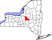
Towns Brookfield | Cazenovia | DeRuyter | Eaton | Fenner | Georgetown | Hamilton | Lebanon | Lenox | Lincoln | Madison | Nelson | Smithfield | Stockbridge | Sullivan
Villages Canastota | Cazenovia | Chittenango | DeRuyter | Earlville‡ | Hamilton | Madison | Morrisville | Munnsville | Wampsville
CDP Other
hamletsFootnotes ‡This populated place also has portions in an adjacent county or counties
Categories:- Villages in New York
- Syracuse metropolitan area
- Populated places in Madison County, New York


Wikimedia Foundation. 2010.