- Chittenango, New York
-
Chittenango, New York — Village — Location within the state of New York
 Chittenango, New York
Coordinates: 43°2′45″N 75°52′26″W / 43.04583°N 75.87389°WCoordinates: 43°2′45″N 75°52′26″W / 43.04583°N 75.87389°W Country United States State New York County Madison Town Sullivan Government - Mayor Ronny Goeler Area - Total 2.4 sq mi (6.2 km2) - Land 2.4 sq mi (6.2 km2) - Water 0.0 sq mi (0 km2) Elevation 453 ft (138 m) Population (2010) - Total 5,081 - Density 2,117.1/sq mi (817.4/km2) Time zone Eastern (EST) (UTC-5) - Summer (DST) EDT (UTC-4) ZIP code 13037 Area code(s) 315 FIPS code 36-15561 GNIS feature ID 0969996 Website http://www.chittenango.org/ Chittenango is a village located in Madison County, New York, in the United States. The village is in the south part of the Town of Sullivan. The population was 5,081 at the 2010 census.
Contents
History
The name of the village is derived from the Oneida name for Chittenango Creek, Chu-de-nääng′, meaning "where the sun shines out."[1] While the name "Chittenango" is often thought by locals to mean "river flowing north" or "where the waters divide and run north," a reference to the direction of water flow from the creek's point of origin at Cazenovia Lake north to Oneida Lake, there is no derivation for these alternatives. On an 1825 map of the area, the village is called Chittening, a name used by early settlers which is thought to be derived directly from Chu-de-nääng′.[2] According to American anthropologist Lewis H. Morgan who studied Iroquois customs and language in his 1851 book League of the Iroquois, the name "Chittenango" may have came from Chu-de-nääng′ Ga-hun′-da, a redundant combination of the Onedia terms for "Chittenango Creek" (Chu-de-nääng′) and "creek" (Ga-hun′-da).[3]
Initial growth of this village is largely attributed to the construction of the Erie Canal which officially opened in 1825, joining Buffalo on Lake Erie with Albany, the capital of New York, and the Hudson River. The Erie Canal passes just north of the village. The Chittenango Canal Company, incorporated in 1818, constructed a canal 1.5 miles in length connecting Chittenango to the Erie Canal.[4] The village became a virtual canal town upon the construction of the Chittenango Canal Boat Landing, which featured a three-bay dry dock where canal boats were built and repaired. The canal brought prosperity, growth and expansion to the village. It created a need for inns, hotels and restaurants, and area farms and factories found the canal useful as an inexpensive and easy way to ship goods further along the canal or beyond. Because the canal connected to the Hudson River, boats were able to ship goods south to the metropolis of Manhattan.[5]
Development increased considerably due to John B. Yates, who opened and operated grist and saw mills, a woolen mill, stores, and founded the village's first church in 1828, the Dutch Reformed Church, now the First Presbyterian Church of Chittenango.[6][7]
The village was incorporated on March 15, 1842.[8] At the time, it contained between 900 and 1,000 inhabitants, about 180 dwellings, three churches, the Yates Polytechnic Institute, a large woolen factory, two large water lime factories, one flouring mill, three taverns and ten stores.[9] In 1853, the first bank in the village, the Chittenango Bank, was organized and began business with capital of $110,000, which increased to $150,000 one year later. The bank closed business nearly one decade later, and in December 1863 the First National Bank of Chittenango was organized, occupying the same building erected by the first bank. This bank also closed down in 1883.[10]
Soon after the incorporation of the village, the first fire company and engine house was built in 1843.[11]
The first newspaper in the village was the Chittenango Herald, established in 1831 by Isaac Lyon. It later bore successively the name of Chittenango Republican, the Chittenango Phoenix, and the Democratic Gazette, until it was discontinued in 1853.[12] In 1869 the Madison County Times was established and papers were published until 1975, at which time the Chittenango-Bridgeport Times was formed. This paper ran until 2009 when it merged with other greater Syracuse area papers to form the current Eagle Newspapers.[13]
The Chittenango Pottery Company, largely owing its early success to its location near the Chittenango Landing, was established in 1897. After burning down twice, the present, now abandoned brick structure was erected.[14]
Culture
The Wizard of Oz
The village of Chittenango holds a three-day annual festival called Oz-Stravaganza! (formerly Oz Fest) to celebrate the literary works of author L. Frank Baum, who was born in Chittenango on May 15, 1856. The children's novel The Wonderful Wizard of Oz was published on May 17, 1900.[15] The festival is typically held during the first weekend of June. The weekend-long festival consists of many events including a parade, which features many community groups. Notably, the parade has also featured several actors and actresses from the 1939 film The Wizard of Oz who played the roles of various Munchkins, including Jerry Maren, Karl Slover, Meinhardt Raabe, and Margaret Williams Pellegrini.[16]
The Wizard of Oz theme continues beyond the annual festival. Several local shops and restaurants have adopted an Oz theme, such as Auntie Em's Place, Over the Rainbow Crafts, Tin Man Construction Co., Emerald City Grill, and Emerald City Bowling. Some businesses use the term "Oz" as an oronym, such as in Oz Cream and in The Land of Oz and Ends.
In 1982, the village installed a brick sidewalk on either side of the downtown portion of Genesee St. which was painted yellow as an homage to the yellow brick road from the novels and film. The sidewalk required regular upkeep as the color would fade over time and the bricks would chip and crack due to the freeze-thaw cycles in the colder months and regular use throughout the year. As part of a downtown Chittenango revitalization project in 2007, the sidewalks were replaced with concrete which was then stamped and colored to replicate the yellow brick road.[17] The old bricks have been made available to purchase during the festival and also on eBay to raise money for the town.[18]
Education
The Chittenango School District enrolls about 2,350 K-12 students in three elementary schools, one middle school and one high school. The district is one of 23 members of the Onondaga-Cortland-Madison BOCES, and employs about 210 instructional staff and 160 additional support staff.[19]
Transportation
Luther Airport is located one nautical mile (1.85 km) east of the central business district of Chittenango.[20]
Notable residents and natives
- L. Frank Baum, author of The Wonderful Wizard of Oz.[21] The village holds an annual festival called Oz-Stravaganza! honoring Baum's life and literary works.
- Dave Mirra, professional BMX bike athlete. Dubbed the Miracle Boy (also Miracle Man), Dave Mirra is the most decorated X Games contestant with 20 medals, 14 of them gold. He has competed and medaled in every X-Games event, and has dominated the BMX competition scene for over 15 years.
- Mark Boccaccio, Composer, Sound Designer/Editor. Mark Boccaccio's music has appeared in both major theatrical films and on NBC, HBO, IFC, PBS, UPN, TBS, and Bravo networks. Awarded a RIIA certified Gold Record for his engineering and mixing work with the band 2 Live Crew. Nominated and won a "Golden Reel" sound editing award in Hollywood from the Academy of Motion Picture Sound Editors (MPSE) . He has also received awards in U.S. film festivals, including "Best Music Score" and "Best Sound Design" at The First Run Film Festival in N.Y.C., as well as an ADDY award for his advertising work. Boccaccio graduated from Chittenango Central High School in 1974.
Geography
Chittenango is located at 43°2′45″N 75°52′26″W / 43.04583°N 75.87389°W (43.045901, -75.873785)[22].
According to the United States Census Bureau, the village has a total area of 2.4 square miles (6.2 km2), all of it land.
Climate
The climate can range from hot summers to very cold winters.
Climate data for Chittenango, NY Month Jan Feb Mar Apr May Jun Jul Aug Sep Oct Nov Dec Year Record high °F (°C) 70
(21)69
(21)87
(31)92
(33)96
(36)100
(38)102
(39)101
(38)98
(37)87
(31)81
(27)72
(22)102
(39)Average high °F (°C) 31
(−1)34
(1)43
(6)56
(13)68
(20)77
(25)82
(28)80
(27)71
(22)60
(16)47
(8)36
(2)57.1
(13.9)Average low °F (°C) 14
(−10)16
(−9)24
(−4)35
(2)46
(8)55
(13)60
(16)59
(15)51
(11)40
(4)32
(0)21
(−6)37.8
(3.2)Record low °F (°C) −26
(−32)−26
(−32)−16
(−27)7
(−14)25
(−4)34
(1)44
(7)38
(3)25
(−4)18
(−8)4
(−16)−26
(−32)−26
(−32)Precipitation inches (mm) 2.60
(66)2.12
(53.8)3.02
(76.7)3.39
(86.1)3.39
(86.1)3.71
(94.2)4.02
(102.1)3.56
(90.4)4.15
(105.4)3.20
(81.3)3.77
(95.8)3.12
(79.2)40.05
(1,017.3)Source: weather.com [23] Demographics
As of the census[24] of 2010, there were 5,081 people, 1,993 households, and 1,380 families residing in the village. The population density was 2117.1 people per square mile (817.4/km²). There were 2,085 housing units at an average density of 868.8 per square mile (336.3/km²). The racial makeup of the village was 96.2% White, 1.1% African American, 0.7% Native American, 0.5% Asian, 0.1% from other races, and 1.6% from two or more races. Hispanic or Latino of any race were 1.8% of the population.
There were 1,993 households out of which 47.5% had children under the age of 18 living with them, 52.1% of households had married couples living together, 13.3% of households had a female householder with no husband present, and 30.8% were non-family households (people living in households with no members related to the householder). 24.2% of all households were made up of individuals and 9.7% had someone living alone who was 65 years of age or older. The average household size was 2.51 and the average family size was 2.97.
In the village the population was spread out with 25.0% under the age of 18 years, 7.1% from 18 to 24 years, 11.6% from 25 to 34 years, 14.4% from 35 to 44 years, 16.7% from 45 to 54 years, 12.1% from 55 to 64 years, and 13.0% who were 65 years of age or older. The median age was 39.8 years. For every 100 females there were 89.0 males. For every 100 females age 18 and over, there were 86.2 males.
Detailed socioeconomic information collected during past censuses was not collected during the 2010 Census. The 2010 Census used only a short form asking ten basic questions, including name, sex, age, date of birth, ethnicity, race, and homeownership status.[25] According to the 2000 Census, the median income for a household in the village was $43,750, and the median income for a family was $50,179. Males had a median income of $34,787 versus $25,902 for females. The per capita income for the village was $20,014. About 4.1% of families and 6.2% of the population were below the poverty line, including 7.1% of those under age 18 and 8.8% of those age 65 or over.
See also
References
- ^ American Scenic and Historic Preservation Society. Annual Report of the American Scenic and Historic Preservation Society to the Legislature of the State of New York. Vol. 27. Albany: J.B. Lyon, State Printers, 1922.
- ^ Beauchamp, William M. Aboriginal Place Names of New York. New York State Education Department. Albany. 1907. p. 112.
- ^ Morgan, Lewis H. League of the Iroquois. Corinth, NY. Corinth Books (1851). pp. 65, 137.
- ^ Mitchell, Samuel Augustus. An Accompaniment to Mitchell's Reference and Distance Map of the United States. Philadelphia, PA. Mitchell and Hinman (1834). ISBN 1-1492-6923-5 p. 228.
- ^ Wyld, Lionel D. Canastota and Chittenango: Two Historic Canal Towns. Charleston, SC. Arcadia Publishing (1998). ISBN 0-7524-0971-9 pp. 7-10.
- ^ "The Town of Sullivan". 2009. http://history.rays-place.com/ny/sullivan-ny.htm.
- ^ "History of Our Church". http://www.firstpreschittenango.com/history.htm.
- ^ Smith, John E. Our country and its people; a descriptive and biographical record of Madison County, New York. Boston, MA. The Boston History Company (1899). pp. 326-327.
- ^ Whitney, Luna M. Hammond. History of Madison County, state of New York. Syracuse, NY. Truair, Smith & Co., Book and Job Printers (1872). p. 674.
- ^ Smith. pp. 322-325.
- ^ Smith. p. 620.
- ^ Smith. p. 675.
- ^ "Eagle News Online: About". http://www.eaglenewsonline.com/about/.
- ^ Smith. pp. 619-620.
- ^ Rogers, Katharine M. L. Frank Baum: Creator of Oz. New York, St. Martin's Press (2002). ISBN 0-312-30174-X pp. 73-94
- ^ "Oz-Stravaganza Guests". http://oz-stravaganza.com/content/2010-oz-stravaganza-guests.
- ^ "NYSDOT and Village of Chittenango Celebrate Project Completion". 2007-06-011. https://www.nysdot.gov/news/press-releases/2007/2007-06-011.
- ^ "Chittenango Journal; Scrub the Yellow Bricks! And Polish That Tin!". The New York Times. 2006-06-04. http://query.nytimes.com/gst/fullpage.html?res=9D03EED81731F937A35755C0A9609C8B63&sec=&spon=&&scp=2&sq=chittenango%20journal&st=cse.
- ^ "District Overview". Chittenango School District. 24 March 2008. http://www.chittenangoschools.org/teacherpage.cfm?teacher=1323.
- ^ "FAA Airport Master Record for 1D5" (PDF). Federal Aviation Administration. 8 April 2010. http://www.gcr1.com/5010web/Rpt_5010.asp?au=PU&o=PR&faasite=15038.1*A&fn=1D5.
- ^ Rogers. p. 1.
- ^ "US Gazetteer files: 2010, 2000, and 1990". United States Census Bureau. 2011-02-12. http://www.census.gov/geo/www/gazetteer/gazette.html. Retrieved 2011-04-23.
- ^ "Monthly Averages for Chittenango, NY (13037)". http://www.weather.com/weather/wxclimatology/monthly/13037.
- ^ "United States Census Bureau". 2010. http://factfinder2.census.gov/faces/nav/jsf/pages/index.xhtml.
- ^ "2010 Census Frequently Asked Questions". 2010. http://2010.census.gov/partners/pdf/2010_TQA_Agent_FAQs_english.pdf.
External links
- Village of Chittenango, New York
- Chittenango Landing Canal Boat Museum
- CLCBM The Erie Canal, Chittenango, NY
- Chittenango Central Schools
- Oz-Stravaganza!
- Chittenango.Com
Municipalities and communities of Madison County, New York City 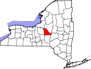
Towns Brookfield | Cazenovia | DeRuyter | Eaton | Fenner | Georgetown | Hamilton | Lebanon | Lenox | Lincoln | Madison | Nelson | Smithfield | Stockbridge | Sullivan
Villages Canastota | Cazenovia | Chittenango | DeRuyter | Earlville‡ | Hamilton | Madison | Morrisville | Munnsville | Wampsville
CDP Other
hamletsFootnotes ‡This populated place also has portions in an adjacent county or counties
Categories:- Villages in New York
- Syracuse metropolitan area
- Populated places established in 1842
- Populated places in Madison County, New York


Wikimedia Foundation. 2010.