- Malad City, Idaho
-
Malad City, Idaho — City — City Hall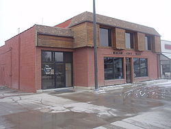
Motto: Where Idaho Begins Location of Malad City, Idaho
Coordinates: 42°11′27″N 112°14′57″W / 42.19083°N 112.24917°WCoordinates: 42°11′27″N 112°14′57″W / 42.19083°N 112.24917°W Country United States State Idaho County Oneida Area - Total 1.7 sq mi (4.3 km2) - Land 1.7 sq mi (4.3 km2) - Water 0.0 sq mi (0.0 km2) Elevation 4,551 ft (1,387 m) Population (2000) - Total 2,158 - Density 1,294.6/sq mi (499.9/km2) Time zone Mountain (MST) (UTC-7) - Summer (DST) MDT (UTC-6) ZIP code 83252 Area code(s) 208 FIPS code 16-50140 GNIS feature ID 0396844 For the Mumbai, India Suburb, see Malad (Mumbai suburb).
Malad City (also commonly known as Malad) is the only city in and the county seat of Oneida County, Idaho, United States.[1][2] Its population was 2,158 at the 2000 census.
The city is named after the nearby Malad River, the name being French for "sickly". Malad City is located along Interstate 15 on the east side of the Malad Valley 13 miles (21 km) from the Utah/Idaho border.
Contents
History
Established in 1864, Malad is one of the oldest communities in the state of Idaho. The community received its name from Donald Mackenzie, a Scottish-Canadian trapper, who passed through the valley between 1818 and 1821 with a party of trappers. Some of his men became sick while camped here and, believing that the illness was caused by drinking water from the valley's principal stream, he named it "Malade" meaning sick or bad in the French language. Actually, the water had nothing to do with the men's illness, as it was later learned by the second party led by Jim Bridger between 1832 and 1835. The men had eaten some beaver that were nibbling on the poisonous roots of a certain tree that put a natural arsenic into their flesh. The beaver would have likely been immune to the poison because of long-term adaptation, but the trappers suffered from their feast.
Malad began largely as a Welsh Mormon settlement whose settlers brought their Welsh traditions with them. In addition to the Mormon majority, some of the leading families in the community belonged to either the Presbyterian Church or the Reorganized Church of Jesus Christ of Latter Day Saints. These two denominations each built a place of worship in the town. Some of the minutes from early town meetings were taken down in both English and Welsh. The city is very proud of its Welsh heritage. Malad lays claim to having more people of Welsh descent per capita than anywhere outside of Wales [1]. Malad celebrated its Welsh heritage by holding an annual “eisteddfod”, patterned after the music and poetry contests held in Wales for over 900 years. The eisteddfod was an all-day event with people coming from all over southeastern Idaho. The event featured music, songs and storytelling of Wales. The custom continued until 1916 and the outbreak of World War I. With the goal of renewing the old eisteddfod tradition in Malad, in 2004, the annual Malad Valley Welsh Festival was established.
In the summer of 1843 John C. Fremont and his party of 39 men passed the spot where Malad City now stands.
Mormon prophet Brigham Young came through the Malad Valley in 1855. In 1856, at his request, Utahn members of The Church of Jesus Christ of Latter-day Saints migrated to the region. This party of 15 families led by Ezra Barnard traveled to the Malad Valley and established a community by the name of Fort Stuart. The following year in 1857, Fort Stuart was renamed Malad City. A post office was later set up in 1865.
By 1886 Malad City was the fastest growing village in eastern Idaho. The city was an important commercial center between Salt Lake and Butte, Montana. In 1906, the railroad reached Malad City, allowing travel to Salt Lake City in only a four hour ride by rail. The population of the city would double over the next 15 years as a result. Malad City experienced a flood when the earthen Deep Creek Dam, northeast of the city, broke June 19, 1910.
Malad City, as the county seat of Oneida County, developed into a thriving and self sufficient small town during the second through the fifth decades of the 20th century. LaGrande Hall was a dance hall where live music was played when ballroom dancing was a popular activity. Young people, not just Malad residents, but those from surrounding communities, met there on Saturday nights to enjoy dancing to the popular music of the 1920s through the 1940s (the community swimming pool is now located in that building). Malad also became home to the #5 J. C. Penney Store. Malad had two movie theatres: the Star and the Aldea. The Star featured first run films, and had a bank night weekly, where a winning ticket (name) was drawn for $100 in the 1950s. The Aldea catered to the younger set with Friday night and Saturday matinee cowboy movies, horror movies and comedies such as the Three Stooges and Abbott and Costello. The two locally established banking institutions were the J. N. Ireland Bank and the First National Bank. In addition to several grocery stores and service stations, there were bars, cafes, hardware stores, appliance stores, Dives Furniture Store and the Great Northern Hotel which included a cafe and the Greyhound bus depot. The Hotel was lost in a fire in the late 1940s, which required fire engines from the Salt Lake City fire department to bring it under control. The Hotel Thomas was built to replace it during the early 1950s. The Reynolds family ran a pick-up and delivery dry cleaning business. Malad had a bowling alley with about eight lanes and manual pin setting. The old post office was located east of the First National Bank and the Idaho Enterprise (weekly) Newspaper presses and office were housed in the basement of the post office building. The bank and post office buildings were beautiful examples of period architecture of the early 20th century, but have since been dismantled. In the 1950s Malad had two drug stores, each with its own soda fountain with made-to-order soft drinks and a variety of ice cream treats. There was a downtown building next to the Chevron service station which had medical offices for two physicians on the main floor and apartments on the upper floor. There were separate GM, Ford and Chrysler dealerships. As a farming community, farm machinery could be purchased locally. Malad had three barber shops. In the late 1950s a drive-in restaurant with car hops was established and continues (but under new ownership). There was a ladies dress shop called "Hazels," next to the Star Theater. There was even a store which sold bicycles and bicycle supplies and parts. A favorite business, B's, was the place to go for candy, soft drinks, snacks, beer, movie magazines, comics, sheet music and to play pin ball machines.
A magnitude 6.1 earthquake shook the Pocatello Valley near the Idaho-Utah border March 27, 1975. The epicenter was only 15 miles (24 km) southwest of Malad City which was hit hardest by the quake. Nearly 2/3 of its homes and businesses had some sort of damage.
Malad City received national news coverage when a corporate jet carrying eight people including four Coca-Cola executives crashed January 15, 1996 killing all onboard [2]. The large twin-engine turbo-prop was flying from Salt Lake City, Utah to Pocatello, Idaho for a Coca- Cola sales meeting. The Mitsubishi MU-2 aircraft crashed and burned at the base of a canyon 8 miles (13 km) northwest of Malad. According to the National Transportation Safety Board in its published SEA96MA043 Accident Report, the cause of the accident was listed as ice on the wings.
Towards the end of 2003, a nationwide influenza outbreak occurred. Malad was likely the hardest hit community in the nation. So many people became ill during the first part of December, 2003 that the city was virtually shut down. The entire school district in Malad was closed for three days in an effort to keep students from spreading the ailment. Roughly a third of the students became ill. Church services and Christmas festivities were also cancelled.[citation needed]
Malad City has the oldest department store in the state of Idaho. Evans Co-op opened in 1865 and is still in business today. Malad City also has the longest running weekly newspaper in Idaho, called "The Idaho Enterprise" which published its first issue on June 6, 1879.[citation needed]
Geography
Malad City is located at 42°11′27″N 112°14′57″W / 42.19083°N 112.24917°W (42.190887, -112.249214).[3]
According to the United States Census Bureau, the city has a total area of 1.7 square miles (4.4 km2), all of it land. It lies on the eastern edge of Malad Valley at 4,540 feet (1384 m) in elevation.
- Days per year with predominate sun: 203
- Days per year with some precipitation (over 0.01 inch): 97
The Wasatch fault runs along the east side of Malad Valley, and there are several active faults in the area to the south and west.
- Timezone: MST (GMT -7), Observes Daylight Saving Time.
- USDA plant hardiness zone: 5
- ZIP code: 83252
- Area Code: 208
Demographics
As of the census[4] of 2000, there were 2,158 people, 797 households, and 561 families residing in the city. The population density was 1,294.6 people per square mile (498.9/km²). There were 908 housing units at an average density of 544.7 per square mile (209.9/km²). The racial makeup of the city was 98.01% White, 0.14% African American, 0.37% Native American, 0.23% Asian, 0.09% Pacific Islander, 0.56% from other races, and 0.60% from two or more races. Hispanic or Latino of any race were 1.85% of the population.
There were 797 households out of which 34.3% had children under the age of 18 living with them, 61.5% were married couples living together, 6.3% had a female householder with no husband present, and 29.5% were non-families. 27.9% of all households were made up of individuals and 16.8% had someone living alone who was 65 years of age or older. The average household size was 2.65 and the average family size was 3.24.
In the city the population was spread out with 29.9% under the age of 18, 7.1% from 18 to 24, 22.6% from 25 to 44, 20.0% from 45 to 64, and 20.4% who were 65 years of age or older. The median age was 38 years. For every 100 females there were 92.7 males. For every 100 females age 18 and over, there were 92.2 males.
The median income for a household in the city was $32,235, and the median income for a family was $38,068. Males had a median income of $29,125 versus $19,338 for females. The per capita income for the city was $13,926. About 6.2% of families and 10.0% of the population were below the poverty line, including 9.7% of those under age 18 and 13.8% of those age 65 or over.
Attractions
Oneida County Pioneer Museum - The building was constructed in 1914 by R.B. Davis and used as a drug store and for other business purposes until becoming home to the museum in 1992. The original safe and the original pressed-tin ceiling are still in good condition and are notable features of the museum. Open: Tues-Sat 1:00 to 5:00 p.m. or by appointment. Admission is free but donations are appreciated. Street address: 27 Bannock St. Malad, ID 83252 Phone: (208) 766 - 9247
Caribou-Targhee National Forest - Located in southeastern Idaho in portions of six different Idaho counties with small portions in Wyoming and Utah, Caribou National Forest covers more than 1 million acres (4,000 km²). It is home to elk, deer and moose, but not caribou. The Malad district includes the Great Basin mountain range. The Malad office is located at: 195 South 300 East, Malad, Idaho 83252 Phone: (208) 766-5900. District Ranger: Jerald Tower
Curlew National Grassland - Established in 1960, the Curlew National Grassland is the only National Grassland of the nations' grasslands in the intermountain west. With over 47,000 acres (190 km2) of land, it provides habitat for a diversity of wildlife such as waterfowl, song birds, birds of prey, upland birds including Sharp-tailed Grouse. Located 16 miles (26 km) west of Malad on Highway 37. Maintained campgrounds and dispersed camping are both available. Phone: (208) 766-4743
Malad Welsh Festival [5] See second paragraph in this article under "History"
Notable natives
- Billy Barty - actor
- John V. Evans - Idaho State Senator, including Majority and Minority Leader positions, and Governor of Idaho
- Ralph R. Harding - State and U.S. Representative
- William Marion Jardine - United States Secretary of Agriculture, United States Ambassador to Egypt
- Olive Davis Osmond - mother of the Osmonds
- Darwin Thomas - Idaho Supreme Court Justice - First native born Idahoan elected to the court
- Sonia Johnson - writer and activist
- William J. Rutter, PhD - Chmn of Dept of Biochemistry & Biophysics at UC San Francisco, played a key role in developing recombinant DNA technology, genetic engineering and methods for biotech companies to develop and exploit this new technology.
- Mabel Jones Gabbott - Hymnal lyricist for LDS hymn book and LDS children's hymns Poet
- Scott D. Danielson - blogger and podcaster
Popular culture
The short film Peluca, the work of Jared Hess and the precursor film to the hit Napoleon Dynamite, mentions Malad. The antagonist, Seth, is played by Jon Heder and tells his friends that he has an FFA competition in "Ma-lawd" the following morning. Peluca and Napoleon Dynamite were both filmed in neighboring Franklin County, Idaho and reference much of the surrounding area in their film.
Education
Malad is served by the PK-12 Oneida County School District. Malad's public schools include:
References
- ^ "Find a County". National Association of Counties. http://www.naco.org/Counties/Pages/FindACounty.aspx. Retrieved 2011-06-07.
- ^ "Subcounty population estimates: Idaho 2000-2007" (CSV). United States Census Bureau, Population Division. 2009-03-18. http://www.census.gov/popest/cities/files/SUB-EST2007-16.csv. Retrieved 2009-04-04.
- ^ "US Gazetteer files: 2010, 2000, and 1990". United States Census Bureau. 2011-02-12. http://www.census.gov/geo/www/gazetteer/gazette.html. Retrieved 2011-04-23.
- ^ "American FactFinder". United States Census Bureau. http://factfinder.census.gov. Retrieved 2008-01-31.
- ^ http://www.welshfestival.com/
External links
 Media related to Malad City, Idaho at Wikimedia Commons
Municipalities and communities of Oneida County, Idaho County seat: Malad CityCity Malad City

Unincorporated
communitiesCherry Creek | Holbrook | Pleasantview | Samaria | Stone
Categories:- Cities in Idaho
- County seats in Idaho
- Populated places in Oneida County, Idaho
- Populated places established in 1864


Wikimedia Foundation. 2010.