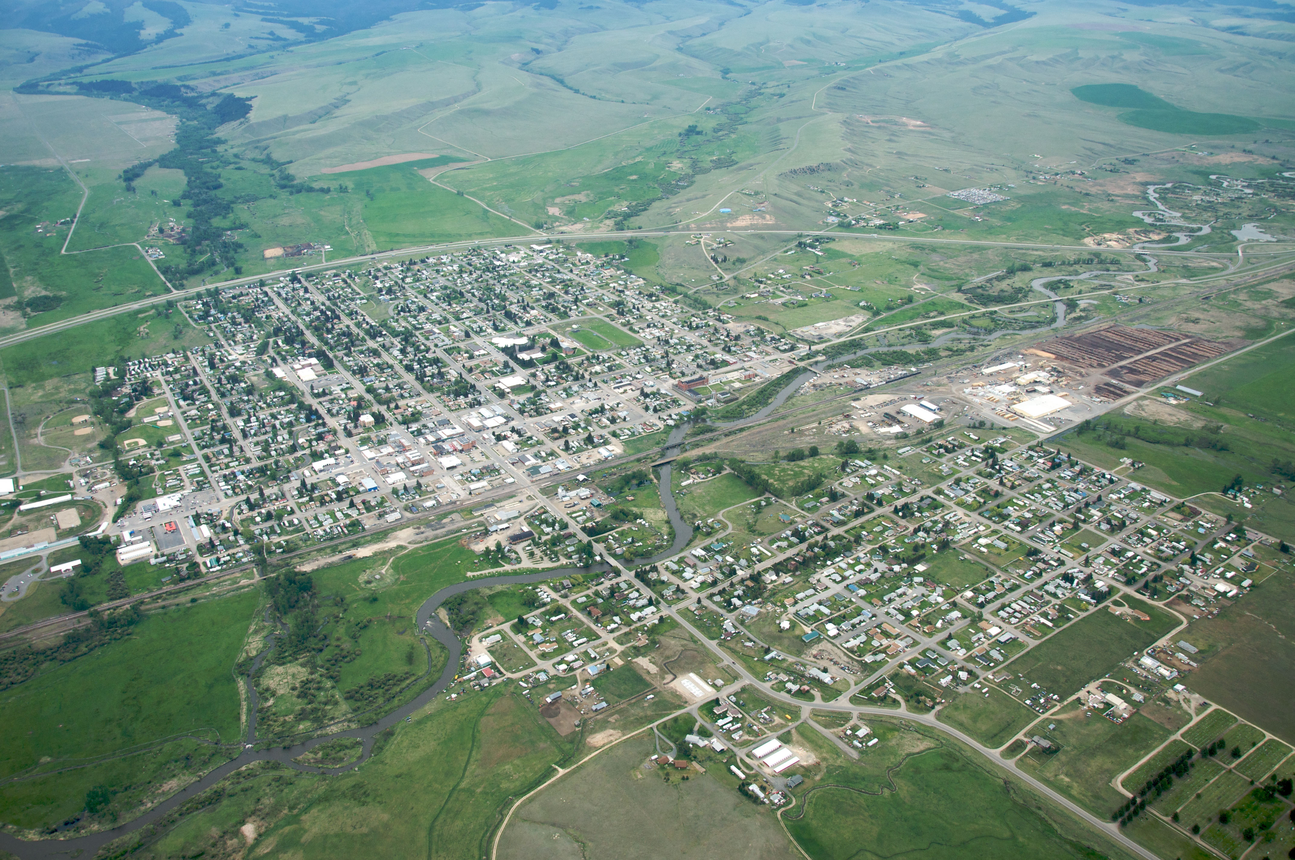
- Deer Lodge, Montana
-
Not to be confused with Deer Lodge County, Montana.
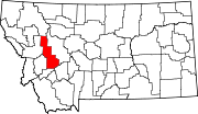
Deer Lodge, Montana — City — 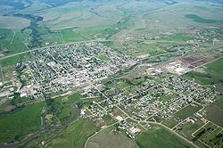 Location of Deer Lodge, Montana
Coordinates: 46°23′46″N 112°43′59″W / 46.39611°N 112.73306°WCoordinates: 46°23′46″N 112°43′59″W / 46.39611°N 112.73306°W Country United States State Montana County Powell Area – Total 1.4 sq mi (3.7 km2) – Land 1.4 sq mi (3.7 km2) – Water 0.0 sq mi (0.0 km2) Elevation 4,567 ft (1,392 m) Population (2000) – Total 3,421 – Density 2,369.3/sq mi (914.8/km2) Time zone Mountain (MST) (UTC-7) – Summer (DST) MDT (UTC-6) ZIP code 59722 Area code(s) 406 FIPS code 30-19825 GNIS feature ID 0782261 Deer Lodge is a city in and the county seat of Powell County, Montana, United States.[1] The population was 3,421 at the 2000 census. The city is perhaps best known as the home of the Montana State Prison, a major local employer. The Montana State Hospital in Warm Springs, and former state tuberculosis sanitarium is in nearby Galen are the result of the power the western part of the state held over Montana at statehood due to the copper and mineral wealth in that area.[2] Deer Lodge was also once an important railroad town, serving as a division headquarters for the Chicago, Milwaukee, St. Paul and Pacific Railroad ("the Milwaukee Road") before the railroad's local abandonment in 1980.
The current Montana State Prison occupies a campus 3.5 miles (5.6 km) west of town. The former prison site, at the south end of Deer Lodge's Main Street, is now the Old Prison Museum. In addition to a former cellblock building, the museum complex includes a theater, antique and automobile museums, and a former Milwaukee Road "Little Joe" electric locomotive.
Deer Lodge is also the location of Grant-Kohrs Ranch National Historic Site, dedicated to the interpretation of the frontier cattle ranching era. This site was the home of Conrad Kohrs, one of the famous "Cattle Kings" of Montana whose land holdings once stretched over a million acres (4,000 km²) of Montana, Wyoming, and Alberta, Canada. The Grant-Kohrs ranch was built in 1862 by Johnny Grant, a Scottish/French/Metis fur-trader and trapper who encouraged his people to settle in Deer Lodge because of its pleasant climate and large areas of bunch grass prairie, ideal for raising cattle and horses. The city's name derives from a geological formation known as Warm Springs Mound which contained natural saline that made for a natural salt lick for the local deer population, the protected valley in which Deer Lodge is located was where most of the local wildlife would winter as the temperatures lowered in the high country.[3]
Deer Lodge was the site of the College of Montana, the first institution of higher learning in the state.
Contents
Geography
 Deer Lodge in 1869[4]
Deer Lodge is located at 46°23′46″N 112°43′59″W / 46.39611°N 112.73306°W (46.396183, -112.732922)[5].
According to the United States Census Bureau, the city has a total area of 1.4 square miles (3.6 km2), all land.
Demographics
Historical populations Census Pop. %± 1870 788 — 1880 941 19.4% 1890 1,463 55.5% 1900 1,324 −9.5% 1910 2,570 94.1% 1920 3,780 47.1% 1930 3,510 −7.1% 1940 3,278 −6.6% 1950 3,779 15.3% 1960 4,681 23.9% 1970 4,306 −8.0% 1980 4,023 −6.6% 1990 3,378 −16.0% 2000 3,421 1.3% Est. 2007 3,502 2.4% source:[6][7] As of the census[8] of 2000, there were 3,421 people, 1,442 households, and 911 families residing in the city. The population density was 2,369.3 people per square mile (917.3/km²). There were 1,593 housing units at an average density of 1,103.3 per square mile (427.1/km²). The racial makeup of the city was 95.67% White, 0.03% African American, 1.02% Native American, 0.61% Asian, 0.61% from other races, and 2.05% from two or more races. Hispanic or Latino of any race were 1.84% of the population.
There were 1,442 households out of which 29.3% had children under the age of 18 living with them, 49.7% were married couples living together, 9.2% had a female householder with no husband present, and 36.8% were non-families. 32.1% of all households were made up of individuals and 15.7% had someone living alone who was 65 years of age or older. The average household size was 2.32 and the average family size was 2.93.
In the city the population was spread out with 25.3% under the age of 18, 6.7% from 18 to 24, 25.1% from 25 to 44, 23.6% from 45 to 64, and 19.3% who were 65 years of age or older. The median age was 41 years. For every 100 females there were 93.1 males. For every 100 females age 18 and over, there were 88.2 males.
The median income for a household in the city was $29,859, and the median income for a family was $36,108. Males had a median income of $27,903 versus $20,227 for females. The per capita income for the city was $14,883. About 8.7% of families and 10.9% of the population were below the poverty line, including 13.3% of those under age 18 and 5.4% of those age 65 or over.
Media
The Silver State Post is Powell County's only newspaper. KBCK (1400 AM) and KQRV (96.9 FM) are two local radio stations.[citation needed]
Government and infrastructure
The United States Postal Service operates the Deer Lodge Post Office.[9]
The Montana Department of Corrections operates the current Montana State Prison facility in a nearby unincorporated area in Powell County, near Deer Lodge.[10]
Education
Education in Powell County is served by Powell County High School located in Deer Lodge. In recent years[when?] the school has had an enrollment of about 300 students. The school currently competes athletically in the 6B conference with Superior, Missoula Loyola, Valley Christian, Darby and Florence. Although being in existence since 1903 the school won its first athletic team state championship in golf in 2005.[citation needed]
Notable residents
- John Bozeman, founder of Bozeman, Montana
- Edgar Samuel Paxson, frontier artist
- Neal Chase, a leader of a small Bahá'í sect, the Baha'is Under the Provisions of the Covenant
- William H. Clagett, U.S. Representative from Montana Territory, lawyer
- William Andrews Clark, United States Senator from Montana, was a banker here
- Eric Funk, Composer and professor at Montana State University
- Phil Jackson, NBA coach
- Conrad Kohrs, cattle rancher
- Jean Parker, actress born Lois Mae Green in Deer Lodge
- Patricia Nell Warren, writer
Film credits
Deer Lodge has been a filming location for a number of movies including:
- Rancho Deluxe (1975)
- Heaven's Gate (1980)
- Fast-Walking (1982)
- Runaway Train (1985)
- Diggstown (1992)
- F.T.W. (1994)
- Love Comes to the Executioner (2006)
- Iron Ridge (2007)
UFO documentary
In a 2004 documentary titled The Secret of Redgate by Lynda J. Cowen and Jim Marrs, a number of Deer Lodge residents explain about their experiences with extraterrestrial beings and the rumours surrounding these events. These occurrences which date back some fifty years took place at a location named Redgate on the eastside of Deer Lodge.[11]
References
- ^ "Find a County". National Association of Counties. http://www.naco.org/Counties/Pages/FindACounty.aspx. Retrieved 2011-06-07.
- ^ Kinsey, Joseph. Montana: High, Wide, and Handsome. N.p.: Bison, n.d., p. 65.
- ^ http://pcmaf.org/history.htm
- ^ Stout, Tom (1921). Montana Its Story and Biography--A History of Aboriginal and Territorial Montana and Three Decade of Statehood. Chicago: American Historical Society. pp. 808.
- ^ "US Gazetteer files: 2010, 2000, and 1990". United States Census Bureau. 2011-02-12. http://www.census.gov/geo/www/gazetteer/gazette.html. Retrieved 2011-04-23.
- ^ Moffatt, Riley. Population History of Western U.S. Cities & Towns, 1850-1990. Lanham: Scarecrow, 1996, 129.
- ^ "Subcounty population estimates: Montana 2000-2007" (CSV). United States Census Bureau, Population Division. 2009-03-18. http://www.census.gov/popest/cities/files/SUB-EST2007-30.csv. Retrieved 2009-05-09.
- ^ "American FactFinder". United States Census Bureau. http://factfinder.census.gov. Retrieved 2008-01-31.
- ^ "Post Office™ Location - DEER LODGE." United States Postal Service. Retrieved on December 2, 2010.
- ^ "Montana State Prison." Montana Department of Corrections. Retrieved on December 2, 2010. "Address: 400 Conley Lake Road; Deer Lodge, MT; 59722"
- ^ Secrets of Redgate website
External links
- Grant-Kohrs Ranch National Historic Site
- Montana State Prison
- Clark Fork Watershed Education Program
- Old Montana Prison Museums
- Powell County Chamber of Commerce
Municipalities and communities of Powell County, Montana County seat: Deer LodgeCity Deer Lodge
CDPs Categories:- Cities in Montana
- Populated places in Powell County, Montana
- County seats in Montana


Wikimedia Foundation. 2010.