- Mountain Line (Montana)
-
Mountain Line 
Founded 1976[1] Headquarters Missoula, MT Service type bus service, paratransit Routes 12 Annual ridership 849,051 (2009)[2] Fuel type Biodiesel Operator Missoula Urban Transportation District Web site mountainline.com Mountain Line is a public transit system providing service to the community of Missoula, Montana and the University of Montana. The legal name of Mountain Line is the Missoula Urban Transportation District, which is governed by a board whose members are appointed by the City of Missoula and Missoula County.
Contents
Services
Mountain Line operates 12 fixed routes on weekdays, 10 of which also operate on Saturdays. There is no service on Sundays or most major holidays. During the Saturdays in the summer, Mountain Line also operates a trolley to two farmers' markets and a craft market in downtown Missoula. Additionally, Mountain Line operates a trolley to "Out to Lunch," an outdoor concert series on Wednesdays during the summer. Paratransit service is provided for people with disabilities who are unable to ride fixed route buses.
Route List
- Route 1 Downtown / University / Community Hospital
- Route 2 Target Plaza / Southgate Mall
- Route 3 Northside
- Route 4 East Broadway Park and Ride / East Missoula / Bonner
- Route 5 Rattlesnake
- Route 6 Higgins / Dornblaser / Opportunity Resources / Southgate Mall
- Route 7 Downtown / Southgate Mall
- Route 8 Adams Center / 5th / 6th / Southgate Mall
- Route 9 Target Range / Community Hospital
- Route 10 Mullan Rd / El Mar / Smurfit Stone / Airport
- Route 11 N Reserve St / Expressway / Airport
- Route 12 Downtown / University / Dornblaser / South Hills
Facilities
Head Office
- Address: 1221 Shakespeare Street, Missoula
- Coordinates: 46°53′02″N 114°00′36″W / 46.88389°N 114.01°W
- Facilities: Head office, administration, bus storage and maintenance
- Opened: 1980
Transfer Center
- Address: 200 West Pine Street, Missoula
- Coordinates: 46°52′25.8″N 113°59′42.2″W / 46.873833°N 113.995056°W
- Facilities: Transfer point, waiting area, restrooms
- Opened: 2000
Park and ride lots
- Lewis and Clark (Route 12)
- Coordinates: 46°50′43.12″N 113°59′50.00″W / 46.8453111°N 113.99722°W
- Dornblaser (Routes 1, 6, 12)
- Coordinates: 46°50′54.05″N 113°59′50.13″W / 46.8483472°N 113.9972583°W
References
External links
Missoula, Montana Education High SchoolsBig Sky • Hellgate • Sentinel • Loyola Sacred Heart High School • Valley Christian • Willard Alternative High School • Sussex School • Clark Fork School • Next Step PrepHigher EducationUniversity of Montana • UM-College of TechnologyMuseums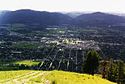
Geography MountainsRiversHistory Media TelevisionPrintBreweries Bayern Brewing • Big Sky Brewing • Kettle House Brewing • Taproom only: Tamarack Brewing • Flathead Lake BrewingServices Health CareTransportationSports TeamsMontana Grizzlies • Osprey (baseball) • Phoenix (semi-pro football) • Maulers (hockey) • Hellgate RollergirlsVenuesWashington–Grizzly Stadium (football) • Ogren Park at Allegiance Field (baseball) • Glacier Ice Rink (hockey) • Dornblaser Field (soccer) • Dahlberg Arena (basketball) • Western Montana Fair Grounds (horse racing)University of Montana Categories:- Bus transportation in Montana
- Paratransit services in the United States
- Transportation in Missoula County, Montana

Wikimedia Foundation. 2010.