- Missoula International Airport
-
Missoula International Airport
Johnson-Bell Field
IATA: MSO – ICAO: KMSO Location of the Montana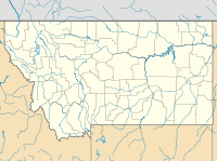
 MSO
MSOSummary Airport type Public Operator Missoula County Airport Authority Location Missoula, Montana Elevation AMSL 3,205 ft / 977 m Coordinates 46°54′59″N 114°05′26″W / 46.91639°N 114.09056°W Website Runways Direction Length Surface ft m 11/29 9,501 2,896 Asphalt 7/25 4,612 1,406 Asphalt Missoula International Airport/Johnson-Bell Field (IATA: MSO, ICAO: KMSO) is a public airport located four miles (6 km) northwest of the city of Missoula in Missoula County, Montana, USA. The airport has two runways. There are currently several expansion projects planned or underway, including the construction of 150 foot control tower. An expansion of the terminal building, providing a new security screening area, was completed in 2007. 565,000 passengers passed through the airport in 2007.
Contents
New Control Tower
The Missoula International Airport is currently building a new 150 foot tall control tower that will be replacing the old control tower, that had served the airport since 1961[1]. The new control tower will be one of the tallest control towers in the Pacific Northwest once completed, and the tallest in Montana. The price tag of the new tower is an estimated 6.77 million dollars[2].
Airlines and destinations
Airlines Destinations Alaska Airlines operated by Horizon Air Seattle/Tacoma
Seasonal: Portland (OR)Allegiant Air Las Vegas, Los Angeles, Phoenix/Mesa Delta Airlines Minneapolis/St. Paul Delta Connection operated by SkyWest Airlines Salt Lake City United Express operated by SkyWest Airlines Denver
Seasonal: Chicago-O'Hare, San FranciscoTop Destinations
Top ten busiest domestic routes out of MSO
(July 2010 - June 2011) [3]Rank City Passengers Carriers 1  Salt Lake City, UT
68,000 Delta 2  Seattle, WA
59,000 Alaska 3  Denver, CO
59,000 United 4  Minneapolis, MN
37,000 Delta 5  Phoenix-Mesa, AZ
20,000 Allegiant 6  Los Angeles, CA
18,000 Allegiant 7  Las Vegas, NV
16,000 Allegiant 8  Chicago O’Hare, IL
6,000 United 9 San Francisco, CA5,000 United 10  Portland, OR
1,000 Alaska See also
References
External links
- Missoula International Airport Official Website
- FAA Airport Diagram (PDF), effective 20 October 2011
- Resources for this airport:
- AirNav airport information for KMSO
- ASN accident history for MSO
- FlightAware airport information and live flight tracker
- NOAA/NWS latest weather observations
- SkyVector aeronautical chart for KMSO
- FAA current MSO delay information
Missoula, Montana Education High SchoolsBig Sky • Hellgate • Sentinel • Loyola Sacred Heart High School • Valley Christian • Willard Alternative High School • Sussex School • Clark Fork School • Next Step PrepHigher EducationUniversity of Montana • UM-College of TechnologyMuseums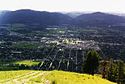
Geography MountainsRiversHistory Media TelevisionPrintBreweries Bayern Brewing • Big Sky Brewing • Kettle House Brewing • Taproom only: Tamarack Brewing • Flathead Lake BrewingServices Health CareTransportationSports TeamsMontana Grizzlies • Osprey (baseball) • Phoenix (semi-pro football) • Maulers (hockey) • Hellgate RollergirlsVenuesWashington–Grizzly Stadium (football) • Ogren Park at Allegiance Field (baseball) • Glacier Ice Rink (hockey) • Dornblaser Field (soccer) • Dahlberg Arena (basketball) • Western Montana Fair Grounds (horse racing)University of Montana Categories:- Airports in Montana
- Buildings and structures in Missoula, Montana
- Transportation in Missoula County, Montana
- Western United States airport stubs
- Western United States building and structure stubs
- Montana stubs


Wikimedia Foundation. 2010.