- Wolf Point, Montana
-
"Wolf Point" redirects here. For other uses, see Wolf Point (disambiguation).
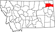
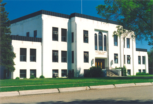
Wolf Point, Montana — City — Roosevelt County Courthouse in Wolf Point Location of Wolf Point, Montana
Coordinates: 48°5′29″N 105°38′33″W / 48.09139°N 105.6425°WCoordinates: 48°5′29″N 105°38′33″W / 48.09139°N 105.6425°W Country United States State Montana County Roosevelt Incorporated (city) 1915 Government – Type Mayor-council – Mayor Dewayne Jager Area – City 0.9 sq mi (2.3 km2) – Land 0.9 sq mi (2.3 km2) – Water 0.0 sq mi (0.0 km2) Elevation 2,000 ft (609 m) Population (2010)[1] – City 2,621 – Density 3,024.8/sq mi (1,167.9/km2) – Urban 3,427 – Urban density 3,909.6/sq mi (1,509.5/km2) Time zone Mountain Standard Time (MST) (UTC-7) – Summer (DST) Mountain Daylight Time (MDT) (UTC-6) ZIP code 59201 Area code(s) 406 FIPS code 30-81475 GNIS feature ID 0778652 Website http://ci.wolf-point.mt.us/ Wolf Point is a city in and the county seat of Roosevelt County, Montana, United States.[2] The population was 2,621 at the 2010 census.[1] It is the largest community on the Fort Peck Indian Reservation. Wolf Point is the home of the annual Wild Horse Stampede, held every year during the second weekend of July. Wolf Point's Stampede is the oldest rodeo in Montana, and has been called the "Grandaddy of all Montana Rodeos". In 2003, Wolf Point was named the official site of the Montana Cowboy Hall of Fame.
Contents
Works Progress Administration
One of Franklin D. Roosevelt's New Deal programs that put people to work across the nation was the Works Progress Administration. This agency was responsible for the construction of the Roosevelt County Courthouse, an airport (the airplane hangar), a golf course, and a library. The Montana Highway Department on Front Street was built around this time. WPA project Fort Peck Dam created electricity, and the WPA erected electric lines in Wolf Point. Many people learned how to drive a car for the first time working on the Fort Peck Dam and roads were built around Wolf Point. In the WPA records, an armory is listed in the same line with roads. The armory and barracks were near the courthouse, today's library, and the Coliseum. Without the WPA funding, the Coliseum, which was torn down to make way for the new Senior Center, was an option for a courthouse. Less identifiable projects created in Wolf Point under Roosevelt include recreation, water wells, and storage sheds.
Geography
Topography
Wolf Point is located in north-eastern Montana at 48°5′29″N 105°38′33″W / 48.09139°N 105.6425°W (48.091303, -105.642538),[3] in the wide, shallow valley of the Missouri River, just below its confluence with Wolf Creek. Wolf Point is situated on the High Plains of eastern Montana. According to the United States Census Bureau, the city has a total area of 0.9 square miles (2.3 km2), all of it land.
The city is located on the north bank of the Missouri River, the southern part occupying the ancestral floodplain of that river. The northern part occupies south facing, low-lying hills overlooking a terrace.[4] The central business district is located in the described southern portion.
Climate
Wolf Point experiences a semi-arid steppe climate (BSkw),[5] with generally cold, dry winters and hot summers. Late spring and early summer is on average the wettest period of the year. During the summer warm, humid air masses more typical of a warm summer continental climate (Dfb) may move into the area from the south or east. Summertime thunderstorms commonly occur and sometimes can be severe featuring hail and, infrequently, funnel clouds or tornados.
Cold waves may cover the area 6 to 12 times per winter, with temperatures well below 0 °F (−17.8 °C). Between cold waves there are sometimes periods of longer than 10 days of mild, but often windy weather caused by chinook winds.[6] These winds cause temperatures to rise rapidly, often giving relief in the form of mild temperatures in the coldest months of the year.
Climate data for Wolf Point Month Jan Feb Mar Apr May Jun Jul Aug Sep Oct Nov Dec Year Record high °F (°C) 60
(16)71
(22)81
(27)95
(35)102
(39)112
(44)107
(42)109
(43)105
(41)93
(34)74
(23)60
(16)112
(44)Average high °F (°C) 23.1
(−4.9)31.9
(−0.1)44.7
(7.1)60.6
(15.9)72.2
(22.3)81.2
(27.3)88.0
(31.1)87.4
(30.8)74.9
(23.8)61.1
(16.2)41.4
(5.2)27.7
(−2.4)57.85
(14.36)Daily mean °F (°C) 11.4
(−11.4)19.9
(−6.7)32.0
(0.0)46.0
(7.8)57.7
(14.3)66.4
(19.1)72.2
(22.3)71.4
(21.9)58.8
(14.9)46.6
(8.1)29.4
(−1.4)15.9
(−8.9)43.98
(6.65)Average low °F (°C) −0.4
(−18.0)7.8
(−13.4)19.3
(−7.1)31.4
(−0.3)43.1
(6.2)51.6
(10.9)56.4
(13.6)55.3
(12.9)42.6
(5.9)32.0
(0.0)17.3
(−8.2)4.1
(−15.5)30.04
(−1.09)Record low °F (°C) −42
(−41)−38
(−39)−31
(−35)0
(−18)19
(−7)0
(−18)35
(2)34
(1)14
(−10)−10
(−23)−21
(−29)−44
(−42)−44
(−42)Precipitation inches (mm) 0.45
(11.4)0.25
(6.4)0.50
(12.7)0.79
(20.1)1.69
(42.9)2.55
(64.8)1.87
(47.5)1.21
(30.7)1.23
(31.2)0.70
(17.8)0.40
(10.2)0.34
(8.6)11.98
(304.3)Source no. 1: NOAA (normals, 1971-2000) [7] Source no. 2: The Weather Channel (Records) [8] Demographics
Historical populations Census Pop. %± 1920 2,098 — 1930 1,539 −26.6% 1940 1,960 27.4% 1950 2,557 30.5% 1960 3,585 40.2% 1970 3,095 −13.7% 1980 3,074 −0.7% 1990 2,880 −6.3% 2000 2,663 −7.5% 2010 2,621 −1.6% U.S. Decennial Census As of the census[9] of 2000, there were 2,663 people, 981 households, and 685 families residing in the city. The population density was 3,024.8 people per square mile (1,168.4/km²). There were 1,091 housing units at an average density of 1,239.2 per square mile (478.7/km²). The racial makeup of the city was 55.73% White, 0.04% African American, 40.52% Native American, 1.01% Asian, 0.34% from other races, and 2.37% from two or more races. Hispanic or Latino of any race were 1.61% of the population.
There were 981 households out of which 37.2% had children under the age of 18 living with them, 49.5% were married couples living together, 15.3% had a female householder with no husband present, and 30.1% were non-families. 26.3% of all households were made up of individuals and 12.6% had someone living alone who was 65 years of age or older. The average household size was 2.63 and the average family size was 3.14.
In the city the population was spread out with 31.0% under the age of 18, 7.8% from 18 to 24, 25.5% from 25 to 44, 20.0% from 45 to 64, and 15.7% who were 65 years of age or older. The median age was 36 years. For every 100 females there were 90.8 males. For every 100 females age 18 and over, there were 83.5 males.
The median income for a household in the city was $27,962, and the median income for a family was $33,681. Males had a median income of $26,325 versus $23,333 for females. The per capita income for the city was $13,605. About 17.0% of families and 17.9% of the population were below the poverty line, including 23.1% of those under age 18 and 5.7% of those age 65 or over.
Government
The city of Wolf Point has a mayor-council form of government with a city council consisting of eight elected council members—two members from each of four wards. The mayor is elected at-large for a four year term. The city council determines the policy direction and administers the daily affairs of city government. The mayor appoints, with advice and consent of the council, the city attorney, the hybrid position of city clerk-treasurer, and the police chief. The position of city judge is shared with the Justice of the Peace of Roosevelt County.[10]
Mayors
Mathew Golik (November 4, 1948 - March 1, 2008) was the mayor between 1999 and 2008. He was appointed mayor in 1999 when the mayor at the time resigned. Golik was elected mayor in his own right in 2001 and re-elected in 2005; he held the post until his death. On March 1 his three-wheeler went through the ice on Fort Peck Lake where he had been ice fishing and he drowned.[11][12]
Education
K-12
The Wolf Point Public Schools, District No. 45/45A operates an elementary, a middle, and a junior/senior high school with a total student enrollment of more than 900 students.[13] Nearby, Frontier Elementary serves some rural areas of Roosevelt County and northern McCone County in grades pre-kindergarten through eighth grade.
College
Fort Peck Community College expanded to Wolf Point. The new brick facility is located one block south of the center of Main Street. FPCC is a tribal community college that offers affordable Applied Science Programs, Associate Degree Programs, Transfer Programs, and GEDs. In 2009, FPCC initiated men's and women's collegiate basketball teams.[14]
Culture
Media
Wolf Point is served by two weekly newspapers, the Wolf Point Herald-News, and the Poplar, Montana, based Fort Peck Journal. A third paper funded by Fort Peck tribal government, the Wotanin Wowapi, ceased publication on January 28, 2008.[15]
Local news, sports, and weather can be heard on radio station KVCK broadcasting on 1450 AM and 92.7 FM.
Wolf Point and Roosevelt County are part of the Minot-Bismark-Dickinson local television media market (DMA).[16] Broadcast television can be received, either directly or via translator, from KWSE 4 (PBS), KUMV 8 (NBC), and KXMD 11 (CBS) all based in Williston, North Dakota; and KFBB 5 (ABC/FOX) based in Great Falls, Montana. Bresnan Communications offers cable television service.
Attractions and recreation
The Roosevelt County Museum provides a glimpse into local history. The museum society purchased a disused farm implement sales building on U.S. Highway 2 to allow for more extensive display of the museum's collections. Fund raising continues in anticipation of the renovation and occupation of the new building in 2008.[17][18] The historic Lewis and Clark Bridge (Wolf Point Bridge) crosses the Missouri River six miles southeast of town on Montana Highway 13. The adjacent Lewis and Clark Bridge Park provides access to camping, fishing, and rafting on the Missouri River.
Notable natives and residents
- Marvin Brookman, rodeo stock contractor and cowboy, inducted into the ProRodeo Hall of Fame in 2005.[19]
- Casey FitzSimmons, National Football League tight end with the Detroit Lions.
- John Lowenstein, former professional baseball player.
- Montie Montana,[20][21] rodeo trick rider, actor, stuntman and cowboy inducted into the ProRodeo Hall of Fame in 1994.
- Ted Schwinden, former democratic Governor of Montana (1981–1989), named one of the "100 Most Influential Montanans of the Century".[22]
- Kam Mickolio, Major League relief pitcher for the Arizona Diamondbacks.
References in literature
- William Least Heat Moon wrote about the night he spent here in his autobiographical book Blue Highways: A Journey Into America: .[23]
- Marvel Comics superhero Red Wolf is from Wolf Point.
Infrastructure
Transportation
Air
Scheduled air service at Wolf Point ended on March 8, 2008, when Big Sky Airlines, the designated Essential Air Services (EAS) operator, ceased operation. Great Lakes Airlines has been given United States Department of Transportation approval to take over EAS service between Wolf Point and Billings, Montana, although a start date for this service has not been established.[24]
Highways
U.S. Route 2, a major east west route in the northern tier of states connects Wolf Point with other Hi-Line communities from Washington state to the Upper Peninsula of Michigan. Montana Highway 25 provides a connection to Montana Highway 13 six miles east of the city. Montana Highway 13 extends from the Port of Scobey on the Canada-United States border in the north to Circle, Montana in the south.
Rail
Wolf Point is located on the Hi-Line of the BNSF Railway and has developed as a major shipment point for grain to West Coast and Great Lakes ports. Wolf Point is served daily westbound and eastbound by Amtrak's Empire Builder, and is the first station stop west of Williston, North Dakota.
Medical facilities
Trinity Hospital offers inpatient care, and emergency care in addition to a wide range of other services, and is operated by Northeast Montana Health Services (NEMHS). NEMHS also operates the Faith Lutheran Home, a 60 bed skilled nursing facility; and the Listerud Rural Health Clinic in Wolf Point.[25] The Chief Redstone Clinic is a facility operated by the Indian Health Service, an agency of the U.S. Department of Health and Human Services. It supports a wide range of health needs for the Native American population in the Wolf Point area on an outpatient basis.[26]
See also
- List of state highways in Montana
References
- ^ a b "2010 Census Redistricting Data (Public Law 94-171) Summary File". American FactFinder. United States Census Bureau. http://factfinder2.census.gov/faces/tableservices/jsf/pages/productview.xhtml?pid=DEC_10_PL_GCTPL2.ST13&prodType=table. Retrieved 2 May 2011.
- ^ "Find a County". National Association of Counties. http://www.naco.org/Counties/Pages/FindACounty.aspx. Retrieved 2011-06-07.
- ^ "US Gazetteer files: 2010, 2000, and 1990". United States Census Bureau. 2011-02-12. http://www.census.gov/geo/www/gazetteer/gazette.html. Retrieved 2011-04-23.
- ^ "Public Facilities - City of Wolf Point, Montana". City of Wolf Point. http://ci.wolf-point.mt.us/public-works/facilities/. Retrieved 2007-09-20.
- ^ "World Climates after Köppen-Geiger" (JPG). http://www3.shastacollege.edu/dscollon/images/Maps-Images/world_climate_map.jpg. Retrieved 2007-08-26.
- ^ "Climate of Montana". National Climatic Data Center (Western Region), National Weather Service. http://www.wrcc.dri.edu/narratives/MONTANA.htm. Retrieved 2007-09-20.
- ^ "Climatography of the United States NO.81". National Oceanic and Atmospheric Administration. http://cdo.ncdc.noaa.gov/climatenormals/clim81/MTnorm.pdf. Retrieved January 15, 2011.
- ^ "Monthly Averages for Wolf Point, MT". The Weather Channel. http://www.weather.com/outlook/travel/businesstraveler/wxclimatology/monthly/USMT0371. Retrieved January 15, 2011.
- ^ "American FactFinder". United States Census Bureau. http://factfinder.census.gov. Retrieved 2008-01-31.
- ^ "City Government - City of Wolf Point". City of Wolf Point. http://ci.wolf-point.mt.us/city-gvnt/. Retrieved 2007-09-20.
- ^ Wolf Point mayor dies after driving ATV into open water Montana's News Station, 3 March 2008. Retrieved on 4 March 2008.
- ^ Wolf Point Mayor Dies When ATV Goes Through Ice Beacon, 3 March 2008. Retrieved on 5 March 2008.
- ^ "Montana Public School Enrollment Data" (PDF). Montana Office of Public Instruction. Fall 2005/06. http://www.opi.mt.gov/PDF/Measurement/EnrollBook2006.pdf. Retrieved 2007-01-30.
- ^ "About FPCC". Archived from the original on 2007-09-21. http://web.archive.org/web/20070921211719/http://www.fpcc.edu/about.htm. Retrieved 2008-02-06.
- ^ Abourezk, Kevin (February 8, 2008). "Tribes shut down long-lived paper". Billings Gazette. http://www.billingsgazette.net/articles/2008/02/08/news/state/35-tribes.txt. Retrieved 2008-02-08.
- ^ "Nielsen Media Research Local Market Universe Estimates (2006-2007 DMA Rankings)". Nielsen Media Research. 2006-09-23. http://www.nielsenmedia.com/nc/portal/site/Public/menuitem.3437240b94cacebc3a81e810d8a062a0/?vgnextoid=130547f8b5264010VgnVCM100000880a260aRCRD. Retrieved 2007-01-30.
- ^ Shumway, Darla. "Montana Historical Society director comes to Wolf Point to help plan new museum". Wolf Point Herald-News. http://lifenotnews.com/wolfpointherald/index.php?option=com_content&task=view&id=311&Itemid=94. Retrieved 2008-02-08.
- ^ "Wolf Point Area Historical Society". http://www.d48.net/museum/index.html. Retrieved 2008-02-08.
- ^ ProRodeo Hall of Fame welcomes six new inductees
- ^ "Inductees". ProRodeo Hall of Fame. http://www.prorodeohalloffame.com/website/Inductees/tabid/61/Default.aspx. Retrieved 2007-01-30.[dead link]
- ^ "Biography for Montie Montana". Internet Movie Database. http://www.imdb.com/name/nm0598936/bio. Retrieved 2007-01-30.
- ^ Chaney, Rob (1999). "The 100 Most Influential Montanans of the Century". Missoulian. http://www.missoulian.com/specials/100montanans/list/091.html. Retrieved 2007-01-30.
- ^ William, Least Heat Moon (1999). Blue Highways: A Journey Into America. Back Bay Books. ISBN 0316353299.
- ^ "Great Lakes prepares for Montana routes". Sidney Herald. December 30, 2007. http://www.sidneyherald.com/articles/2007/12/30/news/news01.txt. Retrieved 2008-02-03.
- ^ "Northwest Montana Health Services". NEMHS. http://www.nemhs.net/index.htm. Retrieved 2007-01-30.
- ^ "Fort Peck Service Unit". U.S. Department of Health and Human Services, Indian Health Service. Archived from the original on 2006-09-26. http://web.archive.org/web/20060926195412/http://www.ihs.gov/FacilitiesServices/AreaOffices/Billings/FtPeck/fpsu-facilities.asp. Retrieved 2007-01-30.
Further reading
- Presser, Marvin W. (1997). Wolf Point: A City of Destiny, Billings, Mont.: M Press. ISBN 0-9652117-0-3
- Hoye, Leota (1976). Roosevelt County's Treasured Years, Poplar, Mont.: Roosevelt County Bicentennial Committee. OCLC 41760470
External links
- Official website
- Wolf Point Chamber of Commerce
- Wolf Point Public Schools website
- Wolf Point Herald-News website
- Fort Peck Journal website
- Wolf Point Historical Photos
Municipalities and communities of Roosevelt County, Montana County seat: Wolf PointCities Wolf Point
Towns Bainville | Brockton | Culbertson | Froid | Poplar
Indian reservations Ghost town Footnotes ‡This populated place also has portions in an adjacent county or counties
 State of Montana
Topics - Index
- History
- Governors
- People
- Geography
- State Government
- Delegations
- Visitor Attractions
Society - Crime
- Demographics
- Economy
- Education
- Politics
Regions - The Flathead
- Glacier National Park
- Regional designations of Montana
- Western Montana
- Yellowstone
Largest cities Counties - Beaverhead
- Big Horn
- Blaine
- Broadwater
- Carbon
- Carter
- Cascade
- Chouteau
- Custer
- Daniels
- Dawson
- Deer Lodge
- Fallon
- Fergus
- Flathead
- Gallatin
- Garfield
- Glacier
- Golden Valley
- Granite
- Hill
- Jefferson
- Judith Basin
- Lake
- Lewis and Clark
- Liberty
- Lincoln
- Madison
- McCone
- Meagher
- Mineral
- Missoula
- Musselshell
- Park
- Petroleum
- Phillips
- Pondera
- Powder River
- Powell
- Prairie
- Ravalli
- Richland
- Roosevelt
- Rosebud
- Sanders
- Sheridan
- Silver Bow
- Stillwater
- Sweet Grass
- Teton
- Toole
- Treasure
- Valley
- Wheatland
- Wibaux
- Yellowstone
Glacier Country
(Northwest)Gold West Country
(Southwest)Russel Country
(North Central)Yellowstone Country
(South Central)Missouri River Country
(Northeast)Wolf PointCuster Country
(Southeast)Beaver Creek BreweryCategories:- Populated places in Roosevelt County, Montana
- Cities in Montana
- County seats in Montana
- Montana populated places on the Missouri River


Wikimedia Foundation. 2010.