- Wardner, Idaho
Infobox Settlement
official_name = Wardner, Idaho
settlement_type =City
nickname =
motto =
imagesize =
image_caption =
image_
imagesize =
image_caption =
image_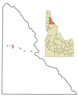
mapsize = 250px
map_caption = Location of Wardner, Idaho
mapsize1 =
map_caption1 =subdivision_type = Country
subdivision_name =United States
subdivision_type1 = State
subdivision_name1 =Idaho
subdivision_type2 = County
subdivision_name2 = Shoshone
government_footnotes =
government_type =
leader_title =
leader_name =
leader_title1 =
leader_name1 =
established_title =
established_date =area_footnotes =
unit_pref = Imperial
area_magnitude =
area_total_km2 = 2.2
area_land_km2 = 2.2
area_water_km2 = 0.0
area_total_sq_mi = 0.9
area_land_sq_mi = 0.9
area_water_sq_mi = 0.0population_as_of = 2000
population_footnotes =
population_total = 215
population_density_km2 = 97.0
population_density_sq_mi = 251.1timezone = Pacific (PST)
utc_offset = -8
timezone_DST = PDT
utc_offset_DST = -7
elevation_footnotes =
elevation_m = 810
elevation_ft = 2657
latd = 47 |latm = 31 |lats = 23 |latNS = N
longd = 116 |longm = 8 |longs = 3 |longEW = Wpostal_code_type =
ZIP code
postal_code = 83837
area_code = 208
blank_name = FIPS code
blank_info = 16-85240
blank1_name = GNIS feature ID
blank1_info = 0400161
website =
footnotes =Wardner is a city in Shoshone County,
Idaho ,United States . The population was 215 at the 2000 census.Geography
Wardner is located at coor dms|47|31|23|N|116|8|3|W|city (47.523164, -116.134190)GR|1.
According to the
United States Census Bureau , the city has a total area of 0.9 square miles (2.2 km²), all the land.History
In 1892, and again in 1899, angry union miners converged on the Bunker Hill mine during confrontations with mine owners.
Demographics
As of the
census GR|2 of 2000, there were 215 people, 88 households, and 60 families residing in the city. Thepopulation density was 251.1 people per square mile (96.5/km²). There were 111 housing units at an average density of 129.6/sq mi (49.8/km²). The racial makeup of the city was 95.81% White, 0.47% Native American, 0.47% Pacific Islander, 1.40% from other races, and 1.86% from two or more races. Hispanic or Latino of any race were 2.33% of the population.There were 88 households out of which 25.0% had children under the age of 18 living with them, 50.0% were married couples living together, 9.1% had a female householder with no husband present, and 31.8% were non-families. 25.0% of all households were made up of individuals and 15.9% had someone living alone who was 65 years of age or older. The average household size was 2.44 and the average family size was 2.85.
In the city the population was spread out with 24.7% under the age of 18, 7.4% from 18 to 24, 24.7% from 25 to 44, 30.2% from 45 to 64, and 13.0% who were 65 years of age or older. The median age was 42 years. For every 100 females there were 104.8 males. For every 100 females age 18 and over, there were 105.1 males.
The median income for a household in the city was $25,500, and the median income for a family was $31,563. Males had a median income of $36,071 versus $21,250 for females. The
per capita income for the city was $14,051. About 14.0% of families and 12.8% of the population were below thepoverty line , including 3.8% of those under the age of eighteen and 6.5% of those sixty five or over.References
External links
Wikimedia Foundation. 2010.