- National Register of Historic Places listings in Owyhee County, Idaho
-
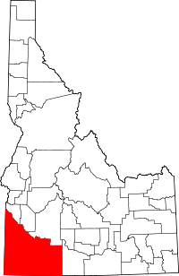 Location of Owyhee County in Idaho
This is a list of the National Register of Historic Places listings in Owyhee County, Idaho.
This is intended to be a complete list of the properties and districts on the National Register of Historic Places in Owyhee County, Idaho, United States. Latitude and longitude coordinates are provided for many National Register properties and districts; these locations may be seen together in a Google map.[1]
There are 14 properties and districts listed on the National Register in the county. More may be added; properties and districts nationwide are added to the Register weekly.[2]
-
- This National Park Service list is complete through NPS recent listings posted November 10, 2011.[3]
Current listings
[4] Landmark name [5] Image Date listed Location City or town Summary 1 Bernard's Ferry May 22, 1978 North of Murphy off State Highway 78
43°23′05″N 116°39′49″W / 43.384722°N 116.663611°WMurphy 2 Bruneau Episcopal Church November 17, 1982 Off State Highway 51
42°52′51″N 115°47′51″W / 42.880833°N 115.7975°WBruneau 3 Camas and Pole Creeks Archeological District May 28, 1986 Address Restricted[6] Wagon Box Basin 4 Camp Lyon Site December 27, 1972 1 mile east of U.S. Route 95
43°08′15″N 117°00′57″W / 43.1375°N 117.015833°WReynolds 5 Camp Three Forks December 15, 1972 South of Silver City
42°42′36″N 117°00′45″W / 42.71°N 117.0125°WSilver City 6 Delamar Historic District May 13, 1976 6 miles west of Silver City
43°01′29″N 116°50′31″W / 43.024722°N 116.841944°WSilver City A mining ghost town 7 Guffey Butte-Black Butte Archeological District October 10, 1978 Approximately 20 miles (32 km) along the Snake River
43°17′10″N 116°32′28″W / 43.28611°N 116.54111°W[7]Grand View Extends into Ada, Canyon, and Elmore counties 8 James E. and Emma Gusman Ranch December 9, 1999 South Mountain Rd.
42°55′42″N 116°59′56″W / 42.928333°N 116.998889°WJordan Valley 9 Noble Horse Barn August 7, 1991 Reynolds Creek 12 miles southwest of Murphy
43°13′03″N 116°45′07″W / 43.2175°N 116.751944°WMurphy 10 Our Lady, Queen of Heaven Church November 28, 1980 Address Restricted
43°02′25″N 116°23′37″W / 43.040278°N 116.393611°WOreana 11 Owyhee County Courthouse November 17, 1982 State Highway 45
43°13′01″N 116°33′01″W / 43.216944°N 116.550278°WMurphy 12 Poison Creek Stage Station May 22, 1978 South of Homedale off Jump Creek Rd.
43°30′08″N 116°56′14″W / 43.502222°N 116.937222°WHomedale 13 Silver City Historic District 
May 19, 1972 Silver City and its environs
43°01′00″N 116°43′00″W / 43.016667°N 116.716667°WSilver City 14 Wickahoney Post Office and Stage Station May 27, 1982 Wickahoney Creek
42°27′22″N 115°58′58″W / 42.456111°N 115.982778°WWickahoney See also
References
- ^ The latitude and longitude information provided in this table was derived originally from the National Register Information System, which has been found to be fairly accurate for about 99% of listings. For about 1% of NRIS original coordinates, experience has shown that one or both coordinates are typos or otherwise extremely far off; some corrections may have been made. A more subtle problem causes many locations to be off by up to 150 yards, depending on location in the country: most NRIS coordinates were derived from tracing out latitude and longitudes off of USGS topographical quadrant maps created under the North American Datum of 1927, which differs from the current, highly accurate WGS84 GPS system used by Google maps. Chicago is about right, but NRIS longitudes in Washington are higher by about 4.5 seconds, and are lower by about 2.0 seconds in Maine. Latitudes differ by about 1.0 second in Florida. Some locations in this table may have been corrected to current GPS standards.
- ^ "National Register of Historic Places: Weekly List Actions". National Park Service. http://www.cr.nps.gov/nr/nrlist.htm. Retrieved March 29, 2009.
- ^ "National Register of Historic Places: Weekly List Actions". National Park Service, United States Department of the Interior. Retrieved on November 10, 2011.
- ^ Numbers represent an ordering by significant words. Various colorings, defined here, differentiate National Historic Landmark sites and National Register of Historic Places Districts from other NRHP buildings, structures, sites or objects.
- ^ "National Register Information System". National Register of Historic Places. National Park Service. . http://nrhp.focus.nps.gov/natreg/docs/All_Data.html.
- ^ Some listings on the NRHP are highly sensitive sites and may be subject to looting or vandalism. The NRHP lists this site as "Address Restricted."
- ^ Location derived from this Bureau of Land Management website; coordinates derived from the GNIS feature record for Guffey Butte. The NRIS lists the site as "Address Restricted".
Properties on the National Register of Historic Places in Idaho  Ada • Adams • Bannock • Bear Lake • Benewah • Bingham • Blaine • Boise • Bonner • Bonneville • Boundary • Butte • Camas • Canyon • Caribou • Cassia • Clark • Clearwater • Custer • Elmore • Franklin • Fremont • Gem • Gooding • Idaho • Jefferson • Jerome • Kootenai • Latah • Lemhi • Lewis • Lincoln • Madison • Minidoka • Nez Perce • Oneida • Owyhee • Payette • Power • Shoshone • Teton • Twin Falls • Valley • Washington
U.S. National Register of Historic Places Topics Lists by states Alabama • Alaska • Arizona • Arkansas • California • Colorado • Connecticut • Delaware • Florida • Georgia • Hawaii • Idaho • Illinois • Indiana • Iowa • Kansas • Kentucky • Louisiana • Maine • Maryland • Massachusetts • Michigan • Minnesota • Mississippi • Missouri • Montana • Nebraska • Nevada • New Hampshire • New Jersey • New Mexico • New York • North Carolina • North Dakota • Ohio • Oklahoma • Oregon • Pennsylvania • Rhode Island • South Carolina • South Dakota • Tennessee • Texas • Utah • Vermont • Virginia • Washington • West Virginia • Wisconsin • WyomingLists by territories Lists by associated states Other Municipalities and communities of Owyhee County, Idaho Cities 
CDP Unincorporated
communitiesBruneau | Dickshooter | Riddle
Indian reservation Ghost towns Categories:- National Register of Historic Places in Idaho by county
- Owyhee County, Idaho
-


Wikimedia Foundation. 2010.