- National Register of Historic Places listings in Blaine County, Idaho
-
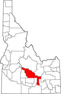 Location of Blaine County in Idaho
This is a list of the National Register of Historic Places listings in Blaine County, Idaho.
This is intended to be a complete list of the properties and districts on the National Register of Historic Places in Blaine County, Idaho, United States. Latitude and longitude coordinates are provided for many National Register properties and districts; these locations may be seen together in a Google map.[1]
There are 20 properties and districts listed on the National Register in the county. More may be added; properties and districts nationwide are added to the Register weekly.[2]
-
- This National Park Service list is complete through NPS recent listings posted November 10, 2011.[3]
Current listings
[4] Landmark name [5] Image Date listed Location City or town Summary 1 Bald Mountain Hot Springs November 17, 1982 Main and 1st St.
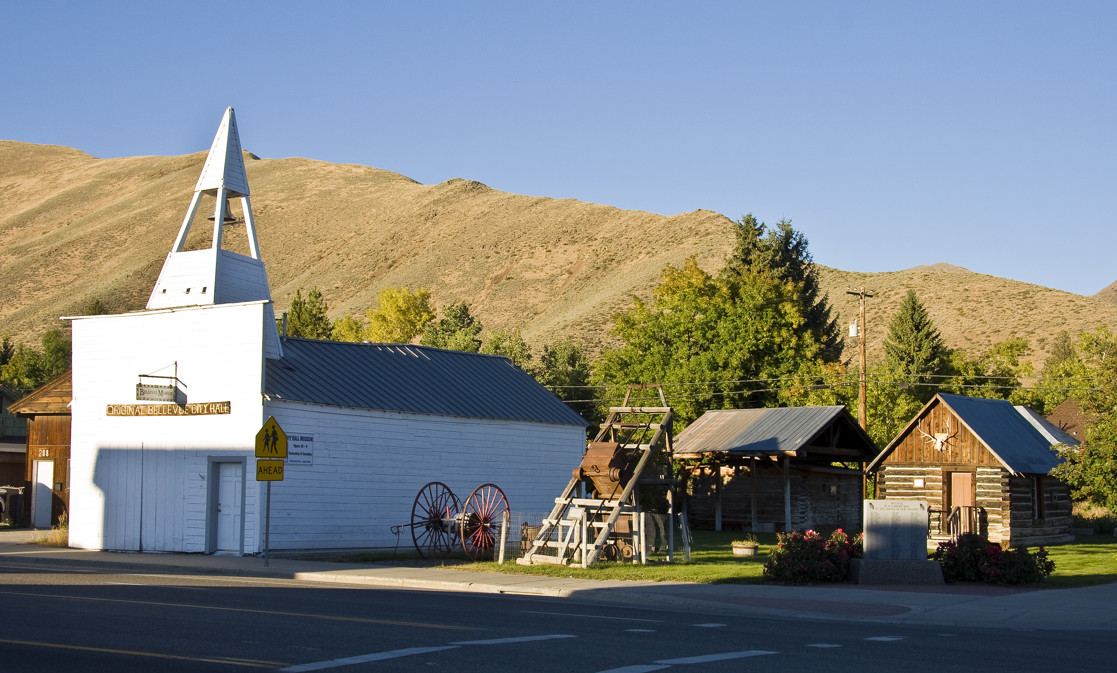
43°40′44″N 114°21′42″W / 43.678889°N 114.361667°WKetchum 2 Bellevue Historic District 
June 16, 1982 Roughly bounded by U.S. Route 93, Cedar, 4th, and Oak Sts.
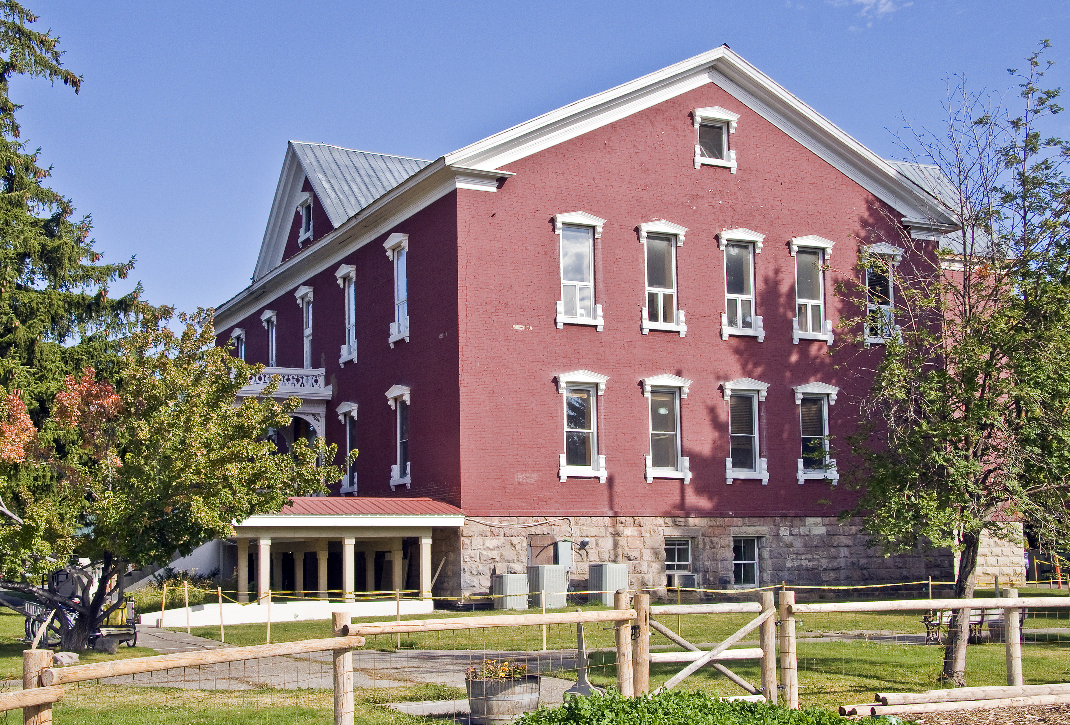
43°27′51″N 114°15′29″W / 43.464167°N 114.258056°WBellevue 3 Blaine County Courthouse 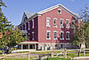
February 17, 1978 1st and Croy Sts.
43°31′08″N 114°18′42″W / 43.518889°N 114.311667°WHailey 4 Eben S. and Elizabeth S. Chase House May 5, 2009 203 E. Bullion St.
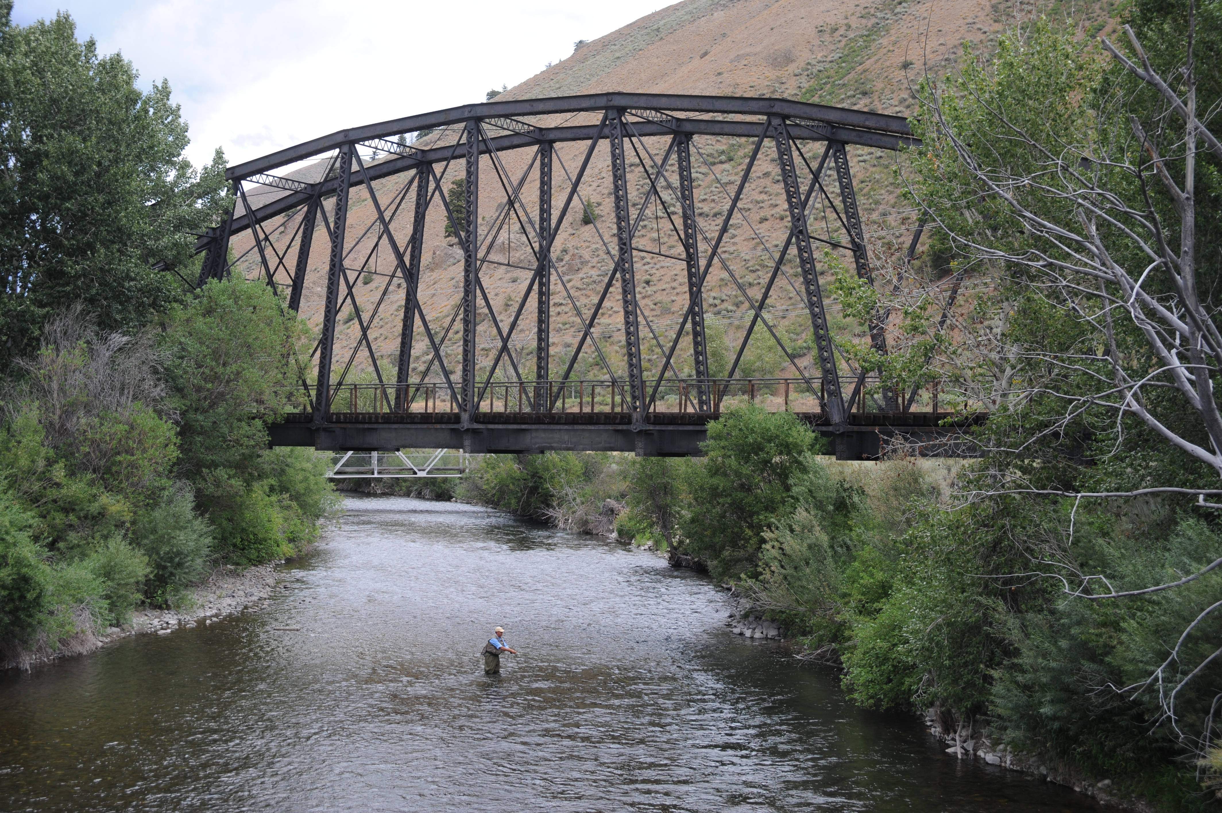
43°31′14″N 114°18′47″W / 43.520633°N 114.312922°WHailey 5 Cold Springs Pegram Truss Railroad Bridge 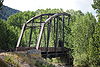
July 25, 1997 Over the Big Wood River 0.5 miles south of the junction of U.S. Route 93 and State Highway 367
43°39′15″N 114°20′55″W / 43.654167°N 114.348611°WKetchum 6 Emmanuel Episcopal Church 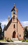
October 5, 1977 101 2nd Ave., S.
43°31′13″N 114°18′44″W / 43.520278°N 114.312222°WHailey 7 Fish Creek Dam December 29, 1978 Northeast of Carey
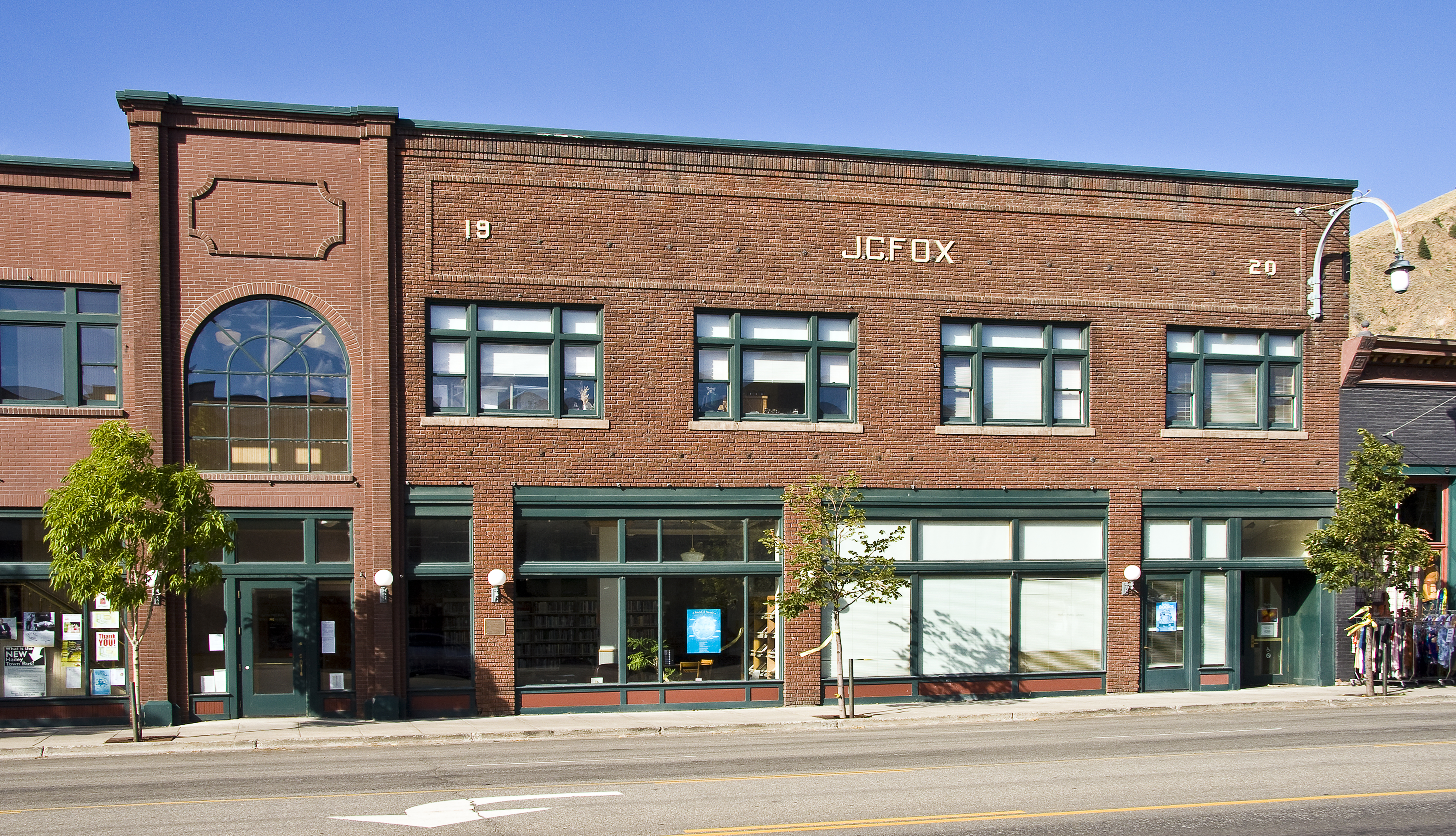
43°25′23″N 113°49′54″W / 43.423061°N 113.831669°WCarey 8 J. C. Fox Building 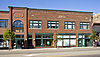
March 31, 1983 S. Main St.
43°31′08″N 114°18′51″W / 43.518889°N 114.314167°WHailey 9 Fox–Worswick House August 31, 2011 119 E. Bullion St.
43°31′15″N 114°18′44″W / 43.52083°N 114.31222°WHailey 10 Gimlet Pegram Truss Railroad Bridge 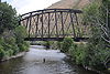
July 25, 1997 Over the Big Wood River 0.5 miles south of the junction of U.S. Route 93 and East Fork Wood River Rd.
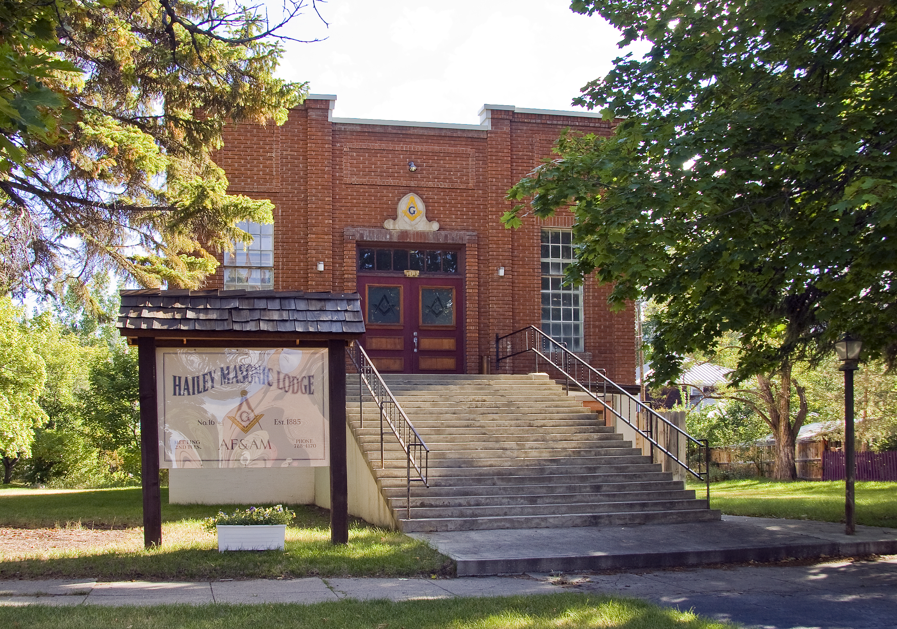
43°35′53″N 114°20′43″W / 43.598056°N 114.345278°WKetchum 11 Hailey Masonic Lodge 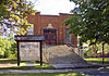
September 12, 2008 100 S. 2nd Ave.
43°31′14″N 114°18′47″W / 43.52059°N 114.31294°WHailey 12 Ketchum Ranger District Administrative Site February 9, 2007 131/171 River St.
43°40′42″N 114°21′45″W / 43.678333°N 114.3625°WKetchum 13 Henry Miller House May 30, 1975 South of Bellevue off U.S. Route 93
43°26′47″N 114°15′16″W / 43.446389°N 114.254444°WBellevue 14 Homer Pound House December 28, 1978 314 2nd Ave., S.
43°31′05″N 114°18′35″W / 43.518056°N 114.309722°WHailey 15 Proctor Mountain Ski Lift January 20, 1980 Trail Creek
43°42′23″N 114°20′06″W / 43.706389°N 114.335°WSun Valley 16 The Rialto Hotel 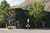
December 30, 2009 201 S. Main St.
43°31′14″N 114°18′58″W / 43.520575°N 114.316097°WHailey 17 St. Charles of the Valley Catholic Church and Rectory November 17, 1982 Pine and S. 1st Sts.
43°31′02″N 114°18′42″W / 43.517222°N 114.311667°WHailey 18 Sawtooth City April 4, 1975 Southeast of Alturas Lake
43°53′48″N 114°50′25″W / 43.89667°N 114.84028°W[6]Sun Valley 19 W. H. Watt Building 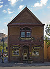
March 31, 1983 120 N. Main St.
43°31′14″N 114°18′53″W / 43.520556°N 114.314722°WHailey 20 Werthheimer Building 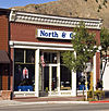
September 12, 1985 101 S. Main St.
43°31′10″N 114°18′53″W / 43.519444°N 114.314722°WHailey See also
References
- ^ The latitude and longitude information provided in this table was derived originally from the National Register Information System, which has been found to be fairly accurate for about 99% of listings. For about 1% of NRIS original coordinates, experience has shown that one or both coordinates are typos or otherwise extremely far off; some corrections may have been made. A more subtle problem causes many locations to be off by up to 150 yards, depending on location in the country: most NRIS coordinates were derived from tracing out latitude and longitudes off of USGS topographical quadrant maps created under the North American Datum of 1927, which differs from the current, highly accurate WGS84 GPS system used by Google maps. Chicago is about right, but NRIS longitudes in Washington are higher by about 4.5 seconds, and are lower by about 2.0 seconds in Maine. Latitudes differ by about 1.0 second in Florida. Some locations in this table may have been corrected to current GPS standards.
- ^ "National Register of Historic Places: Weekly List Actions". National Park Service. http://www.cr.nps.gov/nr/nrlist.htm. Retrieved March 29, 2009.
- ^ "National Register of Historic Places: Weekly List Actions". National Park Service, United States Department of the Interior. Retrieved on November 10, 2011.
- ^ Numbers represent an ordering by significant words. Various colorings, defined here, differentiate National Historic Landmark sites and National Register of Historic Places Districts from other NRHP buildings, structures, sites or objects.
- ^ "National Register Information System". National Register of Historic Places. National Park Service. . http://nrhp.focus.nps.gov/natreg/docs/All_Data.html.
- ^ Coordinates derived from its GNIS feature record and the map attached to the record; the NRIS lists the site as "Address Restricted"
Properties on the National Register of Historic Places in Idaho  Ada • Adams • Bannock • Bear Lake • Benewah • Bingham • Blaine • Boise • Bonner • Bonneville • Boundary • Butte • Camas • Canyon • Caribou • Cassia • Clark • Clearwater • Custer • Elmore • Franklin • Fremont • Gem • Gooding • Idaho • Jefferson • Jerome • Kootenai • Latah • Lemhi • Lewis • Lincoln • Madison • Minidoka • Nez Perce • Oneida • Owyhee • Payette • Power • Shoshone • Teton • Twin Falls • Valley • Washington
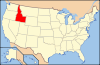
U.S. National Register of Historic Places Topics Lists by states Alabama • Alaska • Arizona • Arkansas • California • Colorado • Connecticut • Delaware • Florida • Georgia • Hawaii • Idaho • Illinois • Indiana • Iowa • Kansas • Kentucky • Louisiana • Maine • Maryland • Massachusetts • Michigan • Minnesota • Mississippi • Missouri • Montana • Nebraska • Nevada • New Hampshire • New Jersey • New Mexico • New York • North Carolina • North Dakota • Ohio • Oklahoma • Oregon • Pennsylvania • Rhode Island • South Carolina • South Dakota • Tennessee • Texas • Utah • Vermont • Virginia • Washington • West Virginia • Wisconsin • WyomingLists by territories Lists by associated states Other Municipalities and communities of Blaine County, Idaho Cities Bellevue | Carey | Hailey | Ketchum | Sun Valley

Unincorporated
communitiesCategories:- National Register of Historic Places in Idaho by county
- Blaine County, Idaho
-


Wikimedia Foundation. 2010.