- Mounds, Oklahoma
-
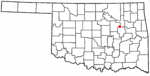
Mounds, Oklahoma — Town — Location of Mounds, Oklahoma
Coordinates: 35°52′34″N 96°3′36″W / 35.87611°N 96.06°WCoordinates: 35°52′34″N 96°3′36″W / 35.87611°N 96.06°W Country United States State Oklahoma County Creek Area – Total 1.2 sq mi (3.0 km2) – Land 1.2 sq mi (3.0 km2) – Water 0.0 sq mi (0.0 km2) Elevation 738 ft (225 m) Population (2000) – Total 1,153 – Density 986.7/sq mi (381.0/km2) Time zone Central (CST) (UTC-6) – Summer (DST) CDT (UTC-5) ZIP code 74047 Area code(s) 539/918 FIPS code 40-49550[1] GNIS feature ID 1095557[2] Mounds is a town in Creek County, Oklahoma, United States. Mounds is located just south of Tulsa; the population was 1,153 at the 2000 census.
Contents
Geography
Mounds is located at 35°52′34″N 96°03′36″W / 35.876076°N 96.059951°W.[3]
According to the United States Census Bureau, the town has a total area of 1.2 square miles (3.1 km2), all of it land.
Demographics
As of the census[1] of 2000, there were 1,153 people, 449 households, and 312 families residing in the town. The population density was 986.7 people per square mile (380.5/km2). There were 500 housing units at an average density of 427.9 per square mile (165.0/km2). The racial makeup of the town was 76.06% White, 1.21% African American, 15.61% Native American, 0.09% Asian, 1.21% from other races, and 5.81% from two or more races. Hispanic or Latino of any race were 1.82% of the population.
There were 449 households out of which 34.1% had children under the age of 18 living with them, 50.6% were married couples living together, 12.2% had a female householder with no husband present, and 30.5% were non-families. 28.3% of all households were made up of individuals and 15.4% had someone living alone who was 65 years of age or older. The average household size was 2.57 and the average family size was 3.10.
In the town the population was spread out with 29.3% under the age of 18, 9.1% from 18 to 24, 25.0% from 25 to 44, 22.4% from 45 to 64, and 14.2% who were 65 years of age or older. The median age was 35 years. For every 100 females there were 93.5 males. For every 100 females age 18 and over, there were 92.2 males.
The median income for a household in the town was $27,050, and the median income for a family was $35,417. Males had a median income of $28,438 versus $18,750 for females. The per capita income for the town was $12,917. About 10.2% of families and 15.7% of the population were below the poverty line, including 17.5% of those under age 18 and 22.3% of those age 65 or over.
Education
Enrollment in the Mounds public school district serves about 840 pupils. The district's overall student/teacher ratio is 14.5:1. There are 2 schools associated with the agency, which is classified as being in or near a rural area. Mounds allocates approximately $2,854 per pupil for instructional expenses.
History
Mounds was first named Twin Mounds, after the two hills that sit to the north and east of what used to be the Clarence Patrick farm, a location several miles northeast of present-day Mounds. When the St. Louis and San Francisco Railroad extended its lines from Sapulpa to Texas, Twin Mounds wanted to be on the railroad as well. The town was moved to a new site on the railroad known as Middle Mounds.
Settlers ran into some difficulties when they tried to build a depot in Middle Mounds, and a plan was made to move the town to its present day location. They again renamed the town, this time calling it Mounds. Farming and stock raising industries attracted many new settlers. Mounds started a one-year high school, which graduated its first class in 1907. A total of sixteen people graduated that year, more students than both Sapulpa (four), and Tulsa (two).
Mounds enjoyed prosperity until the Great Depression; in 1924 the town's population was estimated at 2,000, but in 1950, the population had dropped to only 560. The town never recovered.
References
- ^ a b "American FactFinder". United States Census Bureau. http://factfinder.census.gov. Retrieved 2008-01-31.
- ^ "US Board on Geographic Names". United States Geological Survey. 2007-10-25. http://geonames.usgs.gov. Retrieved 2008-01-31.
- ^ "US Gazetteer files: 2010, 2000, and 1990". United States Census Bureau. 2011-02-12. http://www.census.gov/geo/www/gazetteer/gazette.html. Retrieved 2011-04-23.
External links
Municipalities and communities of Creek County, Oklahoma Cities 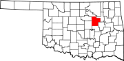
Towns Depew | Kellyville | Kiefer | Lawrence Creek | Mannford‡ | Mounds | Shamrock | Slick
CDP Unincorporated
communitiesGhost towns Pameta | Phillipsburg | Pumpkin Center | Robertsburg | Thompsonville | Twin Mounds
Footnotes ‡This populated place also has portions in an adjacent county or counties
Categories:- Populated places in Creek County, Oklahoma
- Tulsa Metropolitan Area
- Towns in Oklahoma

Wikimedia Foundation. 2010.