- Oilton, Oklahoma
-
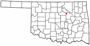
Oilton, Oklahoma — City — Location of Oilton, Oklahoma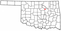
Coordinates: 36°5′6″N 96°35′12″W / 36.085°N 96.58667°WCoordinates: 36°5′6″N 96°35′12″W / 36.085°N 96.58667°W Country United States State Oklahoma County Creek Area – Total 0.7 sq mi (1.7 km2) – Land 0.7 sq mi (1.7 km2) – Water 0.0 sq mi (0.0 km2) Elevation 784 ft (239 m) Population (2000) – Total 1,099 – Density 1,690.2/sq mi (652.6/km2) Time zone Central (CST) (UTC-6) – Summer (DST) CDT (UTC-5) ZIP code 74052 Area code(s) 539/918 FIPS code 40-54000[1] GNIS feature ID 1096192[2] Oilton is a city in Creek County, Oklahoma, United States. The population was 1,099 at the 2000 census.
Geography
Oilton is located at 36°5′6″N 96°35′12″W / 36.085°N 96.58667°W (36.085046, -96.586629)[3].
According to the United States Census Bureau, the city has a total area of 0.6 square miles (1.6 km2), all of it land.
Demographics
As of the census[1] of 2000, there were 1,099 people, 447 households, and 291 families residing in the city. The population density was 1,690.2 people per square mile (652.8/km²). There were 526 housing units at an average density of 809.0 per square mile (312.4/km²). The racial makeup of the city was 86.72% White, 0.82% African American, 6.64% Native American, 0.73% from other races, and 5.10% from two or more races. Hispanic or Latino of any race were 2.73% of the population.
There were 447 households out of which 33.6% had children under the age of 18 living with them, 51.2% were married couples living together, 10.3% had a female householder with no husband present, and 34.7% were non-families. 30.9% of all households were made up of individuals and 16.3% had someone living alone who was 65 years of age or older. The average household size was 2.46 and the average family size was 3.11.
In the city the population was spread out with 29.1% under the age of 18, 9.2% from 18 to 24, 26.7% from 25 to 44, 20.0% from 45 to 64, and 15.0% who were 65 years of age or older. The median age was 34 years. For every 100 females there were 89.2 males. For every 100 females age 18 and over, there were 87.3 males.
The median income for a household in the city was $23,274, and the median income for a family was $29,766. Males had a median income of $26,250 versus $19,219 for females. The per capita income for the city was $11,831. About 21.7% of families and 26.4% of the population were below the poverty line, including 35.7% of those under age 18 and 12.7% of those age 65 or over.
References
- ^ a b "American FactFinder". United States Census Bureau. http://factfinder.census.gov. Retrieved 2008-01-31.
- ^ "US Board on Geographic Names". United States Geological Survey. 2007-10-25. http://geonames.usgs.gov. Retrieved 2008-01-31.
- ^ "US Gazetteer files: 2010, 2000, and 1990". United States Census Bureau. 2011-02-12. http://www.census.gov/geo/www/gazetteer/gazette.html. Retrieved 2011-04-23.
Municipalities and communities of Creek County, Oklahoma Cities 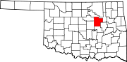
Towns Depew | Kellyville | Kiefer | Lawrence Creek | Mannford‡ | Mounds | Shamrock | Slick
CDP Unincorporated
communitiesGhost towns Pameta | Phillipsburg | Pumpkin Center | Robertsburg | Thompsonville | Twin Mounds
Footnotes ‡This populated place also has portions in an adjacent county or counties
Categories:- Cities in Oklahoma
- Populated places in Creek County, Oklahoma

Wikimedia Foundation. 2010.