- Oologah, Oklahoma
-
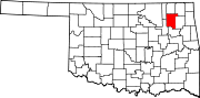
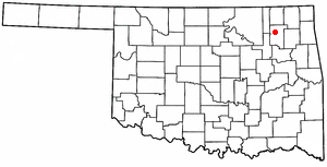
Oologah, Oklahoma — Town — Location of Oologah, Oklahoma
Coordinates: 36°26′36.135″N 95°42′31.053″W / 36.44337083°N 95.70862583°WCoordinates: 36°26′36.135″N 95°42′31.053″W / 36.44337083°N 95.70862583°W Country United States State Oklahoma County Rogers Government – Mayor Jerry Holland Area – Total 1.25 sq mi (3.24 km2) – Land 1.25 sq mi (3.24 km2) – Water 0.0 sq mi (0.0 km2) Elevation 656 ft (200 m) Population (2010) – Total 1,146 – Density 917.43/sq mi (354.22/km2) Time zone Central (CST) (UTC-6) – Summer (DST) CDT (UTC-5) ZIP code 74053 Area code(s) 539/918 FIPS code 40-55700[1] Oologah is a town in Rogers County, Oklahoma, United States. Renowned humorist Will Rogers was born on a ranch two miles east of Oologah, though he usually claimed Claremore as his birthplace, "because nobody but an Indian can pronounce 'Oologah.'"[2] There has been disagreement about the proper spelling for the town name. The official spelling is now Oologah. It was often spelled Oolagah before statehood, and this spelling appears on some old buildings.[3]
Contents
History
In 1889, the Kansas and Arkansas Railway (later, the St. Louis, Iron Mountain and Southern Railway and finally, part of the Missouri Pacific Railroad) laid tracks through the area and established a townsite named Oologah, Indian Territory. Oologah was named for Oologah (Dark Cloud), a Cherokee chief.[4] The post office was opened May 25, 1891.[5]
Early in the 20th Century, the town flourished because of agriculture, coal mining, and oil and gas production. However, these were hard hit during the Great Depression. Town population declined from 324 in 1910 to 236 in 1940. The population had recovered to 299 in 1960. Construction of Oologah dam and lake in 1963, east of town, revitalized the town, which has continued to grow.[5]
In 1991, the Andover, Kansas tornado destroyed the north side of Oologah, including the town's school.
Geography
Oologah is located at 36°26′36″N 95°42′34″W / 36.44333°N 95.70944°W (36.443268, -95.709399)[6]. By comparison, the population was 883 at the 2000 census. According to the United States Census Bureau, the town has a total area of 0.9 square miles (2.3 km2), all of it land.
Demographics
As of the census[1] of 2010, there were 1,146 people and 481 households residing in the town. The population density was 917.43 people per square mile (354.22/km²). The racial makeup of the town was 76.4% White, 0.1% African American, 15.4% Native American, 1% Asian, .7% from other races, and 6% from two or more races. Hispanic or Latino of any race were 3.3% of the population. 609.3% of the population was over 18.
As of the 2000 census, there were 342 households out of which 42.1% had children under the age of 18 living with them, 52.0% were married couples living together, 18.4% had a female householder with no husband present, and 24.3% were non-families. 22.5% of all households were made up of individuals and 9.6% had someone living alone who was 65 years of age or older. The average household size was 2.58 and the average family size was 3.03.
In the town the population was spread out with 31.6% under the age of 18, 8.6% from 18 to 24, 27.7% from 25 to 44, 22.1% from 45 to 64, and 10.0% who were 65 years of age or older. The median age was 33 years. For every 100 females there were 89.9 males. For every 100 females age 18 and over, there were 84.1 males.
The median income for a household in the town was $33,977, and the median income for a family was $40,625. Males had a median income of $37,500 versus $25,000 for females. The per capita income for the town was $16,493. About 7.5% of families and 9.8% of the population were below the poverty line, including 14.7% of those under age 18 and 6.9% of those age 65 or over.
Education
Oologah-Talala public school is a 4A sized high school with excellent facilities. The Oologah Lower Elementary is an "Oklahoma A+" school, recognized as being one of seventeen schools statewide chosen for the prestigious honor.
The Oologah-Talala High School athletic program has gained the school notoriety. In the 1990s Oologah had the most successful class 3A football program in the state; an era that featured the Mustangs as class 3A State Champions in 1997 & 1998[7] and two class 2A state runner-up finishes.
In March 2010, an outbreak of bacterial meningitis killed two students at Oologah-Talala Lower Elementary School.[8]
Famous Citizens
- Will Rogers – Preeminent philanthropist, actor, humorist, philosopher, and political satirist of the early 1900s; born at Dog Iron Ranch just outside of Oologah.
See also
External links
- The Oologah Lake Leader – A well-known local newspaper.
- Oologah Lake on Corps of Engineers website
- Oologah-Talala Public Schools website
- Chamber of Commerce website
- Oologah.com
References
- ^ a b "American FactFinder". United States Census Bureau. http://factfinder.census.gov. Retrieved 2008-01-31.
- ^ Oologah Lake Leader Online
- ^ USA Cities on line.[1]
- ^ Shirk, George H. Oklahoma Place Names. University of Oklahoma Press; Norman, Oklahoma; 1987. ISBN 0-8061-2028-2.
- ^ a b O'Dell, Larry. The Encyclopedia of Oklahoma History & Culture: Oologah[2]
- ^ "US Gazetteer files: 2010, 2000, and 1990". United States Census Bureau. 2011-02-12. http://www.census.gov/geo/www/gazetteer/gazette.html. Retrieved 2011-04-23.
- ^ Oklahoma Secondary School Activities Association
- ^ Bacterial Meningitis Deaths at Oologah Elementary School
Municipalities and communities of Rogers County, Oklahoma Cities Catoosa‡ | Claremore | Collinsville‡ | Owasso‡ | Tulsa‡
Towns CDPs Unincorporated
communitiesFootnotes ‡This populated place also has portions in an adjacent county or counties
Categories:- Populated places in Rogers County, Oklahoma
- Towns in Oklahoma

Wikimedia Foundation. 2010.