- National Register of Historic Places listings in Clay County, Mississippi
-
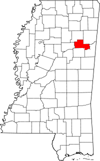 Location of Clay County in Mississippi
This is a list of the National Register of Historic Places listings in Clay County, Mississippi.
This is intended to be a complete list of the properties and districts on the National Register of Historic Places in Clay County, Mississippi, United States. Latitude and longitude coordinates are provided for many National Register properties and districts; these locations may be seen together in a Google map.[1]
There are 27 properties and districts listed on the National Register in the county, including 1 National Historic Landmark.
-
- This National Park Service list is complete through NPS recent listings posted November 10, 2011.[2]
Current listings
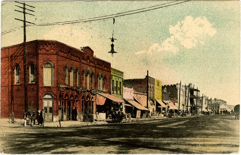
[3] Landmark name [4] Image Date listed Location City or town Summary 1 Dewitt Anderson House August 31, 1990 104 W. Broad St.
33°36′15″N 88°39′02″W / 33.604167°N 88.650556°WWest Point 2 Brandtown Gin Historic District November 15, 1991 Mississippi Highway 47 at Brandtown, west of Prairie
33°48′03″N 88°51′10″W / 33.800833°N 88.852778°WPrairie 3 Brogan Mound and Village Site Discontiguous District May 24, 1991 Address Restricted West Point 4 Clay County Agricultural High School November 15, 1991 Between Pheba Sts. Nos. 7 and 8, south of Mississippi Highway 50
33°35′06″N 88°56′48″W / 33.585°N 88.946667°WPheba 5 Colbert and Barton Townsites June 20, 1977 Western bank of the Tombigbee River, northeast of West Point (Colbert);
33°37′50″N 88°30′15″W / 33.63056°N 88.50417°W
on a bluff over the western bank of the Tombigbee River, northeast of West Point (Barton)
33°38′20″N 88°30′20″W / 33.63889°N 88.50556°W[5]West Point 6 Commerce Street Historic District 
August 31, 1990 508-731 Commerce St.
33°36′06″N 88°38′44″W / 33.601667°N 88.645556°WWest Point 7 Court Street Historic District August 12, 1982 Court Street between Travis and E. Broad Streets
33°36′08″N 88°38′56″W / 33.602222°N 88.648889°WWest Point 8 East Main Street Historic District August 31, 1990 510-1030 E. Main St.
33°36′26″N 88°38′29″W / 33.607222°N 88.641389°WWest Point 9 Mary Holmes Junior College Historic District November 15, 1991 Mississippi Highway 50, west of its junction with Mississippi Highway 45, W.W
33°36′29″N 88°39′55″W / 33.608056°N 88.665278°WWest Point 10 Charles R. Jordan House November 15, 1991 Tibbee-Columbus Rd., south of New Hope Church
33°31′47″N 88°37′53″W / 33.529722°N 88.631389°WWest Point 11 Moses Jordan House August 31, 1990 940 E. Broad St.
33°36′11″N 88°38′33″W / 33.603056°N 88.6425°WWest Point 12 Nathan Mathews House and Mathews Cotton Gin November 15, 1991 Mathews Gin Rd., north of Union Staff Church
33°35′19″N 88°33′43″W / 33.588611°N 88.561944°WWest Point 13 Montpelier Historic District November 15, 1991 Junction of Mississippi Highways 46 and 389
33°43′02″N 88°56′52″W / 33.717222°N 88.947778°WMontpelier 14 Pheba Historic District November 15, 1991 Pheba St. No. 2, just west of Mississippi Highway 389
33°34′52″N 88°57′00″W / 33.581111°N 88.95°WPheba 15 Powell-Vail House November 15, 1991 Eastern side of Vail Rd., 1.2 miles north of Mississippi Highway 50
33°36′16″N 88°55′43″W / 33.604444°N 88.928611°WPheba 16 South Division Street Historic District August 31, 1990 447-646 S. Division St.
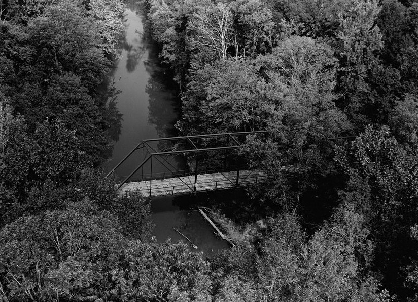
33°36′11″N 88°32′32″W / 33.603056°N 88.542222°WWest Point 17 Tibbee Bridge 
November 16, 1988 Spans Tibbee Creek on Old Tibbee Rd.
33°32′17″N 88°38′00″W / 33.538056°N 88.633333°WWest Point 18 Tibbee School November 15, 1991 Tibbee-Columbus Rd., at Tibbee
33°31′33″N 88°37′43″W / 33.525833°N 88.628611°WWest Point 19 Town of Palo Alto August 20, 1987 Mississippi Highway 47, northwest of West Point
33°40′50″N 88°48′0″W / 33.68056°N 88.8°W[6]Palo Alto 20 Turnage House November 15, 1991 Turnage Rd., northeast of Palestine Church
33°43′18″N 88°54′41″W / 33.721667°N 88.911389°WMontpelier 21 Una Consolidated School November 15, 1991 Una-Prairie Rd., east of Pleasant Grove Church
33°47′45″N 88°47′10″W / 33.795833°N 88.786111°WPrairie 22 Waide Archeological Site July 27, 1999 Address Restricted Palo Alto 23 Waverley 
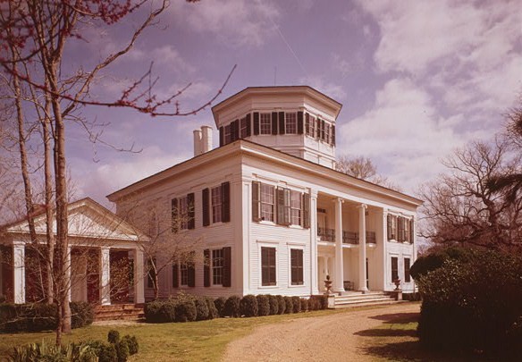
September 20, 1973 10 miles east of West Point
33°34′09″N 88°30′13″W / 33.569167°N 88.503611°WWest Point 24 Waverly Bridge March 20, 1989 Spans the Tombigbee River on the Columbus and Greenville railroad line
33°33′54″N 88°29′48″W / 33.565°N 88.496667°WWaverly Extends into Lowndes County 25 West Point Central City Historic District June 1, 1982 Mississippi Highway 50
33°36′25″N 88°38′59″W / 33.606944°N 88.649722°WWest Point 26 West Point School Historic District August 31, 1990 Roughly bounded by E. Westbrook, Calhoun, Travis and East Sts.
33°36′04″N 88°38′37″W / 33.601111°N 88.643611°WWest Point 27 West Point Unified Historic District December 1, 2009 Roughly bounded by the rear property lines of resources along E. Main St. to the north, McCord St. to the west, and Forest St.
33°36′26″N 88°38′05″W / 33.607092°N 88.634694°WWest Point See also
- List of National Historic Landmarks in Mississippi
- National Register of Historic Places listings in Mississippi
References
- ^ The latitude and longitude information provided in this table was derived originally from the National Register Information System, which has been found to be fairly accurate for about 99% of listings. For about 1% of NRIS original coordinates, experience has shown that one or both coordinates are typos or otherwise extremely far off; some corrections may have been made. A more subtle problem causes many locations to be off by up to 150 yards, depending on location in the country: most NRIS coordinates were derived from tracing out latitude and longitudes off of USGS topographical quadrant maps created under the North American Datum of 1927, which differs from the current, highly accurate WGS84 GPS system used by Google maps. Chicago is about right, but NRIS longitudes in Washington are higher by about 4.5 seconds, and are lower by about 2.0 seconds in Maine. Latitudes differ by about 1.0 second in Florida. Some locations in this table may have been corrected to current GPS standards.
- ^ "National Register of Historic Places: Weekly List Actions". National Park Service, United States Department of the Interior. Retrieved on November 10, 2011.
- ^ Numbers represent an ordering by significant words. Various colorings, defined here, differentiate National Historic Landmark sites and National Register of Historic Places Districts from other NRHP buildings, structures, sites or objects.
- ^ "National Register Information System". National Register of Historic Places. National Park Service. . http://nrhp.focus.nps.gov/natreg/docs/All_Data.html.
- ^ Locations derived from the GNIS feature records for Colbert and Barton; the NRIS lists the sites as "Address Restricted"
- ^ Location derived from its GNIS feature record; the NRIS lists the site as "Address Restricted"
U.S. National Register of Historic Places Topics Lists by states Alabama • Alaska • Arizona • Arkansas • California • Colorado • Connecticut • Delaware • Florida • Georgia • Hawaii • Idaho • Illinois • Indiana • Iowa • Kansas • Kentucky • Louisiana • Maine • Maryland • Massachusetts • Michigan • Minnesota • Mississippi • Missouri • Montana • Nebraska • Nevada • New Hampshire • New Jersey • New Mexico • New York • North Carolina • North Dakota • Ohio • Oklahoma • Oregon • Pennsylvania • Rhode Island • South Carolina • South Dakota • Tennessee • Texas • Utah • Vermont • Virginia • Washington • West Virginia • Wisconsin • WyomingLists by territories Lists by associated states Other Municipalities and communities of Clay County, Mississippi City 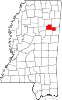
Unincorporated
communitiesAbbott | Cedarbluff | Hopewell | Montpelier | Pheba | Tibbee | Una
Ghost town Palo Alto
Categories:- Clay County, Mississippi
- National Register of Historic Places in Mississippi by county
- Buildings and structures in Clay County, Mississippi
-

Wikimedia Foundation. 2010.