- National Register of Historic Places listings in Clay County, South Dakota
-
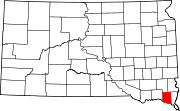
 Location of Clay County in South Dakota
This is a list of the National Register of Historic Places listings in Clay County, South Dakota.
This is intended to be a complete list of the properties and districts on the National Register of Historic Places in Clay County, South Dakota, United States. The locations of National Register properties and districts for which the latitude and longitude coordinates are included below, may be seen in a Google map.[1]
There are 38 properties and districts listed on the National Register in the county. Another 2 properties were once listed but have since been removed.
-
- This National Park Service list is complete through NPS recent listings posted November 10, 2011.[2]
Current listings
[3] Landmark name [4] Image Date listed Location City or town Summary 1 Anderson Homestead March 30, 1978 East of Hub City
42°57′45″N 96°48′23″W / 42.9625°N 96.806389°WHub City 2 William Andre House October 31, 2002 31256 452nd Ave.
42°51′30″N 97°09′35″W / 42.858333°N 97.159722°WGayville 3 Old Armory-Vermillion October 31, 2002 414 E. Clark St.
42°47′03″N 96°55′30″W / 42.784167°N 96.925°WVermillion 4 Austin-Whittemore House 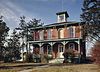
October 18, 1972 15 Austin Ave.
42°46′44″N 96°56′07″W / 42.778889°N 96.935278°WVermillion 5 Bluff View Cemetery Chapel May 31, 2006 0.2 miles south of junction of Crawford Rd. and Pinehurst Dr.
42°46′25″N 96°54′20″W / 42.773611°N 96.905556°WVermillion 6 Building at 125 Ohio St. February 14, 2002 125 Ohio St.
43°00′28″N 97°06′21″W / 43.007778°N 97.105833°WWakonda 7 Burbank School No. 10 July 5, 1996 White St., 2 blocks north of the former Chicago, Milwaukee, St. Paul and Pacific railroad tracks.
42°44′53″N 96°49′41″W / 42.748056°N 96.828056°WBurbank 8 Clay County Courthouse August 18, 1983 211 W. Main St.
42°46′47″N 96°56′08″W / 42.779722°N 96.935556°WVermillion 9 Colton House November 19, 2007 402 S. University St.
42°46′37″N 96°55′26″W / 42.776944°N 96.923889°WVermillion 10 Downtown Vermillion Historic District March 7, 2003 Main St., roughly bounded by Market and Dakota Sts.
42°46′45″N 96°55′52″W / 42.779167°N 96.931111°WVermillion 11 First Baptist Church of Vermillion March 5, 1982 101 E. Main St.
42°46′44″N 96°55′49″W / 42.778889°N 96.930278°WVermillion 12 First Methodist Episcopal Church January 28, 2004 14-16 North Dakota St.
42°46′46″N 96°55′46″W / 42.779444°N 96.929444°WVermillion 13 First National Bank Building of Vermillion February 13, 1986 1 E. Main St.
42°46′45″N 96°55′54″W / 42.779167°N 96.931667°WVermillion 14 Forest Avenue Historic District October 18, 1979 Forest Ave. and Lewis St.
42°46′36″N 96°55′43″W / 42.776667°N 96.928611°WVermillion 15 Garfield Township Hall January 28, 2004 16667 306th St.
42°57′08″N 96°51′50″W / 42.952222°N 96.863889°WBeresford 16 Gunderson House February 9, 2001 24 S. Harvard
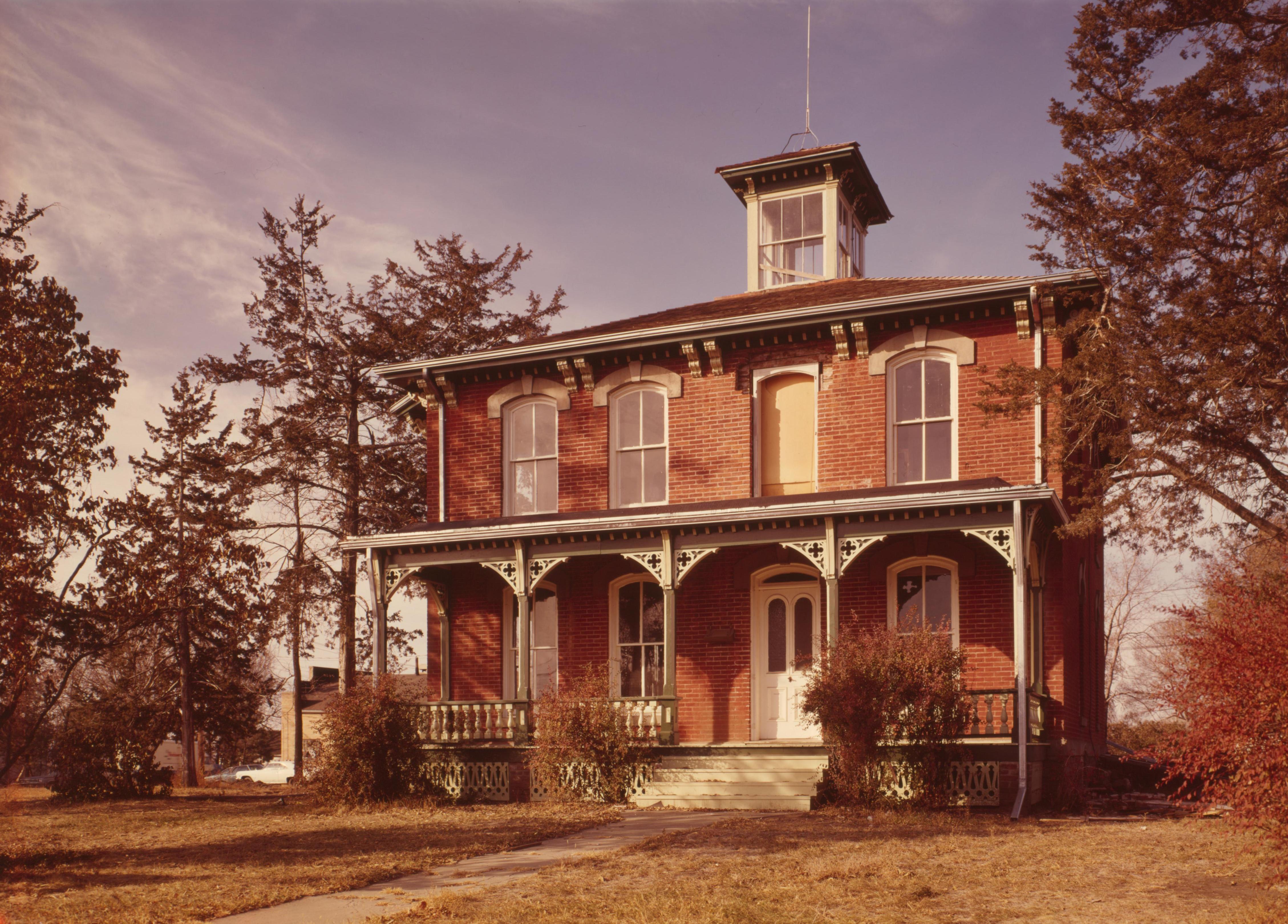
42°46′38″N 96°55′39″W / 42.777222°N 96.9275°WVermillion 17 Inman House 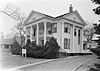
May 24, 1976 415 E. Main St.
42°46′45″N 96°55′31″W / 42.779167°N 96.925278°WVermillion 18 Calle Nissen Johnsen Farm December 17, 1999 31494 453rd Ave.
42°49′31″N 97°07′59″W / 42.825278°N 97.133056°WGayville 19 Jens N. and Anna Junker Farmstead December 20, 1988 Norway Township, Section 6
42°48′46″N 97°08′57″W / 42.812778°N 97.149167°WNorway Township 20 Lincoln School No. 12 August 16, 2000 45352 Timber Rd.
42°47′42″N 97°07′56″W / 42.795°N 97.132222°WMeckling 21 Linden House September 14, 2001 509 Linden Ave.
42°46′26″N 96°55′24″W / 42.773889°N 96.923333°WVermillion 22 Daniel A. Messler Homestead February 14, 2002 30337 Greenfield Rd.
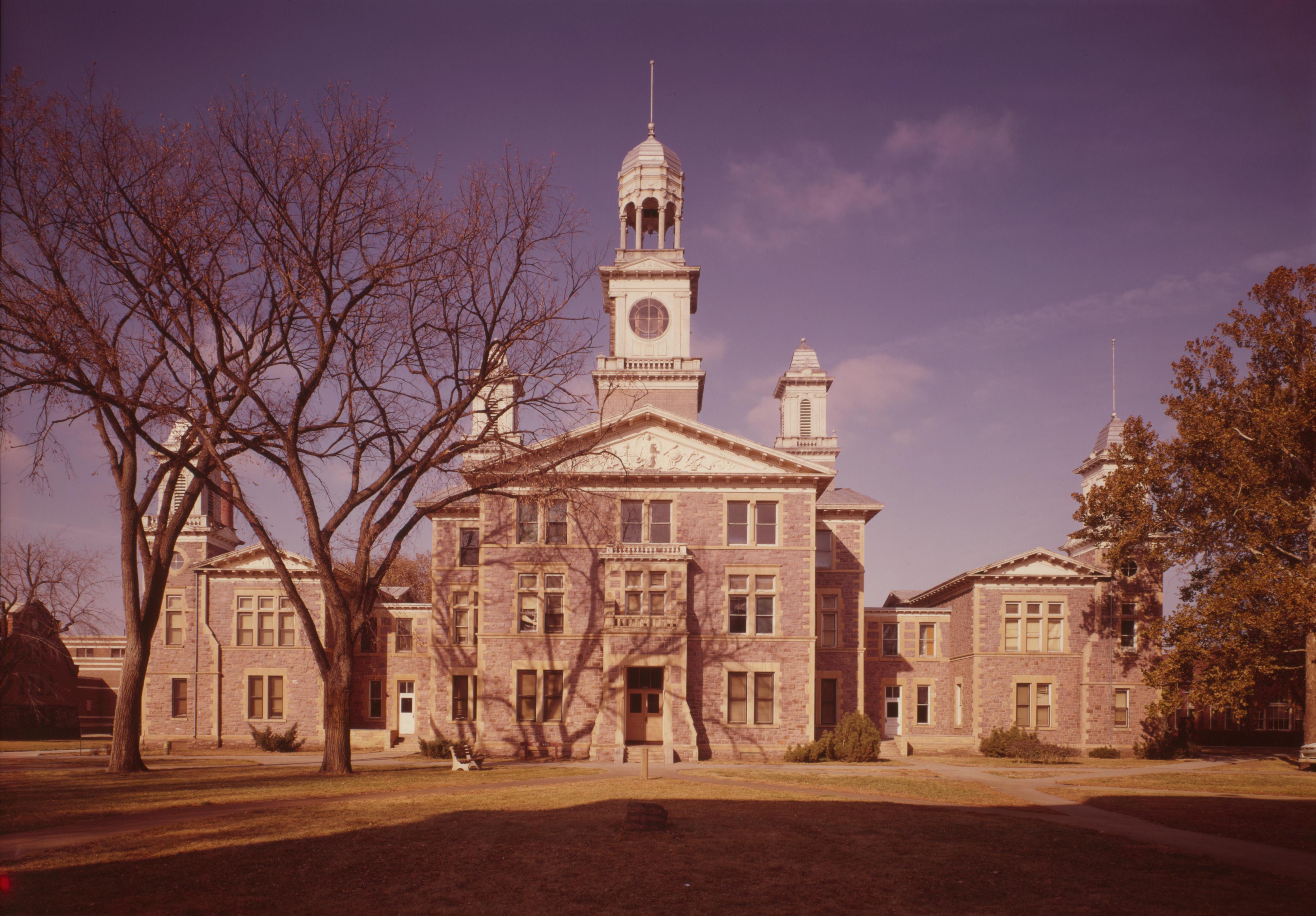
42°59′36″N 96°50′59″W / 42.993333°N 96.849722°WBeresford 23 Old Main 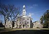
March 24, 1973 Clark St. on the University of South Dakota campus
42°47′02″N 96°55′26″W / 42.783889°N 96.923889°WVermillion 24 Prentis Park November 8, 2001 Plum and Main Sts.
42°46′53″N 96°55′05″W / 42.781389°N 96.918056°WVermillion 25 Rice Farm January 20, 1978 West of Vermillion
42°53′47″N 97°01′11″W / 42.896389°N 97.019722°WVermillion 26 St. Agnes Catholic Church March 27, 1995 202 Washington St.
42°46′54″N 96°56′04″W / 42.781667°N 96.934444°WVermillion 27 Sample-Lindblaum House December 2, 1998 410 Idaho St.
43°00′48″N 97°06′24″W / 43.013333°N 97.106667°WWakonda 28 South Dakota Department of Trans. Br. No. 14-130-176 November 8, 2001 Local road over the Vermillion River
42°49′47″N 96°54′15″W / 42.829722°N 96.904167°WVermillion 29 South Dakota Department of Trans. Br. No. 14-133-170 November 8, 2001 Local road over the Vermillion River
42°50′15″N 96°53′44″W / 42.8375°N 96.895556°WVermillion 30 South Dakota Department of Transportation Bridge No. 14-060-032 January 28, 2000 Local road over Spring Creek
43°02′18″N 97°02′30″W / 43.038333°N 97.041667°WWakonda 31 South Dakota Department of Transportation Bridge No. 14-088-170 January 14, 2000 Local road over Clay Creek Ditch
42°50′14″N 96°59′17″W / 42.837222°N 96.988056°WVermillion 32 South Dakota Department of Transportation Bridge No. 14-090-042 January 14, 2000 Local road over the Vermillion River
43°01′23″N 96°58′56″W / 43.023056°N 96.982222°WWakonda 33 Spirit Mound November 19, 1974 North of Vermillion
42°52′32″N 96°57′32″W / 42.875556°N 96.958889°WVermillion 34 Vermillion Historic District February 24, 1975 Bounded by N. Yale, E. Clark, Willow, and E. Main Sts.
42°46′52″N 96°55′27″W / 42.781111°N 96.924167°WVermillion 35 Vermillion-Andrew Carnegie Library August 18, 1983 12 Church St.
42°46′43″N 96°55′49″W / 42.778611°N 96.930278°WVermillion 36 Wakonda State Bank August 15, 2003 118 Ohio St.
43°00′26″N 97°06′21″W / 43.007222°N 97.105833°WWakonda 37 E.H. Willey House June 17, 1982 104 Court St.
42°46′41″N 96°55′54″W / 42.778056°N 96.931667°WVermillion 38 Yusten House January 23, 2007 30831 Highway 19
42°55′20″N 96°57′17″W / 42.922222°N 96.954722°WVermillion Former listings
Landmark name Image Date Location City or Town Summary 1 South Dakota Department of Transportation Bridge No. 14-105-209 March 26, 2008 (delisted) Vermillion 2 South Dakota Department of Transportation Bridge No. 14-120-222 March 26, 2008 (delisted) Wakonda See also
- List of National Historic Landmarks in South Dakota
- National Register of Historic Places listings in South Dakota
References
- ^ The latitude and longitude information provided in this table was derived originally from the National Register Information System, which has been found to be fairly accurate for about 99% of listings. For about 1% of NRIS original coordinates, experience has shown that one or both coordinates are typos or otherwise extremely far off; some corrections may have been made. A more subtle problem causes many locations to be off by up to 150 yards, depending on location in the country: most NRIS coordinates were derived from tracing out latitude and longitudes off of USGS topographical quadrant maps created under North American Datum of 1927, which differs from the current, highly accurate GPS system used by Google maps. Chicago is about right, but NRIS longitudes in Washington are higher by about 4.5 seconds, and are lower by about 2.0 seconds in Maine. Latitudes differ by about 1.0 second in Florida. Some locations in this table may have been corrected to current GPS standards.
- ^ "National Register of Historic Places: Weekly List Actions". National Park Service, United States Department of the Interior. Retrieved on November 10, 2011.
- ^ Numbers represent an ordering by significant words. Various colorings, defined here, differentiate National Historic Landmark sites and National Register of Historic Places Districts from other NRHP buildings, structures, sites or objects.
- ^ "National Register Information System". National Register of Historic Places. National Park Service. . http://nrhp.focus.nps.gov/natreg/docs/All_Data.html.
U.S. National Register of Historic Places Topics Lists by states Alabama • Alaska • Arizona • Arkansas • California • Colorado • Connecticut • Delaware • Florida • Georgia • Hawaii • Idaho • Illinois • Indiana • Iowa • Kansas • Kentucky • Louisiana • Maine • Maryland • Massachusetts • Michigan • Minnesota • Mississippi • Missouri • Montana • Nebraska • Nevada • New Hampshire • New Jersey • New Mexico • New York • North Carolina • North Dakota • Ohio • Oklahoma • Oregon • Pennsylvania • Rhode Island • South Carolina • South Dakota • Tennessee • Texas • Utah • Vermont • Virginia • Washington • West Virginia • Wisconsin • WyomingLists by territories Lists by associated states Other  Category:National Register of Historic Places •
  Portal:National Register of Historic Places
Municipalities and communities of Clay County, South Dakota County seat: Vermillion Cities Irene‡ | Vermillion
Town Unincorporated
communitiesFootnotes ‡This populated place also has portions in an adjacent county or counties
Categories:- Clay County, South Dakota
- National Register of Historic Places in South Dakota by county
- Buildings and structures in Clay County, South Dakota
-


Wikimedia Foundation. 2010.