- National Register of Historic Places listings in Clay County, Minnesota
-
List of NRHP listings in Clay County, Minnesota. See List of RHPs in MN.
Current listings
[1] Landmark name Image Date listed Location City or town Summary 1 Barnesville City Hall and Jail May 7, 1980 Front and Main Sts.
46°39′48″N 96°25′12″W / 46.663333°N 96.42°WBarnesville 2 John Bergquist House May 7, 1980 719 10th Ave., N.
46°53′13″N 96°46′07″W / 46.886944°N 96.768611°WMoorhead 3 Bernard Bernhardson House May 7, 1980 County Road 59
46°41′35″N 96°47′05″W / 46.693056°N 96.784722°WComstock 4 Buffalo River State Park WPA/Rustic Style Historic Resources October 25, 1989 Off U.S. Route 10 east of Glyndon
46°51′50″N 96°28′04″W / 46.863889°N 96.467778°WGlyndon 5 Burnham Building May 7, 1980 420 Main Ave.
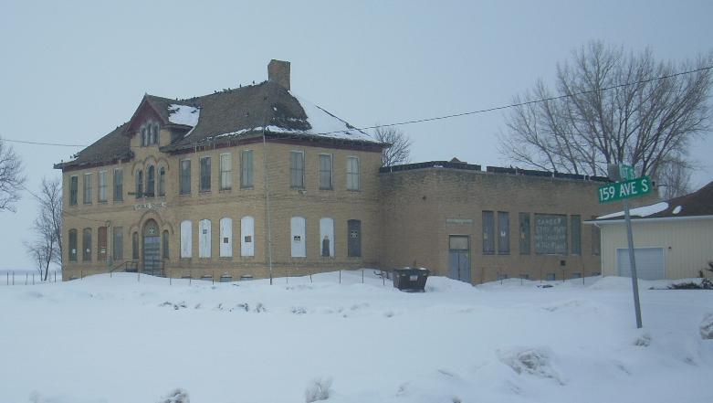
46°52′26″N 96°46′21″W / 46.873889°N 96.7725°WMoorhead 6 Comstock Public School 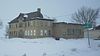
May 7, 1980 Main St.
46°39′39″N 96°45′02″W / 46.660833°N 96.750556°WComstock 7 Solomon Gilman Comstock House December 30, 1974 5th Ave. and 8th St., S.
46°52′10″N 96°46′04″W / 46.869444°N 96.767778°WMoorhead 8 Fairmont Creamery Company February 10, 1983 801 2nd Ave., N.
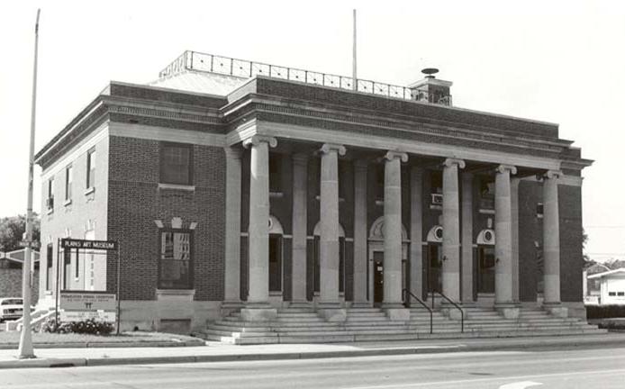
46°52′37″N 96°45′59″W / 46.876944°N 96.766389°WMoorhead 9 Federal Courthouse and Post Office 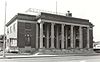
May 7, 1980 521 Main Ave.
46°52′24″N 96°46′15″W / 46.873333°N 96.770833°WMoorhead 10 Lew A. Huntoon House May 7, 1980 709 8th St., S.
46°52′01″N 96°46′05″W / 46.866944°N 96.768056°WMoorhead 11 Wulf C. Krabbenhoft Farmstead May 7, 1980 County Road 69
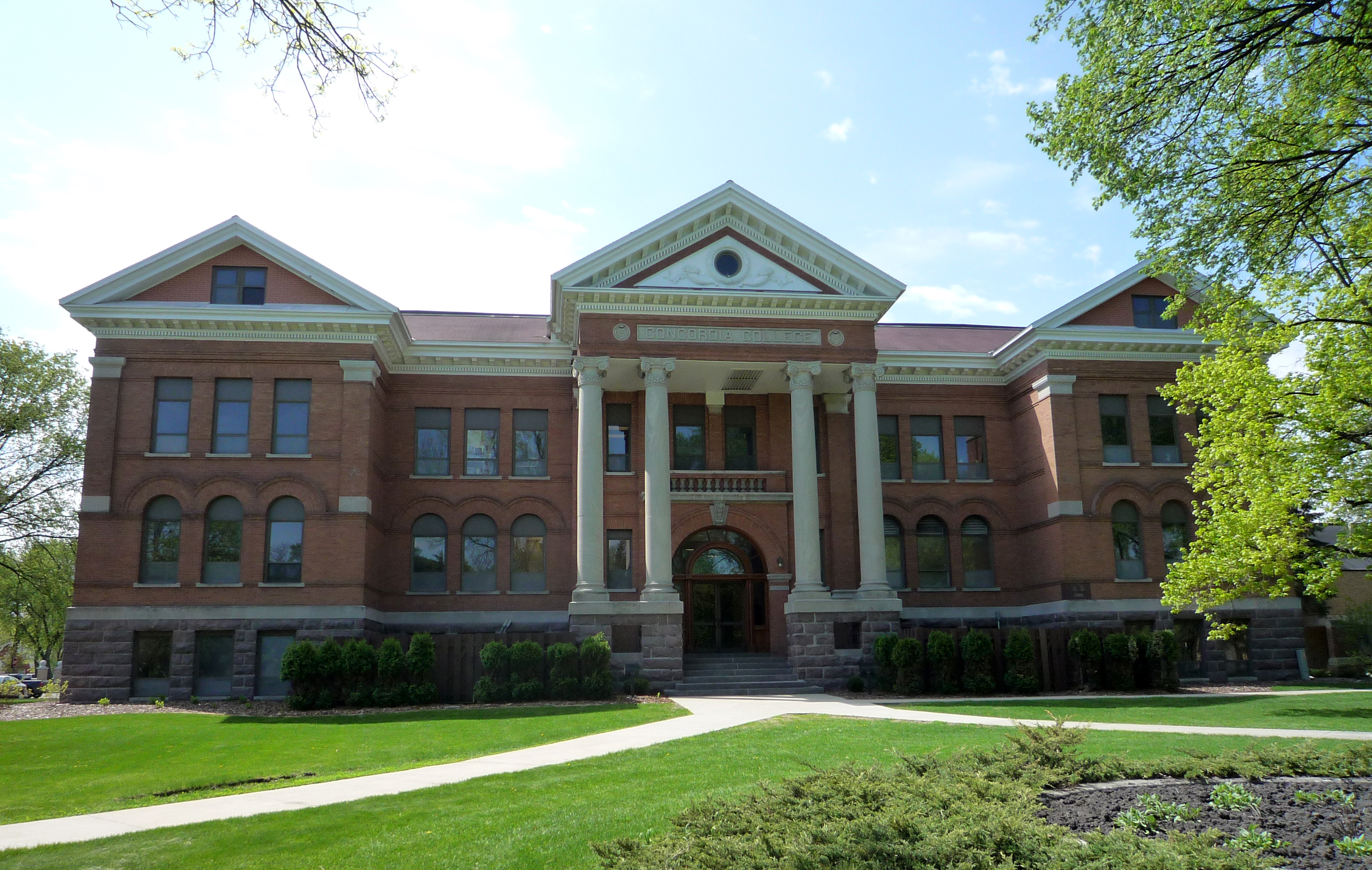
46°47′25″N 96°37′33″W / 46.790278°N 96.625833°WSabin 12 Main Building, Concordia College 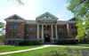
May 7, 1980 S. 8th St.
46°51′56″N 96°46′07″W / 46.865556°N 96.768611°WMoorhead 13 John Olness House May 7, 1980 U.S. Route 75
46°59′31″N 96°45′08″W / 46.991944°N 96.752222°WGeorgetown 14 Park Elementary School December 22, 1988 121 6th Ave. S.
46°52′05″N 96°46′30″W / 46.868056°N 96.775°WMoorhead 15 Patterson-Hernandez House May 7, 1980 1st Ave. and Elm St.
46°39′48″N 96°25′31″W / 46.663333°N 96.425278°WBarnesville 16 Randolph M. Probstfield House May 7, 1980 County Highway 96
46°55′20″N 96°45′08″W / 46.922222°N 96.752222°WMoorhead 17 St. John the Divine Episcopal Church May 7, 1980 120 S. 8th St.
46°52′22″N 96°46′02″W / 46.872778°N 96.767222°WMoorhead 18 Hannah C. and Peter E. Thompson House February 23, 1996 361 2nd St., NE.
46°39′23″N 96°25′05″W / 46.656389°N 96.418056°WBarnesville References
- ^ Numbers represent an ordering by significant words. Various colorings, defined here, differentiate National Historic Landmark sites and National Register of Historic Places Districts from other NRHP buildings, structures, sites or objects.
U.S. National Register of Historic Places Topics Lists by states Alabama • Alaska • Arizona • Arkansas • California • Colorado • Connecticut • Delaware • Florida • Georgia • Hawaii • Idaho • Illinois • Indiana • Iowa • Kansas • Kentucky • Louisiana • Maine • Maryland • Massachusetts • Michigan • Minnesota • Mississippi • Missouri • Montana • Nebraska • Nevada • New Hampshire • New Jersey • New Mexico • New York • North Carolina • North Dakota • Ohio • Oklahoma • Oregon • Pennsylvania • Rhode Island • South Carolina • South Dakota • Tennessee • Texas • Utah • Vermont • Virginia • Washington • West Virginia • Wisconsin • WyomingLists by territories Lists by associated states Other Categories:- National Register of Historic Places in Minnesota by county
- Clay County, Minnesota
- Buildings and structures in Clay County, Minnesota
Wikimedia Foundation. 2010.