- Barnesville, Minnesota
Infobox Settlement
official_name = Barnesville, Minnesota
settlement_type =City
nickname =
motto =
imagesize =
image_caption =
image_
imagesize =
image_caption =
image_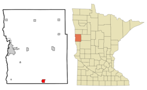
mapsize = 250px
map_caption = Location of Barnesville, Minnesota
mapsize1 =
map_caption1 =subdivision_type = Country
subdivision_name =United States
subdivision_type1 = State
subdivision_name1 =Minnesota
subdivision_type2 = County
subdivision_name2 = Claygovernment_footnotes =
government_type =
leader_title =
leader_name =
leader_title1 =
leader_name1 =
established_title =
established_date =unit_pref = Imperial
area_footnotes =area_magnitude =
area_total_km2 = 5.5
area_land_km2 = 5.4
area_water_km2 = 0.0
area_total_sq_mi = 2.1
area_land_sq_mi = 2.1
area_water_sq_mi = 0.0population_as_of = 2000
population_footnotes =
population_total = 2173
population_density_km2 = 398.8
population_density_sq_mi = 1032.8timezone = Central (CST)
utc_offset = -6
timezone_DST = CDT
utc_offset_DST = -5
elevation_footnotes =
elevation_m = 312
elevation_ft = 1024
latd = 46 |latm = 39 |lats = 7 |latNS = N
longd = 96 |longm = 25 |longs = 0 |longEW = Wpostal_code_type =
ZIP code
postal_code = 56514
area_code = 218
blank_name = FIPS code
blank_info = 27-03574GR|2
blank1_name = GNIS feature ID
blank1_info = 0639637GR|3
website =
footnotes =Barnesville is a city in Clay County,
Minnesota ,United States . The population was 2,173 at the 2000 census. It is considered a bedroom community to theFargo-Moorhead metro area. "Barnesville Potato Days" is held there annually in August.Interstate 94 and Minnesota State Highways 9 and 34 are three of the main arterial routes in the city.Geography
According to the
United States Census Bureau , the city has a total area of 2.1square mile s (5.5km² ), of which, 2.1 square miles (5.4 km²) of it is land and 0.04 square miles (0.1 km²) of it (0.94%) is water.Festivals
"Barnesville Potato Days" is held each year during the end of August, and draws approximately 14,000 people each year.
This top potato-growing region, the Red River Valley, touts its taters at potato-peeling and picking contests and food booths serving potato pancakes, dumplings and sausage. The festival also includes a parade, car show, and street dances.
( [http://www.potatodays.com/ Barnesville Potato Days Festival website -- Link] )Barnesville also hosts the Clay County Fair in mid-July. The fair features rides, 4-H displays and other local attractions. ( [http://www.co.clay.mn.us/AboutUs/CCFair.htm/ Clay County Fair website --Link] )
Demographics
As of the
census GR|2 of 2000, there were 2,173 people, 865 households, and 569 families residing in the city. Thepopulation density was 1,032.8 people per square mile (399.5/km²). There were 923 housing units at an average density of 438.7/sq mi (169.7/km²). The racial makeup of the city was 99.40% White, 0.23% Native American, 0.14% Asian, 0.05% from other races, and 0.18% from two or more races. Hispanic or Latino of any race were 0.69% of the population.There were 865 households out of which 33.2% had children under the age of 18 living with them, 54.5% were married couples living together, 8.0% had a female householder with no husband present, and 34.2% were non-families. 31.2% of all households were made up of individuals and 17.9% had someone living alone who was 65 years of age or older. The average household size was 2.42 and the average family size was 3.05.
In the city the population was spread out with 26.6% under the age of 18, 7.3% from 18 to 24, 27.2% from 25 to 44, 19.9% from 45 to 64, and 19.1% who were 65 years of age or older. The median age was 38 years. For every 100 females there were 95.4 males. For every 100 females age 18 and over, there were 89.8 males.
The median income for a household in the city was $35,814, and the median income for a family was $44,760. Males had a median income of $35,625 versus $22,311 for females. The
per capita income for the city was $18,373. About 3.4% of families and 6.7% of the population were below thepoverty line , including 4.9% of those under age 18 and 16.4% of those age 65 or over.References
Wikimedia Foundation. 2010.