- Comstock, Minnesota
-
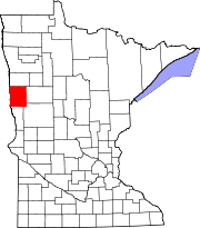
Comstock, Minnesota — City — Location of Comstock, Minnesota
Coordinates: 46°39′36″N 96°44′49″W / 46.66°N 96.74694°W Country United States State Minnesota County Clay Area – Total 0.2 sq mi (0.6 km2) – Land 0.2 sq mi (0.6 km2) – Water 0.0 sq mi (0.0 km2) Elevation 922 ft (281 m) Population (2010)[1] – Total 93 – Density 465.0/sq mi (155.0/km2) Time zone Central (CST) (UTC-6) – Summer (DST) CDT (UTC-5) ZIP code 56525 Area code(s) 218 FIPS code 27-12862[2] GNIS feature ID 0641429[3] Comstock is a city in Clay County, Minnesota, United States. The population was 93 at the 2010 census.[1]
Geography
According to the United States Census Bureau, the city has a total area of 0.2 square miles (0.52 km2), all of it land.
Demographics
As of the census[2] of 2000, there were 123 people, 47 households, and 39 families residing in the city. The population density was 570.5 people per square mile (215.9/km²). There were 49 housing units at an average density of 227.3 per square mile (86.0/km²). The racial makeup of the city was 95.12% White, 1.63% Native American, 1.63% Asian, 0.81% from other races, and 0.81% from two or more races. Hispanic or Latino of any race were 1.63% of the population.
There were 47 households out of which 40.4% had children under the age of 18 living with them, 70.2% were married couples living together, 8.5% had a female householder with no husband present, and 17.0% were non-families. 14.9% of all households were made up of individuals and 6.4% had someone living alone who was 65 years of age or older. The average household size was 2.62 and the average family size was 2.82.
In the city the population was spread out with 25.2% under the age of 18, 6.5% from 18 to 24, 26.8% from 25 to 44, 25.2% from 45 to 64, and 16.3% who were 65 years of age or older. The median age was 39 years. For every 100 females there were 136.5 males. For every 100 females age 18 and over, there were 124.4 males.
The median income for a household in the city was $37,917, and the median income for a family was $41,563. Males had a median income of $29,286 versus $19,375 for females. The per capita income for the city was $19,781. There were no families and 2.2% of the population living below the poverty line, including no under eighteens and 9.4% of those over 64.
References
- ^ a b "2010 Census Redistricting Data (Public Law 94-171) Summary File". American FactFinder. U.S. Census Bureau, 2010 Census. http://factfinder2.census.gov/faces/tableservices/jsf/pages/productview.xhtml?pid=DEC_10_PL_GCTPL2.ST13&prodType=table. Retrieved 23 April 2011.
- ^ a b "American FactFinder". United States Census Bureau. http://factfinder.census.gov. Retrieved 2008-01-31.
- ^ "US Board on Geographic Names". United States Geological Survey. 2007-10-25. http://geonames.usgs.gov. Retrieved 2008-01-31.
Municipalities and communities of Clay County, Minnesota Cities Barnesville | Comstock | Dilworth | Felton | Georgetown | Glyndon | Hawley | Hitterdal | Moorhead | Sabin | Ulen
Townships Alliance | Barnesville | Cromwell | Eglon | Elkton | Elmwood | Felton | Flowing | Georgetown | Glyndon | Goose Prairie | Hagen | Hawley | Highland Grove | Holy Cross | Humboldt | Keene | Kragnes | Kurtz | Moland | Moorhead | Morken | Oakport | Parke | Riverton | Skree | Spring Prairie | Tansem | Ulen | Viding
CDP Unincorporated
communitiesGhost towns Fargo-Moorhead Metropolitan Area (ND-MN) Counties 

Main cities Surrounding
areasAlice | Amenia | Argusville | Arthur | Ayr | Barnesville | Briarwood | Buffalo | Casselton | Comstock | Davenport | Enderlin | Erie | Felton | Frontier | Gardner | Georgetown | Grandin | Glyndon | Harwood | Hawley | Hitterdal | Horace | Hunter | Kindred | Leonard | Mapleton | North River | Oxbow | Page | Prairie Rose | Sabin | Tower City | Reile's Acres | Ulen | Wheatland† - county seatCoordinates: 46°39′34″N 96°44′54″W / 46.65944°N 96.74833°W
Categories:- Cities in Minnesota
- Populated places in Clay County, Minnesota


Wikimedia Foundation. 2010.