- Mapleton, North Dakota
-
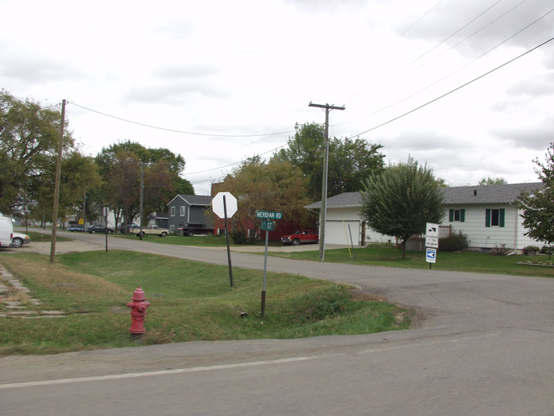
Mapleton, North Dakota — City — A residential neighborhood in Mapleton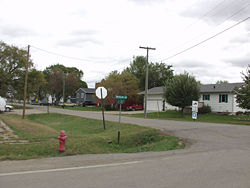 Location of Mapleton, North Dakota
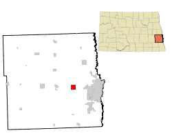
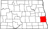
Coordinates: 46°53′24″N 97°3′8″W / 46.89°N 97.05222°WCoordinates: 46°53′24″N 97°3′8″W / 46.89°N 97.05222°W Country United States State North Dakota County Cass Founded 1875 Area – Total 4.0 sq mi (10.4 km2) – Land 4.0 sq mi (10.4 km2) – Water 0.0 sq mi (0.0 km2) Elevation 906 ft (276 m) Population (2010)[1] – Total 762 – Density 151.4/sq mi (58.4/km2) Time zone Central (CST) (UTC-6) – Summer (DST) CDT (UTC-5) ZIP code 58059 Area code(s) 701 FIPS code 38-50580[2] GNIS feature ID 1030095[3] Mapleton is a city in Cass County, North Dakota in the United States. It sits on the banks of the Maple River. The population was 762 at the 2010 census.[1] Mapleton serves as a bedroom community of the Fargo-Moorhead metropolitan area. The core cities are ten miles to the east of Mapleton. Mapleton was founded in 1875.
Contents
Geography
Mapleton is located at 46°53′24″N 97°3′8″W / 46.89°N 97.05222°W (46.890002, -97.052112).[4]
According to the United States Census Bureau, the city has a total area of 4.0 square miles (10 km2), all of it land.
Demographics
Historical populations Census Pop. %± 1890 119 — 1900 322 170.6% 1910 207 −35.7% 1920 198 −4.3% 1930 195 −1.5% 1940 180 −7.7% 1950 169 −6.1% 1960 180 6.5% 1970 219 21.7% 1980 306 39.7% 1990 682 122.9% 2000 606 −11.1% 2010 762 25.7% U.S. Decennial Census As of the census[2] of 2000, there were 606 people, 191 households, and 160 families residing in the city. The population density was 151.4 people per square mile (58.5/km²). There were 193 housing units at an average density of 48.2 per square mile (18.6/km²). The racial makeup of the city was 98.18% White, 0.17% African American, 1.49% from other races, and 0.17% from two or more races. Hispanic or Latino of any race were 1.98% of the population.
There were 191 households out of which 56.5% had children under the age of 18 living with them, 72.8% were married couples living together, 7.3% had a female householder with no husband present, and 16.2% were non-families. 12.6% of all households were made up of individuals and 1.6% had someone living alone who was 65 years of age or older. The average household size was 3.17 and the average family size was 3.51.
In the city the population was spread out with 35.8% under the age of 18, 8.7% from 18 to 24, 35.0% from 25 to 44, 17.8% from 45 to 64, and 2.6% who were 65 years of age or older. The median age was 29 years. For every 100 females there were 102.0 males. For every 100 females age 18 and over, there were 108.0 males.
The median income for a household in the city was $39,038, and the median income for a family was $42,750. Males had a median income of $28,875 versus $19,500 for females. The per capita income for the city was $12,900. About 5.7% of families and 6.0% of the population were below the poverty line, including 7.7% of those under age 18 and 21.4% of those age 65 or over.
Notable people
- Mark Andrews, congressman.
References
- ^ a b "2010 Census Redistricting Data (Public Law 94-171) Summary File". American FactFinder. United States Census Bureau. http://factfinder2.census.gov/faces/tableservices/jsf/pages/productview.xhtml?pid=DEC_10_PL_GCTPL2.ST13&prodType=table. Retrieved 2 May 2011.
- ^ a b "American FactFinder". United States Census Bureau. http://factfinder.census.gov. Retrieved 2008-01-31.
- ^ "US Board on Geographic Names". United States Geological Survey. 2007-10-25. http://geonames.usgs.gov. Retrieved 2008-01-31.
- ^ "US Gazetteer files: 2010, 2000, and 1990". United States Census Bureau. 2011-02-12. http://www.census.gov/geo/www/gazetteer/gazette.html. Retrieved 2011-04-23.
Municipalities and communities of Cass County, North Dakota Cities Alice | Amenia | Argusville | Arthur | Ayr | Briarwood | Buffalo | Casselton | Davenport | Enderlin‡ | Fargo | Frontier | Gardner | Grandin‡ | Harwood | Horace | Hunter | Kindred | Leonard | Mapleton | North River | Oxbow | Page | Prairie Rose | Reile's Acres | Tower City‡ | West Fargo
Townships Addison | Amenia | Arthur | Ayr | Barnes | Bell | Berlin | Buffalo | Casselton | Chaffee | Clifton | Cornell | Davenport | Dows | Durbin | Eldred | Empire | Erie | Everest | Fargo | Gardner | Gill | Gunkel | Harmony | Harwood | Highland | Hill | Howes | Hunter | Kinyon | Lake | Leonard | Maple River | Mapleton | Noble | Normanna | Page | Pleasant | Pontiac | Raymond | Reed | Rich | Rochester | Rush River | Stanley | Tower | Walburg | Warren | Watson | Wheatland | Wiser
CDPs Unincorporated
communitiesFootnotes ‡This populated place also has portions in an adjacent county or counties
Fargo-Moorhead Metropolitan Area (ND-MN) Counties 

Main cities Surrounding
areasAlice | Amenia | Argusville | Arthur | Ayr | Barnesville | Briarwood | Buffalo | Casselton | Comstock | Davenport | Enderlin | Erie | Felton | Frontier | Gardner | Georgetown | Grandin | Glyndon | Harwood | Hawley | Hitterdal | Horace | Hunter | Kindred | Leonard | Mapleton | North River | Oxbow | Page | Prairie Rose | Sabin | Tower City | Reile's Acres | Ulen | Wheatland† - county seatCategories:- Populated places in Cass County, North Dakota
- Cities in North Dakota
- Populated places established in 1875


Wikimedia Foundation. 2010.