- Enderlin, North Dakota
Infobox Settlement
official_name = Enderlin, North Dakota
settlement_type =City
nickname =
motto =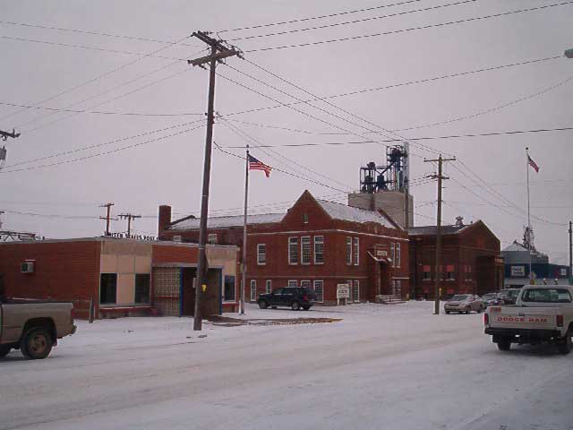
imagesize = 250px
image_caption = Downtown Enderlin: post office, history center, city hall
image_
mapsize = 250px
map_caption = Location of Enderlin, North Dakota
mapsize1 =
map_caption1 =subdivision_type = Country
subdivision_name =United States
subdivision_type1 = State
subdivision_name1 =North Dakota
subdivision_type2 = Counties
subdivision_name2 = Ransom, Cassgovernment_footnotes =
government_type =
leader_title =
leader_name =
leader_title1 =
leader_name1 =
established_title =
established_date =unit_pref = Imperial
area_footnotes =
area_magnitude =
area_total_km2 = 3.7
area_land_km2 = 3.7
area_water_km2 = 0.0
area_total_sq_mi = 1.4
area_land_sq_mi = 1.4
area_water_sq_mi = 0.0population_as_of = 2000
population_footnotes =
population_total = 947
population_density_km2 = 258.7
population_density_sq_mi = 670.1timezone = Central (CST)
utc_offset = -6
timezone_DST = CDT
utc_offset_DST = -5
elevation_footnotes =
elevation_m = 331
elevation_ft = 1086
latd = 46 |latm = 37 |lats = 21 |latNS = N
longd = 97 |longm = 36 |longs = 0 |longEW = Wpostal_code_type =
ZIP code
postal_code = 58027
area_code = 701
blank_name = FIPS code
blank_info = 38-24260GR|2
blank1_name = GNIS feature ID
blank1_info = 1036347GR|3
website =
footnotes =Enderlin is a city in Ransom County,
North Dakota in theUnited States . The population was 947 at the 2000 census. Enderlin was founded in1891 .The name is derivedFact|date=August 2008 from the semi-German "End der Line" ("end of the line"), as the city was once a railroad terminus. Railway shipping remains an important part of the local economy, especially since facilities in nearby towns have closed down. Another important part of the local economy is a sunflower processing plant located several miles east of town.
Geography
Enderlin is located at coor dms|46|37|21|N|97|36|0|W|city (46.622365, -97.600125)GR|1, along the Maple River.
According to the
United States Census Bureau , the city has a total area of 1.4square mile s (3.7km² ).None of the area is covered with water.Demographics
USCensusPop
1920= 1919
1930= 1839
1940= 1593
1950= 1504
1960= 1596
1970= 1343
1980= 1151
1990= 997
2000= 947
estimate= 1035
estyear= 2006
estref=As of the
census GR|2 of 2000, there were 947 people, 406 households, and 233 families residing in the city. Thepopulation density was 670.1 people per square mile (259.3/km²). There were 481 housing units at an average density of 340.4/sq mi (131.7/km²). The racial makeup of the city was 95.88% White, 0.32% African American, 0.42% Native American, 0.32% Asian, 0.95% from other races, and 2.11% from two or more races. Hispanic or Latino of any race were 2.32% of the population.There were 406 households out of which 27.3% had children under the age of 18 living with them, 47.8% were married couples living together, 6.2% had a female householder with no husband present, and 42.4% were non-families. 37.9% of all households were made up of individuals and 20.2% had someone living alone who was 65 years of age or older. The average household size was 2.20 and the average family size was 2.96.
In the city the population was spread out with 22.8% under the age of 18, 5.5% from 18 to 24, 23.4% from 25 to 44, 22.6% from 45 to 64, and 25.7% who were 65 years of age or older. The median age was 44 years. For every 100 females there were 99.8 males. For every 100 females age 18 and over, there were 96.5 males.
The median income for a household in the city was $32,589, and the median income for a family was $41,250. Males had a median income of $36,042 versus $21,023 for females. The
per capita income for the city was $20,883. About 4.7% of families and 7.1% of the population were below thepoverty line , including 7.1% of those under age 18 and 6.6% of those age 65 or over.References
External links
* [http://www.enderlinnd.com/ City of Enderlin official website]
* [http://www.ransomcountynd.com/ Ransom County official website]
Wikimedia Foundation. 2010.